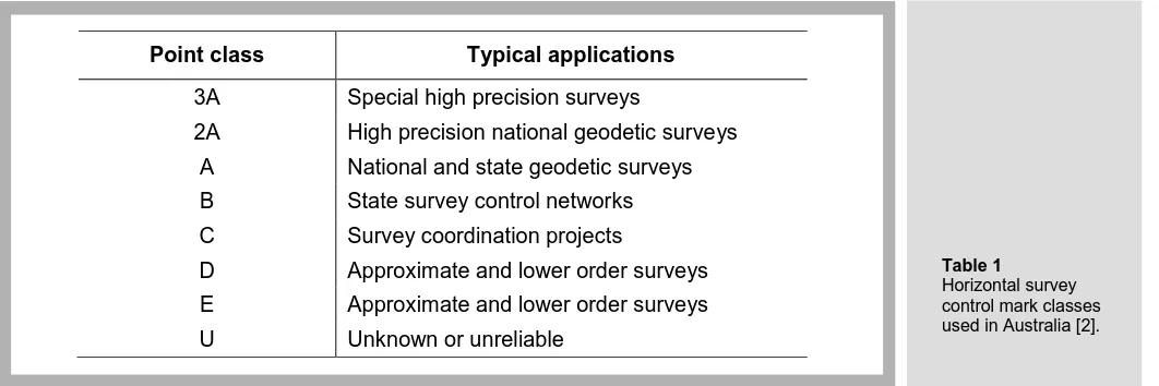
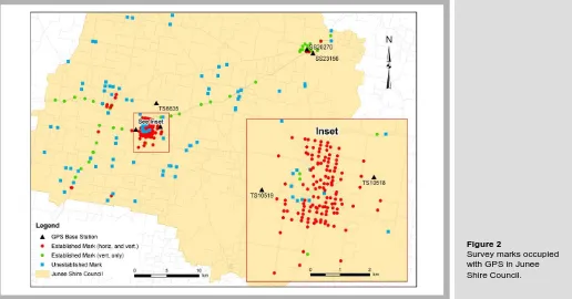
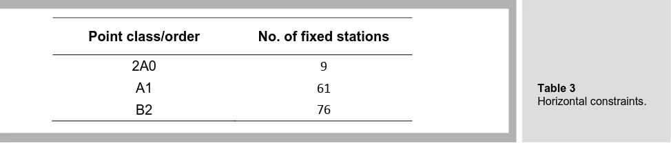
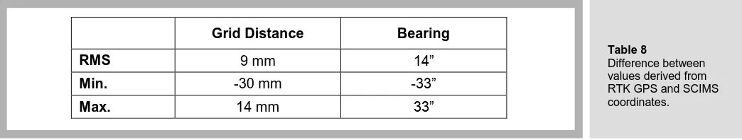
Can RTK GPS be Used to Improve Cadastral Infrastructure?
Full text
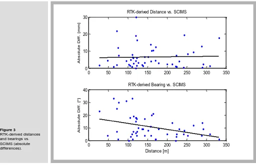
Figure
Related documents
The near-exact actuarially fair crop insurance pre- miums corresponding to each of the five assumed yield distributions are then computed for the typi- cal 65 percent APH
CROWN POINT FIRE RESCUE DEPT CITY OF VINCENNES FIRE DEPARTMENT WASHINGTON TWP VOL FIRE DEPARTMENT SOUTHWEST DISTRICT AMBULANCE SERVICE MANCHESTER TWSHP VOL FIRE & RESCUE
Effect of tow duration on catch rates and mean length of northern shrimp ( Pandalus borealis ) and Greenland halibut ( Reinhardtius hippoglossoides ) in the West Greenland Bottom
The organization’s governing body and leadership, in conjunction with community leaders and organizations should regularly assess the impact and effect of their efforts, using
differs from all congeners by coarse sculpture of cephalonotum, mesoscutellum and hemielytra, wide mesoscutellum, ventral medial carina on abdominal sternum 6 that is absent in other
I’m calling because I have been asked on behalf of a student and her supervisor at Western University to help find clients who might be interested in a research study on
When the surveillance is considered, home automation or the weather monitoring ,the raspberry pi has proved its importance for application in the field as the paper
A somewhat partisan discussion of an important and controversial question of land use, “What shall be done with the low-value back country.” The author, who is evidently a
