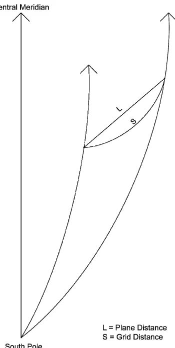
How to establish map projections to facilitate the use of GPS on ground-based surveys
Full text
Figure


Related documents
The national health priority areas are disease prevention, mitigation and control; health education, promotion, environmental health and nutrition; governance, coord-
Statement of Work - A statement of the work or services which the Contractor is to perform under any contract awarded, and which is generally in the form of an exhibit attached
In this study, the in− fluence of the extract from the radix of Scutellaria baicalensis on the activity of ALT manifested itself as an increase in the activity of this enzyme in
The normal increase in blood lactate after injection of epinephrine in the present. patient was evidence that muscle glycogen could be broken down at least to
A ‘black,’, hyperpigmented, adrenal pheochromocytoma is a very rare variant of a catecholamine producing tumor which in the presented case was associated with the presence
These requirements were achieved through exploiting the monolithic 3D printing of soft materials which incorporates membrane enclosed flexure joints in the finger designs,
Targeting adolescents in ages 10–14 and 15–19, the programme aims to ensure universal coverage of health information and services for all adolescents — those in and out of school,
La formación de maestros investigadores en el campo del lenguaje y más específicamente en la adquisición de la escritura en educación ini- cial desde una perspectiva
