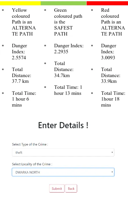
Geographical Information System Based Safe Path Recommender
Full text
Figure


Related documents
This built on our previously introduced calculation of the absolute magnitude of ΔψM in intact cells, using time-lapse imaging of the non-quench mode fluorescence
quences for Antarctic-India break-up". "The Jurassic history of the Africa-Antarctica Corridor – new con- straints from magnetic data on the conjugate continental
Most scholars are of the opinion that possession of zakat must be taken by a qualifying person, and therefore cannot be given (for example) for the construction of Mosques etc.
Considering only women who received abortion care from public facility where there is shortage contraception supplies in study conducted in two of the region and failing to
It was decided that with the presence of such significant red flag signs that she should undergo advanced imaging, in this case an MRI, that revealed an underlying malignancy, which
diagnosis of heart disease in children. : The role of the pulmonary vascular. bed in congenital heart disease.. natal structural changes in intrapulmon- ary arteries and arterioles.
In this PhD thesis new organic NIR materials (both π-conjugated polymers and small molecules) based on α,β-unsubstituted meso-positioning thienyl BODIPY have been
Urban restructuring in Kariakoo might also present a good case study for research on how space is produced.. The setting of an African formerly colonially segregated quarter