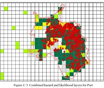
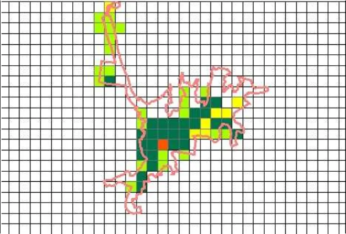
Applications of geospatial information technology for fire risk assessment and management in NSW
Full text
Figure
Outline
Related documents
In the last 15 years, modern biological technologies have crystallized the concept of uniqueness and irreproducibility of human milk, by establishing three new principles: first:
Bridgestone, for example, offers Greatec wide base radials for both drive and trailer positions, and these offer comparable fuel efficiency to other wide base tires..
For the Auditing Accounting Section of the AAA 2010 Annual Meeting at San Francisco, California Session Title: Audit Committee: Composition, Quality and Performance Tuesday August
The main causes of release, for each type of material transported, have also been identified and quantified in terms of relative occurrence: the main cause of release was found to
Analyzing all the above X-ray diffraction pattern cubic zirconia phase is conformed w ith reference to code 27-0997 Standard JCPDS. Hence The XRD pattern shows that the
Yet, despite the efficiencies obtained by converting from paper checks to images (because of Check 21), banks are still assigning check clearing float of three days on paper
SOA adalah suatu teknologi arsitektur pengembangan perangkat lunak dengan pendekatan Service, memungkinkan hubungan dan pertukaran data atau informasi antar bagian menjadi mudah
