South Kesteven District Council
STAMFORD GRANTHAM BOURNE THE DEEPINGSK E E E V N L I I T C R I D T T U U C H T S SO O C N S
“Your Council working for you”
Grantham
Conservation
Area
Designated January 1970
Appraisal & Amendment June 2009
Grantham Conservation Area Appraisal
Location and ContextThe market town of Grantham lies some 24 miles south-southwest of Lincoln along the course of the river Witham. It is surrounded by the undulating Kesteven Uplands, which is a mixed farming landscape with a high proportion of historic woodlands. Archaeological evidence indicates that this area was populated by isolated farmsteads during the Bronze and Iron Ages. The town was founded in the Saxon period between 400-600AD, however relatively little is known about its early development.
The Danes established the town as a centre for regional trade and civil and criminal justice between the 10th-12th centuries. The Domesday Book of 1086 described it as a royal demesne belonging to the King of England with a population of 1,300 and it comprised of a hall, church and four mills.
The medieval town developed around St Wulfram’s Church between the river Witham and Mowbeck and extended southwards to St Peters Hill. It consisted of five main streets which form the nucleus of the modern town centre; Swinegate, Castlegate, Westgate, Market Place and Walkergate, now known as Watergate. Tenement buildings lined the streets with shops on the ground floor and gardens, orchards, stables, wood yards and malt-floors to the rear. St Peters Hill derived its name from an important 11th century estate to the south of the medieval town which belonged to Peterborough Abbey. Tenement buildings belonging to the estate were located along the eastern edge of Swinegate whilst those with Burgage or rent-paying tenure, free of Peterborough, were located to the west of Swinegate and along Westgate.
Market Place was dominated by the Franciscan Friary to the west of Frere Lane, which was established in 1290 by the Grey Friar monks and dissolved in 1539; all traces of the friary have since vanished. The friars had established a system of pipes as early as 1314 which conveyed fresh water from the springs at Gonerby to the friary. The pipe was extended following the dissolution of the friary, and was used as a public water supply from 1597-1851. The ornamental Gothic style Conduit House was built in 1597 to protect the water supply from contamination; the Conduit was repaired in 1795 and 1927.
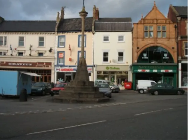
The Market Cross was the former preaching cross of the friars and was erected to denote the site of the market which has been held in the town since the 13th century. The cross has a medieval stepped base with an 18th century cap. The cross was removed in 1779 and later returned but was subsequently removed again in 1884 due its dangerous condition and was replaced by an obelisk. It was returned to its current position in 1910.
The town’s prosperity from the medieval period until the 17th century was derived principally from the production and trade in wool, which was England’s largest export commodity in the medieval period. St Wulfram’s Church, built 1100-1450 on the site of a previous Saxon church, was partially financed by wealthy wool merchants. This prosperity attracted the financially powerful order of the Knights Templar who began purchasing property in the town from 1300, the Angel and Royal Hotel which dates from the late 14th century, was built on the site of a former Templar commandery. King Edward IV granted the first Royal Charter in 1463 which officially recognised Grantham as a town rather than a settlement, and conferred the right of the townspeople to make laws, establish a prison and levy taxes. A number of eminent 17th century figures, including Sir Isaac Newton and the philosopher Henry More, were educated at the Old Grammar School on Church Street, built in 1497. The population increased during the 16th-17th centuries; however there was little outward expansion of the town as new buildings were constructed behind the existing street frontages. Francis Peck’s description of the town in 1731 only mentioned eleven streets; Almes Lane, Castle Gate, Fenkel Street, High Street, Market Place, Swyne Gate, Walkers Gate, West Gate, Vine Street, Cole Hill and Church Lane.
Grantham was a prosperous market town by the early 18th century with an economy based on agriculture and the coaching trade. Westgate was a centre of rural commerce with agricultural service industries such as blacksmiths, nail makers, rope makers, small brass and iron founders occupying the buildings which lined the road. A cattle market was originally held on the
site of wide Westgate which could account for the variation in the width of the road. Five turnpike roads were constructed between 1720-1804 which connected Grantham with the north, Stamford, Nottingham, Melton and Bridge End and enabled farmers from the outlying districts to travel more easily to the market.
The Great North Road, the main coaching route between London and Edinburgh, ran through the town along High Street from 1600 until the mid 19th century. New coaching routes developed through the town following the construction of the turnpike roads. The coaching trade represented a major source of wealth for the town as existing inns, such as the Angel and Royal, expanded and new inns, including The George, were constructed to accommodate the large number of travellers. The inns provided a substantial source of employment; by 1826 more people were employed in running the inns and taverns than in any other single trade.
The principal building material prior to the 18th century was Ancaster limestone, this durable stone was used to construct St Wulfram’s Church, Grantham House, the Angel and Royal and the Old Grammar School on Church Lane. The appearance of the town began to change from 1714 onwards as brick became a fashionable building material and old stone houses were refronted in brick; the original stone walls can still be seen on rear and side elevations of some buildings along Swinegate and Market Place. Thatched roofs were also replaced mainly by clay pantiles or slates. The town began to expand rapidly during the 18th century; many small and medium sized houses were built along Castlegate and Westgate and new streets of modest terraced housing were also built on the outskirts of the town centre.
In 1793 Royal Assent was granted for the construction of a navigable canal to connect Grantham to the River Trent at Nottingham. The canal opened in 1797 and boosted the local economy as it opened up new markets for the export of malt and corn to centres of expanding urban populations in Staffordshire, Lancashire, Yorkshire and Nottinghamshire. The canal was also used to import cheap supplies of coal and coke from the Midlands, which boosted the fledging ironwork industry established in 1815 by Richard Hornsby and Richard Seamann on farmland in Spittlegate, a village to the south of Grantham. Spittlegate was incorporated into the town by the Borough Extension Act of 1879 and became the industrial heartland of the town which consisted of an additional ironworks, a carriage works and brewery.
The town continued to prosper in the 19th century with the construction of the railways. The railway station and the passenger line between Grantham and Nottingham was opened in 1850, followed in 1852 by the Great Northern Railway line which connected the town with London, Peterborough and Doncaster. The railway contributed to the decline of the coaching trade and the canal, but boosted the engineering industry and Grantham became an important manufacturing centre for agricultural machinery which was exported throughout Britain and overseas. During the inter-war years the town provided a base for internationally renowned engineering companies producing a range of products including coal mining machinery and mobile
cranes. These companies prospered until the latter part of the 20th century when the general decline of Britain’s manufacturing
base meant that production moved overseas or ceased altogether.
Today Grantham is an important sub-regional centre and provides a range of key services such as employment, shopping, education and leisure for south west Lincolnshire.
Planning Policy Context
Conservation areas are designated under the provisions of Section 69 of the Planning (Listed Buildings and Conservation Areas) Act 1990. A conservation area is defined as “an area of special architectural or historic interest the character or appearance of which it is desirable to preserve or enhance”. It is the quality and interest of an area, rather than that of individual buildings, which is the prime consideration in identifying a conservation area.
Section 71 of the same Act requires local planning authorities to formulate and publish proposals for the preservation and enhancement of any parts of their area that are designated as conservation areas. Section 72 specifies that, in making a decision on an application for development in a conservation area, special attention shall be paid to the desirability of preserving or enhancing the character or appearance of that area.
This document should be read in conjunction with national planning policy guidance, particularly Planning Policy Guidance Note 15 (PPG 15) – Planning and the Historic Environment.
Listed Buildings
A listed building is one that is included on the government’s Statutory List of Buildings of Special Architectural or Historic Interest. The interiors and exteriors of these buildings are protected by law and consent is required from South Kesteven District Council before any works of alteration, extension or demolition can be carried out.
Key Unlisted Buildings
In addition to listed buildings, the Conservation Area contains a large number of listed buildings that make a positive contribution to the character or appearance of the Conservation Area. These are indentified on the townscape appraisal maps as “positive buildings”. This follows advice provided in English Heritage guidance on conservation area character appraisals, and within Planning Policy Guidance Note 15 (PPG 15), both of which stress the importance of identifying and protecting such buildings.
“Negative buildings” are also marked on the townscape appraisal maps. These are buildings which clearly detract from the character or appearance of the Conservation Area.
Assessment of Character
The Conservation Area consists of the following four distinct but inter-related character areas:
1. The former medieval town centre which consists of a group of 14th-19th century limestone buildings clustered around St Wulfram’s Church. It is the oldest part of the Conservation Area and is a highly significant area which is sensitive to any change or alteration. It comprises of the northern section of Castlegate, Church Street, Swinegate and Bluegate.
2. The 18th century commercial centre is the largest character area within the Conservation Area. The focal point of this area is the medieval Market Place, the two principal retail streets of High Street and Westgate, together with Watergate, Vine Street, the southern end of Castlegate and Finkin Street and other smaller subsidiary streets. This area is characterised by a mix of retail, commercial and other business uses which generally occupy the ground storeys of the buildings whilst the upper storeys are used for office space, storage, housing or remain unused.
3. The 19th century civic centre situated on St Peters Hill which is characterised by a formal layout dominated by the ornate Guildhall and the open green in the foreground.
4. The residential district on the northern periphery of the town centre which comprises of North Parade, Brown Street, Brook Street, Manthorpe Road, Gladstone Terrace, Albion Road, Chambers Street and Welby Gardens.
1. The Medieval Town Centre Summary of main characteristics
XThe oldest part of the Conservation Area and is highly sensitive to change or insensitive alterations.
XA surviving medieval street pattern characterised by narrow roads and footways with granite kerbs.
XBuildings range in date from 12th - early 19th centuries.
XA high concentration of Grade I and Grade II* listed buildings. Swinegate has a large number of Grade II listed buildings.
XAttractive mix of Ancaster stone and brick buildings with clay pantile roofing. The Blue Pig and Number 11 Swinegate are
surviving examples of half timber framed buildings.
XCastlegate, Church Street and Church Trees are characterised by large scale two storey buildings with wide frontages
and a low density of development.
XSwinegate is characterised by two and three storey buildings with narrow frontages and a high density of development.
XThe buildings are set on or close to the line at the back of the footway which forms a continuous building line along the
streets.
XBoundary walls are important enclosing features along Castlegate and Church Street.
XDistinctive pinch point on Castlegate at the junction with Church Street.
XTraditional street signs are important features.
XTrees are an important feature along Castlegate and the perimeter of St Wulfram’s churchyard.
XOpen views from the churchyard to Grantham House, the Old Grammar School and Church Trees. Impressive view of
the west front of St Wulfram’s Church from Swinegate. Spatial Character and Townscape Quality
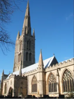
St Wulfram’s Church is the focal point of this area; it dominates the street and skyline due to its large scale and unusually tall steeple, which is the second highest in Lincolnshire. The church is located centrally within the churchyard, which is elevated above street level and enclosed by a brick boundary wall capped with stone copings. The top of the wall is parallel with the level of the churchyard which emphasises the church’s physical separation from the street and reinforces its historical importance. The churchyard has an open character which is enhanced by the mature trees planted around the perimeter of the boundary wall. There are attractive views from the eastern side of the churchyard across to Grantham House and of Church Trees from the north west side. This open character provides a striking contrast with the enclosed approaches to the church and is a significant element of the character of this area.
The northern section of Castlegate from the junction with Brook Street to Bluegate has a relatively low density of development and is enclosed by large scale buildings which abut directly onto the footway and roadside. To the north of the church, the west side is enclosed by the Kings School, which comprises of two and three storey stone buildings with gable roofs connected by post war infill ranges.
The brick infill ranges are unsympathetic in terms of scale, materials and design as the continuous bands of windows and flat roof create a horizontal emphasis which detracts from the vertical emphasis of the original buildings. Beyond the junction with Church Street, the churchyard and the playground to the National School create a more open character on the west side. The school is set back from the footway and is enclosed by a low brick boundary wall surmounted by railings which maintains the continuity of the building line along the street. The mature trees planted along its length contribute to the visual interest and frame attractive views along this section of Castlegate.
To the north, the east side of Castlegate is enclosed by a stone coursed boundary wall with an attractive curved brick coping. The mature trees planted along its length frame open views across the paddock, which forms a contrast with the imposing school buildings to the west. There are attractive views southwards along the street to Grantham House and of the east and north elevations of St Wulfram’s Church. Grantham House is set forward from the boundary wall which creates a distinct pinch point opposite the junction with Church Street. Beyond the junction, the east side is enclosed by the stone frontage of the former stable block and boundary wall of Grantham House.
The south side of Church Street is dominated by the north elevation of St Wulfram’s Church due to its large mass and scale, despite being set back from the roadside. The narrow road is enclosed to the south by the churchyard boundary wall which abuts directly onto the roadside. The north side is enclosed by the Old Grammar School and the high brick boundary wall of the Rectory which abut directly onto the narrow footway.
Swinegate is a narrow street with an enclosed character as there is a high density of development and the buildings abut directly onto the footway creating a continuous frontage along the street. This continuity is interrupted on the west side by the exit to the Watergate car park at the north end of the street. Beyond the junction with Church Trees on the east side, the large open space in front of St Wulfram’s Church, formed by the west side of the churchyard and the wide footway along Church Trees, allows stunning views of the church’s west front.
Church Trees forms a pedestrian connection between Swinegate and Church Street and has an open character as the south side overlooks the churchyard whilst the north side is enclosed by large scale terraced buildings which abut directly onto the footway.
Bluegate is a linear residential street which is enclosed to the north by a terrace of modest brick houses dating from the 19th century. There are attractive views of St Wulfram’s tower and spire and of the east elevation of the Gothic style National School to the rear of the terrace at the east end of the street. The south side is enclosed by the stone boundary wall and rear elevation of the 20th century Russell Read Almshouses. Castlegate, Church Trees and Church Street form attractive and popular pedestrian thoroughfares. Castlegate connects the northern residential areas within the Conservation Area with the historic and civic centre to the south. Swinegate has a more commercial base which forms a link between the residential areas and the commercial centre. The mix of uses within this area, which includes housing, schools, small businesses
and the church reflects the multi-functional origins of this area as the centre of the medieval town and its character is affected by the daily fluctuations of pedestrian and vehicular movement.
Fig. 1. View of the south front of St Wulfram’s Church from Castlegate
Fig. 2. View looking southwards along Castlegate to the pinch point created by Grantham House and the junction with Church Street and the stone boundary wall to the
paddock with brick coping.
Fig. 3. View of Church Trees from the west front of St Wulfram’s Church.
The appearance of the medieval centre is compromised by the traffic markings on the road outside the National School and the number of traffic signs along Castlegate and Church Street. The signs are mounted on individual poles which creates a cluttered appearance in this sensitive part of the Conservation Area.
Quality and Character of Buildings
The large number of listed buildings in this area reflects its historic and architectural significance. There are five Grade I listed buildings: St Wulfram’s Church (12th-14th centuries), Grantham House and stable block (14th century), the Old Grammar School (15th century) and the School House to the rear of Church Street (early 16th century). There are also a large number of Grade II listed buildings dating from the 18th century on the west side of Swinegate. The buildings clustered around St Wulfram’s Church are mainly constructed of Ancaster limestone and share common features such as stone mullion windows, stone lintels and Collyweston slate roofs which contribute to a harmonious street scene in spite of the differences in architectural style. Numbers 1-2 Church Street are fronted in stone with brick rear elevations and a brick boundary wall which fronts onto Castlegate. The Rectory on Church Street is also
constructed of brick; the brick boundary wall is an important enclosing feature of this part of the Conservation Area. The buildings are generally large scale with wide frontages and consist of two storeys, although the Kings School has three storey ranges.
Swinegate has an attractive mix of buildings which contributes to the visual interest of the street. The buildings are domestic in scale and consist mainly of 18th century brick townhouses of two and three storeys which occupy small plots and have narrow frontages. Some also have unusual moustache shaped lintels which are a typical feature of the town centre. Interspersed amongst the townhouses on the west side are stone buildings of two storeys which date from the 17th and early 18th century. There are also two attractive examples of half timber framed buildings, the 16th century Blue Pig and Number 11 which is 17th century in origin. The buildings on Church Trees are larger in scale with wide frontages dating from the late 18th-early 19th century and are constructed of brick and limestone. The roofs are covered with clay pantiles which, together with the variety of building heights, contribute to an attractive skyline.
The modern brick infill buildings at the north end of Swinegate on the east side do not enhance the character of the area but neither do they detract from it as they are relatively plain in design and are built to the same scale as the adjoining historic buildings, although the use of uPVC windows and doors is an inconsistent feature.
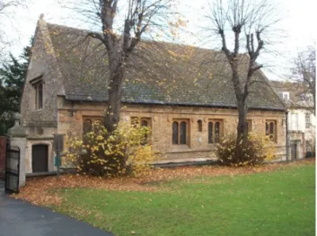
Fig. 4. The Old Grammar School on Church Street viewed from the north side of St Wulfram’s churchyard.
Fig. 5. The Blue Pig at the junction with Swinegate and Vine Street.
Buildings which are inconsistent with the character of the Conservation Area
The buildings identified in this section are generally post war developments constructed without regard to the historic context or overall character of the Conservation Area in terms of their design, scale, use of materials, detailing or plan form. Some of these buildings offer the potential for sensitive redevelopment with a design which respects the historic context and overall character of the Conservation Area. The rationale for identifying these buildings is to emphasise the fact that all other buildings within the Conservation Area, whether listed or unlisted, possess heritage merit or have a neutral impact upon its overall character.
No 10 Swinegate
This one storey brick building with timber boarding and a flat roof with a smaller single storey extension to the rear creates an ugly gap along the street frontage due to the discrepancy in height with the adjacent three and two storey buildings.
Infill ranges to the Kings School, Castlegate
The scale of the two storey post war brick infill ranges, the horizontal bands of windows, flat roof and use of materials detract from the appearance of the original stone buildings.
Management Opportunities and Constraints
XThis area is very sensitive to any change as it is the oldest part of the Conservation Area and inappropriate alterations
could have a damaging impact upon the overall character. Therefore any proposed changes must have regard to the historic context in terms of scale, alignment along the back of the footway, height, form, style, design and materials. The impact of change upon other important elements including the existing street pattern, trees, views and open spaces is also an important material consideration.
XA design code or brief should be produced for potential development sites which specify a high standard of design to
complement the historic character of the Conservation Area.
XAlterations or extensions to existing buildings should be carried out in natural materials appropriate to the location,
should be subordinate to the main building and reflect its character in terms of scale, appearance and detailing.
XThe car park exit at the north end of Swinegate is inconsistent with the enclosed character of the street. It would benefit
from an improved boundary treatment to replace the existing bollards and to restore an enclosed frontage along the street.
Fig. 6. No 10 Swinegate
XThe gap site adjacent to the car park on Swinegate creates a break in the continuity of the street frontage. The site would benefit from sensitive redevelopment which is in keeping with the character of the street in terms of scale, height, form, style, design and materials.
XThe character of the area is affected by traffic signs and markings. A comprehensive approach should be undertaken to
establish which signs are necessary; redundant signs should be removed and the location of signs should be rationalised to minimise the impact of street clutter. The “Streets for All” document produced by English Heritage and the “Streetscape Design Manual” produced by Lincolnshire County Council provide further guidance on this issue.
XTraditional road features, such as gully setts which can be found along Castlegate and granite kerbstones should be
retained. If the opportunity arose the possibility of exposing hidden road features should be investigated.
XExisting highway boundary walls should be retained.
XThe stone flagged footways through the churchyard and along Church Trees should be retained.
XTraditional metal street name signs and painted street signs on the elevations of buildings should be retained and
restored as they contribute to local distinctiveness.
XThe quality of street paving detracts from the character of the area; the use of different coloured paving infills laid in
varying patterns creates a cluttered appearance. A coordinated approach to paving which uses high quality materials in keeping with local tradition would enhance the character of the area. The “Streetscape Design Manual” contains guidance on street enhancement schemes and the principles which should be applied.
XImportant trees and open green spaces which contribute to the character of the Conservation Area, highlighted on the
1. The Commercial Centre
Summary of main characteristics
XA high concentration of listed buildings, including the Market Cross and Conduit House.
XBuildings date from the 14th- 20th centuries.
XBuildings sited to the back of the footways creating a continuous building line.
XPredominant building material is brick, interspersed with older stone buildings. Market Place has examples of stucco and
terracotta buildings. Vine Street has half timber framed stone buildings. Clay pantiles or slate are the dominant roofing materials.
XMarket Place is an important open space and focal point.
XMarket Place, narrow Westgate, High Street, Castlegate and Finkin Street are characterised by three storey buildings
with wide and narrow frontages.
XWide Westgate and Bluegate characterised by small scale two storey brick buildings with narrow frontages.
XVine Street is medieval in origin characterised by a narrow road and footway enclosed by three storey buildings.
XSurviving examples of traditional shop fronts along Westgate and Watergate.
XPredominantly narrow roads and footways with the exception of wide Westgate.
XPinch point on High Street to north of Butchers Row.
XMulberry tree on Vine Street is an important feature.
XTraditional street signs and granite kerbs are important features.
XInappropriate post war buildings detract from overall character of Conservation Area.
XInappropriate modern fascias detract from quality of buildings and overall character.
Spatial Character and Townscape Quality
Market Place is the focal point of the commercial centre. It is an important open space within a predominantly enclosed area. The wide, irregularly shaped square has a high density of development and is enclosed on three sides by buildings which abut directly onto the narrow footways. The north side has a continuous frontage, whilst the continuity of the east and west sides are interrupted by the street entrances which radiate from the square. The restored medieval market cross, located on the north side, signifies the square’s former importance as the historical centre of trade, a role now superseded by High Street which is the primary retail street within the town. There are visual connections between Market Place and the High Street, from the north side of the square looking eastwards towards High Street there is an enclosed view of the façade of the Angel and Royal Hotel. Looking westwards towards Market Place from the Angel and Royal on High Street, there is an attractive open view of the square and market cross with The Conduit in the background. The setting of the Conduit has been enhanced by the use of high quality stone paving on the footway along Conduit Lane.
Fig. 8. North side of the Market Place with the market cross in the foreground. The on street car
parking detracts from the historic character of Market Place and the cross.
Westgate radiates southwards from Market Place and is Grantham’s second major retail street. The street is divided into two distinct character areas, narrow and wide Westgate. Narrow Westgate leads from Market Place and has an enclosed character as the buildings abut directly onto the narrow footways creating a continuous frontage along the street. There are large scale three storey buildings on the west side, whilst the east side is interspersed with smaller two storey buildings. The road curves gently to the west which deflects views along the building frontages. The road narrows as it approaches the junction with Guildhall Street and on the west side beyond the HSBC Bank, the buildings diminish in scale to two storeys. Kings Walk, an attractive stone flagged alleyway with small retail units, connects Westgate with Guildhall Street, and contributes to the visual interest of Westgate.
Beyond the junction with Guildhall Street, there is a sudden change of character as wide Westgate is approached. The road widens to almost double the width of narrow Westgate, the buildings on the west side are set further back from the road which increases the width of the footway, and are smaller in scale than those along narrow Westgate, consisting predominantly of two storeys with narrow frontages. The buildings on the east side vary in terms of height, scale and width of frontages and abut directly onto the narrow footway. The continuity of frontages is interrupted on the east side by the junctions with Stanton Street and Welby Street which lead to the Sir Isaac Newton Shopping Centre. There are attractive views along wide Westgate from the junction with Dysart Road framed by the trees which are located on the west side of the road with the spire of St Wulfram’s Church visible in the background. Poorly sited street furniture on the west side of the road, traffic signs and the pedestrian guard rails at the junction with Dysart Road creates a cluttered appearance which detracts from the overall character of Westgate.
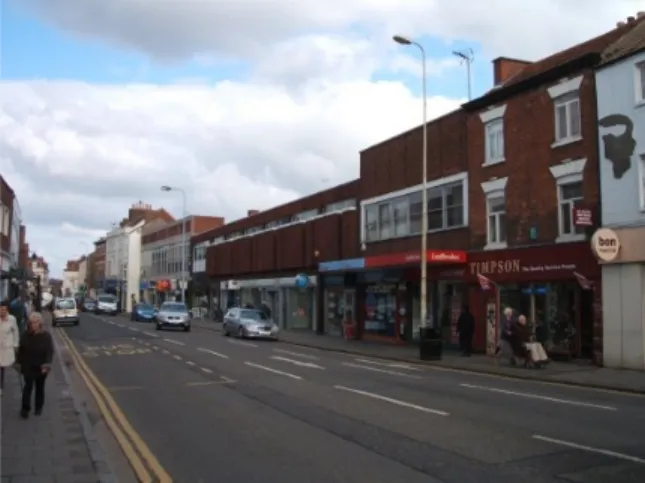
High Street is the primary retail street within the town. It has a high density of development, consisting of two and three storey buildings which abut directly onto the narrow footways and form a continuous frontage along the street. The enclosed character is emphasised by the narrow width of the road which contracts to a pinch point at the intersection with Number 12 on the east side, formerly occupied by Bairstow Eves estate agents. The linear north-south alignment of the street allows long views along its length, the northern view terminates with the attractive façade of the early 19th century former National Westminster Bank which has six large pilasters spanning two storeys on each elevation.
The character of Watergate was substantially and adversely altered by the road widening scheme in the post war period which entailed the demolition of a number of historic buildings. The west side has
retained its original pattern of development as far as The Playhouse public house; the buildings abut directly onto the footway creating a continuous frontage. The car park on the east side is inconsistent with the enclosed nature of the Conservation Area, although it does permit views of St Wulfram’s tower and spire framed by the buildings along Swinegate.
Vine Street is an attractive narrow street which connects the Market Place and High Street with the medieval district. The road is enclosed on both sides by high quality buildings of two and three storeys which abut the narrow footways. The former stables to Vine House, now occupied by Dawns Fashion Gallery, is set back from the footway within a small courtyard with a mature
Fig. 9. The east side of narrow Westgate as it approaches Market Place.
Fig. 10. View northwards along High Street, The George is on the west side of the street with the former National Westminster
Mulberry tree which is an important feature and contributes to the visual interest of the street. The road curves gently to the east which deflects views along the attractive brick, stone and half-timbered building frontages.
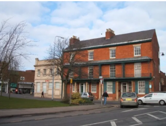
The southern section of Castlegate, beyond the junction with Bluegate up to St Peters Hill, has a mix of uses, including residential, retail, commercial and leisure. The road is enclosed on both sides by buildings of three and two storeys which abut directly onto the footway. The road curves gently to the west which deflects views along the building frontages. The west side has a higher density of development and a harmonious appearance as there are attractive terraces of Georgian brick townhouses interspersed with older buildings which form a continuous frontage along the street. The east side has a lower density of development with a greater mix of architectural styles and the Conservative Club is set back from the footway which interrupts the continuity of building frontages along the street.
Finkin Street is a narrow, linear street which connects Castlegate with High Street. It is enclosed by large scale buildings of two and three storeys with wide frontages which abut directly onto the footway and form a continuous frontage along the street. Elmer Street North and Elmer Street South connect Swinegate with the civic centre. The streets are inconsistent with the overall character of the Conservation Area as they are dominated by car parks and the rear elevations and yards of buildings fronting onto High Street. Nonetheless, there are attractive views of the rear 18th century ranges and courtyard of the Angel and Royal Hotel and of St Wulfram’s tower and spire.
Quality and Character of Buildings
The large number of listed buildings clustered around Market Place, Westgate, Vine Street, the north end of High Street and the southern end of Watergate reflects the architectural and historic quality of the commercial centre.
Market Place consists primarily of three storey buildings dating from the 17th-20th centuries, the buildings differ in scale as some occupy large plots and have wide frontages whilst others are relatively modest in scale, which contributes to the visual interest of the square. There are common architectural details despite the differences in style; sash windows are a prominent feature of the square, particularly on the upper storeys, and a number of buildings also have stone window lintels. The varied use of materials such as brick, stone, stucco and terracotta contributes to the visual interest of the square, which is enhanced by an attractive skyline of pitched, gabled and parapet roofs covered with slate and clay pantiles.
The buildings along wide Westgate date from the 18th-19th centuries and are predominantly built of brick, interspersed with stone buildings on the west side, and there is an attractive 17th century half timbered building on the east side. The buildings vary in scale; those beyond the junction with Guildhall Street are modest in scale, consisting of two storeys with narrow frontages. Narrow Westgate has largely retained its Georgian appearance and is vulnerable to unsympathetic changes or alterations. The scale of the buildings increases to three storeys with largely wide frontages which indicate that they were formerly important public buildings. These include Westgate Hall, the former 19th century corn exchange located on the east side of the road, which is built of ashlar with a decorated frontage and is considerably taller than the adjacent buildings. The combination of pitched and parapet roofs and the
varied heights of the buildings creates an attractive skyline and is an important contribution to the overall character of the street. Fig. 11. View eastwards along Vine Street towards the
junction with Swinegate and Elmer Street North.
There are also surviving examples of traditional shop fronts which contribute to the quality and interest of the street, particularly numbers 12-13 occupied by HH Cox Ltd and numbers 86-87 occupied by C Dryden and The Grantham Florist, pictured below. The character of High Street has been eroded by poorly designed post war developments which disregard the historic context of the street. Some of the buildings have blank frontages on the upper storeys; almost all have inappropriate horizontal bands of windows which do not relate proportionally to the ground storeys and, together with the use of flat roofs and the straddling of several traditional building plots, introduces an alien horizontal emphasis to a street with a traditionally vertical emphasis. Other inconsistent features include the use of concrete canopies which bisect the ground from the upper storeys and undershot ground storeys which detract from the overall quality of the street.
There are a number of surviving historic buildings along High Street, many of which are listed, located at the north end of the street towards the junction with Market Place and Watergate. The buildings are mainly constructed of brick and date from the early 18th-19th centuries; these
are interspersed with older stone buildings which date from the 14th and
17th centuries. There are a number of landmark buildings associated
with the banking and coaching trades which reflect the former wealth
and importance of the town; these include the 14th century Angel and
Royal Hotel, which unusually has retained its original function, the George which was substantially remodelled in the 1990s to create a shopping arcade and the Goose at the Bank, formerly the Guildhall and
town jail which was converted into a bank in the 19th century and is now
a public house.
Castlegate consists of three storey brick townhouses dating from the early 19th century interspersed with two storey 18th century stone buildings on the west side, many of which are listed. The frontages of the brick buildings are narrower than those of the stone but they are all domestic in scale as it was historically a residential street. The roofs are mainly pitched with clay pantiles or slate and some of the stone buildings have dormer windows. The functioning beehive located in the tree outside The Beehive public house, is a unique feature which contributes to the visual interest of the street.
Finkin Street is dominated by large scale stone and brick buildings, such as the 19th century Central Methodist Chapel which is built of ashlar with a plain, rather austere façade which contributes to the enclosed character of the north side of the street. The former York County Savings Bank on the south side is an attractive 19th century building with a highly decorative façade which enhances the approach to High Street. The character of the eastern end of the street has been adversely affected by the unsympathetic installation of uPVC windows and doors and the rendering of historic brickwork.
Bluegate comprises of a modest but attractive 19th century brick terrace of two storey houses with pitched roofs covered with clay pantiles. The buildings have retained original features such as stone foot scrapes but the overall character of the terrace has been compromised by replacement uPVC windows and doors.
Fig. 13. The Angel and Royal viewed from the junction with Market Place.
Buildings which are inconsistent with the character of the Conservation Area The Conservative Club, Castlegate
This is a single storey building with a two storey extension to the rear with small, narrow window openings. It is set back from the road with a car park located in front with an irregularly shaped boundary wall which disrupts the continuity of the building line along the street.
42-43, 46-46a, 50-53a, 56-59, High Street (west side) and 36-28, 24-21, 18-13, High Street (east side)
These post war buildings detract from the overall character of High Street as the wide frontages and flat roofs has introduced a horizontal emphasis to the street. The standard of design is poor, as blank frontages at the second storey level creates a negative impression of High Street as it is approached from Avenue Road and St Peters Hill. The upper storey windows are inappropriate as they do not relate to the ground floors in terms of style or to the proportions of the windows in adjacent historic properties.
Watergate House, Watergate
This three storey post war building occupies a prominent corner location but has little intrinsic architectural or historic merit and creates a negative impression of Watergate from the High Street and also forms an unattractive entrance to Vine Street. The flat roof lacks any visual interest and the plain elevations are dominated by the irregular arrangement of windows which differ on each storey. It is also constructed of poor quality materials and the rear elevation mars the attractive western views along Vine Street towards Watergate.
Management Opportunities and Constraints
XIf the opportunity arose, the Conservation Area would benefit from the redevelopment of the inappropriate post war
developments on Watergate and High Street. A design code or brief should be produced for these sites which specify a Fig. 14. The Conservative Club
Fig. 15. West side of High Street Fig. 16. East side of High Street
high standard of design to complement the historic character of the Conservation Area. It should have regard for the historic context in terms of scale, height, form, style, design and materials.
XAny alterations to a building within the commercial centre should be carried out in appropriate materials and be of a scale
and design consistent with its overall character.
XTo maintain continuity and enclosure, any new development along the main street frontages should abut the highway.
XThe car park at the north end of Watergate would benefit from an appropriate boundary treatment to restore the enclosed
character to this part of the Conservation Area and to enhance the appearance of the town centre from the approach along Brook Street and North Street.
XMarket Place is currently dominated by on street car parking which detracts from its open historic character and affects
the setting of the market cross and Conduit House. This area would benefit from the removal, or reduction, of on street parking provision and allow its potential as an open public space to be explored. This would create a safer, more attractive environment for pedestrians and improve connections between the Market Place and the rest of the commercial centre.
XThe commercial centre would benefit from a co-ordinated approach to the provision of street furniture. This includes the
provision of pedestrian guard rails located at the north end of Watergate and at the junction with Westgate and Dysart Road, which creates an unwelcoming environment for pedestrians. If the opportunity arose an audit should be undertaken to determine if they could safely be removed or reduced in number to diminish the impact of street clutter and to give greater precedence to pedestrians.
XThe commercial centre has been adversely affected by the introduction of modern shop fronts and fascias which
introduce an inappropriate horizontal emphasis and sever the relationship between the ground and upper storeys by disrupting the sense of proportion. The area would benefit from sympathetically designed shop fronts as outlined in the Supplementary Planning Guidance document “Grantham Shopfront Design Guide”.
XThe existing traditional shop fronts on Westgate and Watergate should be retained and where necessary, repaired and
restored.
XHigh Street and Westgate are dominated by traffic, the narrow pavements and lack of safe crossing places creates an
unattractive environment for pedestrians. The area would benefit from a traffic management solution which places a higher priority on pedestrian movement and would allow improved connections between High Street and Westgate.
XThe quality of the street paving detracts from the appearance and character of the commercial centre. The use of small
paving infills in different colours laid in varying patterns creates a cluttered appearance. A coordinated approach to paving would enhance the character of the area.
XGranite kerbstones should be retained.
XThe stone flagged paving on Kings Walk should be retained.
XTraditional street name signs should be retained as they contribute to local distinctiveness.
XThe functioning bee hive located outside The Beehive public house on Castlegate is a unique feature which should be
retained.
3. The Civic Centre
Summary of main characteristics
XFormal layout of civic buildings dominated by Guildhall.
XBuildings date from early 19th -20th centuries.
XLarge scale three storey brick buildings with decorative stone detailing.
XSt Peters Green is an important open space complemented by the 19th century statues.
XNumbers 2-4 St Peters Hill attractive Regency style housing, unique in Conservation Area.
XWide road and footways on east side.
XHigh density of development on west side with buildings of similar scale aligned along the back of the footway.
XInappropriate post war developments and modern shop fronts detract from the character of Conservation Area.
Spatial Character and Townscape Quality
St Peters Hill has an open spacious character which is derived from the width of the road and the broad footway which abuts the open green on the east side. The elongated triangular green forms the focal point of the civic centre and provides an attractive setting for the Guildhall and associated public buildings, although it is separated from these buildings by an access road which is currently used as a taxi rank. It is also an important public space which offers opportunities for informal social interaction. The grassed space is complemented by a mix of mature and young trees which frame attractive views of the Guildhall from the west side of St Peters Hill. The Victorian statues of Sir Isaac Newton, which is situated centrally outside the Guildhall overlooking St Peters Hill and Frederick Tollemache MP located at the southern end of the green overlooking London Road, represent the 19th century spirit of civic pride and contribute to the visual interest of the green. The paved footways which bisect the green are important pedestrian thoroughfares which connect the civic buildings with the retail and commercial businesses along St Peters Hill and High Street.
The east side of St Peters Hill has a formal layout dominated by the Victorian Guildhall which is flanked to the north by Abbey Gardens and to the south by the smaller Session Hall, museum, district council offices, two 19th century semi-detached villas converted into a doctors surgery and a late 19th century building currently used as The Tollemache public house. The large scale buildings consist of two and three storeys and abut directly onto the footway which creates a continuous frontage along the street. They are built to a similar height, with the exception of the Guildhall, which creates a harmonious appearance in spite of the differences in architectural style. The modern council offices have a narrower frontage and are set slightly back from the footway, which reduces its visual impact upon the adjacent historic buildings. Abbey
Gardens provide an open public space for informal interaction; the gardens are enclosed by a low brick wall and railings with trees around the perimeter which separate it from the street. There are attractive views from the gardens across to the west side of St Peters Hill and to the United Reform Church on Avenue Road.
The west side of St Peters Hill has a high density of development; the buildings abut directly onto the footway, forming a continuous enclosing frontage along the street. The north side has a lower density of development, it is bisected by the junctions with Castlegate and Elmer Street South and there are attractive views across to the Guildhall and the green.
Fig. 18. The Guildhall with the museum and district council offices to the right.
London Road is characterised by high density 19th century buildings which abut the footways and form a continuous frontage along the street. The buildings are typically three storeys; those on the east side occupy long narrow plots whilst the west side has a greater diversity of plot widths. Number 12 on the west side is set back from the footway with a small garden enclosed by a dwarf wall and railings which maintains the building line along the street. Number 1-5 on the east side occupies the corner plot of London Road and St Catherine’s Road and mirrors the Tollemache in scale and alignment along the street.
Quality and Character of Buildings
There are seven Grade II listed buildings located within the civic centre, of which the Guildhall is the most prominent. It has an attractive undulating frontage constructed of red brick with decorative stone detailing and an unusual hipped roof with a dominant central lantern, which is visible within and outside of the Conservation Area boundary.
The buildings adjacent to the Guildhall are constructed of brick with stone detailing on the frontages which reflects the design of the Guildhall and contributes to a harmonious street scene. The austere plain frontage of the museum forms a stark contrast with the decorative Guildhall and the Victorian semi detached houses which have attractive stone columns flanking the entrances. The Tollemache public house has decorative stone details on the gables and a central arched window. The district council offices are constructed of a paler brick with stone details, and an arched entrance which imitates the design of the entrance to the Guildhall.
Numbers 2-4 on the north side of St Peters Hill form an elegantly proportioned early 19th century brick terrace and is the only example in Grantham of Regency style houses. The attractive frontages have stone
columns flanking the doorways and a decorative continuous iron balcony at first storey level with a curved metal canopy above which contributes to the visual interest of the area.
The west side consists mainly of three storey brick buildings which are constructed on a similar scale but vary in terms of architectural style. The combination of pitched and parapeted roofs covered in slate or clay pantiles contributes to an attractive skyline which is interrupted by the large scale of the Post Office building to the south of the street and the building occupied by the Nat West bank further north along the street.
There are an attractive range of late19th century buildings along London Road as far as the junction with Rycroft Street on the
west side and College Street on the east. The ground storeys have been converted into retail units with modern shop fronts, however the upper storeys remain largely unaltered. The buildings are largely constructed of red brick with stone detailing and there are examples of second storey decorative bay windows which contribute to the visual interest along the street. Particular
buildings of merit include Number 12 Spitalgate House, an attractive Grade II listed 18th century brick townhouse; the Salvation
Army Citadel which dates from 1900 and has a battlemented brick façade and an octagonal turret; and the red brick building located on the corner of London Road and Wharf Road with decorative stone detailing.
Fig. 19. Numbers 2-4 St Peters Hill, an attractive example of 19th century Regency style housing
Buildings which are inconsistent with the character of the Conservation Area The Post Office, St Peters Hill (west side)
Located at the corner of this part of St Peters Hill and Wharf Road, this three storey concrete and brick building dominates the street due to its large scale which is accentuated by the flat roofline and continuous band of windows at the third and second storey level.
NatWest Bank, St Peters Hill (west side)
This modern three storey infill building dominates the adjacent historic buildings in terms of height and scale and its wide frontage creates an uncharacteristic horizontal emphasis. It projects forward of the adjacent buildings which disrupts the continuity of the building line along the street. The projecting oriel windows on the second storey do not relate proportionally to the building, neither do they reflect the vernacular traditions of the Conservation Area.
The former Job Centre Office, 6-7 St Peters Hill (north side)
The four storey building detracts from the elegant proportions of the neighbouring Georgian properties due to its stepped roofline and large protruding first floor windows with projecting concrete beams.
Management Opportunities and Constraints
XIf the opportunity arose, the Conservation Area would benefit from the redevelopment of the sites occupied by the Post
Office and the former Job Centre building which is currently vacant. A design code or brief should be produced for these sites which specify a high standard of design to complement the historic character of the Conservation Area. It should have regard for the historic context in terms of scale, height, form, style, design and materials.
XAny new development should have regard for the historic context in terms of scale, height, plot widths, form, style, design
and materials.
XThe civic centre would benefit from the relocation of the taxi rank as this would integrate the green with the buildings and
would create a more unified public space.
Fig. 20. The Post Office.
Fig. 21. NatWest Bank.
XThe appearance of the Conservation Area would benefit from more sensitively designed shopfronts as outlined in the Supplementary Planning Guidance document “Grantham Shopfront Design Guide”.
XThe appearance of the Conservation Area would benefit from a more coordinated approach to the provision of street
signage and furniture to reduce the effects of clutter.
XTraditional street name signs should be retained as they contribute to local distinctiveness.
XThe quality of street paving detracts from the appearance and character of the area as the use of small paving infills in
different colours laid in varying patterns creates a cluttered appearance. A coordinated approach to paving would enhance the character of the area.
XImportant trees and open green spaces which contribute to the character of the Conservation Area, highlighted on the
4. The Residential District
Summary of main characteristics
XHigh concentration of listed buildings along North Parade.
XBuildings date from the 18th-20th centuries.
XTerraced two and three storey houses of red brick with isolated examples of older stone buildings.
XBuildings aligned at the back of the footways create a continuous frontage along the street.
XTrees and grass verges are an important feature of North Parade.
Spatial Character and Townscape Quality
North Parade, located at the northern edge of the Conservation Area, is an attractive example of late 18th early 19th century linear ribbon development, comprising of three storey red brick houses with a terrace of two storey cottages at the northernmost end. The east side has an enclosed character as the buildings from the south end of the street up to the junction with New Street abut directly onto the footway. The buildings and the footway are elevated above road level which separates them and pedestrians from the heavy volumes of traffic and the grass verge also softens the appearance of the kerbside. Beyond the junction with New Street, the footway is level with the road and the buildings have narrow frontages enclosed by low brick or stone boundary walls surmounted by iron railings. Trees of varying ages and species line the road which creates an attractive avenue approach to the town centre.
The west side has a lower density of development and a more open character. The terrace of five Georgian houses adjacent to St Mary’s Roman Catholic Church have large gardens and are set back from the road in an elevated position. The adjoining early 20th century housing, although not included in the Conservation Area, contribute to the open character as they are set back from the road within modest gardens.
The north side of Barrowby Road is enclosed by two terraces of 19th century buildings, which are set back from the road with low brick boundary walls and gate piers; some of the walls have retained their iron railings. The church hall is located to the east of the terrace and adjoins the presbytery of St Mary’s Catholic Church. The hall is a large scale attractive brick building which abuts directly onto the footway and is slightly elevated above road level. The character of this area has been adversely affected by the construction of the Asda supermarket and car park which has destroyed the original street pattern in this area; it detracts from the setting of the buildings and impacts on the views out of and within the Conservation Area.
Premier Court is built upon an island enclosed by Broad Street, Brownlow Street, Brook Street and North Street. It consists of four irregularly shaped blocks of modern two storey flats constructed of brick which are grouped around a central courtyard. There are attractive views across to St Wulfram’s spire between the blocks. The north side of Broad Street is enclosed by the side elevation of Number 2 North Parade and two plain brick buildings which are not included within the Conservation Area boundary. The pedestrian guard rails located at the junction with North Street and North Parade at the west end of the street creates a cluttered appearance which detracts from its overall character.
Brownlow Street is enclosed on the west side by Premier Court and on the east side by the Miss Farish Almshouse which is a large two storey stone house with a wide frontage, which also has a range fronting onto Albion Street. The house is adjoined by
smaller scale cottages; the buildings form a continuous frontage along the street and are separated from the footway by small gardens.
The north side of Brook Street is enclosed by a terrace of buildings of a similar scale which abut directly onto the footway, creating a continuous frontage which is interrupted by the access road to Brookstreet Yard and by the junction with Albion Place. Dawson’s Almshouses are set back from the road within pleasant gardens enclosed by a brick wall which maintains the continuity of the building line along the street. The Five Bells public house is set back from the footway and from the adjoining buildings which interrupts the continuity of the building line at the east end of the street. The south side of Brook Street is occupied by the Kings School and consists of modern buildings of irregular sized plots set back from the road with car parking in front, which is at variance with the enclosed character of the Conservation Area. The older school buildings located towards the junction with Manthorpe Road abut directly onto the footway and create a continuous frontage which restores the enclosed character.
Situated to the north of Brook Street, Albion Street, Albion Place, Chambers Street and Gladstone Terrace are characterised by high density late 19th century early 20th century terraced housing. The buildings either abut the footways or are set back within small front gardens enclosed by low boundary walls which maintain the continuity of the building line along the street. There is uniformity in terms of scale as the buildings occupy plots of a similar size and are comprise mainly of two storeys with three storey buildings located on the north side of Chambers Street. The tower and spire of St Wulfram’s Church forms an attractive backdrop to southern views along Albion Place.
Welby Gardens is an attractive planned development consisting of large semi and detached houses dating from the late 19th -early 20th centuries. The buildings are set back from the footway and stand within large grounds enclosed by boundary fences. They are arranged around a central oval garden which is enclosed by a boundary fence and lined with mature trees. There are attractive views from the north of the gardens to the spire of St Wulfram’s Church. The spacious layout and scale of the development contrasts with the high density housing in the surrounding area.
Manthorpe Road is one of the main routes into the town centre from the outlying northern residential areas and its character is adversely affected by heavy traffic. The road curves gently to the north from the junction with Brook Street before following a linear northwards course. The west side is enclosed by terraced buildings which abut directly onto the footway and create a continuous frontage along the street. The east side has a less unified character as the petrol station at the south end of the street and the car park to the Waggon and Horses public house to the north interrupts the continuity of frontages. Beyond the modern complex of flats built between Manthorpe Road and Slate Mill Place, the east side opens out into Wyndham Park which creates a more open and attractive character. There are attractive views from the park across to the listed buildings on the west side of the street and looking southwards along the street of the Kings School with St Wulfram’s tower and spire in the background.
The overall character of the residential district is compromised by street clutter. The busy junction with North Parade, Barrowby Road, Broad Street and North Street is dominated by heavy traffic, pedestrian guard rails, traffic lights and signage. This affects the setting of the buildings at the south end of North Parade and Barrowby Road and the north end of Broad Street and also creates an unwelcoming environment for pedestrians. There are also sections of guard rail located adjacent to the zebra crossing on the east side of North Parade in front of a tree, and outside number 75 Manthorpe Road which do not appear to serve a useful function and contribute to the street clutter.
Quality and Character of Buildings
There are a large number of Grade II listed buildings on the east side of North Parade between New Street and Broad Street. The quality of the buildings is derived from their unity of character as they are built of red brick and are of a similar scale and height, comprising mainly of three storeys with pitched roofs covered with clay or concrete pantiles. There are minor differences in the detailing on the facades and in plot alignments along the footway which contributes to the visual interest of the terrace. The exception is North House, a former 19th century hunting lodge which dominates the southern part of the
terrace as it is built on a large scale with a wide frontage of buff coloured brick. The harmony of the street is interrupted by Number 18, the former Kingdom Hall currently occupied by the Abacus Nursery, the retaining front wall maintains the continuity of the building line along the street but the absence of a roof creates a gap in the attractive skyline.
The three storey buildings on the west side of North Parade are Grade II listed and have a uniformity of character as they are built of red brick with parapet roofs. The buildings have an undulating frontage as Nos. 3, 7 and 11 have projecting bay windows on all three storeys whilst Nos. 5 and 9 have sash windows. The Roman Catholic St Mary’s Church to the south of the terrace is a simple, small scale attractive ashlar building which contributes to the attractive street scene.
Nos. 6-8 Barrowby Road form an attractive brick terrace with small iron balconies outside the second storey windows which creates a strong horizontal emphasis and contributes to the visual interest of this part of the Conservation Area. The church hall has attractive stone detailing over the doors and diamond and cross patterns constructed from different coloured bricks.
Dawson’s Almshouses on Brook Street date from the 19th century and comprise of three ranges of single storey buildings arranged in a horseshoe shape around a central garden. The attractive buildings are constructed of red brick with stone quoins and window details, the entrances consist of double arches supported by a single stone column and steeply pitched roofs with large brick chimneys. The design is significant within the context of Brook Street as the buildings are relatively simple with plain frontages, with the exception of the two attractive late 18th century Grade II listed houses to the west of Five Bells public house.
Manthorpe Road comprises of modest, two storey buildings constructed of brick with narrow frontages. The buildings to the south of the street date from the late 19th century, there is an attractive terrace of late 18th-early19th century buildings beyond the junction with Slate Mill Place. The use of replacement uPVC windows and doors has had a negative impact upon the character of these buildings. There are four Grade II listed buildings towards the north end of the street which date from the 18th century and are larger in scale than the adjoining terraces with wider frontages.
Albion Street, Albion Place and Chambers Street have a uniformity of character as the buildings are relatively simple in design and are constructed of red brick with stone window and door lintels, bay windows are a common feature. Some of the properties have been modernised and their character has been affected by replacement uPVC windows and doors. The terrace on the south side of Albion Street is largely intact as the buildings have retained their timber bay windows and boundary walls. The east side of Gladstone Terrace is particularly attractive as the buildings are largely unaltered and are constructed of brick with stone mullion bay windows and stone detailing on the front elevations. Other significant buildings include the Masonic Hall on Chambers Street and the former school building on Albion Street which has been converted into a nursing home.
Fig. 24. The church hall on Barrowby Road.
Welby Gardens is characterised by large scale two storey brick buildings built in the Edwardian style, some of which have been rendered. The buildings vary in terms of architectural details and in the pitch and ridge lines of the roofs which animate the skyline and contribute to the visual interest of the street.
Management Opportunities and Constraints
XThe residential district would benefit from a co-ordinated approach to the provision of street furniture, including
pedestrian guard rails, traffic lights and signage. If the opportunity arose an audit should be undertaken to determine if the guard rails are necessary and to investigate the possibility of rationalising the number of signals and signs to reduce the impact of the clutter and to give greater precedence to pedestrians.
XIf the opportunity arose, the Conservation Area would benefit from the redevelopment of the site occupied by the petrol
station on Manthorpe Road. Any new development should have regard for the historic context in terms of scale, height, plot widths, form, style, design and materials.
XThe car park of the Waggon and Horses public house on Manthorpe Road would benefit from a more appropriate
boundary treatment along Park Road, which consists of concrete posts, to restore the enclosed character of this part of the Conservation Area.
XTraditional street name signs should be retained as they contribute to local distinctiveness.
XImportant trees which contribute to the character of the Conservation Area, highlighted on the map, should be retained.
Please note that no appraisal can ever be completely comprehensive and the omission of any particular building, feature or space should not be taken to imply that it is of no interest.
Effects of designation
The effects of designation include the following;
1. Subject to certain exemptions, the prior approval of the Local Planning Authority is required for the demolition of buildings within the conservation area.
2. Subject to certain exemptions, six weeks prior notice must be given to the Council of any proposals to top, lop, fell or uproot any trees within the conservation area. The wilful damage or destruction of such trees may also result in an offence having been committed.
3. Certain forms of development, which, by virtue of the provisions of the Town and County Planning (General Permitted Development) Order 1995 could otherwise have been undertaken without planning permission, cannot be undertaken without formal approval from the Local Planning Authority.
4. Applications for planning permission for development which would affect the character or appearance of the conservation area will be advertised.
5. In considering proposals for development within the conservation area, the Local Planning Authority will have regard to the desirability of preserving or enhancing its character or appearance.
Fig. 26. Welby Gardens with the central oval garden in the foreground.
For further help and advice please contact: Planning Policy
Council Offices, St Peter’s Hill, Grantham, Lincolnshire, NG31 6PZ Telephone: (01476) 406080
E-mail: planningpolicy@southkesteven.gov.uk
Alternative formats and languages
South Kesteven has a rich and diverse culture – a community made up of people from different cultures, with differing backgrounds, beliefs or experiences. This diversity is one of the things that make South Kesteven such a great place to live and work.
To ensure all residents of South Kesteven have access to our information material, our information is available in a range of different languages and formats, including large print, Braille, audio tape/CD and computer disc.
To request a document in a specific language or format, you can ring us on: 01476 40 61 27, or email: communications@southkesteven.gov.uk.
Appendix: Record and location of monuments and archaeological finds within Grantham Conservation Area
The Lincolnshire Historic Environment Record contains further information relating to these finds and can be accessed via the Heritage Gateway website: www.heritagegateway.org.uk
Mon UID Pref Ref Record Type Name
MLI34031 34031 Monument Hurst's Almshouses, Grantham
MLI34204 34204 Monument The Course of Greyfriars Conduit, Grantham
MLI34903 34903 Monument Human remains on site of The Blue Bell Public House, Grantham
MLI34913 34913 Monument Undated features, west of St. Wulfram's Church
MLI35073 35073 Find Spot Late Saxon pottery from west of St. Wulfram's Church
MLI81492 35343 Monument The Priory, 7 Market Place
MLI82836 35647 Monument Bridge at Belton Lane, Grantham
MLI82837 35648 Monument Bridge, St. Catherines Road
MLI82935 35658 Monument Human remains found just off Avenue Road, near the Witham
MLI83951 36135 Monument Undated features, 98-99 Westgate, Grantham
MLI83952 36136 Monument A possible Saxo-Norman pit, 98-99 Westgate, Grantham
MLI83953 36137 Monument Post medieval pits and ditches, 98-99 Westgate, Grantham
MLI83955 36138 Monument Medieval artefact scatter, 98-99 Westgate, Grantham
MLI85835 36501 Building Angel and Royal Hotel, High Street, Grantham
MLI85902 36511 Monument Early medieval activity on land at 51/52 George Street, Grantham