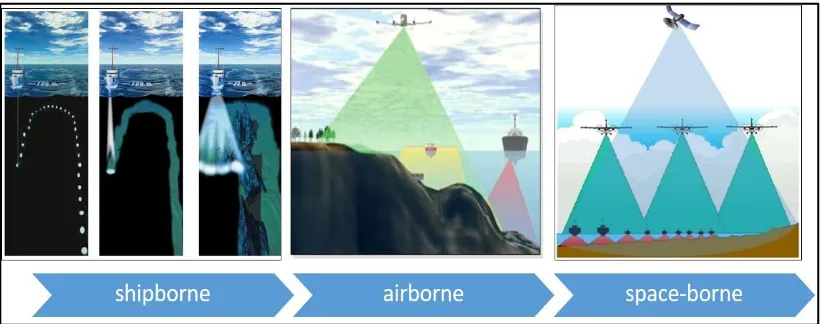
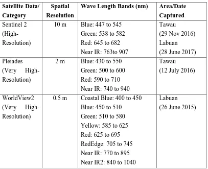
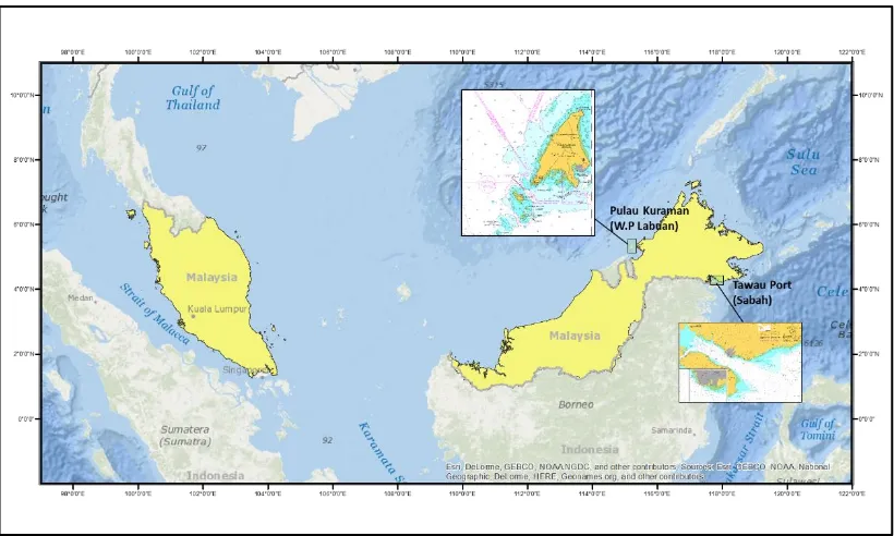
Satellite-derived bathymetry for shallow water hydrographic mapping
Full text
Figure


Outline
Related documents
The purpose of this analysis was to com- pare imaging stroke features across 3 groups of patients: (1) patients with persistent/paroxysmal AF determined either by history,
Classification: The final classification step is based on linear discriminant analysis using all the other subjects (AD and CN populations for AD or CN subjects, and pMCI and
The three visualization classes reflect papers analyzed by our SLR. Respectively, 30 papers deal with urban characterization, 18 with spatial discovery, 12 with
Aetna is one of the nation's leaders in health care, dental, pharmacy, group life, and disability insurance, and employee benefits..
Tajudeen Shah 109 www.PoemHunter.com - The World's Poetry Archive...
The complexity of this fourth death repeats the driving question of Smole’s play: “How does one kill a ghost?” 13 The character of Creon in Slovene renditions of Antigone,
Their authors were Miha Kastelic, librarian, poet and editor of The Carniolan Bee, with his text The Finding of Mercury in Idrija (published in Bleiweis’s.. literature
Results of the experiment indicated that there was no significant residual effect of organic fertilizer applied one year ago on the stem and leaf fresh weights (biomass), stem
