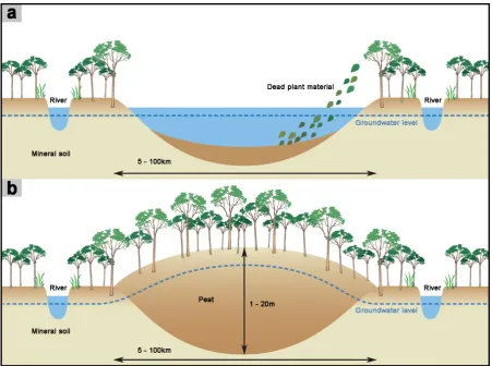
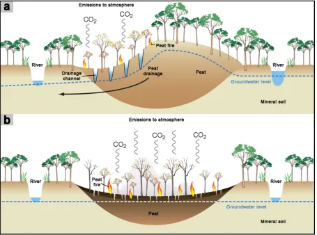
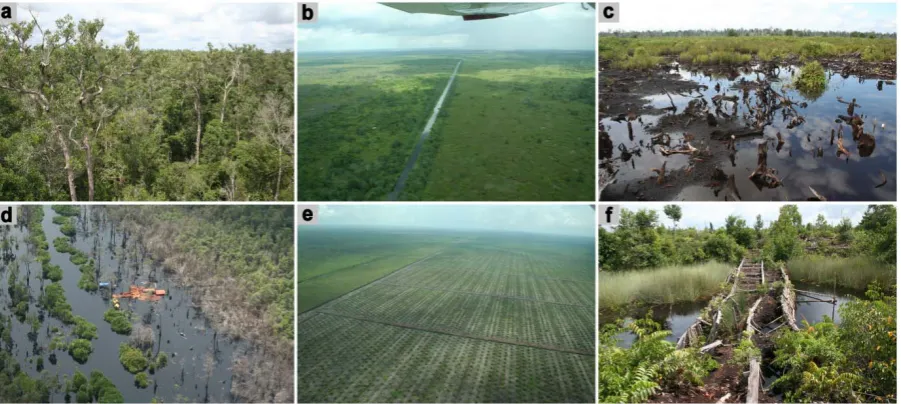
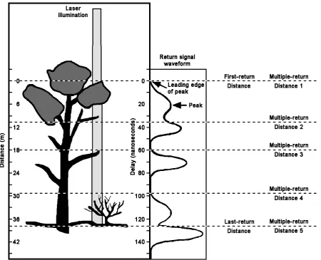
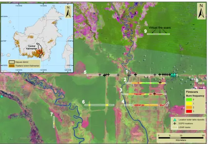
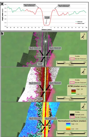
Ballhorn, Uwe (2012): Airborne and spaceborne LiDAR data as a measurement tool for peatland topography, peat fire burn depth, and forest above ground biomass in Central Kalimantan, Indonesia. Dissertation, LMU München: Fakultät für Biologie
Full text
Figure
Outline
Related documents
The Regents established the policy that the appropriate use of commercial credit cards should be administered at the systemwide level and authorized the President to approve
The study used time series data for Zimbabwe (1975-2012) to: (i) empirically determine the link between economic growth and four macroeconomic variables (Foreign
Region X consists of 80 school districts which are governed by school boards consisting of five to seven members as established by the Texas Education Code (1995) except
According to Bolton (2004) preferential procurement in the public construction sector has accelerated the participation of HDIs and SMMEs, however, many
In the spirit of BBC, 5 I show that part of the appreciation of the Canadian bilateral exchange rate (hereafter referred to as CAD) during the Great Appreciation can potentially lead
Therefore, in each class of A through D reserves and resources, implicit recovery factors, which are the maximum theoretical recovery, are applied to in-place oil and gas
Kristin Hill, Great Lakes Inter-Tribal Epidemiology Center Christine Hovell, Jackson County Health Department Mary Kaulaity/Nelis, Bad River Tribal Health Center Carol Rollins,
There were several presentations devoted to the individual center’s knowledge strategies, as well as those devoted to the overall knowledge strategy of NASA. JPL Chief
