Automated Pothole Detection System using Internet
of Things (IOT)
Prof. Amit Zore
1, Kaushal Malkan
2, Mashhuda Shaikh
3, Shrutika Mhashilkar
4, Gurpreet Kaur
51Project Guide, 2, 3, 4, 5Student, Department of Computer Engineering, Dhole Patil College of Engineering, Pune, India
Abstract: It is widely known that the number of accidents on the streets of India is growing at a tremendous rate. And a large number of those accidents are due to the improper maintenance and construction of the roads. Therefore, we are proposing a solution which implements ultrasonic sensors for pothole detection. We are also providing a method of output by utilizing Liquid Crystal Display. A notification is incrementally given to the user in real time about the total number of potholes in his/her route. Also in this system, we have an addon that all the information related to the potholes will be submitted to the officials of the government of India. This is for them to take further actions to improve the condition of the roads. Thus, this technique can be utilized to prevent the better part of the accidents and also take probable measures to improve the state of the streets as soon as possible.
Keywords: Ultrasonic sensor, IoT board, Arduino Microcontroller, Speaker, LCD
I. INTRODUCTION
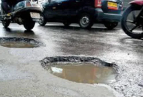
[image:1.595.174.423.414.586.2]One of the most damaging experiences in our life is driving. Because of unsafe road conditions, several drivers are losing their lives. Maintenance of roads has become the most challenging factor within the current situation. There's an enormous increase in population rate moreover as vehicle purchase rate, over the last ten to twenty years. Majority of Indian population travels through roadways on a daily basis.
Fig 1. Condition of Indian roads with potholes.
The most prominent issue for the drivers is their safety on the road. Driving safely isn't the sole way to avoid accidents as a result of the accident might occur because of varied different reasons like an improper construction of roads, potholes, and humps present on the paved surface, etc. Because of severe rains or the run of heavy vehicles on the road potholes are primarily formed.
A Report taken in 2017 in India on Road Accidents, reported by the Transport analysis wing under the Ministry of Highways & Road Transport, has mentioned that several folks died on roads accidents in India in 2017, compared to the quantity of death s in 2016. According to this survey, the states of Uttar Pradesh and Tamil Nadu have reported the most significant number of deaths. According to the information from the report, the country features a record of at least 4,80,652 accidents in 2016, that ends up in nearly 1,50,785 deaths. The quantity tells that a minimum of 413 folks died daily in almost 1,317 road accidents because of potholes.
II. LITERATURE SURVEY
1) Paper Name: A research of pavement potholes detection based on three-dimensional projection transformation.
2) Author Name: H. Youquan, W. Jian, Q. Hanxing, Z. Wei, and X. Jianfang
3) Year: 2010
4) Summary: The optical imaging principle of 3-dimensional projection transformation is utilised in a model, to obtain pictorial information of pothole’s cross-section in pothole detection. Various digital image processing techniques or methodologies, along with: binarization, image processing, thinning, three dimensional reconstruction, error analysis and compensation are performed in the series of image analysis and processing.
1) Paper Name: Metrology and visualization of potholes using the microsoft Kinect sensor
2) Author Name: I. Moazzam, K. Kamal, S. Mathavan, S. Usman, and M. Rahman
3) Year: 2013
4) Summary: An author has developed a model in which a low cost Kinect sensor is used. Kinect gives the direct depth
measurements, thereby reducing computing costs. Meshes are generated for better visualization of potholes. Based on the depth value, the area of the pothole is analyzed.
1) PaperName: Potholes detection based on SVM in the pavement distress image
2) Author Name: J. Lin and Y. Liu
3) Year: 2010
4) Summary: An author has proposed a method for pothole detection based on SVM, where SVM stands for Support Vector
Machine. The measurements of textures derived from the Histogram is extracted as the features of the region of the picture. The main purpose of the non-linear SVM is to judge whether a target image region can be declared as a pothole. According to this, a method for detecting the potholes off the pavement is proposed. The experimental result shows that the algorithm can achieve a high recognition rate.
1) Paper Name: Pothole detection and warning system: Infrastructure support and system design
2) Author Name: S. S. Rode, S. Vijay, P. Goyal, P. Kulkarni, and K. Arya
3) Year: 2009
4) Summary: An author has designed a system in which novel Wi-Fi based architecture for pothole detection and warning system
which assists the driver in avoiding pothole on the roads by prior warning. The system consists of access points placed on the road sides for broadcasting data, which can be received by Wi-Fi enable vehicles as they enter the area covered by the influence of the access points. The application can be integrated in the vehicle so as to alarm the driver in the form of a visual signal, audio signal or even trigger the braking system.
III. PROBLEM STATEMENT
In the past few years, there has been an oversized increase in vehicle population. This increase in vehicle population has led to increasing road accidents and additionally holdup. In keeping with international Road Safety OverReport, 2015 discharged by the World Health Organization (WHO), India accounts for over 200,000 deaths owing to road accidents.
These accidents will be thanks to over rushing, drunk driving, jumping traffic signals and additionally thanks to humps, speed-breakers, and potholes. Thus it's vital to gather data concerning these poor road conditions and distribute a similar to other vehicles that successively facilitate in the reduction of accidents caused thanks to potholes and humps. Hence, we've planned a system that may apprise the drivers concerning any hurdles like potholes and humps, and the govt will utilize this data to correct these roads effectively.
IV. PROPOSED SYSTEM
V. MODULES A. User Module
The user can do the registration method on their mobile screens. Then when the registration is complete, they're going to login to induce info regarding the quantity of potholes within the path from the source to the destination location provided by them. Whenever the user registers, the information can get mechanically updated into the database of the admin section.
Fig: User Module
B. Database
This is the database section where all the data associated with the users and also the locations of potholes is held on. The admin can log in exploitation their username and password and may delete, update and create necessary changes as per the necessities. It additionally stores elaborated info regarding the potholes like it’s depth, breadth and latitude-longitude values.
Fig: Database Tables
Fig: Database Values
C. Admin Module
Fig: Admin Module
VI. SYSTEM ARCHITECTURE
VII. ALGORITHM
Requirement : Network N, Weight of Pothole Identification Id for all the values in the Database as input, Sensor S, Controller, Ed is the set of edges(arcs), V is the correspond to interconnecting points.
1) Step 1: for all pothole id Ed do
2) Step 2: for all Id in the database do
3) Step 3: if Pothole with identification number Id is on arc e then // Arc-damage sum, d1(e) = d0 + b(Id) where b(Id) is the depth of the pothole on arc e with identification Id.
4) Step 4: if d1(e)¿d0
5) Step 5: end if
6) Step 6: end for
7) Step 7: end for
8) Step 8: return pothole Weighted to the server G0 = (V, Ed) of Street network.
9) Step 9: Stop
VIII. TOOLS AND TECHNOLOGY USED
We have created a system in Java technology. Data is held on in MySQL database. We've created a mobile application using android Studio 3.0. For distance activity in between automotive body and paved surface, we tend to use ultrasonic sensing element (HC-SR04). A mobile application that communicates with the vehicle driver using a native server. We've calculated the depth parameter it shows if there's pothole present or not.
IX. REQUIREMENTS
A. Functional Requirements
1) GUI Application: The 3 tier internet applications comprises of presentation logic, business logic, and data logic. Within the presentation logic layer, the computer program (UI) is developed through that users communicate their internet requests. The validations and internet service functionalities are written within the Business logic. The data logic layer handles all the database queries generated as a result of internet requests..
2) Automatic Pothole Detection: Roads conjure to the bulk of means of transportation used as of nowadays in India. It's necessary to take care of the streets as they're stuffed with unannounced obstacles like potholes and humps. These obstacles cause harm to the vehicles and even have led to a variety of accidents within the past that conjure to a substantial quantity, and this should be given a solution regardless. This idea proposes a cheap answer that has timely alerts to the drivers concerning potholes.
B. Nonfunctional Requirements
Performance Requirements
1) All the functions and also the modules should have an honest performance.
2) The performance of the software system can enable users to work with efficiency.
3) Performance of question-answering of data ought to be quick.
a) Safety and Security Requirements: The appliance is meant in modules wherever errors will be detected and fixed simply. This makes it easier to put in and update new practicality if needed.
X. CONCLUSION
The system automatically detects the potholes sends the data concerning this to the vehicle drivers, in order that they will avoid accidents. This method helps us to prevent dreadful pothole thus to avoid any tragic accidents thanks to dangerous road conditions. The knowledge also can be utilized by the govt. Authorities for the upkeep of the roads.
XI. FUTURE SCOPE
This software system will be changed and developed any as per the user necessities within the future. Our enforced system sends a notification detected value to the govt. server once the pothole is detected. To boost it, we will send a reading to the user portal additionally that road pothole is detected.
REFERENCES
[1] Rajeshwari Madli, Santosh Hebbar, Praveenraj Pattar, and VaraprasadGolla,Automatic Detection and Notification of Potholes and Humps on Roads to Aid Drivers, IEEE Sensors J., Vol. 15, No. 8, August 2015.
[2] H. Youquan, W. Jian, Q. Hanxing, Z. Wei, and X. Jianfang, A research of pavement potholes detection based on three-dimensional projection transformation, in Proc. 4th Int. Congr. Image Signal Process (CISP), Oct. 2011, pp. 18051808.
[3] S. S. Rode, S. Vijay, P. Goyal, P. Kulkarni, and K. Arya, Pothole detection and warning system: Software support and infrastructure design, in Proc. Int. Conf. Electron. Comput. Technol., Feb. 2009, pp. 286290.
[4] J. Lin and Y. Liu, Potholes detection based on SVM in the pavement distress image, in Proc. 9th Int. Symp. Distrib.Comput. Appl. Bus. Eng. Sci., Aug. 2010, pp. 544 547
[5] R. Sundar, S. Hebbar, and V. Gola, Implementing intelligent traffic control system for congestion control, ambulance clearance, and stolen vehicle detection, IEEE Sensors J., vol. 15, no. 2, pp. 11091113, Feb. 2015.