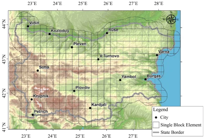
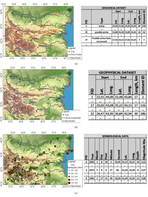
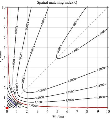
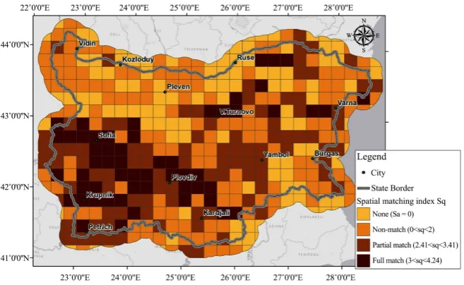
Integration of Geological, Geophysical and Seismological Data for Seismic Hazard Assessment Using Spatial Matching Index
Full text
Figure
Related documents
An integral part of this course is training in techniques and methods for the analysis of subsurface geological and geophysical data (wireline logs, seismic reflection data, etc.),
It aims at augmenting the resources of the central and state boards for prevention and control of water pollution. Following this Act, The Water (Prevention and Control of
The Ottawa Valley Landslide Project (OVLP) is a regional geological, geotechnical and geophysical investigation by the Geological Survey of Canada (GSC) of the critical
“The Articles of Association provides for the distribution in respect of each Accounting Period of surplus net income represented by the distributions and interest
AssET MAnAgEMEnT includes vehicle specifications, cargo, route planning, aerodynamics, idle time (including the consider- ation of on-road motorcycles to replace certain
1) Headform-Helmet contact: it represents the contact between the headform and the helmet. It is modeled by means of a no-linear spring-damper applied between the Headform CG and the
objectively the case. Over-reporting will thus apply to both persons with and without disabilities. In addition, the gold indicator will measure general discrimination rather
The magnetic recording media can be generally considered as a communication channel, although the channel response and characteristics are different from each
