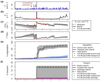
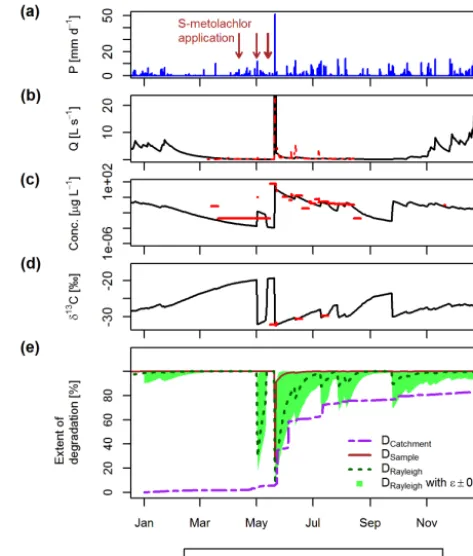
Pesticide fate on catchment scale: conceptual modelling of stream CSIA data
Full text
Figure


Related documents
The study area included over 2600 census tracts. States and other large jurisdictions can easily aggregate areas to create stable LE estimates using the Geographic Aggregation
Keywords: Cloud base height; Sky imager; Irradiance ramp detection; Short-term solar forecasting
Thank you for agreeing to participate in a research project exploring the feasibility of estimating DLA/AA take-up rates. An interview with you will help us to assess the
The theoretical concerns that should be addressed so that the proposed inter-mated breeding program can be effectively used are as follows: (1) the minimum sam- ple size that
According to the aforementioned issues, seven research questions were raised in this study, in which the emphasis of each components of sustainable development, such as the
As previously stated, since this is a PFR, the analysis is limited based on location, character, and extent. Therefore, staff’s review and analysis is limited to the
This method compares the chaotic regions and the sequential order of the cycle numbers between the original and reconstructed BDs, using the Levenshtein distance as a measure..
In addition, the client database enabled continuous tracking, monitoring and reporting on client demand, needs and service provision with feedback and data regularly provided
