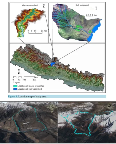
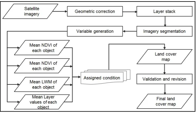
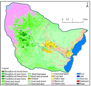
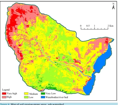
An Optical High and Medium Spatial Resolution Approach for Erosion Prone Areas Assessment in Mustang, Nepal
Full text
Figure

Related documents
Proposals under discussion to revise Vietnam’s 2013 land law reflect a fundamental shift from the historically dominant “land to the tiller” narrative to a new dominant discourse
The remaining six (6) credit hours are electives to be taken from related graduate courses (e.g., Mathematics (MATH), Computer Science (ICS), Software Engineering
For the day-to-day segment the distribution of the spreads between actual interest rates and the related Libor shows that – irrespective of the width of the interest rate band
Type B evaluation: conversion from linear units to log-units. Quantities contributing to
Residents of Alaska, Arizona, California, Colorado, Hawai‘i, Idaho, Montana, Nevada, New Mexico, North Dakota, Oregon, South Dakota, Utah, Washington, Wyoming, and the
Total mass of harvested grapes separated by number of retained primary buds averaged over shade leaf removal treatment, years 2011 and 2012, and cultivar... Effect of shade
In con- trast to adult findings on the role of attentional bias, approach bias and cognitive control, only cannabis craving significantly correlated with current cannabis use
In Section 3 we present the main results: Theorem 1 states that the D-core is the only solution on the space of all TU-games satisfying projection consistency, reasonableness
