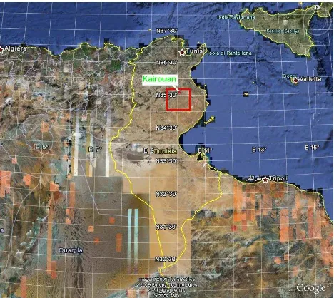
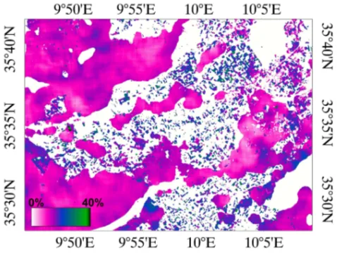
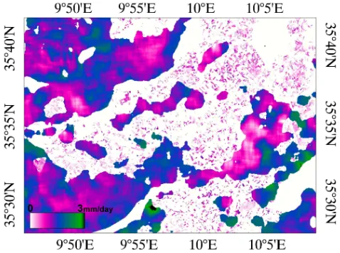
Soil surface moisture estimation over a semi arid region using ENVISAT ASAR radar data for soil evaporation evaluation
Full text
Figure
Related documents
Under reasonable assumptions, it is possible to determine the rover attitude and configuration, given its position and ground characteristics, and whether the rover will slide, tip
Because Handel composed operas in the Italian style, albeit in London, the ornamentation of Because Handel composed operas in the Italian style, albeit in London, the ornamentation
Variables that are used to calculate the instantaneous camber that affect the prediction accuracy include the modulus of elasticity of the concrete, the prestress force, and
RIPS A static source code analyser for vulnerabilities in PHP scripts.. A static source
We improve the automatic speech recognition of broadcast news using paradigms from Web 2.0 to obtain time- and topic- relevant text data for language modeling.. We elaborate an
However, impaired signaling molecule phosphorylation was not specific to the effector memory T cell subset, as we also observed decreased phosphorylation in the CD45RA + subset of
Question: To clarify, data collected from outpatient encounters from October through December 2015 for OP-29 and OP-30 should use the latest version of the Specifications
In order to fill a gap of the understanding of bio-aerosol distribution, dispersion and deposition in a tunnel-ventilated poultry house, a 3-di- mensinal CFD model is successfully
