• No results found

An Inter-Comparison of Techniques for Determining Velocities of Maritime Arctic Glaciers, Svalbard, Using Radarsat-2 Wide Fine Mode Data

N/A
N/A
Protected

Academic year: 2020

Share "An Inter-Comparison of Techniques for Determining Velocities of Maritime Arctic Glaciers, Svalbard, Using Radarsat-2 Wide Fine Mode Data"

Copied!
17
0
0

Loading.... (view fulltext now)

Full text

Figure

Figure 1. Image extents of Radarsat-2 image pairs utilized in this study (green outlines denote Radarsat-2 imagery with acquisition dates)
Table 1. Radarsat-2 Beam modes used in this study with nominal resolution and scene size
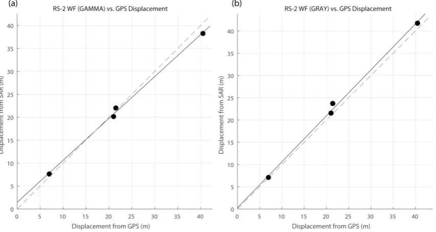
Figure 2. Comparison of displacements of Kronebreen from RS-2 Wide Fine data and GPS. (a) RS-2 Wide Fine (GAMMA) vs
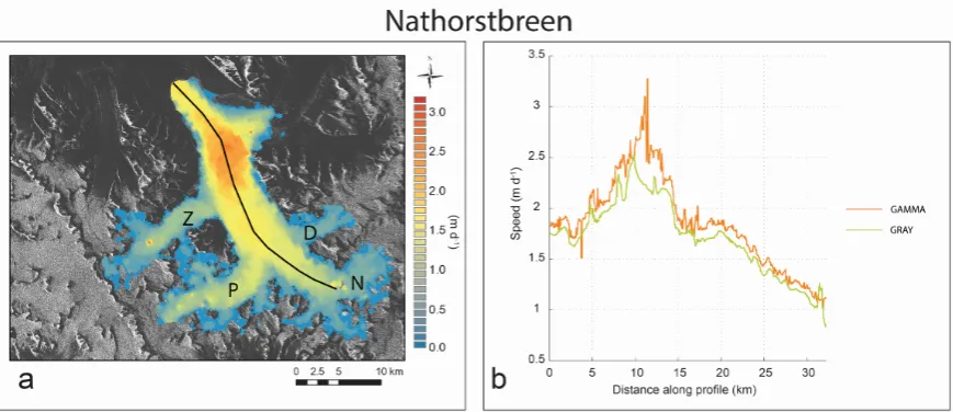
Figure 3. Surface speed of Svalbard glaciers processed with the GRAY method (fastest speed is quoted)
+6

References

Related documents