Proc. IAHS, 374, 105–112, 2016 proc-iahs.net/374/105/2016/ doi:10.5194/piahs-374-105-2016
© Author(s) 2016. CC Attribution 3.0 License.
Open Access
ater
Resources
Assessment
and
Seasonal
Prediction
Construction and evaluation of a Toolbox for the
formulation of the Hydrologic component of the Basin
Management Plans in Colombia
Victor H. Garzón1, Ricardo Garzón1, Pedro M. Avellaneda1, Erasmo A. Rodríguez1, and Leonardo Alfonso2
1Department of Civil and Agricultural Engineering, Universidad Nacional de Colombia, Bogotá, Colombia 2Hydroinformatics Chair, UNESCO – IHE, Delft, the Netherlands
Correspondence to:Victor H. Garzón ([email protected])
Published: 17 October 2016
Abstract. The Colombian Ministry of Environment, Housing and Territorial Development issued the Policy for Integrated Water Resources Management in 2010, with the formulation of Basin Management Plans (POMCA) as a key component. The main purpose of these plans is to support land use planning and sustainable management of renewable natural resources. Since the announcement of the policy; however, advances in the formulation of POMCAs have been limited, due to the need of generating knowledge and the necessary information to formulate such plans. To contribute to the generation of such knowledge, we developed HidroCHEP: a Toolbox to support the formulation and hydrologic characterization of Colombian basins. In this paper, we report the design, architecture, implementation and use of the toolbox, to understand the climatic variability of the country and to improve predictions in ungauged basins. The use of the toolbox is illustrated and evaluated through its application in three pilot river basins (Pamplonita, Gualí and Ceibas) each with different level of available hydrologic and climatic data. This paper focuses on the use of the toolbox for the development of one of the products required by the technical guide for the formulation of POMCA, in the Pamplonita river basin. Main advantages and disadvantages of its application are evaluated. It is demonstrated that the toolbox has the potential to support the formulation of POMCAs in the country and to contribute to integrated national water resources management.
1 Introduction
Four of 214 large basins in the world (with more than 100 000 km2) are located in Colombia, namely the Mag-dalena, Guaviare, Casanare and Meta rivers. The country has also three basins between 50 000 and 100 000 km2 in the Cauca, Inírida and Putumayo rivers, and over 700 000 watersheds with areas smaller than 10 km2. The country’s water network is complemented by the richness of ground-water and surface ground-water storage, among lakes, ponds, reser-voirs, marshes and swamps which reach 17 000 water bodies (IDEAM, 2002). This water wealth represents for Colombia an asset that requires a good characterization for its proper management.
and plan the management of natural resources at the basin level, maintaining a balance between socio economic use and the conservation of the physical and biotic components of the basin.
In this context, the environmental authorities are responsi-ble to declare the planning state of a basin under their juris-diction and to proceed with the formulation of POMCAs with partial or complete external technical support (National De-cree 1729/2002, Article 19). According to the Colombian In-stitute of Hydrology, Meteorology and Environmental Stud-ies (IDEAM), there are 39 basins and 343 basins sub-ject to management and eligible for POMCA formulation (IDEAM, 2004).
Colombia has the urgent need to generate knowledge and information to support the decision making, planning, man-agement and sustainable use of water resources, which is also essential for water quality and hydro-ecological management (Sauquet et al., 2008), the productivity of stream and flood-plain ecosystems (Harris et al., 2000). It is well known that numerous ecological processes in rivers are sensitive to their variations (e. g. Biggs and Close, 1989; Richter et al., 1996; Poff et al., 1997; Cattanéo, 2005; Beechie et al., 2006; Monk et al., 2006, 2007, 2008; Olden et al., 2006).
Data are significant to understand the complexities and the inter – relations of multiple physical and social aspects oc-curring in a river basin (Blöschl et al., 2013). Restrictions on the use and accessibility of basic information for hydro-logical purposes, added to the limited spatial and temporal coverage, are two challenges when modeling water resources in Colombian basins. In addition, the country needs more skilled professionals able to: apply and validate computa-tional tools developed around the globe, understand the role of mathematical modeling to study physical processes, and evaluate different scenarios. The large climatic variability, in both temporal and spatial scales, has been a relevant chal-lenge for the earth sciences in recent decades (Poveda, 2004), and this variability confuses the ability to understand the be-haviour of water resources in the country.
It is evident the need to develop and consolidate technical supporting tools for professionals in the country, who are re-sponsible for carrying out basin management. Proper under-standing of these techniques, along with suitable computa-tional tool, will allow manager to analyze different scenarios and support their decision-making process. To this end, the development of information systems that supports dynami-cally the decision making (IDEAM, 2010) is needed. This is the motivation for Universidad Nacional de Colombia, to
ies implemented with emphasis on the Pamplonita pilot case study. Finally, in Sect. 4, a discussion and conclusions related to the use of HidroCHEP are presented.
2 HidroCHEP: a toolbox for basin management plans
The hydrological toolbox for the formulation of a POMCA, HidroCHEP, is an aggregate of computer applications, case studies and methodologies for formulating the hydrological component of POMCAs. As part of PNGIRH, the Ministry of Environment and Sustainable Development (MinAmbiente) published a technical guide for the formulation of POMCAs (MinAmbiente, 2014), which includes the description of six required stages: readiness, diagnosis, prospective and envi-ronmental zoning, formulation, implementation and monitor-ing, and evaluation. The characterization of the watershed is part of the diagnosis stage and has different topics and ac-tivities with defined products. The toolbox has a wide range of computer applications (most of them from free software), aimed to support the development of the products required by each topic presented in the technical guide.
HidroCHEP also includes a compilation of data sources for catchment characterization. It integrates tools and data sources with each POMCA required product, in order to complete the activity, facilitating the data collection, tools use and the development of the products.
The general architecture of HidroCHEP is indicated in Fig. 1, and it is based on adaptation and complementation of the architecture of similar existing hydrological toolboxes (e.g. eWater, 2012; CSDMS, 2008; Global Water Partner-ship, 2013). The toolbox is web-based, and three main sec-tions are recognized, namely POMCA’s guidelines, tools and case studies, described below.
2.1 Guidelines for the construction of POMCA’s topic-based products
Figure 1.Main components of HidroCHEP’s architecture.
Figure 2.Flowchart of the use of HidroCHEP for the elaboration of a POMCA product.
Topics include hydrography, climate, hydrology, mor-phometry, and slopes. Each of these topics is divided into activities and each activity is briefly described. For in-stance, for the case of hydrography, two activities are rec-ognized, namely (1) identification, description and river net-work drafting, and (2) characterization of drainage systems and patterns. Each activity is described following a struc-ture that includes a description (where objectives, uses and products are mentioned), data needs, tools, and a step–based suggested procedure necessary to complete the activity.
2.2 Hydrological tools repository
One of the objectives of HidroCHEP is to collect different tools, essentially computer applications, which supports the construction of the products required by the POMCA. These are grouped into nine main categories: (1) data processing, tools to process and analyze the information typically used in hydrological applications according to the availability of the data in Colombia; (2) climate characterization, group of tools that allow the characterization of the meteorological variables required by the technical guide of the Ministry; (3) estimation of indexes, set of tools for the calculation of indices typically employed to characterize the hydrological behavior of a watershed; (4) water budget models, tools that
allow to estimate water budgets in a watershed with different levels of aggregation and amount of information; (5) mathe-matical modeling: tools that supports the implementation of mathematical modeling for the simulation of the hydrologi-cal components of the watershed; (6) model’s hydrologi-calibration and validation, tools used for calibration and validation of models within the framework of mathematical modeling in hydrol-ogy; (7) hydrography: set of tools that allow the characteri-zation of the hydrographic network of a watershed; (8) wa-ter resources management, tools that include components of supply, demand, and water resources management, in order to evaluate different scenarios and hydrological responses; and (9) estimation of environmental flows, tools that allow to estimate environmental flows using different methods.
In addition, there is a category dedicated to the compila-tion of sources of informacompila-tion for obtaining the necessary meteorological and catchment characterization data, includ-ing that of global databases, as those produced by the na-tional hydrometeorological network and nana-tional services.
2.3 Case studies
re-Figure 3.Location of the Pamplonita, Ceibas and Gualí catchments in Colombia.
quired by the technical guide, along with the results of the application.
Each case study follows a methodological framework as illustrated in Fig. 2. The user starts to consult the guide for the development of a specific product required by the tech-nical guide, where several available tools are displayed. The user can make an initial selection of a tool, which is recom-mended for a minimal data information available; otherwise a different tool may be selected when there are more infor-mation.
3 Application of HidroCHEP for selected case studies
The actual version of HidroCHEP has three case studies of Colombian basins: Pamplonita, Gualí and Ceibas river
basins. The locations of theses basins are shown in Fig. 3. Each case has different levels of available monitoring and hy-drometeorological information, thus illustrating the toolbox capabilities. This section presents, for the Pamplonita river basin, the use of the toolbox for the development of one of the products required by the technical guide.
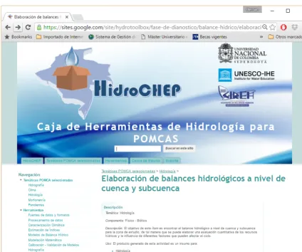
Figure 4.HidroCHEP interface showing a guide for a POMCA selected product.
3.1 Selection of the POMCA’s topic
From the POMCA’s topics included in HidroCHEP, it is pos-sible to choose one out of five themes related to hydrologi-cal characterization: hydrography, climate, hydrology, mor-phometry and slope characterization. Each option has spe-cific products. In the following section, the process to achieve product 06 “Making water budget at basin and sub-basin level”, from the Hydrology topic (Fig. 4), is presented.
According to the guide shown in HidroCHEP, hydroclima-tologic information of the study area is required. Hydrom-eteorological records are available for this basin (IDEAM, 2015).
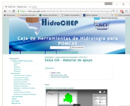
3.2 Selection of the tool
One of the tools available to make a water budget in Hy-droCHEP is the software SAGA GIS (Conrad et al., 2015), a GIS with different interpolation options, and an administra-tion and raster calculator. These features are adequate to meet the goals at this phase of the POMCA development (Fig. 5).
This software requires raster images of each variable con-sidered for the water budget: a balance between rainfall and evapotranspiration.
3.3 Making the POMCA’s product
As evapotranspiration data in the basin are not available, Turc’s equation (Turc, 1961) is used to make an annual esti-mation, and Hargreaves’s equation (Hargreaves and Samani, 1985) is used to make a monthly estimation. This is done using the raster calculator option of SAGA. The results are shown in Fig. 6.
Figure 5.HidroCHEP interface showing the support material for the use of a tool.
4 Discussion
There are many tools and models globally available, which have been designed to achieve different hydrological pur-poses. Each model has different data requirements, and its implementation on real cases may not be straightforward for inexperienced novice user. Having large data sets does not necessarily mean that proper hydrological information is available (Gupta et al., 2008). As reported by Ackoff (1989) and Bellinger et al. (2004), it is necessary to understand that data conducts to information and do not represent the same. The latter embodies the understanding of a relationship of some sort, possibly cause and effect. In the same sense, in-formation produces knowledge and, this one, in turn, under-standing of the hydrological systems.
It is clear that, besides the need to have data available to understand the catchment behavior, techniques to exploit information from individual catchment studies are needed, which is required for the planning and management of wa-ter resources that is aimed by the PNGIRH in Colombia. In this context, HidroCHEP provides the linkage between data
sources and tools, making its use efficient and helpful to un-derstand the behavior of a basin.
Hence, one of the main contributions of HidroCHEP is to provide an easy access to different data sources including global and national hydrometeorological data, which allows the user to include not just traditional rainfall runoff data (and other hydrological data, e.g., soil moisture, evaporation, wind speed), but also other kinds of data related to the behavior of the catchment (e.g., vegetation, topography, drainage struc-ture). The use of new data sources, such as satellite data, combined with field measurements and expert judgment of local hydrologist is also encouraged.
Figure 6.Annual and monthly water budget components for the Pamplonita’s river basin using SAGA GIS.
With these contributions, it is expected that HidroCHEP provides a way to progress the formulation of POMCAS in the country and to advance the understanding of the national water resources. It is expected that stakeholders can gain con-fidence on their decisions, as they will be more informed for integral management.
HidroCHEP is under development. In this regard, a sec-tion dedicated to the users’ feedback is foreseen, including a discussion forum, WIKIs, and the opportunity for scientist and professionals from the hydrologic sciences to share their own experiences.
5 Toolbox availability
All the elements of the Toolbox HidroCHEP can be ac-cessed at the HidroCHEP website https://sites.google.com/ site/hydrotoolbox/. The tools, documentation and case stud-ies are available on this website (in Spanish).
Acknowledgements. The toolbox described in this paper was de-veloped at the Universidad Nacional de Colombia, with the support of UNESCO IHE, and the Colcuencas project (Piloting Colombia’s New IWRM Policy in Key Catchments) under the programmatic cooperation between the Directorate-General for International Co-operation (DGIS) of the Dutch Ministry of Foreign Affairs and UNESCO-IHE, also called the DGIS UNESCO-IHE Programmatic Cooperation (DUPC1). Any opinions, findings and conclusions or recommendations expressed in this material are those of the authors and do not necessarily reflect the views of the Universidad Nacional de Colombia, UNESCO IHE, or the Dutch Ministry of Foreign Af-fairs.
References
Ackoff, R.: From data to wisdom, Journal of Applied System Anal-ysis, 16, 3–9, 1989.
2427.1989.tb01096.x, 1989.
Blöschl, G., Sivalapan, M., Wagener, T., Viglione, A., and Savenije, H.: Runoff prediction in Ungauged Basins: Synthesis across Pro-cesses, Places and Scales, Cambridge University Press, Cam-bridge, ISBN 978-1-107-02818-0, 2013.
Cattanéo, F.: Does hydrology constrain the structure of fish assem-plages in French streams? Local scale analysis, Archiv für Hy-drobiologie, 164, 345–365, doi:10.1127/0003-9136/2005/0164-0345, 2005.
Colombian Institute of Hydrology, Meteorology and Environmental Studies (IDEAM): Colombia’s State Resources and Environmen-tal Profile 2001, Bogotá – Colombia, 2002.
Colombian Institute of Hydrology, Meteorology and Environmental Studies (IDEAM): Zoning and coding watershed in Colombia, Bogotá – Colombia, 2004.
Colombian Institute of Hydrology, Meteorology and Environmental Studies (IDEAM): National Water Study ENA 2010, Bogotá – Colombia, 2010.
Colombian Institute of Hydrology, Meteorology and Environmen-tal Studies (IDEAM): Monthly hydrometeorological records: Se-lected years, 1995–2014, Retrieved from: National environmen-tal information system, 2015.
Community Surface Dynamics Modeling System (CSDMS): CS-DMS Model Repository, CSCS-DMS Web Site, retrieved from: http: //csdms.colorado.edu/wiki/Model_download_portal (last access: April 2015), 2008.
Conrad, O., Bechtel, B., Bock, M., Dietrich, H., Fischer, E., Gerlitz, L., Wehberg, J., Wichmann, V., and Böhner, J.: System for Au-tomated Geoscientific Analyses (SAGA) v. 2.1.4, Geosci. Model Dev., 8, 1991–2007, doi:10.5194/gmd-8-1991-2015, 2015. eWater Cooperative Research Centre: eWater Toolkit, eWater web
site, retrieved from: http://toolkit.ewater.org.au/ (last access: April 2015), 2015.
Global Water Partnership: Integrated Water Resources Management Toolbox (IWRM Toolbox), retrieved from: http://www.gwp.org/ en/ToolBox/ (last access: April 2015), 2013.
Gupta, H., Wagener, T., and Liu, Y.: Reconciling theory with obser-vations: elements of a diagnostic approach to model evaluation, Hydrol. Process., 22, 3802–3813, doi:10.1002/hyp.6989, 2008.
ente): Technical Guide for the formulation of Basin Management Plans (POMCAS), Bogotá – Colombia, 2014.
Monk, W., Wood, P., Hannah, D., Wilson, D., Extence, C., and Chadd, R.: Flow variability and macro invertebrate community response within riverine systems, River Res. Appl., 22, 595–615, doi:10.1002/rra.933, 2006.
Monk, W., Wood, P., Hannah, D., and Wilson, D.: Selection of river flow indices for the assessment of hydroecological change, River Res. Appl., 23, 113–122, doi:10.1002/rra.964, 2007.
Monk, W., Wood, P., Hannah, D., and Wilson, D.: Macro in-vertebrate community response to inter-annual and regional river flow regime dynamics, River Res. Appl., 24, 988–1001, doi:10.1002/rra.1120, 2008.
Olden, J., Poff, N., and Bledsoe, B.: Incorporating eco-logical knowledge into ecoinformatics: an example of modelling hierarchically structured aquatic communities with neutral networks, Ecological Informatics, 1, 33–42, doi:10.1016/j.ecoinf.2005.08.003, 2006.
Poff, N., Allan, J., Bain, M., Karr, J., Prestegaard, K., Richter, B., Sparks, R., and Stromberg, J.: The natural flow regime: a paradigm for river conservation and restoration, BioScience, 47, 769–784, doi:10.2307/1313099, 1997.
Poveda, G.: Hydroclimatology of Colombia: A synthesis from the Inter-Decadal scale up daytime scale, Revista Académica Colombiana, 28, 201–222, 2004.
Richter, B., Baumgarthner, J., Powell, J., and Braund, D.: A method for assessing hydrologic alteration within ecosys-tems, Conserv. Biol., 10, 1163–1174, doi:10.1046/j.1523-1739.1996.10041163.x, 1996.
Sauquet, E., Gottschalk, L., and Krasovskaia, I.: Estimating mean monthly runoff at ungauged locations: an application to France, Hydrol. Res., 39, 406, doi:10.2166/nh.2008.331, 2008.