Aplin, P. and Boyd, D.S. (2015) Innovative Technologies for Terrestrial Remote Sensing. Remote Sensing, 7, 4968-4972.
remote sensing
ISSN 2072-4292 www.mdpi.com/journal/remotesensing Editorial
Innovative Technologies for Terrestrial Remote Sensing
Paul Aplin * and Doreen S. Boyd
School of Geography, University of Nottingham, University Park, Nottingham NG7 2RD, UK; E-Mail: [email protected]
* Author to whom correspondence should be addressed; E-Mail: [email protected]; Tel.: +44-115-8466210; Fax: +44-115-9515249.
Academic Editor: Prasad S. Thenkabail
Received: 22 April 2015 / Accepted: 22 April 2015 / Published: 22 April 2015
Characterizing and monitoring terrestrial, or land, surface features, such as forests, deserts, and cities, are fundamental and continuing goals of Earth Observation (EO). EO imagery and related technologies are essential for increasing our scientific understanding of environmental processes, such as carbon capture and albedo change, and to manage and safeguard environmental resources, such as tropical forests, particularly over large areas or the entire globe. This measurement or observation of some property of the land surface is central to a wide range of scientific investigations and industrial operations, involving individuals and organizations from many different backgrounds and disciplines. However, the process of observing the land provides a unifying theme for these investigations, and in practice there is much consistency in the instruments used for observation and the techniques used to map and model the environmental phenomena of interest. There is therefore great potential benefit in exchanging technological knowledge and experience among the many and diverse members of the terrestrial EO community.
Remote Sens. 2015, 7 4969
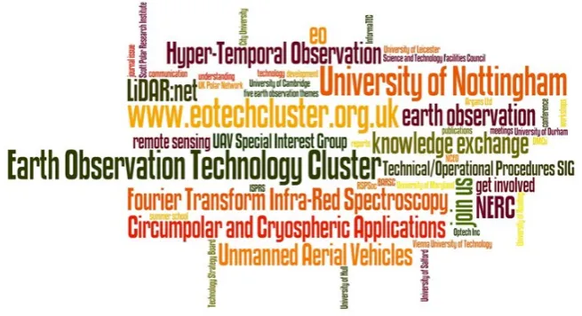
[image:3.595.134.462.204.382.2]Remote Sensing Special Issue entitled ‘Earth Observation Technology Cluster: Innovative Sensor Systems for Advanced Land Surface Studies’. Various innovative technologies for terrestrial remote sensing are presented, including examples of the principal developments and priorities in some of the theme topics, through reference to the papers collected together in this Special Issue.
Figure 1. Earth Observation Technology Cluster word cloud, showing the initiative’s principal EO technology connections and collaborations.
As noted above, the scope of the EOTC was broad to encourage engagement from many diverse disciplines. Examples from some of the main themes are provided below, but the initiative covered broader developments across the range of remote sensing operation. For instance, in this issue, Wang and Shao [2] describe the benefits of an unconventional remote sensing platform—a high altitude platform, or near-space vehicle—for acquiring and processing passive radar imagery. Novel sensor developments are presented here by, for instance, Lato et al. [3], who demonstrate the use of a gigapixel laser scanner for terrestrial photogrammetry applications. Similarly, Content et al. [4] outline a new hyperspectral imaging approach which exploits advanced microslice technology and renders an image as unconventional spectral/spatial units, significantly increasing its spatial information content compared to traditional pixel-based representation. Additionally, novel image processing technology is introduced in this issue by Tommaselli et al. [5] who present a means of exploiting low-cost digital camera technology through automated calibration of multiple oblique scenes to create large synthetic images.
There is a lack of dialogue between scientists developing TLS applications, instrument developers, and manufacturers, which in many cases, leads to inefficient and sub-optimal use of the data.
Novel remote sensing analysis is represented in the EOTC through hypertemporal imaging, which refers to a situation where we have an excess of multitemporal data, collected frequently enough to capture the dynamics of the phenomenon of interest. There is now a real opportunity for hypertemporal remote sensing capability by exploiting new EO constellations or ‘virtual constellations’ (i.e., taking advantage of observations from any appropriate EO sensor that views a particular area) which have the potential to provide daily observations of the land surface at a spatial resolution of up to 10 m. A series of technical challenges related to preprocessing must be overcome to make hypertemporal imagery useful for rigorous scientific work. While we await the launch of sensors, which truly offer hypertemporal remote sensing, there are lessons to be learned from the recent rapidly growing interest in using near-surface terrestrial sensors, which have a (sub) daily temporal resolution. In this issue, for example, Morris et al. [7] explore the potential for automatic extraction of vegetation phenological metrics from traffic webcams.
Significant remote sensing applications are represented in the EOTC through circumpolar and cryospheric studies. Indeed, a large range of polar and cryospheric remote sensing data are freely available to the research community [8]. Glaciology represents one prime example of a cryospheric application exploiting contemporary remote sensing technology. Various advanced EO approaches including gravimetry, laser and radar altimetry, and multispectral classification have been used to characterize key properties of the terrestrial cryosphere such as glacier velocity, volume and albedo variation. In this issue, Racoviteanu and Williams [9] combine visible imagery, topographic information and kinetic temperature to classify debris cover on glaciers in the eastern Himalayas. In a wider polar context, multiple satellite platforms have enabled unprecedented visualization of sea ice dynamics, as well as analysis of permafrost and lake dynamics in many regions of the high Arctic. For instance, this issue includes a study by Reschke et al. [10] using C-band synthetic aperture radar to monitor high-latitude carbon-storing wetlands.
The Earth Observation Technology Cluster was funded in the UK by the Natural Environment Research Council (NERC), and involves a partnership between three main UK umbrella bodies responsible for remote sensing development, practice and exploitation—the Remote Sensing and Photogrammetry Society (academia), the National Centre for Earth Observation (government) and the British Association of Remote Sensing Companies (industry). Importantly, to ensure global relevance and impact, the EOTC is supported by leading international organizations, most notably the International Society for Photogrammetry and Remote Sensing’s Technical Commission VII on Thematic Processing, Modeling and Analysis of Remotely Sensed Data.
Remote Sens. 2015, 7 4971
and application scientists across a range of disciplines and the legacy of the EOTC depends on continuing this fruitful engagement.
Acknowledgments
Many participants, contributors and collaborators have engaged positively with the Earth Observation Technology Cluster knowledge exchange initiative (see www.nottingham.ac.uk/eotechcluster for details). Of particular note are the EOTC manager, Alison Marsh, and leaders of the EOTC themes, Mark Danson, Danny Donoghue, Graham Ferrier, Nikolaos Galiatsatos, Allen Pope, Alberto Ramirez, and Nick Tate, who contributed energetically throughout the project, including towards this paper. Parts of this paper extend on a formative EOTC overview paper presented at the ISPRS Congress in Melbourne [1].
Author Contributions
Paul Aplin led both the Earth Observation Technology Cluster initiative as a whole and the writing and compilation of this paper. Doreen Boyd wrote the section on hypertemporal remote sensing and otherwise supported the writing and editing of the paper, and the EOTC in general.
Conflicts of Interest
The authors declare no conflict of interest.
References
1. Aplin, P.; Boyd, D.S.; Danson, F.M.; Donoghue, D.N.M.; Ferrier, G.; Galiatsatos, N.; Marsh, A.; Pope, A.; Ramirez, F.A.; Tate, N.J. The Earth Observation Technology Cluster. Int. Arch. Photogramm. Remote Sens. Spat. Inf. Sci. 2012, XXXIX-B6, 31–36.
2. Wang, W.-Q.; Shao, H. Azimuth-variant signal processing in high-altitude platform passive SAR with spaceborne/airborne transmitter. Remote Sens. 2013, 5, 1292–1310.
3. Lato, M.J.; Bevan, G.; Fergusson, M. Gigapixel imaging and photogrammetry: development of a new long range remote imaging technique. Remote Sens. 2012, 4, 3006–3021.
4. Content, R.; Blake, S.; Dunlop, C.; Nandi, D.; Sharples, R.; Talbot, G.; Shanks, T.; Donoghue, D.; Galiatsatos, N.; Luke, P. New microslice technology for hyperspectral imaging. Remote Sens. 2013, 5, 1204–1219.
5. Tommaselli, A.M.G.; Galo, M.; de Moraes, M.V.A.; Marcato Jr., J.; Caldeira, C.R.T.; Lopes, R.F. Generating virtual images from oblique frames. Remote Sens. 2013, 5, 1875–1893.
6. Ramirez, F.A.; Armitage, R.P.; Danson, F.M. Testing the application of terrestrial laser scanning to measure forest canopy gap fraction. Remote Sens. 2013, 5, 3037–3056.
7. Morris, D.E.; Boyd, D.S.; Crowe, J.A.; Johnson, C.; Smith, K. Exploring the potential for automatic extraction of vegetation phenological metrics from traffic webcams. Remote Sens. 2013, 5, 2200–2218.
9. Racoviteanu, A.; Williams, M.W. Decision tree and texture analysis for mapping debris-covered glaciers in the Kangchenjunga area, eastern Himalaya. Remote Sens. 2012, 4, 3078–3109.
10. Reschke, J.; Bartsch, A.; Schlaffer, S.; Schepaschenko, D. Capability of C-Band SAR for operational wetland monitoring at high latitudes. Remote Sens. 2012, 4, 2923–2943.