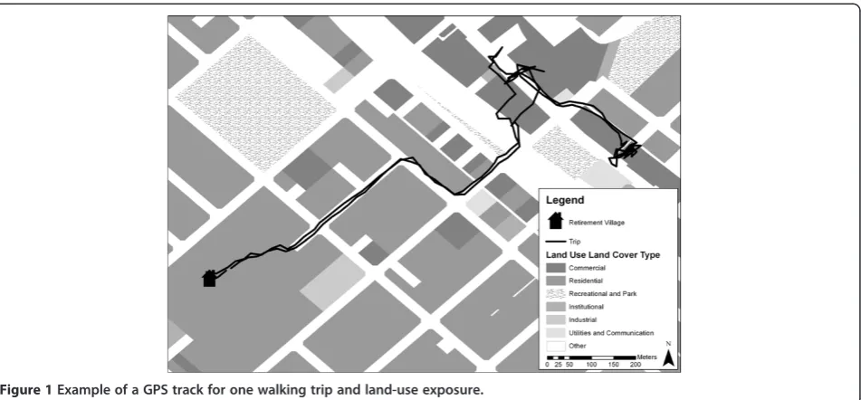
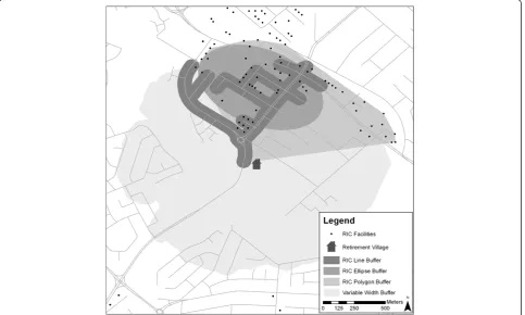
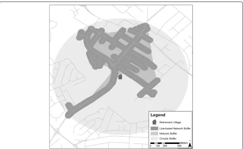
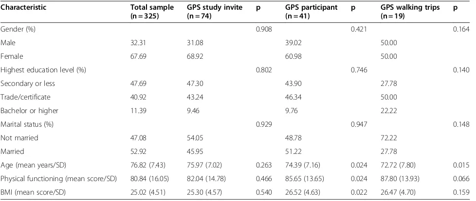
Using GPS technology to (re)-examine operational definitions of ‘neighbourhood’ in place-based health research
Full text
Figure
Related documents
This case allows us to infer that differential diagnosis of primary CNS lymphoma should always be considered when a patient presents with a brain lesion that shows imaging
All school districts that expended $500,000 or more in a year in direct/indirect Federal awards must submit to the Single Audit Clearinghouse a completed and signed Form
The laboratory practice consists of a set of three assignments with specific subjects which are in coordination with the lectures [9]. The subjects covered are:
Expertise and skill to serve as the top leader for fund development, providing strategic and engaging leadership and vision for conceiving and implementing
The investigation of the greenspace involvement and the patterns of the open greenspace provision within the transformed urban structures of the former industrial areas shows, that
The nonlinear dynamics of the double tracked road vehicle with a nonlinear response of the suspension can be analyzed by using the NNMs approach both for a case of the
Support for Mathematics & Statistics • Collaborative and Thematic Resources Support in Mathematics and Statistics (CTRMS)
We conclude that: (1) across the six test sites, the RMSE of the SFH data ranged from 7 m (Tsukuba) (approximately 2 building floors) to 81 m (Beijing) ( approximately 27
