Wireless Communication Based Disaster
Management Tracking System
Ayushi Jhade Gargee Agrawal
Student Student
Department of Electronics and Communication Engineering Department of Electronics and Communication Engineering RCOEM, Nagpur, India RCOEM, Nagpur, India
Dr. S. B Pokle
Professor
Department of Electronics and Communication Engineering RCOEM, Nagpur, India
Abstract
Our paper gives an idea to detect alive or conscious human beings trapped under the debris in disaster environment. We used PIR sensor to detect humans under the debris. We are also using ultrasonic sensor to detect obstacles coming in front of our robo t. Camera is also interfaced to give live streaming of the site which can be viewed on an application so that the rescue team can work accordingly to rescue injured people.
Keywords: PIR Sensor (Passive Infrared sensor), Arduino, ESP Wi-Fi module, GPS, RF module
________________________________________________________________________________________________________
I. INTRODUCTION
Natural disasters include earthquakes, floods, storms, cyclone, fire etc. and these disasters are not in control of humans. Man-made disasters include building collapse, industrial accidents, during mining etc. This model is designed to aid specifically in building collapse and earthquakes.
Due to certain limitations the rescue team cannot reach some parts of the affected areas. In order to speed up the whole process of rescuing and increasing the probability of saving lives of victims.
The remote controlled robotic model is able to provide significant support to rescue operation to great extent. The designed model detects conscious humans trapped under debris.
This paper proposes a remote controlled robotic model which will work in unusual situations of disaster environment and will provide timely help in case of emergencies. This system uses PIR sensor to detect motion of conscious human beings. Another sensor named ultrasonic is used to measure the distance of the obstacle from the robot.
Our system uses GPS which provides the location and movement of the victim detected by the robot. The information regarding the location of the victim can be viewed at the base station on the designated website.
A camera is installed to capture the live streaming of the affected areas. Status of the victims can also be known. ESP Wi-Fi module is used for communication in this system and the proposed model is in its prototype stage.
Autonomous robots have been proposed to rescue team nor by existing tools and techniques since many years. This paper proposes an autonomous robotic system which will work in disasters conditions.
II. LITERATURE SURVEY
This section gives an idea about disaster management systems that are currently available. It also gives information about techniques that are involved in rescuing victims.
Existing Disaster Management Systems:
National Disaster Management Division:
This division of government coordinates in post disaster relief and rehabilitation. Disaster management activities such as distribution of resources and funds are handled. The team does the disaster relief work manually. It is the National Emergency Management Authority that such as assisting the government for taking immediate actions.
Indonesia Disaster Management Information System:
SAHANA Disaster Management System:
It is a central online repository, which provides information about where information on all the internally displaced disaster victims can be stored. But it provides only online information about the people affected during disasters. It is a web based system to manage disaster related problem with different sub applications portals. These sub-applications are built to address the common disaster coordination and collaboration problems in disasters between civil society, Government, private sector, volunteers and the victims themselves.
Disaster Management System with mobile positioning terminals:
Collection and remote management of disaster information with mobile positioning terminals is another existing system, which provides data support for emergency response and scientific decision-making to commanders by uploading accurate, reliable and instant information on disaster-occurred spot. It does some research on instant disaster information upload and remote disaster management using mobile terminals.
Disaster Management System with a Fuzzy Intelligent Decision Support:
This system is an intelligent decision support system designed specifically for typhoon and help in building decision system. Operations like disaster recovery are supported by this system. This system also helps in making decisions in disaster measures and related events. It uses geographical information system for incorporating the typhoon forecasting.
III. PROPOSED MODEL
The proposed model consists of-
1) Base station which is used for controlling and monitoring.
2) Rescue station which is basically our robot which is sent to the site for tracking of humans.
Block Diagram:
Base Station:
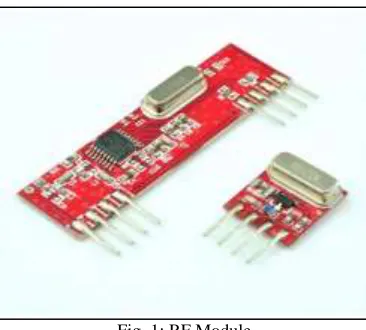
Fig. 1: RF Module
Camera:
It is the eye of our system. In our model we are using wireless CCTV camera to see the live scene of the surroundings from the base station. It is an independent system. There is a transmitter and receiver. Transmitter is placed on the robot and the live streaming of the camera can be viewed on an application. Transmitter will send video data to receiver through radio frequency waves.
L293D:
L293D IC is a current amplifying circuit. It consists of two Darlington pair. It allows DC motor to drive in reverse as well as forward direction. It is a 16 pin IC with eight pins on each side for controlling of motor. It consists of two H-bridge to rotate a motor in clockwise or anticlockwise direction. H-bridge is the circuit for controlling a low current rated motor.
Fig. 2: L293D IC
PIR Sensor:
Fig. 3: PIR Sensor
PIR sensor in our model is used for detecting motion of conscious humans.
GPS:
Global positioning system (GPS) is a space based radio navigation system. GPS is used to detect the Latitude and Longitude of any location on the earth with exact UTC (Universal Time Coordinated) time. GPS uses NMEA 0183 protocol. NMEA 0183 protocol uses a simple ASCII, serial communications protocol that defines how data are transmitted in a “sentence” from one “talker” to multiple “listeners” at a time. NMEA format consist several sentences, in which we only need one sentence. This sentence starts from $GPGGA (referred to Global positioning System Fix Data) and contains coordinate, time and other useful information. GPS receivers send serial data out of a transmit pin a specific bit rate.
Ultrasonic Sensor:
HC-SR04 is an ultrasonic sensor which uses sonar to determine distance to an object. It has an excellent non-contact range detection. Ultrasonic sensor has a high accuracy from 2cm to 400 cm and operation is not affected by sunlight. It emits an ultrasound at 40 kHz which travels through the air and if there is an object or obstacle on its path it will bounce back to the module.
Fig. 4: Ultrasonic Sensor
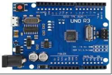
Arduino Uno R3:
Diamond Standard core (LX3) made by Tensilica. The ESP8266 chip is made by Espressif. Modules bearing this chip are made by various manufacturers.
V. WORKING PRINCIPLE
Using RF module the controlling of robot from the base station is done. To move the robot right, left, reverse or forward a transmitting signal is sent to L293D from RF transmitter and with the help of this signal the robot will move accordingly. With the help of ESP Wi-Fi module the whole communication is carried out.
Then, to find the number of injured people PIR Sensor is used. PIR sensor detects the motion and if presence of victim is detected then the information will be sent to the base station. Our proposed system has Ultrasonic sensor to measure the distance to an object by using sound waves.
GPS is interfaced to find the exact location of the robot and it is viewed on the website. The video of surrounding can be viewed using a camera which includes set of transmitter and receiver.
A website is developed for viewing all the necessary information at the base station. Website will be used for viewing total count of victims using PIR sensor, status of Ultrasonic sensor and location of the robot. The live streaming of camera can be viewed on an app named SJCAM ZONE.
In our system we can find all conscious humans in the disaster environment. It is fast and cost effective.
VII. OTHER APPLICATIONS
It can also be used in the following applications:
Inspection of contaminated or hazardous environments Navigating the different terrain of a disaster site Sensor suite for human detection
It gives the locations of victims covered in debris, trapped in voids, or entombed, for certain rescue operations for example- rescuing children trapped inside bore wells.
VIII. FUTURE SCOPE
This prototype can be further enhanced in the future. It can also be used under water if the circuitry is made water resistant or water proof.
Also, it can be used in fire fighting for confirming the position of a victim that can help firemen to a great extent. It can be incorporated as a drone and its corresponding applications such as security purposes.
IR camera can be incorporated in our model with 360 degree rotation to exactly capture IR pattern emitted by human body. Furthermore, by using Omron D6T sensor which detects the presence of humans in unconscious state and this will increase the reliability of detection.
REFERENCES
[1] Hans John Dcruz, “Rescue of alive human being by an autonomous robot using PIC microcontroller” proceedings of International conference on explorations and innovations in engineering and technology, ICEIET 2016.pp-269-273
[2] A.Seethai, “Rescue Robotics Using Artificial Intelligence” International Journal of Advanced Research in Computer and Communication Engineering, December 2013.pp-4589-4593
[3] Shwetha R, Dr. Chethan H K proposed a design on “Automatic and manual controlled alive human detection robot during disaster management” International Journal for Technological Research in Engineering Volume 1, Issue 11, July-2014.pp-28-33
[4] Nagashree C, Kavya Rao B, Maria Jyothi Lobo, Harshitha B S and Antony P J, “Smart Life Tracking and Rescuing Disaster Management System” Department of Information Science & Engineering, St. Joseph Engineering College, Mangalore, VTU, India.pp-10-17
[5] http://drdoficciatac.com/TechnologyDetails.aspx?TechID=T00002 [6] http://www.instructables.com/id/L293D-Motor-Driver/
[7] www.instructables.com/id/wifi-communication-between-two-esp8266/ [8] www.arduino.org