Using a GIS to Assessment the Load Carrying Capacity of Soil Case of Berhoum Area, Hodna Basin, (Eastern Algeria)
Full text
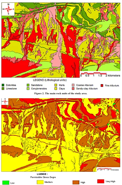
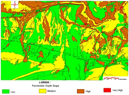
Figure


Related documents
Semantic types are used to identify drug concepts from MEDLINE citations, and UMLS semantic rela- tionships, such as hypernymy, are used to cluster drugs that share an
The current study, which is a collection of 4 studies, fills a gap in the literature by incorporating research on White racial identity, social psychology research on guilt and
As inter-speaker variability among these the two groups was minimal, ranging from 0% to 2% of lack of concord in the 21-40 group and from 41% to 46% in the 71+ generation, we
Large deviations of the this antioxidant activity are considerable, as well as content of phenolic compounds between pollen grains taken from different plant species
Different configurations of hybrid model combining wavelet analysis and artificial neural network for time series forecasting of monthly precipitation have been developed and
The clean screen is not available for HMI devices with touch screen and function keys. In this case, configure a screen without operator controls,
Rare splice mutations of both genes in introns with non-conserved splice sites and with unknown prevalence are not detected by DNA based diagnostics, they can only be identified
For the poorest farmers in eastern India, then, the benefits of groundwater irrigation have come through three routes: in large part, through purchased pump irrigation and, in a
