An Introduction to Spatial Database, Spatial Data Types and Spatial Index Analysis using Multidimensional Geo-Database
Full text
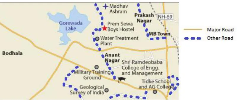
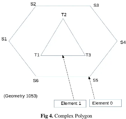
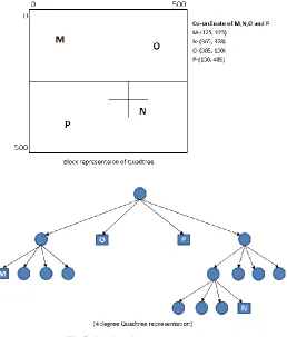
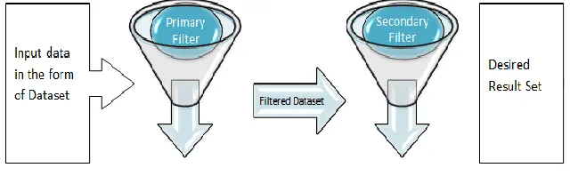
Figure

Related documents
One such agency is the National Library Board of Singapore (NLB), which was recently awarded the Best Practice Award in Resource Management at the 2014 Excellence in Public Service
El model està format per les classes Comentari, Estat i Incidència, aquestes contenen informació de com s’ha de veure la vista dels comentaris, l’estat de la
The second research question investigated if integrating peer feedback into the self- assessment process would help students to create self-assessment ratings that
disclose any information obtained during the mediation unless the parties expressly consent to such disclosure, or unless disclosure is required by applicable rules of law. A
Using observed transaction prices alone, the seminal paper Roll (1984) proposes a simple model to estimate the effective bid-ask spread without information on the bid and the
The broad objective of this study is to assess the implementation of Zimbabwe’s current tobacco- control legislation, and to present an analysis of the current situation in the
The average area of corn grain produced per finished animal was much greater in the Midwest than the Northern Plains, but production values per animal for corn silage,
