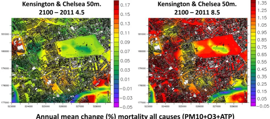
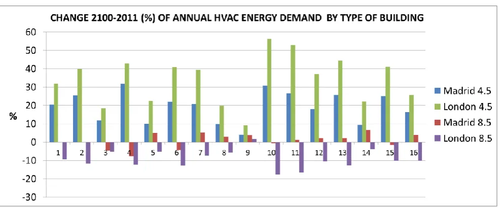
Direct Impacts of Global Climate Change on Urban Areas
8
0
0
Full text
Figure


Related documents