Some initial thoughts on sediment dynamics in the
active phreatic conduits of the Yorkshire Dales, UK.
Phillip J MURPHY
1and John N CORDINGLEY
21
School of Earth and Environment, University of Leeds, LS2 9JT, UK.
2Ingleborough Cave, Clapham, NorthYorkshire, LA2 8EE, UK.
Abstract: Observations by cave divers of the nature and contexts of clastic sedimentary deposits in Yorkshire Dales caves, especially those within water-filled phreatic conduits, are gradually being collected and interpreted. Insights into the age, history, relationships and dynamics of the clastic materials are emerging alongside more obvious basic data such as sediment grain size, clast lithology and possible clast provenance. Potentially these and other aspects have wider relevance to other karst issues, including studies of palaeo-hydrology and sequences of conduit development; they can also provide pointers to the whereabouts and possible significance of currently unknown cave passages.
Received: 09 January 2013; Accepted: 25 February 2013.
© British Cave Research Association 2013 ISSN 1356-191X
C
AVE ANDK
ARSTS
CIENCE, Vol.40, No.1, 2013Transactions of the British Cave Research Association
The study of active sedimentary processes in the phreatic zone of karst aquifers is in its infancy. Most of the historical literature describing attempts to understand phreatic zone processes has relied to a great extent upon studies of drained conduits. This situation was summarized neatly by Lauritzen et al. (1985), who considered that: “This situation is a direct parallel to the case of anatomists dissecting a dead body rather than studying the living organism”. As cave diving progressed from a pioneering exploratory technique to an established discipline (Farr, 1991; Ward and Haywood, 2008), observations recorded by cave divers and by cave-diving scientists with direct access to the phreatic zone have greatly enhanced knowledge and understanding.
From the outset in 1946 in the UK, the Cave Diving Group’s approach has been methodical and scientific. Initial work was obviously centred on developing safe exploration techniques but only a year after the Group was formed members became involved in the first speleological studies within underwater caves. Of special note, and standing out as a rare piece of speleological research to be reported in the journal Nature, was Bob Davies and colleagues’ comprehensive set of experiments at the ‘Torricellian Chamber’ in Peak Cavern’s Buxton Water Sump, Derbyshire (Davies, 1950).
Much of the following Report stems from direct observations by the authors, and from discussions with, and observations by, cave diving colleagues. Caving clubs have a long history of recording their exploits in club journals. Some of these have irregular publication dates and small print runs, but all the references listed here should be available from the British Cave Research Association (BCRA) library, including the Cave Diving Group Newsletter, Descent magazine and various caving club journals. The many available reports provide a fascinating and invaluable store of useful, clear and generally concise observations accessible by cave scientists.
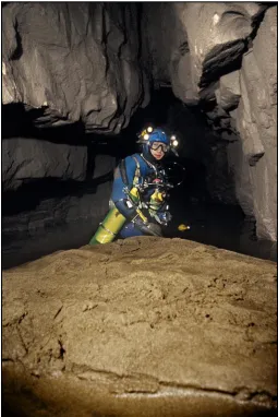
[image:1.595.32.564.493.789.2]Most of the granular bed load within active conduits in the Yorkshire Dales consists of sand and fine gravel-grade materials, derived primarily from overlying strata within the Yoredale and Millstone Grit groups (Figs 1 and 2). Such material moves through the conduits by progradation of dune-like bedforms (Murphy, 1999a). Grains are moved up the stoss (upstream) side until they accumulate high on the lee face. When the build-up of accumulated grains becomes unstable a grain avalanche occurs and this process accretes a single lamina on the dune’s lee side. By this mechanism the bedform migrates downstream and the laminae, known as foresets, dip in the direction of migration.
In active phreatic conduits the situation is slightly more complicated. Firstly, in many instances, the overall shape and size of the bedforms are controlled by the conduit morphology, so that they are probably better described as bars (or barforms) rather than true dunes (Fig.3). Secondly, being dependent upon flow regimes that can fluctuate over time, the direction of water flow in a conduit may change, resulting in a reversal of the direction of sediment progradation. These complications are well illustrated by the description of barform morphology and migration given by Sudell (1987, 1989) in the Notts Pot Downstream Sump. Here a large bedform that had previously stopped diving exploration by filling the passage had migrated what was presumed to be ‘upstream’, but under the prevailing flow conditions acted as ‘downstream’, leaving the diver’s line reel on what had become the far side of the blockage. Similar mobile deposits of sand and fine to medium gravel (Fig.4) are common an water-filled passages across the Dales.
Keld Head in Kingsdale is the longest underwater system thus far explored in the UK. The original route between the West Kingsdale Master Cave and Keld Head, as explored in the 1970s (Plant, 1979a, 1979b), was 1784m long. Further exploration has revealed that for the most of this distance the originally explored passage is paralleled by at least one conduit, and for 400m the original diver’s route, explored downstream from the Master Cave, was in a conduit parallel with the main flow (Cordingley, 1989a). The survey of Keld Head shown by Monico (1995, facing p.123), clearly illustrates the ‘network’-like plan of such phreatic conduits systems.
Conduits parallel to the main flow become active for sediment movement only at times of elevated flow and at different times flow may reverse in the conduit. Exploration of the Black Keld system in Wharfedale remains incomplete but interim survey data suggest the existence of looping parallel conduits such as those in Keld Head awaiting exploration (Judd, 2000b). One such branch 120m into Sump 5 was completely blocked by a sand bar, and the main way on was missed (Murphy, 1999b). Subsequently a number of side passages have been explored in the 640m-long Sump 5, all of which rejoin with the main conduit (Stanton, 2006).
The sumps of Ibbeth Peril Cave 1 in Dentdale provide an example of a system where the water flow is in different directions depending upon discharge. During times of low flow the water in the system enters the phreatic zone beneath the large and spectacular Main Chamber. A shallow static sump leads to a conduit that appears to be in the main flow. This has been followed for 150m from the start of the sump, spiraling beneath itself to reach a depth of 27m. At this point contact with the floor of the passage, which comprised loose sediment at the angle of repose; caused the sediment to slump, burying the diver (Murphy, 1994).
The fact that the sediment was at the angle of repose suggests that the passage had acted as an outlet at times of elevated flow. The River Dee outside the cave entrance does flood spectacularly at times and cavers have been trapped in the cave’s Main Chamber (Bass, 1990). A similar case of a subaqueous sediment slump burying a diver in Notts Pot is recorded by Sudell (1987), and another underwater slump occurred in Leck Beck Head while a diver was swimming above a sediment slope (Cordingley, 1993). Sudden large-scale sediment movement can be highly dangerous and such slumping has been involved in fatal cave diving accidents in the USA (Doron and Paldor, 2010) and in France (Whitehouse et al., 2011).
Sleets Gill Cave, near Hawkswick in Littondale, provides another example of elevated water levels changing the hydrological behavior of a conduit. The Main Gallery in Sleets Gill is an impressive, normally abandoned, phreatic tunnel that is entered by descending a steeply inclined tubular passage to a depth of 24m below the cave entrance. Under low flow conditions most of the active drainage flows beneath the Main Gallery in a much less mature passage, known as Hyperthermia. During times of higher discharge the latter passage is unable to accommodate all of the increased flow and water levels rise to fill the Main Gallery, entering from more than one source. In extreme conditions the water may even rise all the way up the entrance ramp to resurge from the cave entrance (Deane, 1992; Long, 1992a, 1992b).
Net movement of sedimentary material within a cave system is in the general direction from sinks towards resurgence, but complications of changing flow direction can mean that all the accretion to an individual barform might not be in the general direction of overall movement. Hence, when analyzing relict clastic infill with phreatic conduits the results of such periodic variations must be considered. Whereas the ultimate source of the active bed load is from breakdown of overlying strata, the history of sediment movement through cave systems is commonly more complicated and may comprise elements of many entrainment/transportation/deposition cycles.
[image:2.595.32.288.41.305.2]Figure 2: The scalloped bedrock floor of Joint Hole in Chapel-le-Dale is partially covered with sand and gravel clasts, which are actively transported during periods of high discharge. (Photo: John Cordingley.)
[image:2.595.308.564.391.774.2]Large volumes of coarser-grained relict sediment deposits are seen throughout the caves of the Yorkshire Dales. A typical example in Stream Passage Chamber, Gaping Gill, is illustrated by Waltham (1974, p.103, lower photograph). Here the sediment pile consists of intermixed coarse- (cobble and boulder) and fine-grained material. This is best described as a diamicton – a poorly sorted deposit with a wide range of grain sizes. The photograph caption (Waltham, 1974) describes the material as “glaciofluvial debris”. Such terms are now considered best avoided, because they provide little in the way of description and instantly label deposits with a (speculative) mode of origin/emplacement. Generally the use of non-genetic, textural, descriptive terms for cave sediments is far more appropriate, because such descriptions should remain valid no matter how ideas of emplacement evolve.
Occurrences of large volumes of sediment that include particle sizes not currently observed to be undergoing active transport raises questions regarding how they were emplaced. Clasts of larger size require greater amounts of energy to move them into or through a cave, so it appears that they date from a time, or times, when much more groundwater was moving through the aquifer than is now the case. Most commonly a simplistic and non-specific ‘meltwater’-related origin has been suggested. However, in the case of Illusion Pot (between Kingsdale and Chapel-le-Dale) a link with the sub-glacial drainage system of the Chapel-le-Dale ice stream has been invoked (Murphy et al., 2001).
Possible involvement of mass movement in the emplacement of such coarse clastic material, even deep within a cave, should not be dismissed, because episodic slumping of sediment into caves clearly does occur. Even in relatively recent times major slumping events have been recorded at Ireby Fell Cavern in 1954 (Reynolds and Wilson, 1963), Marble Pot in 1980 (Waltham et al., 2005 p.89; Waltham, 2007, p.116), Stream Passage Pot in 1982 (Jefferson, 1984; Schofield, 1985) and at Lost Pot (Walker et al., 1982), Aygill Caverns (Taylor, 2010), Christmas Pot (Benn, 2012) and Hurnell Moss Pot (Allshorn, 2012). The Lost Pot slump was witnessed from inside and the written account gives a feel for the volume and speed of sediment movement involved in some of these episodes. Whereas it can be argued that caver interference might have played a part in destabilizing some of the material that subsequently slumped, this was not the case for the collapse that revealed Notts Pot to cavers in 1946 (Myers, 1952).
Since the early days of radiometric dating (Gascoyne et al., 1983) it has been recognized that some of the major conduits beneath the Yorkshire Dales pre-date at least the two most recent glacial periods. Understanding of how climatic variations and multiple glaciations during the Pleistocene affected local caves has also been enhanced more recently (e.g. Lundberg et al., 2010). It is now clear that there have been many times when groundwater flow must have been greater than current levels, so sediment emplacement could have taken place during many glacial/interglacial cycles.
[image:3.595.171.565.43.302.2] [image:3.595.168.563.561.799.2]Much of the present-day underground drainage in the Yorkshire Dales karst can be thought of as underfit streams occupying conduits that were initially enlarged when the groundwater flow was greater. A large part of the active bedload has been – and is still being – eroded preferentially from very poorly-sorted clastic sediments already in the cave, and the remnant material, comprising clasts that are too coarse to be entrained, is left behind as a lag deposit. An excellent example of this is seen in the upper reaches of the Notts 2 streamway, where actively prograding bars of relatively finer sand-grade material move over a bed of coarser-grained sediments. Whereas the material from these coarser deposits does not normally form part of the active bedload, the lag deposits are commonly encountered by divers.
The development of crusts of hydrated iron oxide and manganese compounds in caves is well known (e.g. Hill and Forti, 1997). In Joint Hole, Chapel-le-Dale, such in situ crusts have been described cementing cobble-grade material that overlies a deposit of clay-grade sediment interpreted as glacial rock flour (Murphy, 1999). This broad stratigraphy is commonly seen in conduits across the Yorkshire Dales and the nearby Morecambe Bay karst (Figs 5 and 6), with particularly good examples in Wooding’s Passage in Keld Head, in the submerged passages of Malham Cove Rising and at Hurtle Pot in Chapel-le-Dale (Cordingley, 1999). Commonly this type of iron oxide-rich material coats the grains of remnant clastic deposits in caves. Whereas the origins of the iron oxides are currently poorly understood, the coatings are generally friable, so their presence confirms that much of the coarse clastic material is not being transported at present. Conversely, active bedload can be identified with moderate certainty by the lack of iron oxide coatings on the sediment clasts.
Local presence of sand-grade particles of iron oxide within the active bedload shows that at least some of the sediment has been re-eroded from deposits that were formerly cemented by iron-rich material. The avalanche foresets seen in the sediment barforms are commonly made conspicuous by the presence of dark iron oxide grains. In complex layered deposits, such as those within Sand Cavern in the Gaping Gill system, well-sorted layers of fine- and medium-grained sand alternate on a centimetre scale with layers of clay-grade sediment. The presence of iron oxide grains within these deposits suggests that the sand layers are sourced underground, presumably by the erosion of diamicton deposits elsewhere in the Gaping Gill system, followed by entrainment of sand-grade material that was then transported to and deposited within Sand Cavern.
The powerful ability of water to move sediment underground was illustrated when a small stream was diverted into pipes and used to wash away the fill from a relict phreatic tube in the West Kingsdale Master Cave system. During three winters 200m3, approximately 500
tons, of sand and gravel were removed (Davison, 1999). Volumes of sediment that can be moved by a single flood event can be immense. Following flood events divers regularly have to dig diving lines from beneath sediment deposits (e.g. Judd, 2000a).
During one flood episode in June 1999 much of the line in the 640m-long Sump 5 of Black Keld was buried and 30m of 5m-wide, formerly swimming and wading passage was filled to water level so that it became a walk (Judd, 2000b). The outflow of water during this event was estimated as 4m3 per second (PJM, observation) as opposed
to 0.04m3 per second during drought conditions (Myers, 1950).
Nevertheless, even in such an extreme flood event, larger clasts were not moved. Another extreme flood event deposited ‘whalebacks’ of sand on the show cave path in Ingleborough Cave and filled part of the cave completely. Removal of the sediment blockage required eight hours of digging by two fit young cavers (Cordingley, 1985). In the upstream sumps of the Kingsdale Master Cave, “vast banks of gravel shifted, burying long sections of the line” (Skorupka, 2004) and on returning to the limit of exploration the diver found the line reel to be “well buried under a metre high sand dune” (Skorupka, 2009).
The main streamway of Notts 2 beneath Leck Fell is 1.3km long between downstream Sumps 1 and 2 in Notts Pot. The first 700m comprises an impressive phreatic tube, beyond which a narrower vadose canyon is incised into the tube’s floor. Early development of the whole of this passage was guided by a single stratigraphical horizon. Exploration has revealed a series of drained phreatic conduits that form a network similar to that revealed in the plan of the system behind Keld Head (Riley, 1987; Stanton, 1987; Walsh, 2001). A dig to facilitate access to the more remote parts of the Notts 2 system involved a 36m-long excavation through a large sedimentary barform that completely fills the passage (Bendall, 2012). The fill was deposited before the network was drained and the dominant direction of foreset dip suggests water movement was from the main streamway towards the west. This example demonstrates that understanding past sediment transport in the phreatic zone could be an aid to cave diggers. Careful study of the deposits being excavated in relict phreatic passages should help predict whether the dig is heading in a palaeo-upstream or palaeo-downstream direction, and enable a more informed assessment of the likelihood of the digging project leading to new passages in the system.
Isolated blocks and slabs of limestone are commonly encountered in flooded conduits. These large angular fragments are presumed to originate from the passage roof and walls by either upward stoping or by wall topple. In an analogous surface situation the topple of an immense block from the wall of the open hole of Hull Pot near Horton in Ribblesdale was formerly assumed to have occurred between 1887 and 1937, based on photographic evidence and cave descriptions (Murphy and Parr, 2004). Information within an additional reference (YRC, 1927) now shows that the topple must have occurred before August 1924. Whereas the toppled block in Hull Pot remains intact, a blockfall recorded in Gaping Gill Main Chamber has broken up and been incorporated into the sediments of the chamber floor, with progress of the break-up being tracked by details recorded in caver surveys (Murphy et al., 2005).
Both of the examples above are from relict caves; however active roof fall has been observed by cave divers in Joint Hole (see Web reference 1) and a falling slab landed on a diver in the West Kingsdale Master Cave (Cordingley, 1989b). The presence on the upper surface of many fallen slabs of scallops and other dissolutional sculpting, which post-date the slab-fall, suggests that they are not breaking apart as has been observed in Gaping Gill Main Chamber (Murphy et al., 2000). The active stream passage behind Malham Cove Rising currently ends after 625m at a blockage of slabs on the line of the Langscar Fault. These slabs appear to be related to tectonic weakness and failure rather than being of dissolutional origin.
Well-rounded boulders and cobbles are commonly found below phreatic lifts at the bottom of phreatic loops. Many of these large clasts are very well rounded, suggesting they have been subject to abrasion in a similar manner to clasts in bedrock potholes in surface rivers and underground streams (Cordingley, 2009). The classic example of these Figure 6: Beck Head; an underwater cave near Witherslack in Cumbria.
[image:4.595.31.288.42.327.2]in the Yorkshire Dales is a group of very well-rounded boulders at the base of the first phreatic loop in downstream Hurtle Pot, Chapel-le-Dale, usually referred to as the ‘dinosaur eggs’ (Cordingley, 1998; Schofield, 2009). In this example individual boulders have been observed to have changed position following large-scale flood events. Normally no downstream movement is evident; the boulders remain trapped in the elbow of the phreatic loop, presumably until they have been abraded and reduced to a size that can be lifted up the phreatic riser during a high-discharge event (Murphy and Cordingley, 1999).
Situations such as presented at Leck Beck Head can embody a combination of several scenarios. Divers excavated through a choke of cobbles and boulders, dealing with heterogeneous material derived from the mass movement of surface deposits, which had previously slumped into a truncated relict entrance and been emplaced within the cave. The continually slumping nature of the underwater dig suggests that such mixed sediments continue to be sourced from the surface. Large quantities of boulders and cobbles lying in the deep part of the Leck Beck Head/Witches Cave connection are trapped within the base of a phreatic loop, and finer, potentially-mobile, gravel deposits are left at the angle of repose on a phreatic riser (Cordingley, 2011).
Conclusions
Direct observation by divers has greatly enhanced understanding of sediment dynamics in the underground karst of the Yorkshire Dales. Sand and gravel clasts are moving actively through phreatic and vadose conduits and the overall sediment movement is acieved by the progradation of migrating bedforms. Most of the coarser-grained sedimentary deposits seen in the caves do not relate to present day hydrological conditions in the aquifer and, in most cases, are relict deposits. Much of the material now observed as moving through the aquifer is derived secondarily by the winnowing-out of relatively fine-grained fractions from heterogeneous (mixed grain-size) clastic deposits, at least some of which were probably emplaced by mass movement such as continues to occur at many cave entrances. Because the direction of water flow in some conduits varies depending upon the overall discharge through the aquifer, the direction of sediment movement in a conduit may also vary over time, giving a complex internal structure to the bedform.
References
Allshorn, S, 2012. Newby Moss Entrance. Descent, 228, p.7. Bass, M 1990. Ibbeth Peril Rescue. Descent 96 p10.
Bendall, R, 2012. Adding a fraction to Notts II. Descent, 228, 1–18.. Benn, G, 2012. Restoring Christmas Pot. Descent, 227, p.13.
Cordingley, J N, 1985. Observations on a flood at Ingleborough Cave. Craven Pothole Club Journal, Vol.6, No.6, 264–265.
Cordingley, J N, 1989a. Cave Diving Group Newsletter, 93, 25–26. Cordingley, J N, 1989b. Cave Diving Group Newsletter, 92, p.14. Cordingley, J N, 1993. Cave Diving Group Newsletter, 108, p.14. Cordingley, J N, 1995. Cave Diving Group Newsletter, 116, 19–20. Cordingley, J N, 1998. Cave Diving Group Newsletter, 128, p.11. Cordingley, J N, 1999. Cave Diving Group Newsletter, 132, p.6.
Cordingley, J, 2009. Spherical clasts from boulder choked phreatic lifts. Cave and Karst Science, Vol.36(1), 29–30.
Cordingley, J, 2011. Geological controls on passage morphology in Witches Cave and Leck Beck Head sump. 45–46 in Monk, P (Ed.) Shuttleworth Pot into Witches Cave II. [Council of Northern Caving Clubs.]
Davies, R E, 1950. Water at a depth of -5ft discovered by diving in Peak Cavern.
Nature, Vol.166, p.894. [Reprinted in Cave Diving Group Newsletter, 130 (January 1999), 4–6.]
Davison, C, 1999. The power to dig or…an alternative use for firehose. Descent,
147, 32–34.
Deane, R, 1992. Lucky Escape: the Sleets Gill rescue. Descent, 106, 20–21. Doron, N and Paldor, N, 2010. The cave resonator and the Parker Tunnel collapse
problem. Safety Science, Vol.48, 607–614.
Farr, M, 1991. The Darkness Beckons (2nd edition). [London: Diadem.] ISBN 0-906-37187-2.
Gascoyne, M, Ford, D C and Schwarz, H P, 1983. Rates of cave and landform development in the Yorkshire Dales from speleothem age data. Earth Surface Processes and Landforms, Vol.8. 557–568.
Hill, C and Forti, P, 1997. Cave Minerals of the World (2nd edition). [Huntsville, Alabama, USA: National Speleological Society.]
Jefferson, J, 1984. Boulder coaxing reopens GG entrance. Descent, 60, p.4. Judd, B, 2000a. Cave Diving Group Newsletter, 136, p.14.
Judd, B, 2000b. Breaking the Black Keld barrier. Descent, 155, 24–26.
Lauritzen, S E, Abbot, J, Arneson, R, Crossley, G, Grepperud, D, Ive, A and Johnson, S, 1985. Morphology and hydraulics of an active phreatic conduit.
Cave Science, Vol.12, 139–146.
Long, M H, 1992a. The Sleets Gill incident. Descent, 106, 21–22.
Long, M H, 1992b. Hydrology and flooding risks [of Sleets Gill Cave]. Descent,
106, p.22.
Lundberg, J, Lord, T C and Murphy, P J, 2010. TIMS U–Th dates on Pleistocene speleothems from Victoria Cave, North Yorkshire, UK: Implications for palaeoenvironment and stratigraphy over multiple glacial cycles. Geosphere World, Vol.6(4), 379–395. DOI 10.1130/GES00540.1 IF2.000.
Monico, P, 1995. Northern Sump Index. [The Cave Diving Group.] Murphy, P, 1994. Cave Diving Group Newsletter, 110, p.13.
Murphy, P J, 1999a. Sediment studies in Joint Hole, Chapel-le-Dale, North Yorkshire, United Kingdom. Cave and Karst Science, Vol.26, No.2, 87–90. Murphy, P, 1999b. Cave Diving Group Newsletter, 130, p.10.
Murphy, P J and Cordingley, J N, 1999. Some observations on the occurrence of channel karren-like features in flooded karst conduits in the Yorkshire Dales.
Cave and Karst Science, Vol.26, No.3, 129–130.
Murphy, P J, Hall, A and Cordingley, J N, 2000. Anomalous scallop distributions in Joint Hole, Chapel-le-Dale, North Yorkshire, UK. Cave and Karst Science, Vol.27, No.1, 29–32.
Murphy, P J and Parr, A, 2004. Late 19th or early 20th century photographs of Hull Pot, North Yorkshire, UK. Cave and Karst Science, Vol.31, No.2, 91–92. Murphy, P J, Parr, A, Strange, K, Hunter, G, Allshorn, S, Halliwell, A, Helm, J
and Westerman, A R, 2005. Investigating the nature and origins of Gaping Gill Main Chamber, North Yorkshire UK, using ground penetrating radar and lidar.
Cave and Karst Science, Vol.32, No.2, 25–38.
Murphy P J, Smallshire, R and Midgley, C, 2001. The sediments of Illusion Pot, Kingsdale, North Yorkshire, UK: evidence for sub-glacial utilisation of a karst conduit in the Yorkshire Dales. Cave and KarstScience, Vol.28, No.1, 29–34. Myers, J O, 1950. The Mossdale Problem. Transactions of the Cave Research
Group, Vol.1, No.4, 19–30.
Myers, J O, 1952. Three ways down Notts Hole. 63–77 in Gemmel, A and Myers, J O (eds), Underground Adventure. [Dalesman.]
Plant, I, 1979a. British divers set for world record at Keld Head. Descent, 40, 21–24.
Plant, I, 1979b. Statham and Yeadon break world record in Keld Head. Descent,
40, 4–7.
Reynolds, T and Wilson, A, 1963. Reopening the Cavern – Ireby Fell. Northern Pennine Club Journal, Vol.2, No.3 (The Red Journal), 17–23.
Riley, P, 1987. The exploration of Notts 2. Northern Pennine Club Journal,
Vol.4, No.1, 9–12.
Schofield, B, 1985. The reopening of Stream Passage Pot. Bulletin of the Bradford Pothole Club, Vol.6, No.4, 52–57.
Schofield, B, 2009. Cave Diving Group Newsletter, 173, p.3. Skorupka, R, 2004. Cave Diving Group Newsletter, 151, p.9. Skorupka, R, 2009. Cave Diving Group Newsletter, 170, p.7.
Stanton, R, 1987. Notts Pot beyond sump 1 – A guidebook description. Northern Pennine Club Journal, Vol.4, No.1.
Stanton, R, 2006. The siege of Black Keld. Descent, 192, 24–25.
Sudell, B, 1987. The Notts Pot Dives. Northern Pennine Club Journal, Vol.4, No.1, 6–9.
Sudell, B, 1989. An attempt to connect Joint Hole and Notts Pot, together with other activities on Leck Fell. Chapter in Thomas, A (Ed.), The Last Adventure. [Wells, Somerset: INA Books.]
Taylor, P, 2010. Aygill Collapse. Descent, 214, p.14 [Aygill Cavern Entrance.] Walker, F, Walsh, A and Shaw, C, 1982. Lost Pot strikes back. Northern Pennine
Club Journal, Vol.3, No.3, 42–46.
Walsh, A, 2001. The quest for a dry way in. Descent, 159, 20–22.
Waltham, A C (Ed.), 1974. Limestones and Caves of North-West England. [Newton Abbot: David and Charles.]
Waltham, T, 2007. The Yorkshire Dales Landscape and Geology. [Marlborough, UK: Crowood Press.]
Waltham, T, Bell, F G and Culshaw, M G, 2005. Sinkholes and subsidence. karst and cavernous rocks in engineering and construction. [Chichester, UK: Praxis Publishing.]
Waltham, A C, Simms, M J, Farrant, A R and Goldie, H S, 1997. Karst and Caves of Great Britain. Geological Conservation Review 12. [London: Chapman and Hall.]
Ward, A M and Haywood, C P (eds), 2008. The Cave Diving Group Manual.
[Cave Diving Group.]
Whitehouse, B, Volanthan, J and Stanton, R, 2011. Rescue at Drogonniere de Gaud, Ardeche Gorge, France: October 2010. Mountain Rescue, 35, 28–31. YRC Committee, 1927. Cave Exploration. Yorkshire Ramblers’ Club Journal,
Vol.5, No.17, 240–245. [Leeds: YRC.]
Web site:
(1) http://www.cavedivinggroup.org.uk/cgi-bin/CDG/BBS/read?Thread=1508 &Message=7962