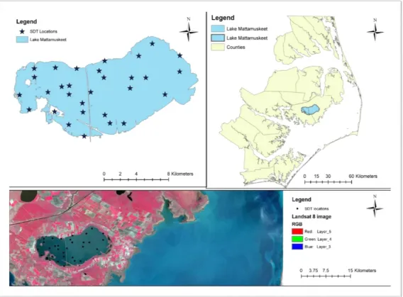
Use of Limited Data to Model Lake Water Clarity from Remote Sensed Data in Lake Mattamuskeet, North Carolina
64
0
0
Full text
Figure


+7


Related documents
The statistical analysis of geochemical data collected from the Whiteside Granite and the Tallulah Falls Formation within upland areas suggest that the sediments associated with
This study attempted to develop an extraction model of spectral values of land objects into land use/land cover classes on remote sensing image in the provision of land
In this study Remote Sensing data alongside a semi-distributed, ArcGIS based Soil Water Assessment Tool (SWAT) software were used to develop a hydrological model for the
