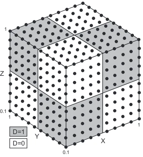
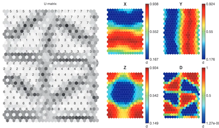
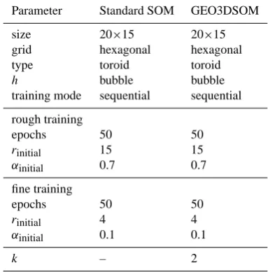
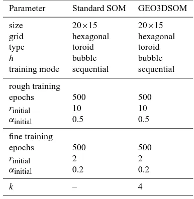
Exploratory data analysis and clustering of multivariate spatial hydrogeological data by means of GEO3DSOM, a variant of Kohonen's Self Organizing Map
Full text
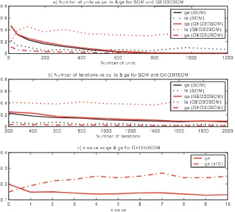
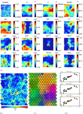
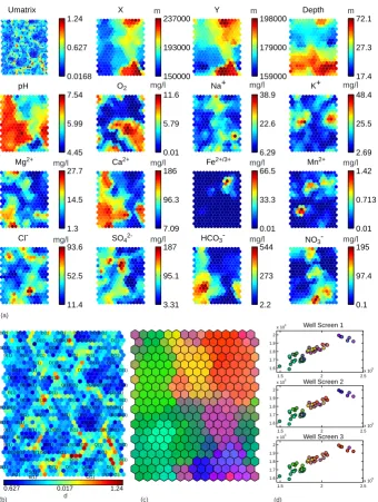
Figure


Related documents
Regarding the polarity for reputation task, our best systems in terms of accuracy ( Uned 2 and Uned 4 ) correctly classified 822 tweets as positive, 810 tweets as neutral and only
It uses sentiment analysis of Twitter data to approximate the public opinion on OER and MOOC in terms of the benefits they promise.. The analysis of the twitter data suggests
As noted in the Literature Review, above, scholarship on the determinants of foreign direct investment (FDI) variously argue the influence of GDP growth, the openness of a
2.3 Defining the ICT Profession
[r]
- Insurance Billing and Coding Specialist, 61 Degree Semester Credit Hours - Diploma - Medical Assisting Services, 39 Semester Credit Hours..
Most of the steps of TOPSIS can be easily generalized to a fuzzy environment, except max and min operations in finding the ideal solution and negative ideal solution1. Thus we
Influence of reinforcement ratio and compressive strength of concrete (HSC and UHSC) on the load carrying capacity, deflection, energy absorption, strains in the concrete
