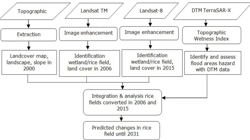
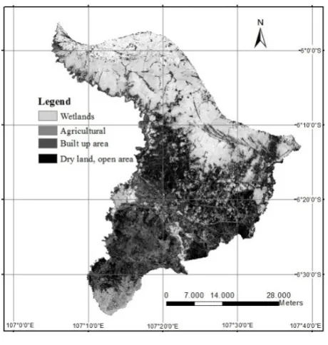
Spatial Modeling on Coastal Land Use/Land Cover Changes and its Impact on Farmers
Full text
Figure


Related documents
5.2 Speech Feature Estimation Based on GMM The GMM-based noise reduction method is performed to estimate s ( t ) [5,6].. (In [5,6], the noise
6-5.1 For telecommunications facilities, fire detection systems shall be designed, installed and main- tained to provide one of three levels of protection: (1) very early
These are: Register (register and record the application to note the date of receipt), Read (read the corres- pondence and decide whether it constitutes a request or not and if
Immunohistochemical analyses of the developing rat spinal cord and fetal human brain stem confirmed the enriched pattern of stathmin expression along the developing CST, and in
For no more than one initial excitation in the chain, matrix elements of the single-excitation subspace evolve according to the equation describing two-dimensional
In this respect, the objective of the current research is to analyze the influence on value generation in cooperation agreements of those factors affecting the potentially
Species of cultivated fishes in Japanese farms are yellow-tail Seriola quinqueradiata, amber jack Seriola purpurescens, striped jack Longirostrum delicatissimus,
While electronic clinical quality measurement (eCQM) automation by U.S. hospitals is progressing, significant barriers remain. After identifying U.S. hospital characteristics
