© 2016, IRJET | Impact Factor value: 4.45 | ISO 9001:2008 Certified Journal
| Page 377
A New Approach for a Car Navigation System
Pranay Kumar Baghel
1, Anil Kumar Mishra
21
M. Tech. Scholar, Bhilai Institute of Technology, Bhilai House, Durg, Chhattisgarh, India
2Associate Professor, Department of Electronics & Telecommunication,
Bhilai Institute of Technology, Bhilai House, Durg, Chhattisgarh, India
---***---Abstract -
Current car navigation equipments treat aroute planning problem as a single-objective problem of finding a link between source and destination. But in this paper, we take this problem as a dynamic multi-objective problem. We show that how this problem can be solved using ABC algorithm. The three considerations a driver keeps in its mind are route length, travelling time and ease of driving. The proposed method gives the solution considering every practical aspect. We give the results of experiments comparing the proposed method with the Dijkstra algorithm and the single-objective GA in applications with a road map and varying data.
Key Words: ABC algorithm, car navigation, Dijkstra, path planning, route finding.
1. INTRODUCTION
Every time a person travels from one place to another, one first determines the best available route to reach the destination. Depending on the time of day and the day of the week, this route selection differs. For example, the driver may know that a certain road is always congested at a particular time and day. As a consequence, he chooses to use a different route to avoid this congestion. So it is a multi-objective optimization problem for a driver to find feasible routes from an origin to a destination on a road map. Route length, travel time, and ease of driving are the three problems which should be optimized concurrently. The travelling time for a road changes with time and so as the toughness for a driver increases with increase in traffic. Car navigation systems are now offered as an essential and basic feature in SUV category. They have become popular among frequent travelers who have to visit different cities and places for marketing or any business trip. These car navigation systems are capable enough to take care for some of the tasks that are performed by a human driver such as reading the map and determining the best route to the reach the destination. They should also know about daily congestion patterns. Because a car navigation system uses a built-in computer, it can compare various routes and the user expects the system to determine the best possible or optimum route fast. This paper is concerned with route planning algorithms that enable a car navigation system to plan optimum routes on very large real-world road networks in
very little time, taking daily congestion patterns and other factors into account.
2. OBJECTIVES OF A NAVIGATION SYSTEM
The information that is required by drivers in selecting routes may be classified into the following three groups. i) Road information: Traffic conditions (congestion, road blocks), near view, the road map.
ii) Destination information: Its location on map and facilities, the purpose of travel, weather at the destination. iii) Mobile information: The car’s location, remaining fuel, vehicle-related conditions, traveler-related conditions (fatigue, hunger, and other physical conditions).
The primary objective of a navigation system is to suggest a path between source and destination. Navigation system performs this task by first getting information of source and destination as their positions on map. Now it recognizes the links joining these two spots. After this, it shows the path. The navigation system tries to find the shortest path. If two of the possible paths are recognized as shortest paths, it shows both of them as alternates. Now maps show information about traffic density on city roads and highways to help the drivers. Under construction roads are also displayed on maps. A good navigation system takes care of this information while suggesting a route. They are also capable of displaying a new route to reach the same destination if the driver changes his plan and follows other road than the suggested one. This is very basic work of a navigation system but based on different conditions and purposes it should change the route.
3. FACTORS AFFECTING ROUTE COST
© 2016, IRJET | Impact Factor value: 4.45 | ISO 9001:2008 Certified Journal
| Page 378
information about length of all the roads that may beencountered in our path. Road class comes second in this list. Expressway, national highway, state highway, link road, municipal road etc are different classes of the road. Also the number of lanes may give a classification where a six or eight lane road is highly preferable than a four lane road and a two lane road is preferable than single lane municipal road. Then we consider the road surface conditions. Most of the Indian rural and sub urban roads are not ideal for driving due to irregular potholes and invisible road signs. This has led to many accidents causing loss of lives and severe damage to vehicles. A road free of potholes and speed-breakers is always preferable. Too many toll barriers and high toll charges make a route costly. While travelling in highways, a toll barrier gives a pause to our journey and makes us spend some money. So we like to avoid a highway which has a toll barrier in it. These toll barriers not only charge us money but also waste our time by keeping us standing in a queue to pay the fee.
Traffic signals also consume time. Traffic lights are applied to make the traffic flow disciplined and manage the flow of the traffic. Now traffic signals have clocks showing the remaining time for us to move. A normal traffic signal stop can cause a delay of about 2 minutes while in heavy traffic areas, this delay may be of 5 to 10 minutes. So more the traffic signals are encountered in our route, more will be the delay. Traffic density on a particular lane varies with time. A lane may be very busy before and after office hours if it has offices in it. Traffic flow may feel a choke for those periods. For rest of the time, the traffic flow is smooth. In different situation like a market road, it my face traffic jam in morning and evening time. These are the situations for city roads. But highways normally have an average traffic density all the time where cars and passenger buses make it busy for the day time and cargo trucks for the night. Along with traffic density, the average speed flow of traffic also varies with time. During peak hours like office times, the average speed of traffic flow is lesser. A study has revealed that Delhi and Pune are the fastest metro cities in country with an average speed of 23 km per hour while Bangaluru and Kolkata are the slowest with speed of 17 and 18 km per hour respectively. Government promotes use of public transport in place of private cars to increase this traffic flow speed.
Not only the earlier mentioned factors but also availability of basic amenities is also an essential factor. It may be the case that a traveler finds that his fuel tank is about to get empty on a highway or wants he to buy a chocolate for child and he need some cash to do all these, so display of a fuel station, a shop and an ATM on map will help him a lot. Location of restaurants and hotels, shopping malls and parking lots are necessary information for us now. A dispensary and a chemist’s shop are very much useful in emergency conditions. A good map should have the information about all of these facilities to either enhance the fun or reduce the panic as may the situation.
Distance is not an only factor deciding cost of the route and it depends on vehicle type and purpose of journey. For a routine passenger, the cost of the travel depends on route length because more the distance, more will be the fuel consumption. But for an emergency vehicle, fuel consumption and other costs doesn’t matter. ‘Journey time’ taken by a route is the cost for them and they may opt for a longer route if it saves journey time. Same is the case for politicians’ vehicles. Cargo trucks may transport fruits and vegetables and so time factor becomes important for them, but when they carry furniture or any other things, they choose a path which consumes minimum fuel. A tourist takes this cost as his entertainment and fun.
4. ARTIFICIAL BEE COLONY (ABC) ALGORITHM
The ABC algorithm is a swarm based, meta-heuristic method based on the model first proposed by Karaboga [1] on the foraging behavior of honey bee colonies. The model is composed of three important elements: employed and unemployed foragers, and food sources. The employed and unemployed foragers are the first two elements, while the third element is the rich food sources close to their hive. The two leading modes of behavior are also described by the model. These behaviors are necessary for self -organization and collective intelligence: recruitment of forager bees to rich food sources, resulting in positive feedback and simultaneously, the abandonment of poor sources by foragers, which causes negative feedback.
The ABC consists of three groups of artificial bees: employed foragers, onlookers and scouts. The employed bees comprise the first half of the colony whereas the second half consists of the onlookers. The employed bees link to particular food sources. In other words, the number of employed bees is equal to the number of food sources for the hive. The onlookers observe the dance of the employed bees within the hive, to select a food source, whereas scouts search randomly for new food sources. Analogously in the optimization context, the number of food sources (that is the employed or onlooker bees) in ABC algorithm, is equivalent to the number of solutions in the population. Moreover, the position of a food source signifies the position of a promising solution to the optimization problem, whereas the value of nectar of a food source represents the fitness cost (quality) of the associated solution.
The search cycle of ABC consists of three rules:
a)Sending the employed bees to a food source and evaluating the nectar quality.
© 2016, IRJET | Impact Factor value: 4.45 | ISO 9001:2008 Certified Journal
| Page 379
c)Determining the scout bees and sending them on topossible food sources.
The positions of the food sources are randomly selected by the bees at the initialization stage and their nectar qualities are measured. The employed bees then share the nectar information of the sources with the bees waiting at the dance area within the hive. After sharing this information, every employed bee returns to the food source visited during the previous cycle, since the position of the food source had been memorized and then selects another food source using its visual information in the neighborhood of the present one. At the last stage, an onlooker uses the information obtained from the employed bees in the dance area to select a food source. The probability for the food sources to be selected increases with an increase in its nectar quality. Therefore, the employed bee with information of a food source with the highest nectar quality recruits the onlookers to that source. It subsequently chooses another food source in the neighborhood of the one currently in her memory based on visual information (i.e. comparison of food source positions). A new food source is randomly generated by a scout bee to replace the one abandoned by the onlooker bees. After some iterations, all the generations become identical and we get the solution.
5. Route Planning Approach
As we have discussed that existing algorithm for a working navigation system performs single objective task of finding the shortest path [3][5][7]. But depending up on the purpose of travel, a traveler may have different priorities characteristics. These priorities are based on class of roads and traffic congestions. Dijkstra’s Algorithm takes distance between two intersections as edge-cost and adds a heavy penalty if it is blocked. So when it calculates the least cost, obviously the heavy penalties increases the path cost so much and chances of selecting it in a route becomes negligible. Same is the case when a path has a road block due to construction work. So only objective is to reduce path cost.
To decide priority, we set some penalties for different factors. These factors are-
Class of road Number of lanes
Number of nodes or signals Surface of road
Traffic Density
[image:3.595.321.542.117.237.2]Now we discuss the amount of penalty for each of these factors.
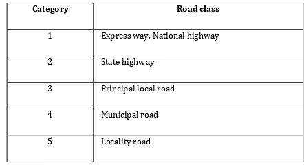
Table -1: Classes of roads
Category Road class
1 Express way, National highway
2 State highway
3 Principal local road
4 Municipal road
[image:3.595.316.545.272.382.2]5 Locality road
Table -2: Constraints and their penalties
Object of
constraint Constraint Penalty
Node To reduce the number of signals PCN
Link To select a major road PCL1
Link To select a wide road PCL2
Route To reduce the number of turns PCR
Table -3: Penalties, conditions and penalty values
Penalty Condition Value
PCN One signal 2
PCL1 Express way 0
National highway 2
Principal local road 3
Prefectural road 4
Municipal road 5
PCL2 Six-lane road 0
Four-lane road 1
Two-lane road 2
One-lane road 3
PCR No turn 0
Left-hand turn 5
Right-hand turn 7
U-turn 10
© 2016, IRJET | Impact Factor value: 4.45 | ISO 9001:2008 Certified Journal
| Page 380
violates constraints shown in Table-2. Table-3 showsexamples of penalties.
6. Result
A map is shown is figure 1. All the nods has been assigned a two digit number for convenience but actually they are treated as a point on graph and are recognized by (x,y) coordinate values. We take a set of source and destination with taking node 76 as source and node 66 as destination. Running for two different conditions and time, we get two routes for same set of source and destination shown on map. The generations of these routes has been explained one by one.
A) Route-1
This route has following sections- Two turns at 60 and 61.
Link 76-18-17-60 and link 61-16-14-13-80-19-66 are national highways.
Link 76-18-17-60 and link 61-16-14-13-80-19-66 have four lanes.
Link 60-61 is 4- lane national highway and has high traffic density.
Traffic density is low for rest of the links in route. As we can see that with just two turns having national highway throughout the route makes it the best route in normal condition. Path is shown in Fig -1. A table to display penalty values
Table -4: Penalty values for route-1
Sr. No. Penalty Category Total Penalty
1 PCL 0
2 PLA 20
3 PTD 6
4 PND 18
5 PTU 4
B) Route-2
This route has following sections- Two turns at 18, 07 and 14.
Link 76-18 and link 14-13-80-19-66 are national highways.
Link 76-18 and link 14-13-80-19-66 have four lanes. Link 18-15-12-07 is an expressway and has 6 lanes. Link 07-06-14 is a state highway and has 2 lanes. Traffic density is low throughout the route.
[image:4.595.311.556.119.483.2]As we can see that with three turns having an expressway and national highway in route makes it preferable in normal condition. A table to display penalty values is shown in Table -5.
Table -5: Penalty values for route-2
Sr. No. Penalty Category Total Penalty
1 PCL 4
2 PLA 20
3 PTD 0
4 PND 18
5 PTU 8
[image:4.595.310.559.525.760.2]Fig -1: Path generated for route -1
© 2016, IRJET | Impact Factor value: 4.45 | ISO 9001:2008 Certified Journal
| Page 381
We have taken the same source and destination in boththe cases but results are different as shown by figures. This is because of change in road conditions.
Based on the above shown results and generated route, it can be said that in a dynamic environment, where the traffic conditions are continuously changing, there are always a possibility of generation of a different route for same source and destination. It shows that our system is able to take care of dynamic conditions.
7. CONCLUSIONS
Car navigation systems are being offered as an essential feature of new cars. A navigation system offers the driver the possibility to be guided to his destination, by means of spoken and/or visual advices. The key components of a car navigation system are positioning, route planning and guidance. A driver expects that the system can make a route quickly or within a few seconds. Furthermore, he expects that the system provides him an optimum route according to a particular cost function describing his preferences. Planning optimum routes fast on very large road networks still poses a significant challenge to navigation system developer and manufacturing companies. At the same time, taking information on daily congestion patterns into account is getting more important. Drivers become increasingly demanding, and expect that traffic information is not only provided, but also used for determining the best route.
A lot of research work is going on in field of path planning for autonomous robots [10], the future belongs to them only. If regular monitoring is performed to collect real time data about condition of roads and its surface, we can have various advantages of applying this system in transport systems. Traffic pattern and congestions study will help in this regard in many ways. The very first scope using this work is in governing the speed of public transport vehicles. An ambulance can be programmed to do not cross the speed limit for a particular segment of the road[11].Traffic flow diversion is easy for rush hours in school and office areas. Tour planners can get help in planning a trip. Individuals will get this more helpful in planning their vacation trip. Transport and logistics companies may plan an efficient route and timing for cargo handling. Some work has been done on this and future expects more research in this field. If we keep on increasing the consideration points we will get more refined results.
REFERENCES
[1] Dervis Karaboga and Beyza Gorkemli “A comprehensive survey: artificial bee colony (ABC) algorithm and applications” Springer Science+Business Media B.V. 2012.
[2] Ashita S. Bhagade, Parag. V. Puranik “Artificial Bee Colony (ABC) Algorithm for Vehicle Routing
Optimization Problem” IJSCE Volume-2, Issue-2, May 2012.
[3] Adham Atyabi, David and M.W. Powers proposed a paper “Review of classical and heuristic-based navigation and path planning approaches”. IJACT Volume5, Number14, October 2013.
[4] Muthiah A and Rajkumar R “A Comparison of Artificial Bee Colony algorithm & GA to Minimize the Makespan for Job Shop Scheduling” ELSEVIER 2014. [5] Vi Tran Ngoc Nha, Soufiene Djahel and John Murphy “A Comparative Study of Vehicles’ Routing Algorithms for Route Planning in Smart Cities. IEEE 2012.
[6] Leena.N and K.K.Saju proposed a paper “A survey on path planning techniques for autonomous mobilerobots” ICAET-2014.
[7] Shivani Sanan and Leena jain proposed a paper “Shortest Path Algorithm” IJAIEM july 2013.
[8] Narendra Singh Pal and Sanjeev Sharma proposed a paper “Robot Path Planning using Swarm Intelligence: A Survey” IJCA DES 2013.
[9] Hitoshi Kanoh “Dynamic route planning for car navigation systems using virus genetic algorithms” 2007 – IOS Press and the authors.
[10] Hitoshi Kanoh and Kenta Hara “Hybrid Genetic Algorithm for Dynamic Multi-objective Route Planning with Predicted Traffic in a Real-World Road Network”, 2007.