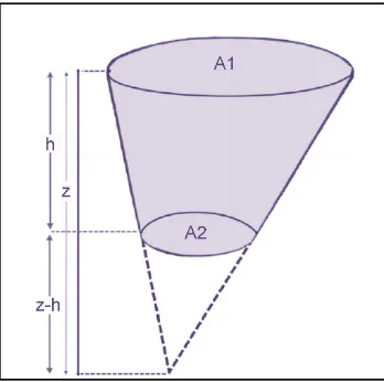
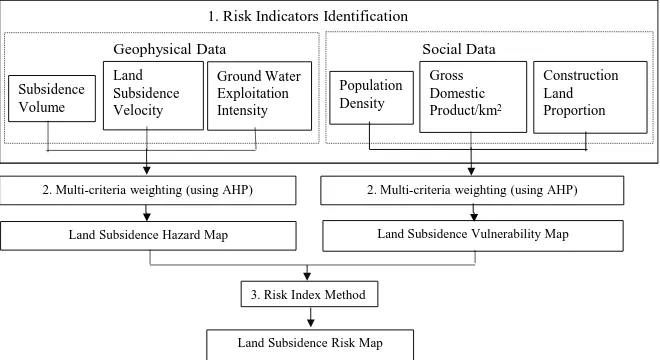
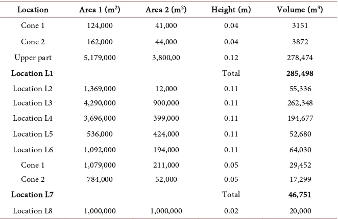
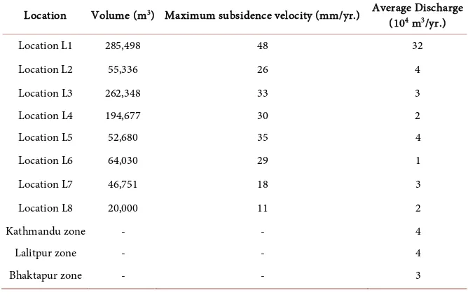
Risk Assessment of Land Subsidence in Kathmandu Valley, Nepal, Using Remote Sensing and GIS
Full text
Figure
Related documents
Furthermore, emerging data demonstrate the safety, feasibility, and potential benefit of early mobility in critically ill patients, with the need for multi- center randomized trials
According to paragraph 3 of Article 9, these plans shall include NZEB definitions reflecting national, regional or local conditions, and numerical indicators of
Bastedo, “Curriculum in higher education: The organizational dynamics of academic reform,” in American Higher Education in the Twenty-First Century: Social, Political, and
Saliha Abdou is now with the Department of Architecture and urbanism, University Mentouri of Constantine Algeria (e-mail: outtassaliha2004@yahoo.fr). shading and
Keywords:- Intuitionistic fuzzy set(IFS), TIFN, GTIFN, Nearest interval approximation, Average ranking
All factors addressed in this essay were significant in determining the outcome of each war. However each factor impacted upon at least one other, making it impossible to predict
De Hoge Raad heeft in Vano/Foreburghstaete een heldere overweging gegeven ten aanzien van de samenloop van ener- zijds dwaling en anderzijds de tekortkoming in de garantiever-
Urinary L-FABP correlates with kidney function decline in patients with acute on top of CKD after coronary angiography at baseline compared to patients with stable
