Upper Sun River Drainage Basin Origin Determined by Topographic Map Interpretation Techniques: Lewis and Clark and Teton Counties, Montana, USA
Full text
Figure

Related documents
The special features and aims of the programme are as follows • to introduce students to basic theories and major research results in sociology, political science, media
The upper Caney Fork River, Collins River, Rocky River, Cane Creek, and Hickory Creek, in White, Warren, Grundy, and Van Buren Counties support the only known populations of
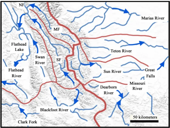
The Blackfoot River flows westward across Montana from the Continental Divide to its confluence with the Clark Fork River five miles upstream from Missoula, as shown on the map
From your main device list, click on one of the devices you want to rename, press the “ ” button on the top right for advanced settings, and click Modify Device Name. You’ll
As these buffers may be weakening with the dramatic housing reforms, socio-economic and cultural changes taking place in post-reform urban China, we use data from the 2010
Queer logics of statecraft are evident in those moments in domestic and international relations when actors or orders rely upon a queerly conceptualized Barthesian and/or – an
British Columbia supported energy KfW Development Bank has issued efficiency in new hospitals meeting green bonds since July 2014, including Leadership in Energy
