THE TIME-DEPTH OF CORDED WARE
BURIAL LANDSCAPES
A comparative study of Single Grave and Battle Axe burial
alignments in Denmark, The Netherlands and Sweden
Fig. title page - Burial mounds on the alignment of Trehuse-Sjørup-Dollerup, Denmark; the Single Grave culture barrow ‘Høj 20’ seen from the south
(Ebbesen 2006, 393, fig. 315).
Louise Olerud
The time-depth of Corded Ware burial landscapes: A comparative study of Single Grave and Battle Axe burial alignments in Denmark, The Netherlands and Sweden
Louise Olerud BA, 1530836
Bachelor Thesis Archaeology (ARCH 1043WY) Supervisor: Dhr. drs. R. Jansen
3
Table of contents
1 Introduction ...5
1.1 Problem statement ...7
1.2 The dataset ... 10
1.3 Methods ... 11
1.4 Outline ... 11
2 Theoretical framework ... 12
2.1 Burial mounds, barrow landscapes and temporality... 12
2.2 The Corded Ware ‘culture’... 16
2.3 Corded Ware chronology ... 19
2.3.1 The chronology of the Single Grave culture in Denmark ... 21
2.3.2 The chronology of the Single Grave culture in The Netherlands ... 26
2.3.3 The chronology of the Battle Axe culture in Sweden ... 29
3 The Danish alignment of Trehuse-Sjørup-Dollerup ... 34
3.1 Introduction: the research history of Trehuse-Sjørup-Dollerup ... 34
3.2 Results... 37
3.3 The time-depth of Trehuse-Sjørup-Dollerup... 40
3.4 Conclusion ... 44
4 The Dutch alignment of Angelslo-Emmerhout... 46
4.1 Introduction: the research history of Angelslo-Emmerhout ... 46
4.2 Results... 52
4.2.1 GIS analysis ... 53
4.3 The time-depth of Angelslo-Emmerhout ... 55
4.4 Conclusion ... 59
4
5.1 Introduction: the research history of Lilla Beddinge ... 60
5.2 Results... 63
5.3 The time-depth of Lilla Beddinge ... 64
5.4 Conclusion ... 67
6 Discussion ... 69
6.1 Comparison of the case-studies: Trehuse-Sjørup-Dollerup, Angelslo-Emmerhout and Lilla Beddinge ... 69
6.2 Homogeneity versus regional variability? ... 72
7 Conclusion... 74
Summary... 76
Samenvatting... 77
Consulted webpages ... 78
References ... 79
List of tables, figures and appendices... 85
5
Figure 1.1 - The distribution of the Corded Ware culture (after Beckerman 2015, 15, fig. 1.1).
1
Introduction
Throughout large parts of Europe, the phenomenon of prehistoric burial mounds can still be seen in the present-day landscape. In some regions, there are clusters of burial mounds, and in others, there are long alignments of these barrows that can extend over dozens of kilometres. Therefore, one may speak of ‘barrow landscapes’,
which can be composed of hundreds of burial mounds (Bourgeois 2013, 3-4). In North-Western Europe, barrow landscapes appeared in the third and second millennia BC. The first round burial mounds usually covered an individual grave and were intentionally distributed over large areas in long alignments. This is a
6
Figure 1.2 - The elements of the Corded Ware culture that recur throughout Europe. 1) Battle axes; 2) Corded Beaker; 3) ‘Strichbündelamphora’; 4, 10 & 15) Single burial in a gender-specific position and beneath a barrow; 5) Amber disc; 6) Bone disc; 7) Facetted battle axe; 8) Beaker with a herring-bone decoration; 9) Beaker with a triangle-ornament; 11-13) (Flint) axe, chisel and blade; 14) Bowl; 16) ‘Wellenleisten’ storage vessel; 17) Straight-walled beaker; 18) Amphora; 19) Short-necked beaker (Furholt 2014, 69, fig. 2).
7
ancient DNA research seem to confirm that large-scale migration played a significant role in the spread of the Corded Ware culture (Kristiansen et al. 2017, 335). The Corded Ware culture corresponds with several regional variants, such as the Single Grave culture in The Netherlands and Denmark, and the Battle Axe culture in
southern Sweden and Norway (fig. 1.3) (Ebbesen 2006, 15-6, 22; Malmer 2002, 131, 139; Schier 2014, 10). These regional variants do have certain differences; for example, in the Battle Axe culture, flat-graves are a common form. This grave-form is however unusual in the Single Grave culture (Ebbesen 2006, 129).
Figure 1.3 - The regional variants of the Corded Ware culture (Milisauskas and Kruk 2002, 297, fig. 9.3).
1.1 Problem statement
8
landscape, which would have had a specific cultural and ideological value (Doorenbosch 2013, 14). The uniform burial rite of the Corded Ware culture throughout Europe indicates the presence of a shared concept of burying the dead and organising the (barrow) landscape (Bourgeois 2014, 3). Consequently, the investigation of barrow landscapes as a whole may yield valuable information about this concept and about the meaning of the barrow landscape to the Corded Ware peoples, about whom a lot is still unknown (see Chapter 2). The comparative study of barrow landscapes in different regions is important to comprehend if there really is a shared concept of burying the dead, and if so, what this concept may entail.
An important aspect of the barrow landscape is its time-depth; if several burial mounds were erected simultaneously, this would have had a significantly different meaning than if the burial mounds were built centuries apart. Each new barrow added to the physical and visual structure of the alignment, and thus meant a restructuring of the landscape and the relationships between the barrows
(Bourgeois 2013, 195, 204). Throughout prehistory, and even in the Roman period, new barrows and urnfields were added to the barrow landscape. In its re-use the alignment was still present; it had become part of the collective memory, even though the meaning of the landscape and even of the concept of a burial mound itself could have changed (Bourgeois 2013, 205-6; Bourgeois and Fontijn 2012, 529-30). Even in historical and modern times, humans have interacted with the ancient burial mounds that were preserved and remained visible in heathland. In the Low Lands, the barrow landscapes were gradually seen as something outside of the Christian community and as evil, as ‘heathen’. During the High Middle Ages, barrow landscapes started to be systematically destroyed, to ‘Christianise’ the landscape. Some barrows were used as a gallows mound, where criminals were executed and laid to rest (Bourgeois 2013, 44-5, 206; Roymans 1996, 240). Furthermore, the later interest in burial mounds as research objects, starting in the late nineteenth century, can also be seen as a way in which humans have interacted with these captivating monuments from the prehistory (Bourgeois 2013, 207; Hübner 2005, 11).
9
barrow landscapes is also necessary. Landowners and the public are interested in more information about the barrows in certain regions (Doorenbosch 2013, 15). An in-depth understanding of the barrow landscape is crucial to tell the story of this phenomenon and to properly preserve and protect the present heritage.
This thesis is a comparative study of the time-depths of Corded Ware burial alignments in different regions. I have chosen three case-studies: 1) Trehuse-Sjørup-Dollerup (Denmark); 2) Angelslo-Emmerhout (The Netherlands); and 3) Lilla Beddinge (Sweden) (fig. 1.4). These alignments were chosen because they are located in different regions of the Corded Ware culture. Moreover, these alignments have been largely excavated, through which a lot of data has been collected. This data has been published and is accessible for research. Below I will elaborate upon the chosen dataset.
10
Research questions
The goal of this comparative study is to determine whether there is a pattern in the time-depths of burial alignments in different regions, and if this pattern can provide us with information about the barrow landscape organisation by the Corded Ware people. There are four sub-questions that I hope to answer for each alignment:
1. What are the dates of the primary burials in the alignment?
2. How much time has passed between the different primary burials in the alignment?
3. In what sequence have the primary burials been placed in the alignment? 4. What underlying pattern may explain this time-depth of the alignment? Then I will try to answer the following two more general questions:
5. What similarities and differences can be determined between the time-depths of the different alignments?
6. What underlying pattern can explain these similarities and differences?
1.2 The dataset
The barrow alignment of Trehuse-Sjørup-Dollerup was situated in Central Jutland in Denmark. The alignment consisted of more than 40 burial mounds, of which 37 date to the Single Grave period. G. V. Blom and Th. Thomsen excavated the mounds for the National Museum in 1899-1901 (Hübner 2005, 973; Ebbesen 2007, 373).
Angelso-Emmerhout is situated in the eastern province of Drenthe in The Netherlands. The area contained more than 100 grave monuments from different periods. Fourteen of these graves were dated to the Single Grave period, four or five of which were presumably covered by a burial mound. Excavations were conducted in the 1930s by F. C. Bursch and in 1960-1968 by J. D. van der Waals (Arnoldussen and Scheele 2012, 153, 157, 159).
11
interesting to see if there are any similarities with the other alignments of the Single Grave culture.
1.3 Methods
To investigate these burial landscapes, I will conduct a literature study; the graves have been excavated and published. The information from the publications is added in a database, in which every separate grave is described. Then, based on the
typochronologies of the finds, I shall determine the relative date of the graves; the Danish alignment was excavated in the beginning of the 20th century, so there are no radiocarbon dates. The Dutch and Swedish alignments barely yielded any
radiocarbon dates. However, using typochronologies to date the burials is not without problems. I will discuss the limitations of this method in Chapter 2. The dates of the burial mounds will lead to a sequence of the graves and thus a time-depth of the alignment; this time-time-depth will be analysed by considering the grave goods and the positions of the burial mounds in the landscape. Provided that detailed spatial information is available, I shall use a Geographical Information System for this last aspect. Lastly, the time-depths and the corresponding patterns of the different burial landscapes are compared through an interregional analysis.
1.4 Outline
Chapter 2 will be an explication of the theoretical framework that underlies this study. Here, I shall define the used terms and concepts, and also discuss the
methodological limitations of establishing a chronology for the Corded Ware period. The three following chapters will present the results of the analysis for each
12
2
Theoretical framework
In this chapter, the theoretical concepts and debates related to the subject of this thesis are discussed. In the first paragraph, I shall explain what a burial mound is and how this phenomenon interacts with a landscape. Then I will discuss the Corded Ware culture and in particular specify the problems concerning its chronology, as this is relevant to the used methods in this thesis. Lastly, the chronologies of the different regions in this study are presented.
2.1 Burial mounds, barrow landscapes and temporality
As the term suggests, a ‘burial mound’ or ‘barrow’ is a mound constructed on top of
a grave. The mound is part of the ‘burial ritual’, which is the whole set of activities carried out during the burial of a person (Lohof 1994, 99). The burial mound was built with sods, turf, chalk, sand and/or stones, and could be constructed in a wide variety of ways. Some scholars see the construction of this mound as the essential part of the burial ritual, and not necessarily the actual burial of the dead individual (Bourgeois 2013, 11-2; Ebbesen 2006, 151-2). This burial ritual was exclusive; only a select group of the total population is buried in this way. In the case of the Corded Ware culture (see 2.2), strict gender conventions were adhered to and
predominantly men were buried in or under a barrow (Lohof 1994, 113). In many cases, people from later periods buried their dead in the pre-existing burial mound, added new layers of material to increase the size of the barrow or even (re)built features such as post circles around the mound. To distinguish the original mound from later additions, Bourgeois proposes to name the initial mound phase the
‘primary barrow’ and name the additional layers ‘secondary mound phases’ (fig. 2.1) (Bourgeois 2013, 28-30).
By constructing a burial mound, which was meant to be a lasting and visible monument, people physically altered the surrounding landscape and changed the meaning of this landscape. The burial mound is a lieu de mémoire, which turns a
13
Figure 2.1 - Plan and profile of a hypothetical burial mound which consists of a primary barrow with a primary burial, two secondary mound phases, several secondary burials, and different surrounding barrow features (Bourgeois 2013, 29, fig. 3.3).
14
alignments and/or clusters of burial mounds, and in relation to other elements in the landscape (Bourgeois 2013, 12-3, 15). The locations of monuments are often chosen in such a way that they draw attention to the monument and its place in the landscape (Scarre 2011, 6). This is definitely the case with burial mounds; the barrows are placed in the landscape in a way that they are more visible than their immediate surroundings and in some cases even more visible than other burial mounds. Each burial mound contributes to a complex, relational ‘barrow landscape’,
shaped by the interplay between each individual barrow and other (pre-existing) structures (Bourgeois 2013, 156-7). In different periods, the primary barrows were placed in the landscape in different ways; the first burial mounds of the Late
Neolithic were placed in alignments, whereas the placement of later barrows was more dispersed and less structured. The ideas behind the placement of the first barrows would also have been different than those behind the placement of later barrows (Arnoldussen and Fontijn 2006, 304; Bourgeois 2013, 188). Numerous hypotheses have been posed on why burial mounds were placed in the landscape, mainly emphasising territoriality and ancestral presence to mark property and control of land, or ritual or cosmological landscapes. These hypotheses
unfortunately often depart from merely one perspective and disregard the temporal depth of the barrow landscapes, reducing the landscape to a singular event
(Bourgeois 2013, 16-20).
Barrow landscapes are ‘cultural landscapes’; palynological research has shown
that probably most burial mounds were built in open and possibly long and narrow corridors of fully developed heathland, which means that the heath was present for at least a few decades before the barrows were built (Bourgeois 2013, 181-2; Doorenbosch 2013, 24, 225, 235). The heath landscape must have been managed, either by grazing, burning and/or sod-cutting. Grazing must have been the most common method to (unintentionally) maintain the heath, for which several
15
monument in the landscape or even visually emphasising the monument (Doorenbosch 2013, 238; Scarre 2011, 5-6).
Before the construction of a monument, a landscape may have already been mythically significant or sacred, and the construction of a monument would have given these associations a physical form (Scarre 2011, 5-6). In contrast to our
modern conception of ‘landscape’, premodern and non-Western societies often experience and structure their landscape by means of mythical and ancestral deeds and presences (Lemaire and Kolen 1999, 16-7). In the case of Late Neolithic barrow landscapes, this may also have been the case. Doorenbosch proposes that the
heathland area where the burial mounds were built can be considered as ‘ancestral heaths’; people buried their ancestors here, but this landscape had also been used by
their ancestors prior to the arrival of the burial mounds (Doorenbosch 2013, 237).
This brings us to the concept of ‘temporality’. This term, as introduced by Ingold
(1993), is a perspective which weaves time and landscape together; simply put, landscape embodies the (inter)activities of past and present generations. The landscape is a story, formed by movement. Perceiving the landscape is thus in essence an act of remembrance, in which the observer is engaged with this landscape as a participant (Ingold 1993, 152-64). The temporality of the Late Neolithic barrow landscape can be seen in the placement of barrows as lieux des mémoires in ‘ancestral heaths’, but also in their structuring in alignments. Although
it is debated whether the alignments indicate prehistoric roads, it seems clear that linearity and movement may have been important to the builders of these first mounds; the linearity of the burial mounds would have been noticed when walking along the alignment, encountering a succession of monotonous mortuary symbols that commemorate the dead and their genealogical and mythical histories
(Bourgeois 2013, 188-92). Depending on the time-depth of the barrow landscape, and in particular if there was a large time-span between the barrows, the identity of those buried would have probably been unknown and perhaps even mythical (Arnoldussen and Fontijn 2006, 304; Bourgeois 2013, 196).
16
Figure 2.2 - Standard grave inventory of a Corded Ware burial (in this case Dutch Single Grave culture): gender-specific position (in this case male), flint blade (A), battle axe (B), flint axe (C) and Corded Ware beaker (D) (after Drenth 2005, 358, fig. 19)
happens when new barrows are constructed; every new barrow interacted with the older monuments (Bourgeois 2013, 28, 159-60, 177).
2.2
The Corded Ware ‘culture’
In many countries, a specific type of barrow was frequently encountered at the end of the nineteenth and the beginning of the twentieth century; these burial mounds contained a single individual buried in a crouched
position with a standard set of grave goods: a ceramic pot decorated with cord impressions, a flint axe, a stone axe for a male (head in the west) and amber jewellery for a female (head in the east) (fig. 2.2) (Beckerman 2015, 13, 23-4; Ebbesen 2006, 153-4).1 At that moment it was thought that material assemblages identified a particular group of people, or
‘culture’ (Renfrew and Bahn 2012, 32, 36).
Accordingly, the burial mounds were
regionally attributed to the so-called ‘Single Grave culture’, after the graves, the ‘Protruding Foot Beaker culture’, after the shape of the vessels in the graves, the ‘Corded Ware culture’, after the dominant technique of decoration on the beakers, or
either the (Swedish-Norwegian) ‘Battle Axe’ or ‘Boat Axe culture’, after the shape of
the stone axes in the graves (Beckerman 2015, 14; Larsson 2009, 59). This
widespread, ‘revolutionary’ culture appeared suddenly and was seen as a new
migrating group: the Indo-Europeans (Beckerman 2015, 13; Schier 2014, 10). The sudden spread of this culture was thought to take place during an initial, unitary
1 Larsson notes that the gender-specific positions and grave inventories are generalisations and
exceptions are known. Moreover, the bones are often not preserved well enough for an
17
phase, which was called ‘A-horizon’, since A-type beakers, amphorae and axes were seen to co-occur across the whole Corded Ware area during this phase (see 2.3). The existence of an A-horizon has however been disputed by numerous scholars, since the A-type objects rarely occur in association across the whole Corded Ware area (Beckerman 2015, 17; Furholt 2014, 70; Larsson 2009, 60; Schier 2014, 10).
Nowadays, the term ‘culture’ is often replaced by ‘complex’ or ‘phenomenon’,
and it is debated what this phenomenon represents: the material expression of an
ethnic or linguistic group, an ideology, etc. Yet the term ‘Corded Ware culture’ is still
widely used, and it is still seen as a widespread, unified social phenomenon, spread across Europe from the Dutch coast to the Russian forest steppe and from
Scandinavia to the Alps (Beckerman 2015, 14; Furholt 2014, 68-9; Schier 2014, 10). There are even still scholars who regard the Corded Ware culture as revolutionary; a period in which radical changes occurred in material culture, economy and social organisation, dominated by a rise of elites and martiality (Anthony and Ringe 2015, 208, 210; Beckerman 2015, 14). Recent ancient DNA research seems to confirm the idea of a large-scale migration event around the beginning of the third millennium BC (see below; Kristiansen et al. 2017, 335).
The Corded Ware culture is mainly known from funerary contexts, as settlements are under-represented; only in parts of The Netherlands, Germany, Switzerland, Denmark and Finland, have settlement sites been preserved and excavated (Beckerman 2015, 20, 22; Furholt 2014, 70). There are however variations in the way scholars consider burials to reflect patterns of daily life and social structures. Much is still unknown about the Corded Ware social organisation, ideology, subsistence, technology, economy and use of material culture. Numerous scholars have compiled social models for these aspects of the Corded Ware culture. Based on their burials, many associate the Corded Ware culture with the
development of a more individual, stratified society with pronounced gender roles and martiality as a social value, from a group-oriented and egalitarian society in the preceding period, represented by communal megaliths (Beckerman 2015, 14, 20-5; Schier 2014, 11).
18
Furholt 2014, 70). Furthermore, there is a lot of debate regarding the nature of the spread of the Corded Ware culture, either through migration, diffusion or a
combination of both. The migrationist view was common amongst the early researchers of the Corded Ware culture, whereas the diffusionist view developed under influence of the New Archaeology. The paradigm combining migration and diffusion has become popular in recent years. Social and material culture change is explained by an increase in mobility driven by marital necessities. This increase in mobility is recently supported by isotope studies, which revealsthat movements of individuals or small groups were common during the Corded Ware period
(Beckerman 2015, 14-6). Recent ancient DNA analysis attests that there was a widespread and abrupt genetic admixture shortly after 3000 BC between Neolithic DNA and a new gene pool, possibly originating from the Yamnaya people from the Pontic-Caspian steppe (Kristiansen et al. 2017, 335). This is supported by recent research by historical linguists, associating the Corded Ware culture with a spread of Indo-European dialects from the Pontic-Caspian steppe, incidentally replacing and merging with the earlier Neolithic languages (Anthony and Ringe 2015, 208, 210; Kristiansen et al. 2017, 340-1).
Where the Corded Ware culture originated, has also been much debated. Recently, ancient DNA research pinpoints the Pontic-Caspian steppe as the most likely origin area, but Jutland, Germany, southern Russia and Poland have also been proposed (Beckerman 2015, 17; Kristiansen et al. 2017, 335; Larsson 2009, 59). Numerous reasons for the spread of the Corded Ware culture have been proposed, such as economic changes (e.g. the adoption of the plough) leading to social changes and an increase in mobility, or climate change (Beckerman 2015, 18-9). According to Kristiansen et al., the Corded Ware culture may have spread through seasonal activities of youthful male war-bands and exogamy between Yamnaya/Corded Ware males and indigenous females; in this view, the Corded Ware culture is the result of a hybridisation of migrant Yamnaya and indigenous Neolithic communities
(Kristiansen et al. 2017, 338-9, 342).
The above discussion makes it clear that there is no consensus on what the
Corded Ware ‘culture’ really is, how this phenomenon developed and from where.
19
a mistake to treat the presence of similar material culture traits as a sign of
uniformity; this is an over-simplification and the available archaeological evidence contradicts the existence of an A-horizon (Furholt 2014, 67-9, 75). Additionally, the large distribution area of the Corded Ware culture means that the interpretation of a regional phenomenon is not necessarily relevant for other regions (Larsson 2009, 60). Recent research emphasises the regional variability of the Corded Ware culture, which is not one ‘culture’ or ‘ethnicity’, but more a mosaic of certain novel elements that were adopted in different ways across different regions. These elements originated in different regions and were spread across the whole Corded Ware area via supra-regional networks. Hence, the Corded Ware culture incorporates both shared traits and specifically regional or even local traits (Beckerman 2015, 27-8; Furholt 2014, 75).
2.3 Corded Ware chronology
Due to the persistent idea of the Corded Ware culture as a uniform social
phenomenon, scholars have regarded it acceptable to use chronologies from one region to establish a chronology for another region. Particularly the southern Scandinavian evidence has been drawn upon to establish supra-regional chronologies (Furholt 2014, 70-1).
Most chronologies of the Corded Ware culture are based on the typologies of beakers and battle axes. A ‘typology’ is a grouping of artefacts into types. This is
based on the notion that artefacts of a given period and place have a recognisable
style, the principle of ‘like goes with like’, and the idea of an evolutionary style development in artefacts. It follows that a ‘typochronology’ is the chronological
order of a typology. This order is established by ‘seriation’, a method that deals with
the associations of the different types. By matching an artefact with a well-established typochronology, one is able to assign a relative date to the artefact (Renfrew and Bahn 2012, 123-5). Typochronologies are however not
20
were used contemporarily; stylistic variation may have been caused by other reasons than mere evolutionary development (Furholt 2014, 71).
In 1898, Müller divided the Danish Single Grave Period into three periods, based on the positions of the graves in Jutlandic burial mounds: the Underground Grave, the Ground Grave and the Overground Grave Periods. Later, Glob divided these periods further, based on his typochronology of Jutlandic battle axes: Early and Late Underground Grave, and Early and Late Ground Grave Periods (Ebbesen
2006, 149). Although Glob’s chronology of battle axe and associated pottery types comprised stratigraphic observations, these observations were limited, and it is mainly based on the assumption that graves below the prehistoric land surface were the oldest. Nevertheless, his chronology became the basis for the later definition of the A-horizon; Glob’s early types were regarded as early in other regions as well, hence a uniform early horizon could be ‘identified’ across the whole Corded Ware
area (Furholt 2014, 70). Later chronologies that were established for different regions, were not based on stratigraphy or absolute dating methods, with the exception of the typochronologies of The Netherlands (see 2.3.2) and central Germany, thus leading to different and opposing chronological models that still embedded the old mass migration idea (see 2.2). In recent research, absolute dating methods have been incorporated to revise Corded Ware chronologies (Furholt 2014, 70-1). Yet there still are difficulties with establishing a chronology of the Corded Ware period; besides the difficult typochronologies, radiocarbon dates are not always reliable due to broad ‘wiggles’ and plateaus in the calibration curve, such as the plateaus of 2880-2580 cal BC and 2460-2200 cal BC, coincidentally the time frames in which the Corded Ware period is often said to begin and end (see below; Furholt 2003, 15-6). The precision of the radiocarbon date is also determined by the standard deviation of the date. Moreover, there are issues such as an uncertainty of association or the use of old wood and there is a lack of dendrochronological dates and of studied stratified contexts (Beckerman 2015, 14, 154-5; Bourgeois 2013, 26-7). One is therefore often still bound to relative dating, thus regional
21
typochronologies, I have decided to use this method after all, where radiocarbon dates are unavailable; as long as the limitations are acknowledged and explicated, typochronologies can be used in the absence of a better alternative. In the following paragraphs, I will present the chronologies of the different regions that are
investigated in this thesis.
2.3.1 The chronology of the Single Grave culture in Denmark
Above, an overview is given of the development of the chronology of the Single
Grave Culture in Denmark. After the establishment of Glob’s typochronology, the
Danish Neolithic was divided into four periods (Early, Middle, Younger and Late Neolithic) in 1978. The Younger Neolithic was seen as the period in which the Single Grave Culture was dominant, and from 1984 onwards this period is also called the Battle Axe Period (Ebbesen 2006, 27). Ebbesen defines the Younger Neolithic (2850-2400 cal BC) as the period between the construction of the first Single Graves and the replacement of battle axes by flint daggers in men’s graves (Late Neolithic)
(Ebbesen 2006, 27, 29). Glob’s typochronology for the Younger Neolithic has been
revised separately by Hübner and Ebbesen in the 1980s and 1990s, who published their dissertations in 2005 and 2006 respectively. Ebbesen had however already completed the manuscript of his work in 1992, consequently disregarding thirteen years of archaeological research (Larsson 2006a, 230). Hübner does include references from the later 1990s and the early 2000s.
According to Ebbesen, a new chronological system was needed, as Glob’s
chronology mostly relied on battle axes (Ebbesen 2006, 149). Tab. 2.1 is an
overview of Ebbesen’s proposed new chronology, in comparison to the older chronologies in Denmark. It also shows the characteristic pottery and battle axe types per period, according to Ebbesen.
22
Table 2.1 - The revised periodisation of the Single Grave Period in Jutland and the Danish islands by Ebbesen (Ebbesen 2006, 29, 171).
Müller (1898) Glob (1945)
Ebbesen (2006) Pottery Battle axes
Underground Grave
Early Younger
Neolithic I
YN I, 1
(2850-2775 cal BC)
Type I Glob A, B
Late YN I, 2
(2775-2680 cal BC)
Type I Glob C, D, E
Ground Grave Early YN I, 3
(2680-2600 cal BC)
Type I & II Glob F, G, H
Late Younger
Neolithic II
YN II, 1
(2600-2500 cal BC)
Type II & straight-walled
Glob H, I
Overground Grave
YN II, 2
(2500-2400 cal BC)
Type II & straight-walled
Glob K, L
Table 2.2 - The revised periodisation of the Danish Single Grave Period by Hübner (Hübner 2005, 660, 726-38).
Glob (1945) Hübner (2005) Pottery Battle axes
Early Underground
Early Young Neolithic (YN 1)
Phase 1a
(2850-2800 cal BC)
A1a A2-3, B1-3
Phase 1b
(2800-2700 cal BC)
A2a, A1b-2b, A1c-6c A1, B4, C1-3, D1-5, E1-4, F1
Late Underground
Phase 1c
(2700-2600 cal BC)
A3a-5a, A3b-5b A, B, C1-3, D, E1-4, F2-6, E5-6 Early Ground
Middle Young Neolithic (YN 2)
Phase 2a
(2600-2525 cal BC)
A6a-7a, A7d, A9b, A10a-b
H1-2, G3-4, G7-8
Late Ground Phase 2b
(2525-2450 cal BC)
A6a-7a, A7d, A9b, A10a-b
H3-4, I1-2
Late Young Neolithic (YN 3)
Phase 3a
(2450-2350 cal BC)
B1a-c, B2b, B2f, B4a-d, B4f, B5, B6, C1b, E3, E4, E8a
I3-5, K1-2a, L3a
Overground
Phase 3b
(2350-2250 cal BC)
B1d, B2a-e, B3, B4e, B6, C1a, E8b
K2b-6, L1-2, L3b
on the Danish islands and in Schleswig-Holstein, from the end of YN I (Ebbesen 2006, 78, 150). Hübner presents a different chronology than Ebbesen (tab. 2.2). Her
dissertation is a revision of Glob’s typology and chronology, based on
23
due to financial reasons Glob had not published a catalogue himself (Furholt 2014, 72; Hübner 2005, 9, 57-8, 660-7). Hübner’s work encompass 2386 graves, which is a much larger dataset compared to the 582 graves that were available to Glob in 1945 (Hübner 2005, 60; Larsson 2006b, 297). Hübner distinguishes three Younger
Neolithic Phases, of which the first two roughly correspond to Ebbesen’s phases, but
her last phase continues until 2250 cal BC; she admits the problems of radiocarbon dating, hence maintaining a longer time-span than Ebbesen (Hübner 2005, 660-7; Larsson 2006b, 298). The pottery and battle axe types are based on Glob’s typology,
with some modifications (fig. 2.3 and fig. 2.4). It is notable that pottery is rare in the first phase and only becomes more common as a grave good from Phase 1b/1c (Hübner 2005, 187-8). Furthermore, it is striking that the battle axe type A1, which was regarded as the earliest battle axe by Müller and Glob, thus supporting an early A-Horizon, only occurs from Phase 1b; it seems that this supra-regional variant had developed from the regional and more complex battle axes A2-3 and B1-3 (Furholt 2014, 72-3; Hübner 2005, 151).
24
25
26
2.3.2 The chronology of the Single Grave culture in The Netherlands
As mentioned in paragraph 2.2, the Corded Ware culture was initially called the‘Protuding Foot Beaker culture’ in The Netherlands, according with the shape of the
vessels in the graves. In 1978, Lanting introduced the name ‘Single Grave culture’ (or Enkelgrafcultuur), to emphasise an affiliation with the Danish and north German
Enkeltgravkultur and Einzelgrabkultur (Drenth 2005, 333). In The Netherlands, the chronology of the Single Grave Culture was divided into four phases by Drenth and Lanting in 1991; this chronology is still in use, after a few minor revisions by the same authors (tab. 2.3) (Drenth 2005, 347-9). Their chronology is mainly based on finds from burials, but also from settlements. According to the authors, the battle axes that have been discovered in Single Grave burials in The Netherlands are typologically similar to the battle axes found in Jutland, and here the stratigraphy of burial mounds is more known than in The Netherlands. To the authors this justifies the use of the Danish relative dates of the battle axes in their chronology of the Dutch Single Grave culture (Drenth 2005, 348). Drenth and Lanting used the typochronologies of battle axes by Glob and Struve (Jutlandic axes) and Brandt (facetted axes) and of beakers by Glasbergen (Protruded Foot Beakers) and Van der Waals (All-Over-Ornamented Beakers) (fig. 2.5) (Drenth and Lanting 1991, 42, 46). Besides typochronology, radiocarbon dates and dendrochronology have been employed in establishing their chronology (Drenth 2005, 348; Drenth and Lanting 1991, 42). The authors note that their chronology should not be taken too absolutely (Drenth and Lanting 1991, 42). In a later article, Drenth warns that the duration of
every phase is an ‘estimated guess’ (Drenth 2005, 348). A serious drawback of
Drenth and Lanting’s chronology is that they have not used calibrated radiocarbon dates, which makes it a purely artificial chronology; especially the ‘wiggles’ and
27
Table 2.3 - The periodisation of the Single Grave Culture in The Netherlands by Drenth & Lanting (Drenth 2005, 349; Drenth and Lanting 1991, 42-6).
Phase Date Pottery Battle axes
Phase 1 c. 2800-2750 BC 1a, (1b, 1f)
continuous cord decoration on neck
A1, A2
Phase 2 c. 2750-2650 BC 1a, 1b, 1f, (later: 1d)
decoration up to broadest point of body
B/A, B, facetted type 1, (later: C, C/A (P2))
Phase 3 c. 2650-2550 BC 1a, 1b, 1c, 1d, 1e, 1f, probably first AOO (2IIb)
sharp bend in body, possibly decoration of edge
D, E, (C, P2), regional derivate types, facetted type 2a
Phase 4 c. 2550-2400 BC (1a), 1b, 1c, 1d, 1e, 1f, ZZ, AOO (2IIa-d)
decoration of inside of edge, notched edge (particularly AOO)
28
29
Table 2.4 - The renewed typochronology of Single Grave beakers in The Netherlands. The dates between brackets are less reliable (Beckerman 2015, 193, tab. 4.8). PFB: Protruding Foot Beaker; AOO: All-Over-Ornamented Beaker.
Type Calibrated date BC
(1δ - 68.1% probability)
Calibrated date BC
(2δ - 95.4% probability)
PFB 1a (3011)2876-2350 (3091)2890-2296
PFB 1b (2566)2561-2349 (2577)2570-2301
PFB 1c 2567-2350 2578-2296
PFB 1d (2838)2546-2347 (2866)2568-2299
PFB 1e (2874)2836-2494(2293) (2881)2859-2475(2210)
PFB Zig-Zag (2874)-(2299) (2881)-(2204)
AOO 2IIb 2871-2481(2351) 2893-2467(2298)
AOO 211c 2623-2475 2862-2460
Due to the aforementioned methodological problems with Drenth and Lanting’s
chronology, Beckerman has reassessed radiocarbon dates from Corded Ware settlement sites at the coast of The Netherlands in Noord-Holland in her
dissertation, following Furholt. This has resulted in a new chronology of the Corded Ware pottery in The Netherlands (tab. 2.4) (Beckerman 2015, 152-184, 193). This new chronology shows that different types of Protruding Foot Beakers were in use for long periods of time. All-Over-Ornamented Beakers are demonstrated to be contemporaneous with Protruding Foot Beakers, and not intermediate between the Protruding Foot Beakers and Bell Beakers, as often presumed (Beckerman 2015, 191). This chronology may however only be regionally valid (Noord-Holland in The Netherlands) and merely applicable to settlement contexts; Beckerman admits that it is problematic to determine whether this chronology can be extrapolated to the whole of The Netherlands (Beckerman 2015, 192). Despite these limitations, I will use her chronology as a guideline in my analysis, in contrast to the even more problematic chronology by Drenth and Lanting.
2.3.3 The chronology of the Battle Axe culture in Sweden
Another regional variant of the Corded Ware culture is the ‘Swedish-Norwegian
Battle Axe culture’. This term was coined by Malmer in his dissertation (1962),
which is still the leading work on the period; for this reason, although the same phenomenon is sometimes called the ‘Boat Axe culture’, ‘Battle Axe culture’ is most
30
Neolithic B (c. 2900/2800-2400/2300 BC), and in southern Sweden it co-existed with the ‘Pitted Ware culture’, which is seen as representing a ‘de-neolithisation’, with a return to marine hunting (Larsson 2009, 17, 45). The basic shape of Battle Axe pottery is a small rounded beaker with little or no neck; although it also has an S-shape, it is more globular and wide-mouthed than the slim, long-necked beakers of the Protruding Foot Beakers of the Single Grave culture. The decoration may vary between the Battle Axe and Protruding Foot Beakers as well (Malmer 2002, 131; Larsson 2009, 60, 64). Malmer thought that the Battle Axe pottery may deviate from the continental pottery because of influences from both the Pitted Ware culture and the earlier Funnel Beaker culture (Malmer 2002, 131). According to Larsson, the Battle Axe culture was developed when Pitted Ware communities interacted and practiced exogamy with Finnish Corded Ware communities, who themselves were influenced by the Polish and perhaps even Russian Corded Ware communities (Larsson 2009, 257-61). Swedish-Norwegian battle axes (fig. 2.6) are also different from Danish and North Germane battle axes, except for type A, which corresponds with the typical Corded Ware A-type, and type C1, which corresponds with the Danish battle axe type B (Malmer 2002, 156, 168; Larsson 2009, 65).
While Malmer’s typochronology (tab. 2.5) was first published in his
dissertation, he published shorter, yet updated versions in 1975 and 2002 (Larsson 2009, 121). Malmer’s typochronology is still in use as the seriation holds up well
31
Table 2.5 -The periodisation of the Battle Axe culture in Sweden (Malmer 1962, 89, 651; Malmer 2002, 136-7, 156).
Period Pottery Battle axes
1 A, E1 Early phase
(1-3)
Early part of phase: A, B, C1a Later part of phase: C1b, D1a, D1b
2 B, E1
3 G, M C2
4 H, M Late phase
(3-5)
C2, D2
5 J C2, E1, E2
Despite that Malmer’s typology of pottery and battle axes is still seen as correct
and useful, it has been criticised; it highlights some aspects, while minimising other aspects and emphasising homogeneity, hence disregarding interregional variation and particularities (Larsson 2009, 64, 132; Olausson 2015, 104-5). It is now
acknowledged that the chronological sequence of the different types is not a straight line, but that the types are partially contemporaneous and that there are regional differences, although it is unclear which exact pottery types co-existed and for how long (Edenmo 2008, 45; Larsson 2009, 132).
Recently, Edenmo (2008) has revised Malmer’s typochronology, to cater to the
regional differences of the battle axes; according to him, Malmer’s typology and
chronological scheme makes a regional perspective hard to develop (Edenmo 2008, 74, 271). Based on regional combination diagrams of ceramics and battle axes in graves, he split the Battle Axe culture into three broad periods (tab. 2.6) (Edenmo 2008, 96-9, 113). Within these periods there are no evident chronological
differences between the types, and this applies to the whole of Battle Axe Sweden (Edenmo 2008, 113, 271). This new chronology cannot be assigned any absolute
dates, in the same manner as Malmer’s typochronology, and it does not contradict
the earlier typochronology either (Edenmo 2008, 113-4; Larsson 2009, 132). In fact,
it still makes use of Malmer’s typochronology; the periods are simply broader.
Despite its limitations, I will use Malmer’s typochronology, since Edenmo’s
32
Table 2.6 - The revised typochronology of battle axes during the Battle Axe period in Sweden by Ebenmo (Ebenmo 2008, 113).
Period Battle axes
MN BI A, B, C1a, (D1a)
MN BII C1b, D1a, D1b, C2, D2
MN BIII (C2), E1, E2
33
34
3
The Danish alignment of Trehuse-Sjørup-Dollerup
In this chapter the first case study will be discussed: the alignment of Trehuse-Sjørup-Dollerup, in Mid-Jutland, Denmark. Before I present the results from the analysis, I will describe the alignment and its research history. Lastly I will discuss the dates of the barrows and the resulting time-depth of the alignment.
Unfortunately, I had no access to detailed geographical data of the alignment; hence, I could not apply a GIS analysis.
3.1 Introduction: the research history of Trehuse-Sjørup-Dollerup
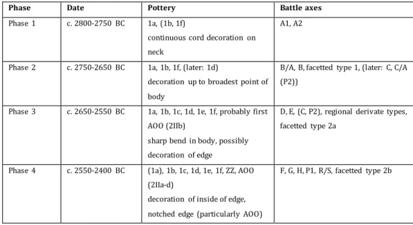
Between the towns of Trehuse, Sjørup and Dollerup (fig. 3.1), there used to be an alignment of burial mounds, consisting of more than 40 barrows. This alignment had a north-south orientation and was one of the largest burial mound alignments in Jutland. The landscape in which the alignment was located, is characterised by low hills, directly to the west of the moraine landscape of the Hovedopholdslinjen, which marks the boundary of the ice sheet during the Weichselian glaciation (fig. 3.2). Further to the west, the landscape flattens out towards a large heathland (Ebbesen 2006, 373; Jørgensen 1977, 9).
The alignment has now mostly disappeared due to ploughing and the building of (rail)roads. South of Sjørup, however, the alignment extends across the east side of the forest Havredal Plantage (fig. 3.3); more than 50 unexcavated burial mounds are still located here, amongst which the Store Ståhøj, a 3.5 m high barrow. Hence, the alignment used to be more than 5 km long (Miljø- og Fødevareministeriet. Naturstyrelsen).
Most of the barrows at Trehuse-Sjørup-Dollerup have been excavated. Around the fin de siècle, the idea was that the alignment represented the course of an
35
Figure 3.1 - Aerial photograph of the area of the barrow alignment of Trehuse-Sjørup-Dollerup (after Google Maps).
36
Figure 3.4 (above) - The alignment continues south of Sjørup; the black dots are burial mounds. The Store Ståhøj is located just to the
southeast of the ‘P’ sign (after Miljø- og Fødevareministeriet.
Naturstyrelsen).
Figure 3.3 (right) - The alignment of Trehuse-Sjørup-Dollerup. The coloured dots are excavated burial mounds; the grey are unexcavated. The numbers are the original numbers that the excavators gave the barrows. Unfortunately, Høj 33 is not shown on the map. Black: in the catalogue of Hübner and Ebbesen; blue: in the catalogue of Ebbesen; yellow: Bronze Age burial mounds (after Hübner 2005, 973; Ebbesen 2006, 374).
37
3.2 Results
Most barrows at Trehuse-Sjørup-Dollerup were between 1 and 2 m in height and 11-19 m in diameter, but eight were smaller than 1 m (21,6% of the total), and five were larger than 2 m (13,5% of the total). The smallest barrow was Høj 37: 12-25 cm in height and 7 m in diameter. The largest barrow was Høj 32: 2.74 m in height and c. 19 m in diameter. At least seventeen barrows had been disturbed by
ploughing before the excavations (Høj 9, 11, 14, 15, 17, 18, 21, 22, 23, 24, 25, 26, 27, 28, 29, 35, 36; 48,6% of the total). No flat-graves are known at Trehuse-Sjørup-Dollerup.
In three burial mounds, no graves were found: Høj 1, Høj 9 and Høj 14. The landowner had excavated Høj 9a and Høj 9b before the National Museum
excavations; these barrows did not yield any graves either, nor finds. I have added these two barrows to my database under number 25, together with Høj 9. Eighteen burial mounds only revealed a primary grave, whereas twelve mounds had been re-used, either in a later stage of the Young Neolithic or during the Bronze Age (fig. 3.5). There are four burial mounds that did not produce a clear picture; Høj 15 may have had two primary graves, Høj 8 and Høj 36 may or may not have been re-used, and Høj 29 contained an Iron Age urngrave but also three pits with an unknown function. Nevertheless, it is possible to give an overview of the different types of primary graves (fig. 3.6). Tab. 3.2 is an overview of the 29 Underground graves at Trehuse-Sjørup-Dollerup; Høj 18 and Høj 33 have two Underground graves. These graves had been dug into the underground before the burial mound was built over the grave, and are generally considered to be the oldest burial type (see Chapter 2) (Furholt 2014, 72). Tab. 3.3 is an overview of the primary Ground graves at Trehuse-Sjørup-Dollerup; these graves were located on the old surface under the mound. There are at least five primary Ground graves; Høj 8 may also have a Ground grave and Høj 15 possibly has two Ground graves. Only one barrow has a secondary Ground grave (Høj 38). Lastly, tab. 3.4 shows the two primary Overground graves, out of a total of thirteen Overground graves at Trehuse-Sjørup-Dollerup.
38 Figure 3.6 - The reused barrows at
Trehuse-Sjørup-Dollerup (after Hübner 2005, 973).
(Høj 12, 20, 26, 28, 31 and 32), were enclosed by a stone construction, such as a stone cist. Høj 4 produced traces of a ring ditch, and Høj 21 a ring-bank. Høj 31 revealed traces of a broad belt with red burnt soil and charred wood. Indications for a wooden coffin were found in three barrows (15,8%): Høj 7, Høj 11 and Høj 12. No post circles or palisaded ditches were encountered (or recognised).
The orientation of the primary grave is known for 31 barrows (83,8% of the total) (tab. 3.6). Eighteen of these displayed an E-W orientation (58,1%), most of which were Underground graves (Høj 2, 3, 4, 5, 10, 12, 13, 18, 21, 33, 35, 36 and 37). Three E-W oriented primary graves were Ground graves (Høj 15, 20 and 26) and one an Overground grave (Høj 8). Eight graves have a NE-SW orientation (Høj 17, 24, 27, 28, 31, 32, 34, 38; 25,8%), and two an ENE-WSW orientation (Høj 7 and Høj 23; 6,5%). All ten are Underground graves. Two Underground graves have a NW-SE orientation (Høj 6 and 39; 6,5%). One Overground grave, in Høj 11, had a WNW-ESE orientation (3,2%).
39
Figure 3.7 - The primary barrow features at Trehuse-Sjørup-Dollerup (after Hübner 2005, 973).
There are seventeen graves (45,9% of the total) with traces of human remains (tab. 3.7); twelve of these were the primary graves. Although the Minimum Number of Individuals (MNI) in four of these graves is higher than 1, this is related to the re-use of these barrows; there seem to be no double- or mass-graves in this alignment. In ten of the primary graves, a soil silhouette was preserved of the buried individual. These soil silhouettes were not preserved equally well; in two primary graves only some tooth remains were found. Nevertheless, in ten cases (58,8%) it could be determined where the head of the body used to be (eight heads in the west; two heads in the southwest), and in eight cases (47%) the position of the rest of the body could also be determined. One primary grave (Høj 21; 5,9%) displayed a body that was buried on its back; the other bodies (47,1%) had been buried on their right side, which could indicate a male grave (Furholt 2014, 70).
28 barrows (75,7% of the total) included grave goods with certainty (tab. 3.8); for several barrows, it is unsure whether a find is a grave good or not. Seven barrows yielded pottery (Høj 12, 17, 26, 30, 32, 34, 36; 25%), and six a battle axe (Høj 8, 25, 30, 35, 36, 38; 21,4%). Nine graves contained a flint axe (Høj 3, 11, 13, 15, 28, 31, 36, 37; 32,1%); eight were thick-butted (type 1; Hübner 2005, 328), of which one is of the type 1A, and one axe was thin-butted (type 2; Hübner 2005, 340). Other grave goods were flint blades of varying uses and lengths (variant A: <5.1 cm; variant B: 5.2-8.5 cm; variant C: >8.5 cm;
40
4.1-6 cm; variant C: ø >6 cm; Hübner 2005, 378) (Høj 2, 5, 17, 20, 27, 28, 32; 25%). Several secondary graves produced bronze objects, and in one case an iron nail (Høj 29).
3.3 The time-depth of Trehuse-Sjørup-Dollerup
There are unfortunately no radiocarbon dates of the barrows at Trehuse-Sjørup-Dollerup; the alignment had been excavated before this technique was available. To reconstruct the time-depth of the alignment, I have to date the barrows by means of relative dating.
Tab. 3.9 is an overview of the dates of the barrows, including the source of the date. Three barrows could not be dated, due to the absence of a grave or finds (Høj 9, 14 and 29). In fifteen cases, the date of the primary barrow is based on the grave type: Underground, Ground or Overground (Høj 4, 6, 8, 10, 17, 20, 22, 23, 24, 25, 26, 27, 33, 35, 38, 39; 40,5% of the total). For three barrows, the grave type was decisive for the date of its reuse (Høj 2, 12 and 17). However, these dates are not
unproblematic. Underground graves can occur throughout all Single Grave phases (Hübner 2005, 739). The distinction between the grave types also seems to be arbitrary, particularly between the Ground and Overground graves (e.g. Høj 35 had an Overground grave extending to c. 18 cm above the old land surface, whereas the Ground grave in Høj 30 is located at c. 20-30 cm above the surface). The depth of a grave is in many cases hard to tell from the excavator’s drawings.
41
Figure 3.8 - Group 1 of the sequence at Trehuse-Sjørup-Dollerup (after Hübner 2005, 973). The remaining barrows are marked grey.
Figure 3.10 - Group 2 of the sequence at Trehuse-Sjørup-Dollerup (after Hübner 2005, 973). The barrows that have already been constructed, are marked black.
Figure 3.11 - Group 3 of the sequence at Trehuse-Sjørup-Dollerup (after Hübner 2005, 973).
42
Fig. 3.8-3.11 show the resulting chronological sequence of the alignment during the Single Grave period. I have grouped the dates into four, based on their maximum and minimum dates and their lifespan. Because of the low resolution of the dates, it is possible that barrows in the same group are actually decades (or even centuries!) apart, and that barrows in different groups may be contemporaneous. I want to emphasise that these groups do not necessarily signify separate construction events; there are no strict boundaries between the four groups. There are four barrows that occur in each of the groups: Høj 1, 7, 14 and 29. These could not be dated (properly). The reuse of Høj 35 extends across groups 3 and 4. The division is simply a (visual) tool, meant to help with recognising a pattern.
The first group of dates (fig. 3.8) consists of nine barrows that are likely to have been constructed between 2850-2700 cal BC (24,3% of the total): Høj 2, 7, 12, 21, 25, 28, 31, 32 and 36. These barrows were constructed within 150 years. The
primary graves of these barrows were Underground graves, and all contained one or two grave goods: flint blades of the variant C (Høj (12), 21, (32), 36; 44,4%) or B (Høj 2, 7, 25, 28, 31, (32); 66,7%), flint axes type 1(A) (Høj 28, 31; 22,2%), an amber disc of the variant B (Høj 2) and a battle axe A1 (Høj 25). Five barrows (55,6%) showed traces of grave/barrow features: a wooden coffin (Høj 7), two stone rows lining a coffin (Høj 12), a ring-bank (Høj 21), a burnt rim (Høj 31) and a stone frame (Høj 36). The orientations of the graves were either E-W (Høj 2, 12, 21, 25, 36; 55,6%) or (E)NE-(W)SW (Høj 7, 28, 31, 32; 44,4%). Four graves (44,4%) revealed traces of human remains, which all indicated that the body was lain with its head in the west (Høj 21, 28, 31, 36). Two bodies had been buried crouched on its right side (Høj 28, 31), and one body had been buried on its back (Høj 21).
Sixteen barrows were constructed in 2850-2600 cal BC (43,2% of the total), a period of 250 years (fig. 3.9). These barrows were: Høj 3, 4, 6, 10, 13, 17, 18, 22, 23, 24, 27, 30, 34, 35, 37, 38 and 39. These barrows may be more or less
43
blades of the variant B (Høj 18) or of an unknown type (Høj 23, (35)) and an amber bead (Høj 27). Høj 30 is an exception in two ways: its primary grave was a Ground grave, and it included six grave goods: a battle axe E3 (dating the Ground grave to 2700-2600 cal BC), a grinding stone, a fire flint and a fragmented flint dagger. Eight barrows (50%) comprised grave/barrow features: a ring-ditch (Høj 4), a stone base (Høj 10), a stone circle (Høj 37) and in most cases a stone frame (Høj 6, 13, 34, 35, 39). The graves were again mainly oriented E-W (Høj 3, 4, 10, 13, 18, 35, 37; 43,8%) or (E)NE-(W)SW (Høj 17, 23, 24, 27, 34, 38; 37,5%). Two graves had a NW-SE orientation (Høj 6, 39; 12,5%). Six graves yielded traces of a body, again all with the head in the west (Høj 13, 17, 18, 23, 27, 30; 37,5%). All bodies except the one in Høj 13 demonstrate to be buried on its right side and crouched.
The third group (fig. 3.10), of dates between 2600-2450 cal BC, introduces the reuse of older barrows: Høj 35, 36 and 38. These secondary graves were
Overground graves (Høj 35, 36) or a Ground grave (Høj 38). Additionally, four barrows (10,8% of the total) were constructed within 150 years: Høj 5, 15, 20 and 26. These primary graves were either an Underground grave (Høj 5) or a Ground grave (Høj 15, 20, 26). Only Høj 26 did not provide any grave goods and was dated by means of its grave type. The other graves (85,7%) had at least one grave good (Høj 5 had 35, Høj 20 had 10 and Høj 36 had 8): amber beads (Høj 5, 20), amber discs of the variant A (Høj 5), flint axes of the type 1 (Høj 15, 36), battle axes F(2)/G (Høj 35, 38), a weathered battle axe (Glob G?) (Høj 36) and potsherds (Høj 36). Only two graves (28,6%) displayed features: a stone frame in Høj 15 and a stone base in Høj 26. The graves were mostly oriented E-W (Høj 5, 15, 20, 26, 35; 71,4%); the grave in Høj 38 was oriented NE-SW. Only Høj 26 revealed weak traces of a soil silhouette.
The last group (fig. 3.11) consists of the graves dating to 2450-2250 cal BC; these are mainly reused barrows (seven or eight): one Overground grave in Høj 2, 17, 32, 35 and possibly 38, and two Overground graves in Høj 12, 26 and 28. The two graves in Høj 12 were covered by a stone, one of the graves in Høj 26 was surrounded by a stone frame, and one of the graves in Høj 28 was topped by a stone layer. Only two new barrows, Høj 8 and 11 (5,4% of the total), both with an
44
axe D1 (Høj 8), battle axes F(2)/G (Høj 35, 38), a flint axe of the type 1 (Høj 11), amber beads (Høj 17, 28, 32), C1c and B6 beakers (Høj 26) and potsherds (Høj 12). Again the graves were mainly oriented E-W (Høj 2, 17, 26, 28, 32, 35); the grave in Høj 26 had an orientation of NW-SE. One cremation may be dated to this period (Høj 12). Two graves revealed traces of a body with its head in the west; Høj 26 had a body lying on its back and Høj 17 had a crouched body lying on its right side.
The division in four groups seems to bring out an interesting pattern. The first two groups only involve primary barrows; no barrows are reused yet. This amounts to 25 barrows (67,6% of the total), that have been constructed within 250 years, or approximately over ten to twelve generations (c. 20-25 years per generation). The barrows cover a primary Underground grave, or in one case a primary Ground grave. Group 3 and 4 on the other hand combine the reuse of nine older barrows with the construction of six new barrows (16,2% of the total), over a period of 350 years (c. fourteen to seventeen generations). These graves are mainly Overground graves, but there are also some Ground graves and one Underground grave.
I suggest that this pattern may indicate two different use-phases of the
alignment of Trehuse-Sjørup-Dollerup during the Single Grave culture: one earlier, more active phase, and a second phase in which the Single Grave people were less active in burying their dead on the alignment. The graves of the first phase generally contain one or two grave goods, which are mainly flint blades (52%). There are only few beakers and battle axes (4% and 8% respectively). The graves are oriented either E-W (48%) or NE-SW (40%), and 52% of the graves have a feature. The second phase includes graves with more than two grave goods. There also seems to be an increase in beakers (20%), battle axes (26,7%) and amber beads (40%) compared to the earlier phase. Lastly, the later graves are more dominantly oriented E-W (73,3%), and 46,7% of the graves have a feature. There does not seem to be a significant difference in the position of the dead between the two phases.
3.4 Conclusion
45
Due to the limitations of typochronologies and a complete lack of absolute dates, the dates of the barrows are highly problematic. The resulting time-depth of the alignment may nevertheless reveal an interesting pattern; the Single Grave people may have constructed and added to the alignment in two phases: an earlier, more active phase, dating to c. 2850-2600 cal BC, during which about ten to twelve generations constructed 25 primary barrows, and a later phase, dating to c. 2600-2250 cal BC, when nine older barrows were reused and six new barrows were added to the alignment by about fourteen to seventeen generations of Single Grave people. In the second phase we see an increase in the use of beakers, battle axes and amber beads as grave goods, and some graves have more than only one or two grave goods. Moreover, the graves are more uniformly oriented E-W.
There is no abrupt boundary between the two phases; the low resolution and limited reliability of the dates cannot support this. If there indeed was a
development from a more active construction phase to a less active construction phase, this would have been gradual, probably unintended, and a logical
46
4
The Dutch alignment of Angelslo-Emmerhout
The second case-study, that of the alignment of Angelslo-Emmerhout in The Netherlands, will be discussed here. First, I shall describe the alignment and its research history. Then I will present the results of the literature study and the GIS analysis. Lastly, I will discuss the resulting time-depth of the alignment.
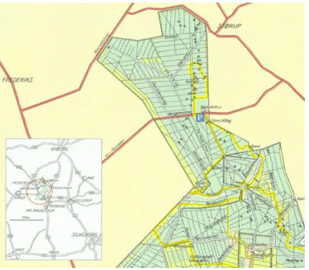
Figure 4.1 - Aerial photograph of the districts Angelslo and Emmerhout, to the east of the town Emmen (after Google Maps).
4.1 Introduction: the research history of Angelslo-Emmerhout
47
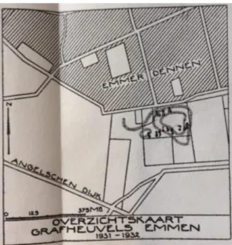
Figure 4.2 - The locations of the excavations around the Emmerdennen by Bursch in the 1930s (Bursch 1937, 42, fig. 13). II and IV: burial mounds and urnfield, excavated in 1931-1932; V: urnfield, excavated in 1933; VI and VII: stone heap cremation graves and Roman burial mounds, excavated in 1937.
Figure 4.3 - Plan of the burial mounds to the south of the Emmerdennen (II in fig. 4.2), excavated in 1931-1932 (Bursch 1936, situation map).
excavations in the south and the east of the woodland Emmerdennen, unearthing ten prehistoric burial mounds and two urnfields (fig. 4.2 and 4.3) (Bursch 1936, 56; Bursch 1937, 42, 51, 53-4). Between 1960 and 1968, a further 13 ha was excavated, under the supervision of professor H. T. Waterbolk and J. D. van der Waals (Arnoldussen and Scheele 2012, 153; Kooi 2008, 330, 327). During these excavations, 106 funerary monuments were
investigated, among which two megalithic graves (the hunebedden
D46 and D47) and three flat-graves from the Middle Neolithic, and nine Single Grave inhumation graves, of which only two (or three) were covered by a barrow (fig. 4.4 and fig. 4.5) (Arnoldussen and Scheele 2012, 153, 156-9). It was also found that later graves, burial mounds,
48
Scheele 2012, 160-177). Additionally, house plans from the Middle Bronze Age B onwards were uncovered, indicating an intertwined funerary and domestic usage of this prehistoric cultural landscape (Arnoldussen and Scheele 2012, 166-78).
Van der Waals has published the preliminary results of the excavations in 1962, 1963, 1967 and 1968 in the Nieuwe Drentse Volksalmanak; a proper report was unfortunately never published, although some findings were published in the 1970s. In his dissertation on Bronze Age burial mounds, Lohof (1991) included the barrows of Angelslo-Emmerhout in his catalogue, but not the flat-graves (Lohof 1991, 35, 38). A proper overview of the site was finally published by Arnoldussen and Scheele in 2012. This article discusses the results from the excavations east of the
Emmerdennen. Yet in 1960-1961, Van der Waals had re-excavated the terrain to the south of the Emmerdennen, where Bursch had found burial mounds and an urnfield in 1931-1932 (fig. 4.6). Between the remnants of the burial mounds and ring ditches of the urnfield, Van der Waals unearthed three Single Grave flat-graves (Van der Waals 1963, 251-2; Bakker and Van der Waals 1973, 18-9).
49
Figure 4.4 - The excavation trenches at Angelslo-Emmerhout and Emmerdennen-South (see fig. 4.6), with the discovered Single Grave burial mounds and flat-graves and the megalithic graves/hunebedden (large map: after Arnoldussen and Scheele 2012, 154, fig. 1; small map: after Bakker and Van der Waals 1973, 18, fig. 2). The location of the graves at Emmerdennen-South is an estimation, based on broad coordinates, the assumption that ‘I’ is Tum. I, excavated by Bursch in 1931, and the imprecise situation map by Bursch (Bursch 1936; Lohof 1991, 35, 48).
50
51
Figure 4.6 - The graves of Emmerdennen-South (western cluster, approximate locations) and of Angelslo-Emmerhout (eastern alignment) on the aerial map of the area, showing the proximity of both sites (after Nationaal Georegister).
52
4.2 Results
The excavations at Angelslo-Emmerhout and Emmerdennen-South yielded at least fourteen primary graves from the Single Grave Culture (tab. 4.2). Four or five of these graves had been covered by a burial mound (grave name: ‘Tumulus’ and
Roman number; 28,6% or 35,7%); the other ten or nine were flat-graves (grave
name: ‘Grave’ and a letter or number; 71,4% or 64,3%). Two additional barrows may have been built during the Late Neolithic (No. 50, 53). Six graves (37,5% of the total) displayed traces of a barrow feature: a ‘beehive’ construction (No. 38, 46; 33,3%), a palisade ditch (No. 41, 51; 33,3%) and a ring-ditch (No. 52, 53; 33,3%). All six barrows had been reused during the Middle Bronze Age or the Iron Age, with the addition of secondary interments, secondary barrow phases and/or barrow
features. Four primary graves revealed traces of a tree-trunk or wooden coffin (No. 40, 50, 52, 53). Of four graves it could be determined that it had an E-W orientation (No. 39, 50, 52, 53; 25% of the total).
Only four primary graves (25% of the total) showed traces of the burial, in the form of a soil silhouette (tab. 4.3). Two of the soil silhouettes indicate that the body was laid on its right side, crouched and with its head in the west. The soil silhouette in No. 53 was very badly preserved, but demonstrated that the head of the body was located in the east. Unfortunately, Van der Waals did not describe the position of the soil silhouette in No. 41 (Van der Waals 1967, 211). Moreover, Van der Waals reported that remains of crouched soil silhouettes were found in No. 47, 48 and 49, but it is unclear whether this means that each flat-grave had a soil silhouette. There are also no remarks about the position of these soil silhouettes (Van der Waals 1963, 251).
53
remaining three primary graves without grave goods are No. 46, 50 and 53; the grave goods in Graves No. 51 and 53 are secondary.
4.2.1 GIS analysis
Unfortunately, the graves at Emmerdennen-South have no exact coordinates; they are not depicted on the map by Arnoldussen and Scheele, and Lohof’s catalogue
discloses such imprecise coordinates that some graves would be located on the same spot. However, I have been able to find their approximate locations, by using
three of Lohof’s coordinates (for No. 47, 50, 53), the map by Bakker and Van der Waals (see fig. 4.6; assuming that the ‘I’ is Tum. I/No. 50) and the situation map by Bursch (see fig. 4.3). Consequently, I was able to incorporate these approximate locations in the GIS analysis together with the exact coordinates of the graves at Angelslo-Emmerhout.
An unavoidable obstacle turned out to be the fact that the whole area is a residential district. Because of this, the topographical and geological maps
(including the soil map) could not give any insights into the landscape of the area. The AHN map, which shows the relief of the landscape, includes buildings and roads and therefore was of no use either. The geomorphological map did happen to be useful (fig. 4.8). By projecting the graves over the geomorphological map, it becomes clear that the burials lie directly on top of the eastern part of the Hondsrug ridge complex. This complex consists of parallel ridges of ground moraine and boulder till, separated by valleys formed by glacial meltwater (Jongmans et al. 2013, 236-7, 294). The burials at Angelslo-Emmerhout are located on ground moraine, in a sloping landscape on the east side (see fig. 4.4). Slightly to the west, the burials at
Emmerdennen-South are located on the geomorphological unit of ‘Anthropogenic’,
54
Figure 4.8 - The geomorphological map of Angelslo-Emmerhout/-Emmerdennen (above) and the surrounding area (below), with the (approximate) locations of the graves(after Geoportaal provincie Drenthe).
55
4.3 The time-depth of Angelslo-Emmerhout
Assigning a date to the Single Grave burials at Angelslo-Emmerhout/-Emmerdennen appeared to be a difficult task. The only Single Grave burial that has been dated by radiocarbon dating is No. 38 (Arnoldussen and Scheele 2012, 159). No. 39 has also produced a radiocarbon date, but this date is associated with the later use of the burial mound during the Middle Bronze Age (Lohof 1991, 41). The chronological sequence of the graves therefore has to be established by dating the graves with typochronologies (tab. 4.5).
Seven graves could be dated with Beckerman’s typochronology of Protruding
Foot Beakers (No. 40, 44, 45, 47, 48, 49, 52) (Beckerman 2015, 193). It is notable that the dates have a very large timespan; most types appear to have been used for long periods of time, but the timespan is also partly the result of the chosen interval. Beckerman uses the 1δ interval to show that there is a long lifespan of certain
characteristics due to plateaus in the calibration curve, and the 2δ interval for more
precision, but this has an even longer lifespan (Beckerman 2015, 193). To be safe, I
have chosen the dates with the 2δ interval. The dates between brackets had a 1
minus ranking after Beckerman’s assessment of the reliability of the radiocarbon dates; although I added these dates in the table, I calculated the timespan based on the more reliable dates (Beckerman 2015, 193, 155).
Unfortunately, Beckerman does not include battle axes in her chronology of the Corded Ware culture, nor any other grave good category. It follows that the graves that did not produce any datable ceramics, but did yield other grave goods, had to be dated with the chronology by Drenth and Lanting and the corresponding relative dates by Drenth (Drenth and Lanting 1991; Drenth 2005, 349). There are two graves that contained a battle axe, but no Beaker (No. 39, 41). Two graves had to be dated by their greenstone axe (No. 42, 43), and one by its Grand-Pressigny flint dagger (No. 51).