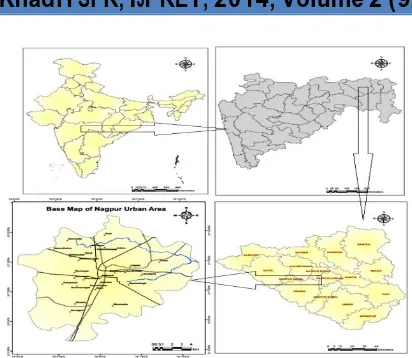
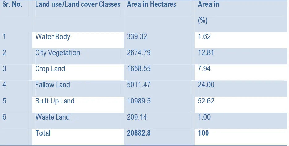
[NORMAL] LAND USE AND LAND COVER AREA ESTIMATION FOR NAGPUR CITY, MAHARASHTRA USING REMOTE SENSING AND GIS TECHNIQUES
Full text
Figure

Related documents
Schellhammer PF, Venner P, Haas GP, Small E, Nieh P, Seabaugh D, Patterson A, Klein E, Wajsman Z, Furr B: Prostate specific antigen decreases after withdrawal of antiandrogen
Using mass equivalent and stiffness of beam and spring, we can calculate natural frequency of the system having Static deflection of 25mm.. Mass equivalent of the system
Wu Z, Dong F, Zhao W, Wang H, Liu Y, Guan B: The fabrication and characterization of novel carbon doped TiO 2 nanotubes, nanowires and nanorods with high visible light
Networked sensors/actuators, PLC control and the SCADA operating environment Manual, Voltage, Frequency, Torque, Power factor (cos phi) and Droop control.
The culture of the Adivasis is an integral part of modern Oriya heritage Centuries of myths, legends and history have all blended into a grand composite
The present paper has argued that excessive general impairment of gene expression can be expected to manifest as abnormality of behaviour and appearance, with certain
For single- photon sources it is desirable to maximize the biexciton (XX) shift so that in the two-photon cascade through the intermediate exciton (X) state the two photons have a
This layer consist of the core IPV6 network of 4G and other heterogeneous access networks such as GSM (Global System for Mobile communications), CDMA( Code Division
