• No results found

San Francisco s Earthquake Risk

N/A
N/A
Protected

Academic year: 2021

Share "San Francisco s Earthquake Risk"

Copied!
85
0
0

Loading.... (view fulltext now)

Full text

Figure

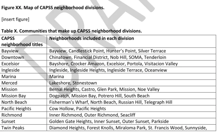
Figure XX. Map of CAPSS neighborhood divisions.
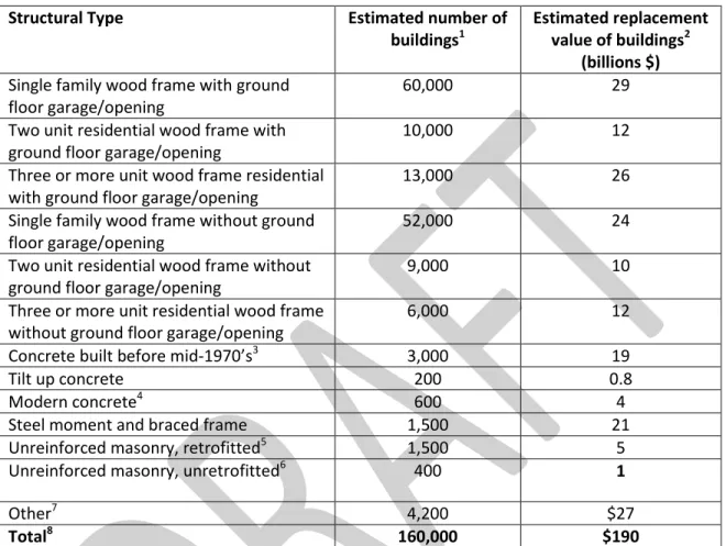
Table X. Estimated number and value of buildings of various structural types in the City
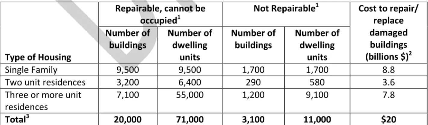
Table X shows the amount of damage that buildings used for various purposes are estimated to  experience in the Magnitude 7.2 San Andreas scenario due to shaking and liquefaction
Table Y. Estimated damage states of buildings in a Magnitude 7.2 earthquake on the San Andreas  fault, by neighborhood
+7

References

Related documents