• No results found

Fast building damage mapping using a single post earthquake PolSAR image: a case study of the 2010 Yushu earthquake

N/A
N/A
Protected

Academic year: 2020

Share "Fast building damage mapping using a single post earthquake PolSAR image: a case study of the 2010 Yushu earthquake"

Copied!
12
0
0

Loading.... (view fulltext now)

Full text

Figure

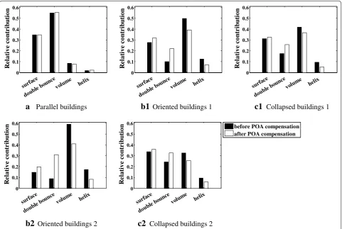
Fig. 1 Relative contribution of the different scattering mechanisms of the three kinds of buildings before and after POA compensation
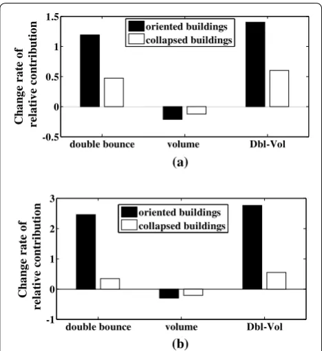
Fig. 2 Change rate of the relative contribution of the different scat-tering mechanisms for the oriented and collapsed buildings before and after POA compensation
Fig.  4 with the five colored rectangles are the samples of collapsed buildings in red, oriented buildings in blue, and parallel buildings in orange
Fig. 4 Pauli RGB color composite image of PolSAR data of Yushu County, with red (|HH − VV|), green (|HV|), and blue (|HH + VV|)
+4

References

Related documents