David
T.
Hartgen
Nancy
Roy
The
processes associatedwiththedesignand
construction ofmajor
highways can cause divisive controversies withnegativeoutcomes.
These
controversies arisefrom
thean-ticipatedimpacts of
proposed
alternativehighway
locationsbeforeactual construction;however,
much
lessattention ispaidtotheeffects,predicted
and
unanticipated,ofnew
roadsafterribbonsarecut.
Once
constructiondecisions aremade,
the short time period duringconstructionand
shortlyafterthe grand
opening
providesa unique"window
ofopportu-nity"for
communities
totake positive actionstoreapthefullbenefits of the
highway
while reducing its negative effects(Figure 1).
To
thosecommunities
willingtoadaptto their changing environment,actiontaken duringthisparticulartime period caneffectivelyproduce
positivebenefits.There
isno
uncer-tainty about
some
ofthe highway's direct effects, such asredistributionoftrafficvolumes; however,indirectimpacts,
suchas
economic development
alonghighwayinterchangeswillnotbefeltfor
some
timeand
are thereforeamenable
tochange.
David
T.Hartgenisprofessorand
coordinatorof'transportationsmdies at UNC-Charlotte, where he directs the university's
growingInterdisciplinaryTransportation Studiesprogram.
He
isauthor of over
150
publicationsand
reportsin allaspectsofnansportation policy
and
isU.S.editorofthejournalTranspor-tation.
He
holds degrees in engineeringand
transportationplanning
from
Duke
Universityand
Northwestern University.Nancy Roy
is acommunity
development specialist with theNorth
Carolma
Division ofCommunity
Assistance,Fayette-ville,N.C.
She
hassixyears experienceincommunity and
re-gionalplanningin North Carolina.
She
holds adegreefrom
AustinPeayStateUniversity,and
ispursuinga graduatedegreeinpublicaffairsatNorth CarolinaStateUniversity.
The
North
Carolina Division ofCommunity
Assistance,incooperation with local governments, other state agencies,
and
the privatesector, has initiated a study ofthe newest portion ofInterstate 40,a four-lanedivided limited-accessroadrunning
from
RaleightoWilmington, North
Carolina.The
goalsofthestudyareto identifythemajor
impacts ofthehighway
corridor,asconstructedand
opened;and
todevelopactions that
governments
and
the private sectorcantaketoreduce the highway's negative impacts
and maximize
itspositive ones.
A
Profile
of
the 1-40
Corridor
This 120-mile stretch of Interstate40,
under
discussionand
planningforalmost twentyyears,was
finallyopened
toFigure 1
The "Window
of Opportunity"after
Highway
Constructionplanning
o
i
o
-% \
after—effects^-
—
worse
W
-~~~~
—
^^
betterTime period
! for this study
CAROLINA
PLANNING
Figure2
Interstate
40
Corridor
r-/
Wake
X^
/
^4k
Raleigh \/ (k^L.303 jr
V
/ Garner* W .^Clayton
\
^Fuquay^VarinaJK
Johnstonjjft/Lillington
\
11 24rjfee^ „ , //
• \ fttjj^'rourOaks ( Goldsboro>
/
.. Bensonfi^^w«
//
Hamett
Dunn^X
^-^
Wa
yne
^^,-^/f
\^J»-J\NewtonGrove\
^^^
j«"i^VV
.
MountOlive/Cumberland
//
}m
\S\\
^\
\ Fayetteville //
<
c,v,„^r,
Tk.Du
Plm II
•
/J\
Sampson
Ia ,,, I\ // 1 r l\\ Warsaw
\
\M>
V
Clinton 1^
Kenansville]
S
\
/u
903Onslow
\
Jacksonville^
V~
\
/11<A
„\
(Wallace*Q"
/I
•>
\.\
r
Si117 \y
Pender
V
3\
^v^ BurgawwP \
/
210O I-40Exits ^-V.VJ002
132/
\ /Wilmington
New\
/Hanover
\J.fl
trafficin
June
1990 (Figure2). Itrepresents thelastmajor
component
ofinterstatework
tobe done
inNorth
Carolinaand
inthe nation. Interstate40
isone
ofthe longesthighwaysinthecountry,running2,455 miles
from
theNorth
CarolinacoasttoBarstow,California.
Interstate40
now
connectstheformerlyisolatedportcityof
Wilmington
totheinterstatesystem.The
1-40corridorisessentiallyrural incharacter, interspersedwithsmalltowns, agricultural
communities and
farmingdistricts.Income
lev-els
and
general accessibility in the central portion of the corridor are lower,compared
withthe corridor's ends. Inter-state 40 has increasedbothlocal accessibilityand
regional interconnectedness. 1-40 diverts truckand
tourist trafficfrom
parallel routes, reducingtraffic congestionin nearby communities, but businesses relyingon
the diverted trafficmay
alsobehurt.However,
reducedairpollutionand
trucknoise, particularly at night, are
some
of the positiveeffects.Inthefuture,roadsfeeding theinterstate
may
increase in traffic,and
new
development
sur-rounding the interchangeswill result.
Recrea-tionalbusinessislikelyto benefit,since1-40has theeffectof
opening up
the central coastofthe Carolinas,considerablyreducingthetraveltimeto Carolina beaches
from
the inland cities ofRaleigh
and
theupper
Piedmont.The
resultingincrease in thetouristtradewillbring
conges-tion tobeach
and
coastalcommunities.Beach-front property prices
may
also rise. Businessmay
bedivertedfrombeach-relatedcenterssouth ofthis area, particularlytheGrand
Strandre-gionof
South
Carolina,and from
the north,par-ticularly the
Outer
Banks
of northernNorth
Carolina'sseashoreand
southernVirginia.Es-sentially, the effect ofthe
highway
may
be to"smooth
out" thebeach-front propertydevel-opment
to raiseeconomic
levelsand
accessibil-ity in the central part of the
North
Carolinacoast, thereby producinga
more
uniformeco-nomic
basealongthe coastofVirginiaand
the Carolinas.Militaryaccesswillimprove,benefittingthe
major
military installations at Jacksonville,Fay-etteville,CherryPoint,
and
Goldsboro.As
trucktraffic increases, the Port of
Wilmington
may
become more
attractive toEuropean
tradethan otherports,particularlyforCarolina-produced commodities. Citizens along the corridor willnow
findthemselvesclosertoareaservices,hos-pitals,
community
colleges,and
shopping,ex-pandingthemarketsforthese
and
otherregion-ally based activities.
These
residents will also find themselves closer in travel time tomajor
metropolitanareas,thus increasing the
attrac-tiveness of those regions for jobs.
Moreover,
the corridorcommunities
willbecome more
attractiveresidentialsitesforpeoplepresentlyliving intheurbanareas.
Pre-Study
Phase
In
August
1989, theNorth
CarolinaDivision ofCommu-nityAssistance
(NCDCA)
began
tosurveyinterest in con-ducting a study of the Interstate'seconomic
impact.The
effort
was
considered timely since local officialsand
themedia had been
predictingan"economic
boom"
and
calledtheInterstate'scompletion"thesingle
most
importantfactorto affect
development
in southeasternNC
for decades."Despite these claims
and
risingexpectations,no
objective research to quantify the expecteddevelopment had
been conducted.With
the costofthe 120-milestretchof highwaysupportforastudytodeterminepossible
economic
impacts andidentitystrategies touseinthe corridor.An
importantfactor tobe consideredwas
the rural,pre-dominantlyagriculturalnature ofthe corridor.Excludingthe corridorstartingpointatRaleigh,
and
terminusatWilming-ton,only two
communities
out ofthethirtyhave populations over5,000and
amajorityhavelessthan1,000.To
initiate thisdiscussion,
NCDCA
organized akick-offdinnersponsored bya largeutilitycompany. Over
100 personsrepresenting30communities
attended theOctober
1989 event. Speakers presentedvisionsofwhat
the studycouldofferand
describedhow
itwould be
directed by thecommunity
and
results-oriented. Subsequently,
many
localgovernments
requestedand
received special presentationsto theirgoverningboards. Eventually,38communities
supportedthestudyand
agreedtoparticipate in corridor-widestrategic planning.
An
1-40 SteeringCommittee
was formed
toguidethisstudy.While
gatheringcommunity
supportand
involvement,NCDCA
was
alsodiscussingthestudydesignwiththeUni-versityof
North
Carolina at Charlotte. Since localgovern-ment
feescould onlybe expectedtogenerate$25,000againstan estimated totalcostofover$100,000, adraftofthestudy design
was
presentedtopotential fundingsources.The
cor-porate
and
agency sponsors tookgreatinterest inthestudyand
made
several suggestionsforrevisionsto thedesign toensuretheresults
would
beusablebysmallercommunities.Funding
Along
with reviewingand
refiningthestudy design,fund-raising
became
amajor
focus for the steering committee.Telephone and
electriccompanies, theNorth
CarolinaRuralEconomic
Development
Center,and
theNorth
CarolinaDepartment
ofTransportationresponded
quicklywithgen-erous
commitments.
The
committee
askedcommunities
to contributeatarateofthree centspercapita(with aminimum
payment
of$150
and
acap of$3,000),tohelpfundthestudy.As
thecommittee
moved
its meetingplacetoseveralsmalltowns alongthe corridor, the public
became
interested,and
citizen attendance increased. Positive
media
coveragere-sultedin
numerous
small,butextremelyimportantcontribu-tions
from
financial institutions, rural electricmembership
co-ops, regional councilsofgovernment, tourismauthoritiesand
chambers
ofcommerce.
The
challenging taskofraising sufficient fundspresentedan opportunityforsteering com-mitteemembers
representing ten countiestowork
togetheron
acooperativebasis,astheywill havetodo
toimplement
studyfindings.The
studyisstructured intotwo major
efforts,one
com-munity-oriented, theother technically-oriented (Figure3).
The
NCDCA,
asthecoordinatingagency,has overallrespon-sibility
and
leads thecommunity
involvementprocess. UNC-Charlotte,under
contracttoNCDCA,
hasprimaryrespon-sibility for technical elements of the study
and
provides assistancetoNCDCA
on
thecommunity
involvementpor-Figure 3
Proactive
Planning
Schedule
I-4D
Comrrjittee
and
NCDCA
* Kick off
l r-:nmmittw~l
-. pnmiir mtg C
II Mrntegy I
1
Ml=s
iMinding" Implem
I IJp-ilgn" I
UNC-Chorlbtte
r
DataIAnoiysis
-T Policy.
Window,Fig.1
Sept Dec Mar Jun Sept Dec Mar June 1989
1990
1991tion.
The
studyconsisted ofdevelopment
of thecorridor-widestrategicplanaddressingissues
common
toallcommu-nitiesaswellasfollow-upprojectstoaddress needs of
indi-vidual communities.
With an approved
study design, the universitybegan
data collection inMay
1990. Thisallowedfor the steering
committee
to be briefedon
the strategicplanningprocess
and
todiscussthegeneraleconomic
climateofthe region.
The
overallgoalofthe technicalwork
istoprovideasound
basefor
communities
todevelopstrategicplans thatfitwellwith corridor objectives.
A
fundamental
constraint of the technicalwork
isthatthetimetoplan,organize,gatherand
analyze data,
make
decisionsand
take action isshort,two
yearsatmost.Therefore,a great dealofinformationneedstobe compiled, organized
and
presentedrapidly,so thatdevel-opment
and implementation
ofstrategic plans can occurbefore negativeimpactsresult Thisconstrains the technical
effortto a seriesofquick
work
sessions, each withprelimi-nary
and
finalfindings.Preliminaryfindingsaremade
avail-ableinrapid
form
forearlydiscussion,and
arefollowedup
laterby
more
detailed technical reports.Gathering Information
County
and
Town
StatisticsAn
extensivedatabase containingabout400
economicand
demographic
variables describing the region is being pre-pared.Informationconsistsprimarilyofcensusand
similar items;community
reportson
education, health,and
budgets; transportationstatisticson
mileageand
services;labor forceand wages
bymajor
SIC
category;and
populationstatisticsby ageand
ethnicity.Where
possible, several yearsofdata arebeingcompiled sothattrends
may
be developed.The
studyisnot waiting for final results of the 1990 census, although thosestatisticsare available
on
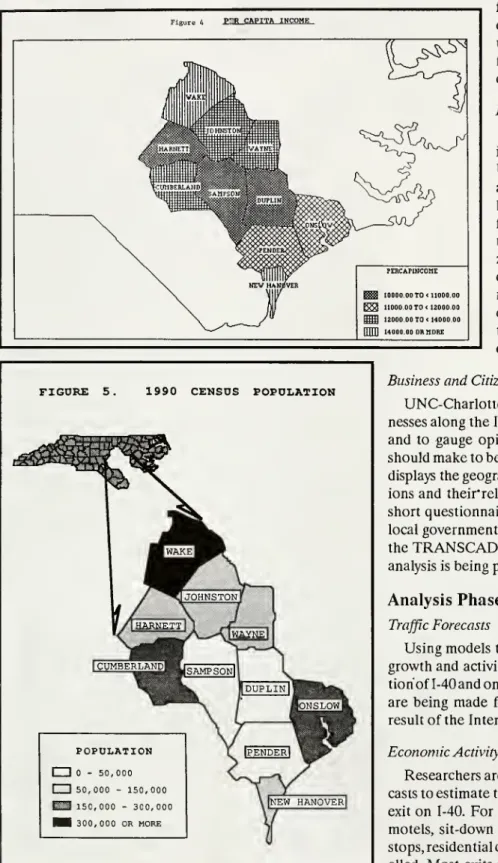
apreliminarybasis.Figures4and
5show
examples.A
modern
transportation-oriented geographic10
CAROLINA
PLANNING
base to store
and
display this information.TRANS-CAD
provides theability tomix,match and combine
a varietyofstatisticsspatiallyand
providesauniqueenvi-ronment
tobetterunderstandcomplex
relationships.Itprovides afullrange of outputgraphics
and
transporta-tionmodeling
featuresas well.P"RCAPITA INCOME
Traffic
Data
Working
with statistics provided by theNorth
CarolinaDe-partment of Transportation, a
complete
trafficpicture for the regionisbeing developed usingtheTRANSCAD
data base.Sta-tisticsare available
on
averagedailytrafficand peak hour
loads,truck/tractor
movements,
speedsand
capacities,aswell as plansfor future road improvements. Traffic counts
collected sincethe
opening
of1-40 are being used todevelopestimates ofthe diversionef-fect
from major
parallel streetsand
thein-creasedtraffic
on major
feederfacilities.Interchange
Growth
Inordertobetterunderstand
how
growth
atinterchanges along 1-40 is likely to develop,
UNC-Charlotteresearchersreviewedpastgrowth
atinterstate intersectionsinrural
North
Caro-lina.
They
visited 103 interchangesand
identi-fiedtheirgrowth
patterns.Relatingthese pat-terns to availability ofinfrastructure, traffic,zoningpatterns,visibility,sewer
and
water,and
otherregional
and
site-based parameters,the researchersdeveloped aseriesofsimplemod-els of interchange growth.
They
then applied thesemodels
to characteristicsofthe 1-40inter-changes toestimate
growth
potential.FIGURE
5.1990
CENSUS
POPULATION
!
^^Vf
JOHNSTONf I
/IHARNETT
A_^A]
WAYNElBERLANDi lr
|t,UM
sampsonM k,
V |DUPLINll|j§ftft(i
*\
/ 11 'I'SLOWjL jPOPULATION
1 1 - 50,000
1 1 50,000 - 150,000
13
150,000 - 300,000Hi
300,000 OR MOREX
iPENDERlpll^
\|NEW HANOVER1
Business
and
CitizenSurveysUNC-Charlotte
surveyed a representativesample
of busi-nessesalongthe 1-40 corridor todeterminetheir characteristicsand
togauge
opinion aboutimprovements
thatcommunities
should
make
tobenefitfrom
1-40.The
TRANSCAD
datasystemdisplaysthegeographicrelationships
between
respondents' opin-ionsand
their"relianceon
1-40. Similarly, citizenscompleted
a shortquestionnairefocusingon
theiropinionsaboutpotentiallocal
government
strategies.This datawas
also displayedusingthe
TRANSCAD
system.As
this informationcomes
together,analysisisbeing prepared
on
a varietyofsubstantive questions.Analysis
Phase
TrafficForecasts
Using models
thatrelatetraffic topopulationand
economic
growth
and
activity,analystsare forecastingtrafficon
eachsec-tionof I-40and
on major
paralleland
feeder routes.Adjustments
are beingmade
forroute diversions or traffic reductions as aresultofthe Interstate.
Economic
ActivityatExitsResearchersare analyzingexitcharacteristics
and
traffic fore-caststoestimatethe already increasingeconomic
activity ateachexit
on
1-40.For
each exit, thedevelopment
potentialfornew
motels, sit-downand
fast-food restaurants, gas stations, truckstops,residentialdevelopment,
and
otherservicesarebeingshows
therelative twenty-yeardevelopment
pres-sureat 1-40interchanges usingtheseprocedures.Economic
ForecastsEconomic
forecasts,beingprepared withaloca-tionquotient
economic
forecastingmodel,williden-tify those individual counties
which
are likely toenjoy
employment
growth
asa result of1-40. This growthisbeingcompared
withgrowth
ratesof other groups of counties inNorth
Carolinaand South
Carolinathathave not
had
recentmajor
improve-ments
inaccessibility.Growth
PointsUsing
amethod
known
assuccessive overlays,anumber
of key locations in the corridor arebeing analyzedfortheiroverallgrowth
potentialforretailand
industrialsites.Thismethod
involves assessingeach pointforincreasesin accessibility,interchange development,traffic,population,
employment, and
spending power.
Portof Wilmington
The
team
is assessing the extent of changes intradethroughthePort of
Wilmington
asaresultoftheincreased1-40trade. Accountingforrecent events
inEastern
Europe,
thestudywillalsolookbriefly at theeffectsofincreasedtraffictothePort ofWilming-ton, particularlythe effects oftruck
and
containertraffic
on
thestreetcirculationsystem ofthecity.Figure 6
20
Year Development
Pressureat1-40 Exits- 1989TrafficLevelsLJ SingleFamilyHomes
Ed SitDownRestaurants
Gas
B
FastFoodI Motels
apj
CrossRoutes
Community
Participation
Community
involvementis an integral part of the studyand
islargelyresponsibleforitssuccess.Community
partici-pation inthe study is beingensured through a
number
of mechanisms.1-40 Steering
Committee
Earlyinthe study,county
and
community
representativesinthecorridor
were
askedtoparticipateinstudydesignand
planning
and
tojoina steeringcommittee. Thiscommittee
consistsofelectedofficials,economic development and
chamber
of
commerce
directors, private sectorindividuals,and
gov-ernment
agencyrepresentativesofthe region.The
1-40Steer-ing
Committee meets
periodicallytoreviewstudy progress,provideguidance,
and
inform thegeneralpublic.Public
Forums
Sincethe data collectionphase providedabreak overthe
summer
months
of1990, thecommittee was
facedwiththepossibility that the project might lose
momentum.
Itwas
decided that this
would
be an excellent time toencourage
community
input. Publicforums,sponsored bylocal cham-bers ofcommerce, were
scheduled duringJulyand
August
atfour locations alongthe corridor. Agricultural groups, the general public
and merchants
representinga varietyofbusi-nessinterests
were
invited.Over 300
persons attended theforums
and
participatedinastructuredagenda
aimed
atun-coveringissues as well as prospectivestrategies. Excellent
media
coverage helpedtokeep
the projectbeforethe publicand
toemphasize
thefactthatthe steeringcommittee
would
use theforum
informationwhen
theirplanning meetingsre-convened
inthefall.Strategic
Actions
As
the study proceeds, task forces arebeing organizedtoreviewinformationforeach sub-area ofthe entire corridor,
and
torespond tosuggestions concerningstrategies.These
groupswillfocus
on
sixkeyareas:Education
Infrastructure
Recreation
and Tourism
Community
ServicesEconomic
Development
12
CAROLINA
PLANNING
The
strategydevelopment
process involvesbothplansforvarious sub-areasofthe corridor
and
corridor-wide strate-gies tobeimplemented
bygroups ofcountiesworking
to-gether.There
willbeoverallsteeringcommittee
reviewofthe separate task force strategy meetings, sincemany
issuesareinterrelated.
As
the project enters the policy phase, the studywillproducea
well-documented
corridordevelopment
planforthethirty-fivecommunitiesintheregion.Secondly,through theplanningprocess, participantswilldevelopa historyof
working
togetherand
gainunderstandingthat the highwaylinkagescanleadtocorridor-wide benefitsforall
communi-tiesinvolved.Results ofthis studyshould be available in September,
1991.
While
itispremature
to identify specificactionsappro-priate for avarietyof circumstancesinthe corridor,it
may
beuseful atthispointtolist
someof
theitems beingconsidered. Transportadon
In lprovenrents•
Widen
selectedmajor
routes that feed1-40 tofourlanes. • Acceleratecompletionofan urban looparound
Wilming-ton.
•
Upgrade unpaved
roadstopaved roadstatus.• Reconfiguretruckrouteaccess through communities.
Interchange
Development
• Providesewer and/or waterservicestoselected
interchanges.
• Carefully
zone
theareaaround
each interchangeand
be-tweenan interchange
and
itsnearbytownsforappropri-atedevelopment.
•
Encourage
businessestolocate closerto 1-40.Signs
and
AdvertisingPass signordinanceslimiting the
number
and
sizeofsignsvisible
from
1-40.Establish corridor standardsforsignap-pearance
and
size.Development
and
Community
ServicesRe-signdirectionstohospital
and
community
colleges.Advertise
community
collegeand
trainingservicesinnew-markets.
Coordinaterealestatelistingsacross the corridor. Establish a corridor association of
chambers
ofcom-merce.
Expand
ormerge
schooldistricts.Advertisethe corridorindistantcities.
• Restructure the
economic
recruitment process to takeadvantage ofthefavorable 1-40business climate.
Develop and
maintaina database ofland parcels forin-dustryrecruitment purposes.
• Assistexistingbusinesses toattract
new
employees.• Establishacorridor-wideplanningdistrict.
• Establish corridor-widezoning ordinances
and
acoop-erativezoning treatment of grandfatheredparcels.
CooperativeCorridor-
Wide
Strategies•
Promote complimentary
advertisingofcommunity
serv-icesacross a
number
oftowns.• Enactsigning
and
zoningordinances.• Establishan 1-40business association.
• Preparealong-rangecorridor
development
plan.Summary
Inthe
window
ofopportunity provided bytheopening
ofa
new
highway, cooperativestrategicplanningisparticularlycharged. Efforts
must
be undertakenrapidly,data collectedand compiled
accuratelyand
quickly, decisionsmade, and
actions implemented.Numerous
constraintsand
threatsoperate to
undermine
the probable success ofthe effort.Communities
may
not have available funds.They
may
notwork
well together.They
may
view each otherascompetitorsratherthanascooperators or
may
simply not agreeon what
isbest for the region.
The
narrowness ofthe timewindow
increasesthe pressure.On
theother hand,the benefitsofasuccessfulcooperativeeffortaresubstantial.
Communities
thatcanwork
togethertofindwaystoparticipateindeveloping apositive future areina
betterpositiontoensure thattheirplansucceeds.
The
singularopportunityto directthe benefitsderived
from
theaccessibil-ity provided by Interstate 40
may
substantially affect the corridorformany
yearstocome.
While
the stakes are highand
therisksaregreat,thereisno
better alternativethantoleverage theopportunities
which
havebeen
provided.Acknowledgements
This materialisbaseduponworksupportedinwholeorinpartby the1-40
SteeringCommittee andnumerous privateand public projectsponsors.
Majorcontributorstothestudy include theNorthCarolinaRuralEconomic DevelopmentCenter, theNorthCarolina DepartmentofTransportation
andtheU.S.Economic DevelopmentAgency.Theprojectismanagedby the
NorthCarolina Division ofCommunityAssistance.Anyopinions,findings,