Charles
pattison
flying
into
turbulence:
the
raleigh-durham
airport
expansion
controversy
The
Raleigh-Durham
Airport Authority(RDUAA)
is in the process of
expanding
its facilities toaccommodate
currentand
projected air carrieroperations. Five alternative plans
have
been
drawn
up
by consultants, onlyone
ofwhich
isseen
assufficient by the Airport Authority.This alternative,
known
as Plan B,would send
aircraft directly overUmstead
Parkand
aconsiderablenumber
ofhomes
and
businesses. Forthis reason, PlanB
isopposed
by
many
area residents.Strenuous arguments
forand
against thevarious alternativeshave
come
from
all sides, yet thedebate
seems
bogged
down
because
of a failure to reach aconsensus
on
areaneeds and
desiresand
ageneral lackofinformationon
the costsand
benefits ofthe various plans.Is
expansion
necessary inthefirst placeoristhismerely an attempt
on
the part ofRDUAA
tokeep
pace
withcompeting
facilities inGreensboro and
Charlotte? Is Plan
B
clearly superior to the other alternatives?The
most
significantconclusionisthatno
one
has presented the detailed informationnecessary to
make
an intelligent choicebetween
these plans.
However,
in-depth research suggeststhat an alternative other than Plan
B
offers amore
modest
but totallyadequate
solution. This articlewill briefly review the struggle over
expansion
ofRaleigh-Durham
Airportand
follow with a detailedaccount
ofthe benefitsand drawbacks
ofeach
planas
seen
by the author.current
history
of
rdu
airport
The
RaleighDurham
Airport Authority(RDUAA)
originated in 1939after
Durham
and
Wake
Countiestogether with the cities of
Durham
and
Raleighsuccessfully petitioned the state legislature to
provideenabling legislation fora four-party aviation
facility.1
Thislegislation allowed
each governmental
body
tobe assessed one-fourthofthe costwhen
any
bond
issueswere
floated. It also allowed thejurisdiction
most
directly affected by the airport facility to have a say in its future growth.By
1968, theRDUAA
had
documented
itsneed
forexpansion.
The
only questionwas
where. Initially,the Airport Authority
endorsed
aproposalknown
as Plan A. Thisscheme
called for anew
10,000 footrunway 5000
feet southeast of the existingrunway
(#5-23) with both
runways
operating simultaneous-ly.A
new
terminalwould be
locatedbetween
thetwo
runways,
and
primaryaccesswould be from
N.C.54.A
controversyensued,however,when
itwas
learnedthatthe plan
would
involveanexchange
of350
acresof airport land for 264 acres
from
Umstead
State Park. Local attention focusedon
thiswhen
anewspaper
ran aSunday
feature articleon
aNorthCarolina State University scientist
conducting
habitat studies of gray squirrels in that area.
The
expansion
planwould
end
the researcheffortwhen
the Park land
was
traded.The
prospect of a landexchange
incensedmany
people, spurring thein-itiation of a group, Citizens to
Save
Umstead
Park,specifically organized to
oppose
the Authority'splan. Their claim
was
that PlanA
would
require cuttingeasements
on
230 acres of the Park's land with other rights for low level flyovers givenon an
additional
620
acres.2Noisepollutionwas
allegedto affect 1100 of the Park's
5200
acres.The
RDUAA
justified the plan as its least cost proposal.
The
ultimate test for PlanA
came
ina$20
millionbond
voteon
November
5, 1968. Its failure to passwas
attributed to a possible tax increase, theRDUAA/Umstead
Park landexchange
and
a lackofdata supporting the Airport's
expansion
plans.3Aftermodifying Plan A, the
RDUAA
againtriedtoarrange a land
exchange
withUmstead
Park in1970.4
But the North Carolina State
Board
ofCon-servation
and Development,
alongwiththe NationalPark Service, refused, 5forcing the reconsideration
of priorities.
The
RDUAA
developed
11 alternateschemes
with theaid of a consultant, J. E. Greiner,and
the Federal Aviation Administration (FAA).Each
of thesewere
discussedby
all partiesmen-tioned above.
Four
were
decided tobe worthy
ofCharles Pattison
graduated
fromtheDepartment
ofCity
and
Regional Planning at the University ofNorth Carolina,
Chapel
Hill, in May, 1976. Whileatthe University
he majored
in transportationplan-ning.
He
served asan
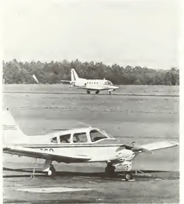
intern with the GuilfordAir traffic controllers
monitor
flights atRaleigh-Durham
AirportCourtesy of RaleighNewsand Observer.
more
in depthstudy.They
were
coined PlanB, PlanC.and
PlanC-1.PlanA
was
retainedforcomparativepurposes
only. Plan D,which
stretched the existingrunway
to 10,000feetwas
alsodeveloped.A
subse-quentproposal, C-2, has
now
emerged,
and
isbeingendorsed
by the airlines through a tradeorganiza-tion, the Air Transport Association of
America
(ATA).
The
Airport Authority hasendorsed
PlanB
and
successfully petitioned the
Wake
County Board
ofCommissioners
torezone2000
acresinWake
Coun-ty in anticipation of the plan's approval.6
A
publichearing scheduled for
November,
1973,drew
littlepublic response. Shortly thereafter, the
FAA
offerred tentative approval following furtherdocumentation based
on
theenvironmental impactassessment
due
in 1974.These
findingswere
presentedwith other
documents
(PhysicalDevelop-ment
Planand
Financial Report) ata publichearingin
December,
1974.A
revised impact statement ispast
due
but is still to be released.Although
some
objections
were
raised-thesewillbe examined
later in detail-theRDUAA
feltconfidentenough
tosend
all the necessary
documents
on
toWashington,
urging the
FAA's
prompt
approval of Plan B.expansion
requirements
The
Raleigh-Durham
Airportisresponsiblefortheaviation
needs
of theResearch
Triangle Region,which
includes the metropolitan areas of Raleigh,Durham, and Chapel
Hill. In the periodfrom
1950-1970, Raleigh's population increased
84%
whileDurham's
grew
by 44%.7As
a regional airport, this facility's expansion isan attempt to
keep pace
withpopulation
growth
in order to preserve theeconomic
vitality of the area.The
underlyingpremise here is that
added
populationmeans
in-creased airport use.
Market studies prepared by
two
consultants in1970
and
1972showed
thatpassenger
facilities atRDU
were
inadequateand
thatdemand
forlong-haul (1500 miles) non-stop carrier service
was
increasing.8In the periodfrom 1966-1972,
enplaned
passengers increased
by
107%
and enplaned
cargotonnage
increased by 178%.9Enplaned
passengersareexpected to risefrom 712,300in 1975 to
2,287,-600 by 1995.10Totalairportoperations(landings
and
takeoffs) will increase from 192,300 in 1975 to
450,000 by 1995."
One
problem
arising from thisincrease isthatthe existing terminal
cannot
accom-modate
more
passengersand
existingrunways
cannot
meet
the loadspresented byheavieraircraftsoon
to be operatingfrom
the airport. In fact, theprincipal instrument
runway
willneed
tobe
rebuiltinorder to handle higher traffic
volumes and
heavierweight aircraft. Further, increased
passenger
volumes
can onlybe
accommodated
throughcon-structionofa
new
terminal.A
second problem
arisesfrom the fact that the airport has only
one
fullyinstrumented runway.
Should
thisrunway
requiremajor
repairs,theentirefacilitywould be shutdown.
A
crashwould
createthesame
result. Ineithercase,"The
Airport
Authority
has
only
provided
a
limited
amount
of
data
on
the
alternatives
itrejected,
whereas
complete documentation
was
offered
for
the
alternatives
they
selected."
all
passenger
trafficwould have
tobe
rerouted toGreensboro
where passengers would
take abustoRaleigh-Durham.
(Ineach
ofthealternativesaback-up runway
is provided to solve this difficulty.)criteria
The
criteriaadopted
as ameans
ofevaluating thealternatives agreed
upon
by
theRDUAA
and
theFAA
are:amount
and
cost of land to be acquired, operationaland
safety feasibility of the facilities,development
costs, environmental impacts, landuse compatibility,
and
accesson and
off the air-port.12Unfortunately, a proper evaluation of the alter-natives has
been
made
difficultdue
to a lack ofinformation.
The
Airport Authority has onlyprovid-ed a limited
amount
of dataon
the alternatives itrejected,
whereas
complete
documentation
was
offeredforthealternativetheyselected.Operationaland
safetyfeasibilityevaluationswere
done
onlyforrequirements as specified by the
FAA. Cost
factorsconsidering site preparation, drainage, relocations,
and
airfieldpavements
were developed
in detailedfinancial estimates onlyforthe alternatives
deemed
feasible by the Airport Authority.
Environmental criteria consisted of
community
noise, air pollution, water pollution (including soil erosion), natural
phenomena
characteristicofeach
area,
and
noise toUmstead
Park.Sewage
and
industrial wastes for all
comparisons were found
"The
question
of
reducing
general
aviation
operations
out
of
Raleigh-Durham
isimportant
since
these
flights
account
for
over
half
of
the
projected
growth through
1995."
minimal
and
notconsideredin detail.Potential landuseconflicts
were
evaluatedwith respecttoimpactson
Umstead
State Parkand
theResearch
TrianglePark.
Secondary
considerationwas
given to thenumber
ofhomes
and
institutions that mightbe
affected by the expansion.
Criticisms
about
the airport'smeasurement
ofnoise contours
and
the actual cost savingsamong
the alternatives are being considered in the final draft of the environmental impact statement.
Although
due
in October, 1975, this reportwas
postponed
toJanuary, 1976.Atthistime,the impactstatement still has not
been
released.alternatives
The
consultant preparingthe AirportMaster Plandeveloped
three alternatives toaccommodate
theairport's projectedexpansion.
These
include(1)theremoval ofaircarrierservice
from
the existingsitetoanunspecified
new
location,(2)theremovalofsome
or all of the general aviation operations so
no
additional
runways would be
required,and
(3) thedevelopment
of the existing site to itsmaximum
potential by the additionof
new
runways and
otherfacilitiesastheyare required.13
A
searchfor
new
aircarrier sites
was
conducted.However,
the nearest suitable locationwas
found
tobe
40 milesfrom
thepresentsite, outsidethejurisdiction ofthe
RDUAA.
Subsequent
discussionswiththeFAA
about
thissiteconcluded
that its distancefrom
thepresentfacilitywould
undulyaltertheairtradeoftheareabecause
of its inconvenience,
and
the investment lossin-curred in
making such
amove
would be
unaccep-table.14
The
removal of general aviation
(non-commercial) operations
was
discussedand found
tobe possible.
The
question of reducing the general aviationoperations out of
Raleigh-Durham
is importantsince these flights
account
for over half of the projectedgrowth through
1995 (see the following section, Question 6).However,
theconsultantfeltitwas
"inappropriate" tomake
any
proposals withregardto this asNorth Carolinaispresently
working
on recommendations
for general aviation facilitiesfortheentirestate.
Such
action eliminatedall but the last alternative - developing the present site to itsmaximum
potential.As
noted previously, thisresulted in 12
scheme
layouts, ofwhich
threewere
suggested by
theFAA, two by
RDUAA,
six by theconsultant,
and
one by
theairlines.The
fiveaccep-table plans plus the
now
defunct PlanA
appear
inFigure 1.
Fig. 1
PLAN
A:Runway
5R-23L, the existing7500-footrunway,
would be
rebuilt.A
new
10,000-foot runway, 5L-23R,
would
be built5000
feet southeast of the existing 7500-foot runway.Runway
14-32
would
be lengthenedfrom
4500
feet to6500
feet. (This is the plan thatwas
rejected in 1968because
itrequired a landexchange
with
Umstead
Park.)PLAN
B:The
existing 7500-footrunway
would
be
rebuilt. Existingrunway
32R-14L
would
be
lengthened to6500
feet.A
new
10,000-footrunway,32L-14R,
would
be constructed.New
terminal facilitieswould be
re-quired. (This is the plan supportedby the
RDUAA.)
PLAN
C:A
new
10,000-foot runway, 5L-23R,would
be
developed
5000
feetnorthwest
and
parallel torunway
5-23.
Runway
5R-23L,7500
feet,would
be rebuilt.
Runway
32R-14L
would
be
lengthenedto6500
feet.Terminalfacilities
would be
similar totheones
above. This alternative requires the
most
fill,would
remove
the greatestamount
of vegetation, has the greatest erosion hazard,and
incurs the greatest cost.Runway
layoutswould
expose
more
residents tonoiselevelsof30
NEF
thanany
otherplan.
PLAN
C-1Runway
5R-23L would be
thesame
as in Plan C.
Runway
5L-23R
of10,000 feet
would
be
re-orientedslightly
from
C
inordertoreduce
the land-fill requirements. This layoutwould
lengthen the glideapproach
paths which, in turn,
would
requirethe airport to
buy
more
land,in-cluding
added
industrialand
^.\ S.R. 1959
"V
N
A
'--?.~r
i
Research
Triangle
Park
\.J
-\
i
i
i 1
i
/
/
/
N.C. 54
k
i-i
r
Umstead
State
\
t
1
V
Park
S.R. 1002
Map
showing
layout of existingrunway
and
alternatives B, C,and
C-2.PLAN
C-2:Runway
5R-23L
would
be rebuiltand
lengthened 750 feet for anew
length of 8,250 feet.
A
new
runway
designed
to serve general aviation(private) operations
would be
con-structedata lengthof
6000
feet.Thisrunway, 5L-23R,
would be
1000feetcloserto
5R-23L
thaninC.Although
it could serve as a
backup
runway,future
expansion
would
be limited.(This plan is supported
by
the air-lines.)PLAN
D:Runway
5-23would be
rebuiltand
a 2500-foot additionwould be
made
togive it a 10,000-foot length. This is
the do-nothing alternative as it
represents the
minimum
actionre-quired to
meet
FAA
safetyre-quirements.
Such
activitywork
would
require the airport tobe
clos-ed for an indefinite period of time.
However,
even the rebuildingwould
not allow the airport to service the predicted
demand
increases.Only
total project costs are available for thealternatives. Detailed cost figures areprovided only
for Plan B. For this reason, detailed estimation of
costs for the other alternatives is not possible.
No
figures for various
runway
configurations men-tioned in theabove
plans are given. Accepting this limitation, speculationabout
benefitsand
costsforthe other alternatives is the only
method
left forcomparison.
effects
of
the
alternative
plans
The
lack of precise information for theschemes
notsupported by
RDUAA
make
itdifficulttoanalyzeand
compare
the alternatives.The
Master Planpresentedtovarious
groups and
displayedatpublichearings contained detailed estimates for Plan
B
alone.
Research
bytheauthoreventually resultedinmore
detailed figures.These
findings are outlined below.Amount/
Cost
ofLand
tobe
Acquired:No
costs areprovided exceptfor Plan B. This iscritical since the
land costs vary
depending on
where
and from
whom
it is purchased.
However,
theamount
purchased
under each
alternative is listed,and
arough
com-parison of costs might be
deduced
from
this.Operational
and
Safety Feasibility:This criterionprovides
no
basis ofcomparison
since all alter-nativeshad
tomeet
FAA
specifiedminimum
re-quirements.
Development
Costs:As
indicated, there areno
detailed cost figures except for Plan B. Apparently
not included in the Master Plan.
One
can
assume
thatthe
minimum
costofeach
alternative'sterminal facilities isthesame.
Table1 presentstheconstruc-tion
and
variable costs associated witheach
alter-native (land required, fill,
homes
displaced, etc.).Some
question mightbe
raisedabout
thepreceeding cost figures.
A
more
exact estimateappears in the following (Table 2)
which
examines
each
component
of the various alternatives.Note
that all plans are
cheaper
except B.The
new
table indicatesC-2
couldcostup
to $17,000,000lessthanthe figure giventothe Raleigh
News
and
Observer.Environmental Impacts: Air pollution estimates
for 1980 indicate
no
realadvantage
forany
one
alternativealthoughall fall
below
the1975levelsdue
to expected future restrictions
on
aircraft engines.Likewise, estimates for 1995 again reveal
no
actualadvantage
forany
alternative.With design controlstaken intoaccount, theimpact
of the various alternatives
on
local water quality isalso
seen
as minimal. All projectswould
provideerosion controls
and
be
designed
to minimizepetroleum
waste
and stormwater
runoff.Costswere
not given for the control
systems
under
each
alternative, thus
no
realadvantage
is apparentforany
plan.'5 It should be pointed out, however, thatPlan C-2's costs
would be
$5,000,000 greaterthanthe others
because
its6000
footrunway would cause
the airport
sewage
treatment planttobe
relocated.Noise
measurements
for the various alternativeswere based on what
isknown
as theNoiseExposure
Forecast
(NEF)
system.NEF
levels are calculatedfrom
aircraft noiseexpressed
inEPNdb
(effectiveperceived noise
measured
indecibels)togetherwiththe
number
ofoperationsoccurring duringdaytime
and
night-time periods.'6The
FAA
has published guidelines indicatingland-use activities
which
are compatible with thevarious
NEF
levels. Within theNEF
30-40 range,activities
where
uninterruptedcommunication
is essentialshould considersound
indesign. General-ly, residentialdevelopment
is not considered a suitable use, although multi-familydevelopments
where
sound
control featureshave
been
incor-porated might
be
considered. Open-air activitiesand
outdoor
living willbe
"affected" by aircraftsound.
The
construction of auditoriums, schools,churches,
hospitals,and
theaters is notrecommended
in this zone.At or
above
theNEF
40range,FAA
guidelinesurgethatland
be
reservedfor activitiesthatcan
tolerateahigh level of
sound
exposure
such
assome
agricultural, industrial,
and commercial
uses.No
residential
developments
ofany
type arerecommended.
Sound
sensitive activitiessuch
as schools, offices hospitals, churches,and
the likeshould not
be
constructed in this area if at allpossible.
Table 1
COST
OVERVIEW
AND
REQUIREMENTS
(a)
(b)
$
Cost
(1973) EnvironmentalConsequences
X
106build
ngs
(all types)Land
in fill requirements selective cHearingexposed
toNEF
40 oracres in cubic yards required ii acres higher contours
PLAN A
105 1595 11,006,000 309 not givenPLAN
B
100 1929 17,073,000 333 62PLAN
C
117 1923 23,022,924 294 11PLAN
C-1 120 2245 15,483,694 488 11PLAN
C-2* 110 760 13,367,100 00PLAN D
75 545 3,280,000 36 00(a) Costfiguresweretakenfroma Raleigh
News
andObsen/erarticledated2/20/76.Thereissome
questionastowhether these numbers represent the total cost orjustthe construction cost.A
telephone conversation with thenewspaperreporter, Rick Nichols, and the Airport Director, Henry Boyd (4/20/76), failed to clarify this. Costs include each environmental consequence listed except the
NEF
contours.(b) Airpollution was minimalforeachalternativeand notincluded(see
RDU
AirportMasterPlan.Environmental ImpactAssessmentReport,p.67, pp.99-104).Stormwaterrunoff values are alsominimalandnotlisted(sameasabove,p.92).
'Except for cost, all figures are taken from the Greiner Engineering Sciences' report, Analysis for the
FAA
of aRunway
Orientation
Scheme
Proposed by theATA, May, 1975.Table3 gives project alternatives
and
thenumber
of residencesor institutionsthatare within
NEF
30-40 contour range.
The
effect ofa givenNEF
levelon
surrounding land has
been
previously noted.These measurements
indicate that while PlanB
subjects fewer residencestoa
combined
NEF
30-40contour, it subjects
more
to the higher noise levelthan the fourotheralternatives
combined. There
isasignificant increase in noise
between
thesetwo
contours since the
NEF
scaleis logarithmic. In fact,the
NEF
chartsuggest thatno
residentialconstruc-tion be allowed in an area
exposed
tomore
than 30NEF.
The
Master Plandoes
notmention
damage
payments due
to noise, but itwould
seem
to beRDUAA's
responsibility to offersome
compensation
tothese
homeowners
ifPlan Bis approved.Itshouldbe notedthat Plan
C-2
was
not submitted intimetobe considered in theEnvironmental Impact
Assess-ment
Report. However, given its similarbut smaller scalerelative to PlanD,smallerNEF
contours could be expected.Land
Use
Compatibility:The
principlemeasure-ment used
in determining land-use compatibilitywas
thenumber
ofhomes
and/or institutions thatTable 2
COSTS
DERIVED
USING
COMPONENT
ESTIMATION*
(1973 Million Dollars)
Plan
A
PlanB
PlanC
Plan C-1 PlanC-2
PlanD
Embankment
14 22 29 19.7 17 4.2Airfield 22 22 22 22 13 10
Land
3.5 4 5 6 2 1.5Roads
2 4 4 4 2 2Drainage
Structure/
Miscellaneous
Costs 1 5
Terminal 30.2 30.2 30.2 30.2 30.2 30.2
Power
LineRelocation 2 2
Sub
total 71.7 83.2 92.2 83.9 69.2 47.9Contingencies,
Engineering,
Administration 15.8 18.3 20.3 18.5 15.2 10.5
TOTAL
87.5 101.5 112.5 102.4 84.4 58.4'These are the author's estimatesas derived from the
RDU
AirportMasterPlanandtheGreiner EngineeringSciences' Analysis for theFAA
ofaRunway
OrientationScheme
Proposed bythe ATA.(1) The costhere is $1.27/cubicyard offill versus .75/cubicyard used in earlierestimated.
(2) Costs assumed equal except forC-2 and
D
which have lessextensive runways.(3) All schemes have the
same
terminal requirements.(4) Allows for a
22%
underestimateof project costs.(5) Does not include possible relocation ofeight industries.
would
have tobe
acquired byRDUAA
in order toimplement each
alternative plan.These
figures aresummarized
in Table 4."PLAN
Table 4
RESIDENCES BUSINESSES
CHURCHES
A
2B
18 2C
13 7C-1 47 8 1
C-2
not given not given not givenD
Airport Access:
No
figures for road relocationexist except forthose previously noted. Total road
relocation
and
accesscostsforB
in 1973dollarsare $5,065,340.'°Although
the roadsto be relocated orimproved
foreach
alternative are developed,no
specific costs arepresented exceptfor Plans
Band
C-2.
questions
on
the
airport
plan
Following is a series of questions addressing the
most
seriousshortcomings
ofRDUAA's
supportforPlan B.
Are
theNEF
forecasts accurate? Itappears
that they are technically correct, althoughthecontoursfor Plan
B
are distorted. Forecastsshow
takeoffsoccurring
on
the 10,000 footrunway
away
from
Umstead
Park (towardDurham). Landings
would
take place from the opposite direction bringing
aircraft in over
Umstead
Park.Under
normal
con-ditionsgreaternoiselevels
occur on
takeoff thanon
landing.
However,
if these landing patternswere
reversed, the Park area
would
be subjected to substantiallyhighernoiselevels. Itisverydifficultto justify theexpense
of the 10,000 footrunway
ifplanes are only allowed to takeoff
and
land inspecified directions. It
appears
more
likely thatno
such
restrictionwould
beimposed
withsubsequent-ly higher
NEF
levels occurring overthe Park.Another
possible bias isfound
in theNEF
contourmeasurement
itself.Under
theNEF
system, noiselevels are arrived at by averaging the highest
peak
frequencies recorded during both a
day and
nightperiod, a practical
approach
formost
large airportswhere
flights occuraround
the clock. AtRaleigh-Durham,
however,most
of the flightsoccur
onlyduring daylight hours. Thus,
when
the lowernight-time figures are
averaged
with the daylight operations,amuch
lowernoisecontouris indicatedthan
would
appear
under
othermeasurement
systems. Considering the fact that those facilities
most
seriously affected by theproposed expansion
(Research Triangle Park
and
Umstead
State Park)operate only during the day, the
NEF
contourmeasurement
system
does
not givean
accurateindication of the
annoyance
one
is likely to ex-perience.CO
O
t>
c
-C
r
3 o
O
Existing terminalfacilitiesat
RDU
cannot
handletheexpected
increase inpassenger
useTable 3
PLAN
A
B'
9
C
20C-12'
C-2
D
22NEF
30not given
44
homes,
1church
208
homes,
2churches
228
homes,
2churches
not given
258
homes,
2churches
NEF
40not given
61
homes,
1church
11
homes
11
homes
not given
Why
areno
projects costs given for the alter-natives? This appears to be in keeping withFAA
policywhich
only requires costdocumentation
forthe
endorsed
plan.No
specificstatementexplainingthis policy
was
found.However,
the policy fordeveloping environmental impact statementsallows
only detailed evaluation for the
proposed
plan.23Supposedly, time
and
cost factorswould
precludeextensive
documentation
foreach
alternative,although this is
what
is required for accurateand
objective judgments.
Did the public hearing afford theopportunity for
adequate
public input? Apparently, the AirportAuthority revealed very little
about
theexpansion
schemes
except Plan B.As
evidenced bythesample
survey, the Northwest
Community
Task
Force felt therewas
inadequate citizen inputdue
to a lack ofknowledge
about the hearings.24Excessive
and
incomplete data
were
also cited as contributing tothe frustration
and
confusion of trying to interprettheairport's MasterPlan.25
It
was
notedthatthelocalplanningagencies
and
public librariesgivendatabyRDUAA
did not have acopy
of the Financial Planwhich
is crucial in understanding the overallproposal. Citizens felt the Airport Authoritymerely
went
through themotions
ofconducting
a publichearing, "complyingwith theformofpublichearing
requirementsset out in
FAA
regulations -on
aplanto
which
the Authoritywas
alreadycommitted."26In addition, the
chairman
of the hearing onlyallowedeach
speaker five minutes,and
even
then theremarks
had
to be limited to PlanB
alone.27Are
there inherent biases in theEnvironmental
Impact Statement(the
same
firm thatprepared
thephysicalplan
recommending
PlanB was employed
to
examine
its environmental impact)? Thispossibility
does
existand cannot be
excluded. Itappearsveryunlikely thatthe
same
firmrecommen-ding a specific plan
would
find fault with it in asubsequent
report.Although
theFAA
hasno
guidelines
which
preventthisfrom
happening, it isobvious thatthefinal statement
would appear
more
valid if a disinterested third party
were
to carryoutthe evaluation.
How
much
considerationwas
given to relocatingthe general aviation sectorto anotherfacility?This
course of action
was
acknowleged
by the AirportAuthority, but it
does
notappear
tohavebeen
givenmuch
serious thought. Infact,RDUAA
playeddown
the role of general aviation in future airport forecasts. For example, consider future airport
operations (Table 5).29
The
present facilities are said tobe
operating atmaximum
capacitynow,
which
is 192,300operations/yr.
Looking
at the lastcolumn
below
would
seem
to indicate the general aviation sectorconstitutes a large majority of the airport's
opera-tion. In fact, if the general aviation portion of the
airport'soperations could be completelyeliminated, there
would
beno need
forany
new
runways."...
(I)t isobvious
that
the
final
(environmental
impact)
statement
would
appear
more
valid
ifa
dis-interested
third
party
were
to
carry
out the evaluation"
Does
PlanC-2offerany
costadvantages
over PlanB?
Itappears that Plan C-2 could beup
to$17,000,-000
cheaper
than B. Its shorterrunways
provideadequate
and
efficientservice forbothcommercial
and
private aircraft. Thismeans
less maintenance,land,
and
land fill costs than B. Safety is alsoimproved
by placing general aviationoperationson
one runway and commercial
flightson
another. Itshould be
mentioned
thatRDUAA
hasdeveloped
amodified Plan
B
which
incorporates thesame
featurespresented byC-2.
Such
a planwould
giveB
lowercosts.30
However,
theFAA
has evaluated bothofthese modifiedplans
and
feelsneitherrepresentsgood
planning.3'What
isthejustification forthe 10,000 footrunway
required in the other alternatives,
and
can
C-2'sshorter (8,250 foot) length provide
adequate
ser-Table 5
YEAR
1975 1980 1985 1990 1995
TOTAL
AIR
GENERAL
without generalCARRIER
AVIATION
MILITARY
aviationOPERATIONS
OPERATIONS
OPERATIONS
TOTAL
operations40,200 138,100 14,000 192,300 54,200
47,400 189,700 14,000 251,100 61,400
55,000 254,200 14,000 323,200 69,000
65,800 327,100 14,000 406,900 79,000
The
need
forexpanded
facilities atRDU
is largely the result of increasing generalaviation activities Courtesyof RaleighNewsandObserver.Wee?
Originally,the 10,000 footrunway
was
justifiedby consultants
who
describedtheneed
asbased on
future
enplanement
forecasts.RDU
was
projectedtohave
substantial increasesinlong distanceflightstothe
Midwest and
West
coast.These
flightswould
requirelonger
and
strongerrunways
ofup
to 10,000feet in order to
compensate
for heavier aircraftweights
due
toadded
fuel requirements. Itnow
appears
that C-2's lengthwould
offermore
thanadequate
service sincethenew
generationofwide-bodied jets require less takeoff distance than
ex-isting models.
The
Air Transport Association ofAmerica (ATA) which
supportsC-2, hasargued
thatRDUAA
is trying tocope
with general aviation increasesby
developingatopofthe linerunway
forlong-haul carriers.
The
Association further statesthat
commercial
flightsare notexpected
toincreasesignificantly in the next 25years into
RDU
and
thatgeneral aviation operations
have
more
modest
re-quirements.
Table 5 clearly
shows
that if general aviationoperations
were removed from
themain
runway
(asC-2
suggests), the existing facilitywould
beade-quate for the period
through
1995.Although
ATA
acknowledges
that themain runway would have
torebuilt
and
lengthened, itmakes
agood
argument
for eliminating B's 10,000 foot strip.
By
forcingprivate planes onto a
new
6500
foot runway,C-2
would
eliminate congestionand
promote
safetysimultaneously.
On
the otherhand,B
overbuildsforthe projected
demand
by
providing a 10,000 footrunway which
isunnecessarily long,and two
secon-dary
runways
of7500
and 6500
feetwhich
(when
combined)
areexcessiveforthedemands
presentedby the general aviation sector.
RDUAA
has accepted the idea thatthe bestway
tomaximize
thedevelopment
of the present site istoprovide a 10,000 foot
runway
for the occassional(only several times a year)
West
Coast
orEuropean
charter flight.
As
ATA
noted, these are the onlyflightsthat
would
requiresuch
a long runway,and
allother
commercial
flights could beaccommodated
on
the shorterand
lesscostlymain
runway
ofC-2. Itseems
difficulttobelievethat B'shighercostcan
bejustified simply by
RDUAA's
desire to offer amore
complete
butseldom used
service.What
type ofNEF
contoursdoes C-2 have?
The
contours
would be
similar toPlan D.32NEF
contours30
and
40would
beextended
slightlyon
thesouthwestern
end
ofrunway 5R-23L
due
tothe750foot addition.
More
importantly,runway 5L-23R
would
be shortenedfrom
C's10,000feet to6000
feet,and would be
moved
closerto5R-23L
by 1000feet.Bothofthesefactors
would
substantiallyreducethenoise produced. In addition, since
runway 5L-23R
would
only beused
for generalaviation operations,one
could expectthe noise levelsabove
the30NEF
range
would
not be generated.Although
the Airport Authority suggests thatC-2
would have
twice the noise impact of B, itgivesno
indication
what
NEF
levelswould be
experienced. Itshould be noted that since
C-2
issiimlartoD
in itsNEF
contours,no
home
or businesswould
ex-perience the very loud 40
NEF
level generated byPlan B.
How
accurateare the totalcost figures?The
new
1973 construction cost figurefor Plan
B was
$101,-000,000.
Assuming
an inflation rate of8%/year
foreach
year since then, PlanB
would
now
costapproximately $126,000,000.
The
accuracy
of theother figures is difficult to ascertain given variable land
and
fill costswhich
are notdocumented
intheMaster Plan.
There
is also theproblem
of socialcosts
which have
notbeen
documented.
How
does
one
transform the higher noise levels ofS
intomonetary
losses? Is theresome
method
fores-timating the
number
and
cost of law suitswhich
might be forthcoming from property
owners
(publicand
private)?These
considerationswere
notmade
by
RDUAA
and can
only be estimated in relativeterms.
conclusions
A
few
conclusions cansummarize
the findings ofthisarticle:
1.
The
RDUAA
has not maintained close contact with the public. Until itdoes
so, itmust
expectcontinued conflicts.
2.
The
Airport Authority shouldadopt
an attitudethat
appears
more open
and
willing to accept3.
The
above
might bestbe
achieved by allowingsome
of thecommunity
groups
to participatemore
directly in airport plansand
decisions.4.
The
FAA
needs
to be urged to alter its publichearing policyso as nottopresentaclosed
mind
tovariousalternatives.
The
existingformat allowsthe Airport Authority to
make
its choice in theabsence
of citizen input.5.
FAA
guidelines should bedeveloped
which
pre-vent
one
consultantfrom
preparingmore
thanone
part ofanairportmasterplan.Thiscouldhelp eliminate possible conflicts of interest.6.
The
NEF
contourapproach
to noisemeasure-ment does
notseem
particularlysuitedtothecaseat hand.
An
average ofdaytime
and
nighttimenoise levels tends to result in a value
which
underestimates actual noise levels during the
most
critical part ofRDUAA's
operationalactivity(daytime).
Such
an underestimate couldhave
serious
consequences
fortheResearch
Triangle Park as well asUmstead
State Park.7. Detailed financial estimates should
be
requiredfor
each
alternative ratherthan only for theone
the Airport Authority isendorsing.
Comparisons
are difficultand
almost impossible without thisinformation. This requirement should be
developed regardless ofthe
FAA's
policy.8. Sufficient information has not
been
provided todetermine
which
alternative is best.No
actionshould
be
taken until this informationbecomes
available. It
does appear
that Plan B,which
isbeing offered as the'best'alternative
by
RDUAA,
would
tend to loseany advantages
it mightnow
have
when
more
complete
data is available.Using the datathat is available suggeststhat
C-2
might
be
a 'better' alternative thanB
for severalreasons.
The
cost section of thepaper
noted thatalthough Plan
B
is being called the least-costalternative, Plan
C-2
is clearly less expensive.The
higher noise levels associated with
B
have
been
noted.
The
question ofrunway
lengthsseem
toimply that C-2's shorter, cheaper,
and
totallyade-quate
runway
is to be preferred to B'smore
costlyand
noisy 10,000 foot structure. Similarly, the6000
footgeneral aviation
runway
offeredby C-2
appearsto present an
added
safety feature in separatingcommercial
and
privateaircraft.Whether
or notthisrunway
could serve as aback-up
for themain
commercial
stripwas
notanswered.A
basic policy questionappears
tobe
the real issue.Does
theRaleigh-Durham
Airportneed
a facilitywhich
would seldom
beused
with respecttoitsdesigned potential (PlanB),orisa
more
modest,but totally
adequate
alternative (Plan C-2) theanswer? Although complete documentation
islack-ing, the author's research suggeststhat
C-2
offersthe best solution atthis time.
The
conflictwhich
hasdeveloped
overthe alter-nate tobe
selectedseems
tobe
tied toRDUAA's
insistence
on
supporting Plan B.Notes from
thepublic hearings have
suggested
that PlanB
was
more
or less selected prior to these meetings.Subsequent
papersand
reportshave
attempted todiscredit the other alternatives
and
embellish B.Such
a policyseems
destinedformore
conflict,and
the final result
can
onlybe
a voter rejection ofanyreferendum
designed to helpimplement
Plan B.Footnotes
'Durham HeraldSun, February22, 1942. •RaleighNewsand Observer,October 27, 1968.
3
lbid., November7, 1968.
-Ibid.,April 25, 1970.
5lbid.,June
14, 1970.
^Raleigh-DurhamAirport Master Plan. Environmental Impact
AssessmentReport, prepared byJ.E. GreinerCo., Inc., March, 1974, p. 10 (hereinafter referred toas E.I.A. Report).
'Ibid., p.6.
8
lbid„ p. 7.
9
lbid., p. 6.
'"Raleigh-DurhamAirportMasterPlan.FinancialDevelopment Plan, prepared by Landrum and Brown, October, 1974, p. 24 (hereinafter referred toas FinancialPlan).
"Ibid., p.42.
"Raleigh-Durham Airport Master Plan. Interim Final Physical/Technical Development Plan, prepared by Greiner Engineering Sciences, Inc., October, 1974, p. F-2 (hereinafter referred toas PhysicalPlan).
"Ibid. "Ibid.
,5
£././4. Report, p. 93.
16
Letter toRegionalDirectors,SectionE,NoiseImpact
Assess-ment in Airports Environmental Seminar conducted in
Washington, D.C., May 8, 1975, by the FAA. p. 4 (hereinafter referred toas Seminar).
"E.I.A. Report, pp. 107-108.
,8
lbid„ p. 135.
,9
lbid.
20
lbid.
2,
lbid., p. 137.
22PhysicalPlan,
p.J-7.
"Seminar, Section C, Guidelines for Organization and/or Reviewof Environmental Documentation, p. 2.
"CommunityReport, p.30. "Ibid.,p. 3.
26
lbid., p.7.
27
lbid., p. 11.
2aFinancialPlan,
p. 42. ^PhysicalPlan, p. H-2. xRaleigh-Durham
Airport Authority. Analysis fortheFederal Aviation Administration of a Runway Orientation Scheme
Proposedbythe AirTransport AssociationofAmerica, prepared byGreiner EngineeringSciences, Inc.. May, 1975, p. 14.
3,
lbid., p. 12.