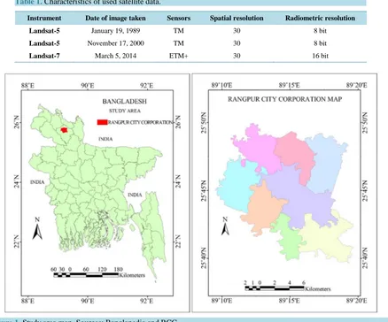
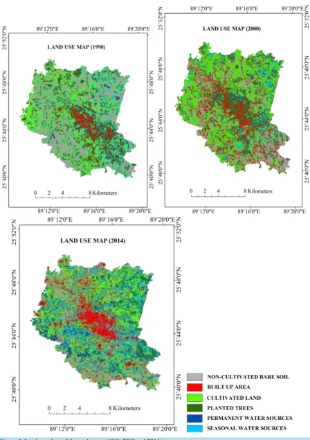
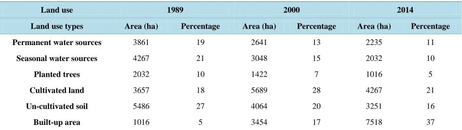
Monitoring the Changing Pattern of Land Use in the Rangpur City Corporation Using Remote Sensing and GIS
Full text
Figure

Related documents
Non developmental dimensions of adult regeneration in Hydra BRIGITTE GALLIOT*, WANDA BUZGARIU, QUENTIN SCHENKELAARS and YVAN WENGER Department of Genetics and Evolution, Institute
Wu Z, Dong F, Zhao W, Wang H, Liu Y, Guan B: The fabrication and characterization of novel carbon doped TiO 2 nanotubes, nanowires and nanorods with high visible light
ABSTRACT: The present paper presents the results of an experimental investigation carried out to study the effect of Hydrochloric acid on High performance concrete with
Of course, in equilibrium the principals are not tricked, but this incentive externality that each principal’s contract bestows upon the other principal, leads to a greater amount
The present paper has argued that excessive general impairment of gene expression can be expected to manifest as abnormality of behaviour and appearance, with certain
For single- photon sources it is desirable to maximize the biexciton (XX) shift so that in the two-photon cascade through the intermediate exciton (X) state the two photons have a
This layer consist of the core IPV6 network of 4G and other heterogeneous access networks such as GSM (Global System for Mobile communications), CDMA( Code Division
