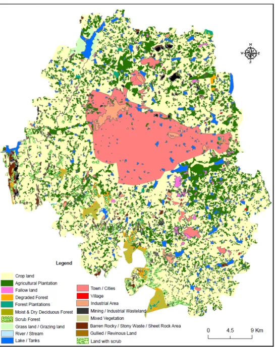
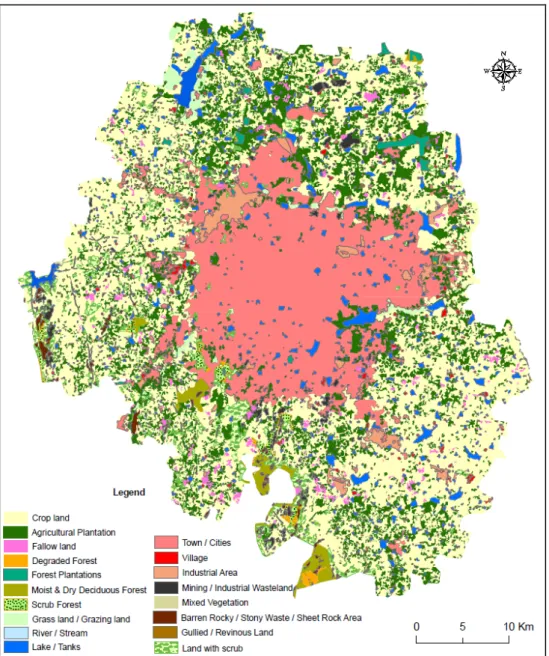
Land-Use Change in Urban Bangalore Using GIS and Remote Sensing
Full text
Figure


Related documents
1) To study the effect of lateral load resisting systems for a regular high rise building. 2) To study the effect of lateral forces on high rise irregular structure. 3) To analyze
a: Plasma renin concentration (PRC) of control (filtered air) and ultrafine carbon particles (UfCPs) exposed SHRs at several time points: before exposure (baseline), first, second
We discovered and confirmed a separate CHIKV introduction to Brazil in Feira de Santana, which com- prises ECSA genotype infections, a CHIKV genotype previously undetected in
The effect of the aqueous solution of root extract of Withania somnifera on lipid peroxidation was investigated on stress induced rabbits and mice .The oral administration
The reference-hypernetted chain integral equation, incorporating a spherically symmetric approximation for the bridge function Bo(12), has been numerically solved for a
ABSTRACT: The present paper presents the results of an experimental investigation carried out to study the effect of Hydrochloric acid on High performance concrete with
Cylindrical grasp training with SENS gradually sta- bilizes the grip force. After a 2-month intervention period, the patient was able to maintain a stable finger- tip pressure
In this paper we analysed the sample points from the human vertebra by using the method of Stehlík (2009) which is based on the likelihood ratio statistics.. We found out, that
