C. Area b e t w e e n t h e S c a n d i n a v i a n a n d t h e Alpine G l a c i a t i o n
1. Periglacial Sediments and their Stratigraphy
b y A R N O S E M M E L , F r a n k f u r t a. M . translated b y H . J . S P Ä T H , Mülheim a. d. R .
With 1 figure
1. I n t r o d u c t i o n
" F o r m e r periglacial a r e a s " refers to that p a r t of the Federal Republic of G e r m a n y which neither w a s covered b y S c a n d i n a v i a n or A l p i n e ice during the Pleistocene nor affected b y glaciofluvial processes. Essentially this is the region of the central G e r m a n hill country (Mittelgebirge) excluding its highest parts which h a v e been g l a c i a t e d .l)
This region also is of special interest for stratigraphical Q u a t e r n a r y research because it is the link between the N o r t h e r n and Alpine g l a c i a t e d areas. It is from here that i m p o r t a n t contributions might be given for synchronizing N o r t h e r n and A l p i n e glacial a d v a n c e s . A t present, however, there is no answer at hand t o this question because the difficulties in achieving a reliable stratigraphy e.g. of the terraces all along the Rhein still p r o v e t o be too great. In spite of the enormous ammount of w o r k done during the past years these p r o blems much rather increased than decreased.
Such a sceptical view seems t o be surprizing t a k i n g into consideration the great a m o u n t of well preserved periglacial p r o d u c t s that c a n be found at numerous places together with interglacial products. B u t this view is m a i n l y due to the v a s t variety of p r o d u c t s which dims the chronology of periglacial events. T h e following pages shall s h o w the present state of Pleistocene research in the area between the A l p i n e a n d the N o r t h e r n glaci ation. A l s o the most important questions which still cannot be answered shall be discussed.
2. S t r a t i g r a p h y of t h e T y p i c a l P e r i g l a c i a l D e p o s i t s
H e r e t y p i c a l periglacial sediments are loess eolian sand, solifluction deposits, a n d g r a v e l terraces. T h e y occur in most parts of the hill country a n d the internal basins a n d mostly they a r e definitely of periglacial origin. In some places they reach a great depth a n d they can often be classified b y interglacial p r o d u c t s they contain.
2 . 1 . L o e s s
In recent times the most intensive research on periglacial deposits in the F e d e r a l Republic of G e r m a n y has been done on loess. T h e initiative resulted from investigations b y F R E I S I N G ( 1 9 5 1 , cit. S E M M E L 1 9 6 8 ) in the n o r t h of W ü r t t e m b e r g a n d b y S C H Ö N H A L S
1) ROTHER ( 1 9 7 1 ) summarizes the results of investigations dealing with the Pleistocene glacia tion of the H a r z , Bayerischer Wald, and Schwarzwald. Studies by FEZER ( 1 9 7 1 ) and PAUL ( 1 9 6 9 ) have been published later. MENSCHING ( 1 9 6 0 ) finds different explanations for forms in the Hohe Rhön which used to be interpreted as being of glacial origin.
294 Arno Semmel
( 1 9 5 0 , cit. S E M M E L 1 9 6 8 ) in the R h e i n g a u . F r o m then on special attention has been p a i d t o the Wuerm loess, because F R E I S I N G a n d S C H Ö N H A L S h a d w o r k e d out different results. M o r e problems were created b y profiles from B a y e r n , published b y B R U N N A C K E R (e.g. 1 9 5 9 , cit. SEMMEL 1 9 6 8 ) . L a t e r it w a s found that B R U N N A C K E R S main horizons also occur in the Wuerm loess o f Hessen, Niedersachsen, a n d Württemberg (SEMMEL 1 9 6 3 , cit. 1 9 6 8 ; R O H
D E N B U R G & M E Y E R 1 9 6 6 ; R O H D E N B U R G 1 9 6 8 ) . A s t r a t i g r a p h i c a l l y i m p o r t a n t correction
has been necessary only in so f a r as B R U N N A C K E R equated his " B r a u n e n Verwitterungs
h o r i z o n t " with F R E I S I N G S " N a s s b o d e n I I I " . F o r F I N K (e.g. 1 9 6 1 , cit. S E M M E L 1 9 6 8 ) the
former one n o r m a l l y is a stratigraphical equivalent of "Stillfried B " . It had become a p parent that this " N a s s b o d e n " lies a b o v e the " B r a u n e Verwitterungshorizont" ( S E M M E L 1 9 6 3 ) .
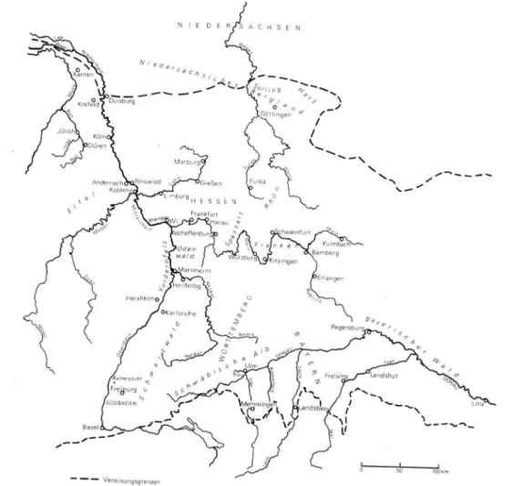
Fig. 1. Topographical situation of the sites discussed.
According t o recent investigations in Niedersachsen, Hessen, Wuerttemberg, a n d B a y e r n a schematic collective profile can be constructed. Thus the b a s e of the Wuerm loess is formed b y a n intensive Bt h o r i z o n (in more h u m i d areas a p s e u d o g l e y soil), which d e
-v e l o p e d from a n older loess during the last interglacial era.2) O n t o p of it solifluction, Schwemmlöss or loess alternate with several (offen u p to three) humuszones, chernozem like soils. They belong to warmer periods of t h e early Wuerm a n d p r o b a b l y correspond to the interstadials Amersfoort, Broerup, a n d O d d e r a d e . A t times a tendency t o d e v e l o p Bt- h o r i z o n s c a n b e noticed. T h e loess on t o p p r o d u c e d a soil called " B r a u n e V e r w i t t e rungshorizont", "Lohner B o d e n " , or the slightly differently developed " H a i n e r b e r g e r B o d e n " . C o m m o n l y this is regarded as the most distinguished horizon in the upper W u e r m loess a n d is s u p p o s e d to be the base of the L a t e Wuerm loess. Leached brown soils or pseudogley-like leached brown soils as climax soils generally developed on t o p of the L a t e Wuerm loess. I t is only in small less humid a r e a s (Rheinhessen, Wetterau) that w e find chernozems.
Beside this collective profile of course there a r e m a n y individual soil profiles with a simpler structure. Especially in Niedersachsen a n d Hessen, however, more complex soil profiles are k n o w n where p o o r l y developed soil horizons (e.g. " N a s s b o d e n " a c c o r d i n g to F R E I S I N G ) a n d tuff horizons ( S E M M E L 1 9 6 7 , cit. S E M M E L a n d S T Ä B L E I N 1 9 7 1 ) h a v e a spe cial significance. Finding several generations o f ice wedges R O H D E N B U R G ( 1 9 6 6 , cit. 1 9 6 8 ) could demonstrate a repeated freeze-thaw process in the soil during the Wuerm g l a c i a l .
A still greater difficulty presents the integration of Wuerm loess profiles from sou thern Baden a n d Niederrhein into this scheme. T h a t is why B R O N G E R ' S ( 1 9 6 6 , cit. 1 9 6 9 ) parallelization (published with all reserves) o f t w o "Verbraunungszonen" in the profile of Heitersheim with Broerup-Amersfoort- a n d P a u d o r f - A r c y ( = Stillfried-B)-Interstadial has not yet been achieved c o m p l e t e l y .3)
T h e most complicated stratigraphical situation can be found on the Niederrhein. O n l y in the most recent past a definite equivalent o f the "Lohner B o d e n " ( = Stillfried-B) has been found ( R O H D E N B U R G & SEMMEL 1 9 7 1 ) . B e f o r e that investigations undertaken b y P A A S (e.g. 1 9 6 8 ) introduced m a n y profiles which showed brown forest soil-like material a n d tundra gley soils above leached brown soils a n d humus zones o f the last interglacial not corresponding typologically t o the "Lohner B o d e n " (Stillfried-B). B R U N N A C K E R (e.g. 1 9 6 7 , cit. 1 9 6 9 ) also could not find any definite equivalents of this soil in the m a n y p r o files he had a n a l y s e d . Probably it is missing as a result of erosion a n d displacement during the early L a t e Wuerm (SEMMEL 1 9 6 8 ) . A c c o r d i n g t o our research on m a n y profiles t u n d r a gley that h a d been compared with the " S t i l l f r i e d B " (formerly called P a u d o r f I n t e r -s t a d i a l ) certainly belong-s to L a t e Wuerm loe-s-s ( R O H D E N B U R G & S E M M E L 1 9 7 1 ) . T h i -s fact should be kept in mind when interpreting the publication of F I N K et a l . ( 1 9 6 7 ) w h o dis cuss the parallelization of Wuerm loess from the Niederrhein a n d Belgian a n d Dutch profiles.
Profiles from Hessen a n d the Niederrhein c a n n o t be regarded as equivalents m a i n l y because the deep loesses of the basin of N e u w i e d (on the Mittelrhein) still present a num ber o f unsolved problems. T h e discussion m a i n l y deals with the Pleistocene profile o f the c l a y pit Kärlich (recent literature B R U N N A C K E R , S T R E I T & S C H I R M E R 1 9 6 9 ) . B R U N N A C K E R ( 1 9 6 8 , cit. 1 9 6 9 ) identified main horizons u p t o then unknown, a n d S C H I R M E R ( 1 9 7 0 ) analysed the Wuerm loess. Unfortunately, however, the equivalent of the "Lohner B o -d e n " still cannot be -definitely trace-d in the profile o f Kärlich ( S C H I R M E R 1 9 7 0 , 2 7 6 f.). In m y opinion merely some shifted material o f this soil can be found in a shallow d e pression ( R O H D E N B U R G & S E M M E L 1 9 7 1 , A b b . 1 ) .
2) LESER (1967, cit. 1970) discusses the question whether the last interglacial soil in the present-day chernozem area of Rheinhessen has been a chernozem.
3) According to my own investigations (March 1972) in the exposure Heitersheim Wuerm loess shows the "Lohner Boden" ( = Stillfried-B) and above it a well developed „Nassboden" (probably corresponding to E 2 of the scheme of Hessen).
It is much easier to synchronize the collective profile (p. 2 9 4 f.) with some Wuerm loess profiles from the G e r m a n D e m o c r a t i c Republic (e.g. L I E B E R O T H 1 9 6 3 , cit. SEMMEL 1 9 6 8 ) ,
from the C S S R (e.g. K U K L A 1 9 6 9 , cit. R O H D E N B U R G & S E M M E L 1 9 7 1 ) , and from A u s t r i a
(e.g. F I N K 1 9 6 1 ) (for details see S E M M E L 1 9 6 8 , 1 0 ff.). There facies a n d age of the m a i n horizons are undoubtedly identical.
The Wuerm loess stratigraphy outlined a b o v e is mainly based on pedological criter-ions. In our a r e a rarely a n y other criteria are a t h a n d (e.g. R E M Y 1 9 6 9 ) . Also p a l y n o logical investigations did not lead to stratigraphical results (e.g. F R E N Z E L 1 9 6 4 ) . A c cording to recent research charcoal lying just a b o v e the Bt- h o r i z o n of the last interglacial age belongs t o c l i m a t o l o g i c a l l y indifferent species (e.g. R O H D E N B U R G & M E Y E R 1 9 6 6 , 1 3 5 ; S E M M E L 1 9 6 8 , 3 2 ) . Recent 1 4C - d a t i n g s indicate the doubtful figure of about 2 0 0 0 0 a.b.p., and all 1 4C - d a t i n g s of humus material brought a b o u t 2 8 0 0 0 a.b.p. ( m a x . ) , a figure much too small. S h o u l d these results be correct then the whole Wuerm loess stratigraphy in middle Europe w o u l d be incorrect. A plausible 1 4C - d a t i n g , however, was achieved in the loess province on the Niederrhein. A humus layer in the loess profile at Erkelenz shows a 1 4C - a g e of at least 4 9 0 0 0 ± 2 0 0 0 / ± 1 7 0 0 a.b.p. (cit. according t o S C H I R M E R & S T R E I T 1 9 6 7 , 8 7 , cit. B R U N N A C K E R et a l . 1 9 6 9 ) . P A A S ( 1 9 6 8 , 3 6 ) equates this sample ( g r o 2 6 7 5 ) with his brown forest soil-like "Frimmersdorfer Bodenbildung" which he thinks t o b e an equivalent of the " P a u d o r f - I n t e r s t a d i a l " ( = Stillfried-B).
In contrast t o the many Wuerm loess profiles there are relatively few pre-Wuerm loess exposures that could be distinctly analysed. These profiles show loess resp. loess l o a m beneath the m o r e or less well developed Wuerm loess a n d the basal soil of the last inter glacial age. This loess resp. loess l o a m contains one or several ( m a x . 8 ) fossil Bt-horizons (leached brown soils) or S^-horizons (pseudogley soils). Additionally there are sometimes soils of less intensity (humus zones and " N a s s b o d e n " ) . The greatest number of fossil soils ( T y p e : leached b r o w n soils) is found in the profile of the pit at B a d Soden, south of the Taunus (SEMMEL 1 9 6 7 , cit. S E M M E L & S T Ä B L E I N 1 9 7 1 ) . Starting from below this profile shows white Pliocene clay, an early Pleistocene terrace (stratigraphically between T e g e len- and Waal Interglacial a g e ) , loess loam, then pseudogley soil, loess loam, five B t - h o r i zons, calcareous loess, and four Bt- h o r i z o n s (including the present t o p soil). C h a r c o a l a s relics of willows a n d poplars is found on t o p of most of the fossil soils. H o w e v e r n o pollen could be extracted from these substrata.
Sedimentpetrographically a n d soiltypologically in the whole profile above the P s e u d o gley no stratigraphically relevant distinction could be found. T h e fossil soils often lie immediately one a b o v e the other or they are interrelated, on the other hand they c a n be separated by several meters of loess or loess loam.
Therefore a " D o p p e l u n g " of certain soils as described for Ceverny K o p e c ( K U K L A 1 9 6 9 , cit. R O H D E N B U R G & S E M M E L 1 9 7 1 ) and a coordination of such " D o p p e l b ö d e n " a n d certain interglacial ages is not feasable. Paleomagnetic studies (carried out by D r . F U J I -WARA at the D e p a r t m e n t of G e o l o g y , University of S a p p o r o ) showed the partly reverse orientation of the loess loam which lies above the pseudogley. Consequently it has a n a g e of no less than a b o u t 7 0 0 0 0 0 years. A t the present time more paleomagnetic experiments are in process a n d some are carried out in the profiles of Ostheim, north of H a n a u a n d Reinheim in the northern O d e n w a l d . A t both locations several fossil Bt- h o r i z o n s lie a b o v e a very intense pseudogley soil. B O E N I G K et al. ( 1 9 7 2 , 1 5 5 ) give information about loess which lies beneath " T e g e l e n " - p e a t in the Wetterau.
In southern B a d e n B R O N G E R ( 1 9 6 9 ) found a sequence of loess with five Bt- h o r i z o n s on top of (presumably) early Pleistocene gravel. H e r e as well there a r e no remarkable dif ferences between older a n d younger fossil soils. In Austria, northern Italy, a n d C S S R , however, there h a v e been findings which suggest that the soils of the early Pleistocene
are rotlehm-like products (see SEMMEL 1 9 7 2 , 1 9 ff.). In my opinion B R O N G E R is right b y saying that it is impossible for him to correlate his fossil soils with specific interglacial ages. Some years a g o ( B R O N G E R 1 9 6 6 , T a b . 6 , cit. 1 9 6 9 ) the three uppermost soils h a d been compared with the "classical" interglacial a g e s ; accordingly the fossil leached brown soil on t o p was a product of the Riss/Wuerm-Interglacial, the soil in the middle a p r o d u c t of the Riss I / R i s s II-Interglacial, a n d the lower soil a product of the Mindel/Riss-Inter-glacial.
According to B R U N N A C K E R et al. ( 1 9 6 9 ) the loess profile of the pit at Kärlich shows four fossil leached brown soils. In m y opinion, however, the youngest of these soils is not a fully developed leached brown soil but rather a brown forest soil of interglacial charac ter (see S C H I R M E R 1 9 7 0 ) . O n the other h a n d the soil that w a s c o m p a r e d with " S t i l l f r i e d - B " b y B R U N N A C K E R et al. (Lb., 1 2 7 ) is a remainder of a Bt- h o r i z o n which needed a similar climate as the older Bt-horizons in order t o develop (see R O H D E N B U R G & S E M M E L 1 9 7 1 ) . O n the eastern slope of the Kaiserstuhl K H O D A R Y - E I S S A ( 1 9 6 8 ) describes loess with four remainders of leached brown soils; the oldest but one has developed especially well.
Loess profiles with four fossil Bt- h o r i z o n s h a v e been found in Franken ( S E M M E L & S T Ä B L E I N 1 9 7 1 ) a n d northern Hessen ( S E M M E L 1 9 7 2 ) . Profiles with three remainders of fossil leached brown soils are very frequently found. P A A S e.g. ( 1 9 6 8 ) , S C H I R M E R & S T R E I T ( 1 9 6 7 , cit. S C H I R M E R 1 9 7 0 ) describe such profiles of the Niederrhein. T h e loess layers on the lower M i d d l e Terraces of M a a s and Rhein h a v e been studied by P A A S and are especial ly important. As this terrace supposedly has been developed during the Drenthe (see p . 3 0 2 ) the formation of leached brown soils must also h a v e been possible during the E e m I n t e r -glacial age as well as during t w o post-Drenthe-periods. Recent studies (still unpublished) b y S C H I R M E R show that this terrace even holds four fossil leached brown soils at F r i m mersdorf-West which follow each other closely in pairs. The profile at Riegel (Kaiserstuhl) holds 3 Bt- r e m a i n d e r s ( G U E N T H E R 1 9 6 1 ) as well. A t Marktheidenfeld a n d Mosbach near Wiesbaden-Biebrich there are loess layers with three remainders of fossil leached b r o w n soils on t o p of paleontologically analysed fluvial deposits. In both pits differences occur between loess-stratigraphical a n d paleontological datings ( S E M M E L 1 9 6 8 , cit. 1 9 7 2 a ) . These problems shall be dealt with a length on p a g e 2 9 9 ff.
All in all it can be stated that it is still impossible to a p p l y a n y of the present Plei stocene chronologies used in the Federal R e p u b l i c of G e r m a n y to the sequence of B t - h o r i zons beneath the fossil soil of the last interglacial age. The comparison of the soils of the m a n y exposures is still very difficult. In m y opinion the scientific methods used in this field of investigation p r o v e d to be incorrect in the long run. This is also true for B R U N N -A C K E R ' S (e.g. 1 9 7 0 a n d H Ä D R I C H 1 9 7 0 ) definition of the iron content and also for M E T Z G E R ' S (cit. B R U N N A C K E R 1 9 7 0 ) definition of the "Steighöhe". T h e division a n d the correlation of the loesses with the aid of tuff has been very successful in the Wuerm loess ( S C H Ö N H A L S 1 9 5 9 , cit. 1 9 6 4 ) ; in older loesses, however, this methods often fails ( S E M M E L 1 9 6 7 , cit. S E M M E L SC S T Ä B L E I N 1 9 7 1 ) . R e c e n t studies b y B I B U S ( 1 9 7 3 ) in the W e t t e r a u can be mentioned here as well.
2 . 2 . E o l i a n s a n d
The former periglacial area covered with eolian sand in the Federal R e p u b l i c of G e r m a n y is much smaller than the area n o w veiled b y loess. E o l i a n sand is found in the Oberrhein V a l l e y , in the D o n a u Valley, a n d the v a l l e y system of the Main (Würzburg, K i t z i n g e n , Schweinfurt, a n d Erlangen). H e r e B R U N N A C K E R ( 1 9 5 9 ) distinguishes three different eolian s a n d s ; the t w o older ones h a v e been developed during the late Wuerm, the youngest one developed as a consequence of clearing w o o d l a n d s in prehistoric times. B E C K E R ( 1 9 6 7 ) m a d e a more detailed study of the eolian sands in the northern Oberrhein
Valley. H e s e p a r a t e d a very much stratified basal complex from a much younger b o d y of sand. Sometimes Laacher pumice tuff (Allerod) is found between both bodies of sand. It had also been found by S O N N E & S T Ö H R ( 1 9 5 9 ) in the eolian sand north of M a i n z . Recent surveys show that Laacher pumic tuff normally can only be found in the upper 5 0 cm of the eolian sand ( S E M M E L 1 9 6 9 , cit. 1 9 7 2 a ) . Post-Pleistocene (historical) eolian sand covers only some small areas.
The position of eolian sand beneath the Laacher pumice tuff still lacks a stratigraphical explanation. P r o b a b l y this eolian sand dates back to the dry cold phase that according
to S C H Ö N H A L S , R O H D E N B U R G & S E M M E L ( 1 9 6 4 ) b e g a n about 2 0 , 0 0 0 a.b.p. ( m i d d l e L a t e
Wuerm). A definite synchronization even with nearby loess profiles has not yet been p o s
sible (see S E M M E L 1 9 6 9 , 8 8 , cit. 1 9 7 2 a ) .
2 . 3 . S o l i f l u c t i o n D e p o s i t s
Periglacial solifluction was very frequently found in the G e r m a n hill country. Gener ally there is no outcropping of pre-Pleistocene rock but it is covered b y several layers of solifluction material. Consequently, these deposits are the original soilforming material and their analysis is rather i m p o r t a n t for the soil scientist. The deposits mainly contain solifluction material as well as alluvial deposits. A c c o r d i n g to the topic of this report all those recent publications shall be discussed which deal with both solifluction layers a n d their stratigraphical analysis.
In the hill c o u n t r y of Niedersachsen R O H D E N B U R G ( 1 9 6 5 , cit. 1 9 6 8 ) and B A R T E L S
( 1 9 6 7 ) studied debris layers that had been developed in the transitional zone of R ö t / M u -schelkalk. O n top the series of solifluction deposits frequently show alluvial sediments consisting of loess, Muschelkalk- and R ö t - m a t e r i a l . These sediments are underlaing the present flood plain. Consequently, they should d a t e back to the Wuerm glaciation. T h e overlying stratum consists of Röt-Muschelkalk-solifluction and of Muschelkalk debris rich with loess. O n t o p there are Röt-solifluction, Muschelkalk debris without loess, a n d soli-fluctionloess. O n the eastern slope of the Solling R O H D E N B U R G ( 1 9 6 5 a, cit. 1 9 6 8 ) dis covered a two-cyclic series of the three-sectional sequence Röt-solifluction, Muschelkalk-solifluction, a n d loess. The underlying sequence is supposed to d a t e back to the early a n d middle Wuerm (referring to S C H Ö N H A L S et al. 1 9 6 4 ) , the top sequence to the late Wuerm ( R O H D E N B U R G 1 9 6 8 , 8 3 ) .
This division lacks the youngest periglacial solifluction layer of the L a t e D r y a s a g e ( S E M M E L 1 9 6 4 , cit. 1 9 6 8 ) . In all other areas it is present unless it has been washed off by Holocene soil erosion. R O H D E N B U R G (ib.) equates the loess veil with the "Mittelschutt", and the underlying solifluction layer with the b a s a l debris free of loess (according to SEMMEL 1 9 6 8 ) . Such three-sectional solifluction deposits are very frequently found in the hill country. T h e "Mittelschutt" however, is often restricted to f a v o u r a b l e positions. This sequence does not a l w a y s lead to definite stratigraphical conclusions. Such a body of soli fluction deposits could only h a v e been deposited in the L a t e Wuerm. O n the other h a n d individual layers (except the t o p debris layer = "Deckschutt") can be older indeed ( S E M M E L 1 9 6 8 , 6 6 f.).
The difference between the three-sectional division of the solifluction layers according to SEMMEL ( 1 9 6 8 ) and the division into " B a s i s - , H a u p t - and Deckfolge" as it has been
introduced b y S C H I L L I N G & W I E F E L ( 1 9 6 2 , cit. S E M M E L 1 9 6 8 ) for the hill country of the
G e r m a n D e m o k r a t i e Republic is based on the stratigraphically often uncertain position of the deposits. These authors also h a v e a different opinion concerning the regional distribu tion of the "Deckschutt" ( = Deckfolge). A c c o r d i n g to S C H I L L I N G & W I E F E L "Deckschutt" only exists in the highest regions of the mountains. In t h e F R G , however, "Deckschutt" also occurs in basins. For example in the lower M a i n V a l l e y (in less than 1 0 0 m O . D . ) it can
be related to ice wedges a n d cryoturbations that developed in the Laacher pumic tuff of the Alleröd. O t h e r forms of permafrost a r e filled with "Deckschutt" that largely con sists of pumic tuff ( S E M M E L 1 9 6 9 , cit. 1 9 7 2 a ) . I t d e v e l o p e d a brown forest soil a n d shows all qualities of a "Lockerbraunerde". Its relation t o Laacher pumice tuff has been discus sed b y S C H Ö N H A L S ( 1 9 5 9 ) and S T Ö H R ( 1 9 6 3 ) . J u d g i n g from all recent results this m a t e r i a l is in fact Laacher pumice tuff a n d not a n older tuff the age of which lately has been identified b y E R L E N K E U S E R , S T R A K A & W I L L K O M M ( 1 9 7 0 ) . A p a r t f r o m the tuff c o n t e n t these "Lockerbraunerden" mostly a r e a d d i t i o n a l l y characterized b y loess loam c o m p o nents. These can a l s o be found in the t o p soil o f m a n y other profiles, such as in the leached brown soils of the Schwäbische A l b ( H E M M E 1 9 7 0 ) .
2 . 4 . G r a v e l T e r r a c e s
Pleistocene gravel terraces in the F R G frequently have been the object of quatern a r y geological a n d -geomorphological studies. T h e terraces of the Rhein-system have been of major interest. Their division is also the main object of the following chapter. A sum m a r y of Pleistocene v a l l e y development in the a r e a of the drainage d i v i d e between M a i n and D o n a u a n d the hill country of F u l d a - W e r r a is given by S C H R Ö D E R ( 1 9 7 1 ) a n d S E M M E L ( 1 9 7 2 a n d 1 9 7 3 ) .
According to K A I S E R ( 1 9 6 1 ) in the basin of the Niederrhein fluvial gravel with t y p i c a l Pleistocene minerals is found on t o p of Pliocene sediments. This gravel contains several interglacial clay layers. Following the Dutch division of the Q u a t e r n a r y the oldest c l a y is supposed to be a deposit of the Interglacial. The gravel layers below Tegelen-c l a y are supposed t o be part of the Older M a i n T e r r a Tegelen-c e of the Rhein (see Q U I T Z O W 1 9 6 2 ) . B a s e d on sedimentpetrographical investigations B O E N I C K ( 1 9 7 0 , cit. 1 9 7 2 ) concludes that the change from " P l i o c e n e " to "early Pleistocene" sediment facies does not occur a t the base of the gravel b u t already in the underlying c l a y , called Reuver. K O W A L C Z Y K ( 1 9 7 1 , 8 ,cit. B O E N I G K et a l . 1 9 7 2 ) , however, still uses the traditional separation according t o which coarse-grained coloured gravel ( = Pleistocene) lies above light gravel rich with q u a r t z or clay rich with humus ( = Pliocene). A c c o r d i n g to the Dutch division sediments rich with clay ( = C r o m e r ) are the last layers of the early Pleistocene sediment sequence. T h e gravel between Tegelen clay a n d C r o m e r material supposedly belong to the Y o u n g e r M a i n Terrace which also contains clay of the W a a l - I n t e r g l a c i a l ( K A I S E R 1 9 6 1 ) .
T h e difficulties o f connecting the different late Pleistocene gravels a n d clays in the N i e d e r r h e i n a r e a a r e discussed by B O E N I G K , K O W A L C Z Y K & B R U N N A C K E R ( 1 9 7 2 ) . P r e s e n t l y there is no satisfactory solution at hand. E v e n p a l e o m a g n e t i c methods could not solve the p r o b l e m completely.
Indications of a periglacial climate in this area h a v e often been described ( e . g . Ä H O R N E R & K A I S E R 1 9 6 4 ) . In the field of investigation of K O W A L C Z Y K drift blocks are only f o u n d in the gravel a b o v e the Tegelen clay, synsedimentary ice wedges only in the overlying stratum of the Y o u n g e r Main Terrace.
In the Rhein-Main area, however, drift blocks a r e already found embedded in the gravel beneath c l a y layers of the Tegelen-Interglacial (SEMMEL 1 9 7 2 a, 6 3 ) . Such blocks are missing in the underlying Pliocene. In contrast t o the Pliocene sediments which con tain only resistent rocks a n d minerals the gravel between the Tegelen clay holds m a n y components easily t o be weathered. O n t o p of the Tegelen clay which is said to be the oldest interglacial p r o d u c t a gravel series containing drift blocks follows. This g r a v e l series contains three m o r e interglacial c l a y layers which according t o their pollen contents should be older than the Holstein-Interglacial. T h e whole sequence is p a r t of the " K e l sterbacher T e r r a c e " between Aschaffenburg a n d F r a n k f u r t / M . ; t o w a r d s the west it merges into the complex o f the "Mosbacher S a n d e " south o f Wiesbaden. It is p a r t of an
enorm-ous gravel accumulation which is frequently found in the upper Rhein system. T h e early Pleistocene deposits of H e r x h e i m , Jockgrim, a n d Rheinzabern in the V o r d e r p f a l z ( P E T E R S 1965, cit. S E M M E L 1972), a n d of Marktheidenfeld in Unterfranken ( K Ö R B E R 1 9 6 2 ) a r e p a r t of it as well as valley fill in the O d e n w a l d ( S E M M E L 1 9 6 1 , cit. 1968), in the a r e a of Würzburg ( R Ü T T E 1971), a n d the sand of M a u e r near H e i d e l b e r g ( K Ö R B E R 1 9 6 2 ) . F u r ther down the Rhein early Pleistocene gravels in the basin of N e u w i e d ( B R U N N A C K E R 1971) is also p a r t of these gravel accumulations.
It is very difficult, however, t o compare the s t r a t i g r a p h y of these different exposures. These difficulties shall be discussed below a n a l y s i n g some exposures. Because of its f a u n a contents the greatest p a r t of the Mosbacher S a n d is mostly d a t e d back to the later Plei stocene ( C r o m e r to Elster or M i n d e l ; see e.g. A D A M 1964). Referring to p a l y n o l o g i c a l re sults most of the sediments o f the Kelsterbacher Terrace, however, are older than the " C r o m e r " (pollen analysis b y v . D . B R E L I E , B O R G E R , S O N D E Y , still unpublished; see S E M MEL 1972 a ) . G U E N T H E R ( 1 9 6 9 ) found Archidiskodon meridionalis in the lower section of the three-divisional Mosbacher S a n d . Therefore he suggests a greater age. I n contrast to the different paleontological interpretations fieldgeological findings suggest t h a t the Mosbacher a n d Kelsterbacher deposits are stratigraphically identical (SEMMEL 1 9 6 9 , cit. 1972 a ) . In v. D . B R E L I E ' S opinion (written information from M a y 5, 1972) it is possible to connect the horizons of the Kelsterbacher T e r r a c e a n d the Dutch division of the early Pleistocene b y Z A G W I J N , M O N T F R A N S & Z A N D S T R A (1971). Accordinly, the f o l l o w i n g interglacial ages can be n a m e d (starting from b e l o w ) : Tegelen, Waalien, Interglacial I , Interglacial I I . T h e " C r o m e r - K o m p l e x " is d i v i d e d b y the last t w o interglacial ages. T h e Elster glaciation starts a b o v e the Interglacial I I . A c c o r d i n g to the present state of research the Kelsterbacher Terrace m a i n l y consisting of deposits of the t(i>-Terrace ( S E M M E L 1 9 7 2 a ) could be d i v i d e d in the following w a y :
t(2) -Terrace ~ 5th G l a c i a t i o n 4t h Interglacial (Interglacial I I ) - Terrace = 4t h G l a c i a t i o n 3r d Interglacial (Interglacial I) t(Dc - Terrace ^r, 3r d G l a c i a t i o n 2nd Interglacial (Waalien) t(i)i. - Terrace — 2nd G l a c i a t i o n 1s t Interglacial (Tegelen) t(l)a - Terrace — 1s t G l a c i a t i o n Pliocene
Within the deposits of the type " M o s b a c h i u m " B R U N N A C K E R ( 1 9 7 1 ) sets aside profiles with five t o p layers from those with four t o p l a y e r s . T h e latter t y p e is characterized b y a younger b o d y of gravel incised in the older deposits. According t o B R U N N A C K E R a t least the older section of the fluvial sediments in the p i t of Kärlich in the basin of N e u w i e d is p a r t of the M a i n - T e r r a c e s ( p r o b a b l y Y o u n g M a i n Terrace), though presumably the ear liest Pleistocene is missing.
T h e K - A r - d e t e r m i n a t i o n b y F R E C H E N & L I P P O L T ( 1 9 6 5 , cit. F R E C H E N 1 9 7 1 ) is b a s e d on the assumption that the earliest Pleistocene is older than the Main Terraces of the Mittelrhein which themselves should be younger than the W a a l - I n t e r g l a c i a l , a n d possibly
they a r e of minor K - A r - a g e . A s s u m i n g that the Tegelen-Interglacial is the oldest Pleistocene interglacial the Kelsterbacher Terrace is differently structured. H e r e the ear liest Pleistocene is represented by the g r a v e l beneath the Tegelen clay. In Marktheiden-feld a s well the earliest Pleistocene seems to be missing; in the Main V a l l e y , however, it is represented by high-level terraces called U p p e r , M i d d l e , and L o w e r M a i n Terrace ( K Ö R B E R 1 9 6 2 ) . O n the Untermain such high-level terraces a r e equivalents of the Kelster bacher Terrace from the Rhein-Graben region ( S E M M E L 1 9 6 9 , cit. 1 9 7 2 a ) . In spite of its greater number of t o p layers the fluvial complex o f the profile of Kärlich can be well connected with the profiles of Mosbach a n d Marktheidenfeld, because the "obere Schot ter" (according to B R U N N A C K E R et al. 1 9 6 9 , A b b . 7 ) surely corresponds to the E - T e r r a c e of K Ö R B E R ( = t(2)-Terrace of SEMMEL, 1 9 6 9 ) , resp. the " H a u p t - S c h o t t e r " corresponds to the A - T e r r a c e ( = t ( i ) - T e r r a c e ) . In spite of some obvious similarities the differences within the sequence of the t o p l a y e r s might well be coincidental ( S E M M E L 1 9 7 2 a ) .
Recently it has been discussed a t length under which climatic conditions these early Pleistocene sediments were deposited. P a l y n o l o g i c a l findings (v. D . B R E L I E 1 9 6 6 ) a n d the occurrence of a n o r g a n i c remnants o f frost climate suggest g l a c i a l - a g e conditions for the colder sections. R e c e n t faunistic investigations, however, yielded different a n d con t r a d i c t o r y results (see A N D R E S 1 9 7 1 ; B R Ü N I N G 1 9 7 0 ; R Ü T T E 1 9 7 1 ; S E M M E L 1 9 6 9 ; H E I M 1 9 7 0 ) .
T h u s the stratigraphical division o f the early Pleistocene fluvial sediments is rather difficult; the stratigraphical analysis o f the younger g r a v e l terraces, however, is subject t o even more uncertainty. D u e to p a l y n o l o g i c a l findings v . D . B R E L I E ( 1 9 6 6 ) suggests that deposits of the C r o m e r - , Holstein-, a n d E e m - I n t e r g l a c i a l lie a b o v e the early Pleistocene in the Oberrhein-Graben near K a r l s r u h e . These interglacial deposits a r e separated from one another by g l a c i a l - a g e gravel b o d i e s . K A I S E R ( 1 9 6 1 ) published similar sequences for the Niederrhein a r e a , a n d summarized the terraces of the Mittelrhein V a l l e y . A c c o r d i n g to this author there a r e below the M a i n Terraces three U p p e r Middle Terraces, the M i d d l e a n d the Lower M i d d l e Terrace as well as an O l d e r a n d Younger L o w e r Terrace. T h e different terrace g r o u p s can be distinguished by h e a v y minerals that reflect the Pleistocene v o l c a n i s m of the Schiefergebirge.
I n the Limburger B a s i n A N D R E S ( 1 9 6 7 ) suggests another set of five younger terraces beneath the terraces t h a t probably correspond to the R h e i n - H a u p t - T e r r a c e s (slightly dif ferent interpretation b y B I R K E N H A U E R 1 9 7 1 ) . In the upper L a h n V a l l e y , however, H E I N E ( 1 9 7 0 , cit. 1 9 7 1 ) suggests only three terraces beneath the M a i n Terraces. K Ö R B E R ( 1 9 6 2 ) often describes at least five terraces in the Main V a l l e y that are younger than the " e a r l y Pleistocene Mosbachium". In the U n t e r m a i n area south of the Taunus a terrace complex holds six sections which a r e younger t h a n the Mosbach sands. The t w o youngest ones d a t e back to the last g l a c i a t i o n . The upper o n e is covered b y loess (see K A N D L E R 1 9 7 0 , S E M M E L 1 9 7 2 a ) . The terrace t<5) is covered b y loess including a fossil Bt- h o r i z o n ; the loess on t o p
of the terraces t(4) a n d t<3) holds t w o fossil Bt- h o r i z o n s , a n d the oldest t(2)-terrace a b o v e
the Mosbachium is veiled by loess which includes three fossil Bt- h o r i z o n s . Thus at least
nine individual g r a v e l terraces can be specified in the Untermain area. A p a r t from the t w o oldest layers synsedimentary ice wedges were found in all other g r a v e l layers. This terrace sequence is a l s o visible in the n a r r o w M a i n V a l l e y cutting through the Spessart. Therefore its formation seems to be d u e t o climatic rather than tectonic influences.
A similar amount of separate terraces can be seen in the area of the Mittelrhein a n d southern Niederrhein. Recently W I N T E R ( 1 9 6 8 ) disputed the existence of the " K r e f e l d e r M i d d l e Terrace" t h a t is supposed to b e developed between the L o w e r M i d d l e T e r r a c e a n d the Older L o w T e r r a c e . A c c o r d i n g t o F R E C H E N & v . D . B O O M ( 1 9 5 9 , cit. B R U N N A C K E R et a l . 1 9 6 9 ) the O l d e r L o w Terrace is built up by the layers Wuerm I , I I , a n d I I I . T h i s
division, based on sedimentpetrographical studies, (see also F R E C H E N & H E I N E 1 9 6 9 , cit. F R E C H E N 1 9 7 1 ) , seems to be subject to further discussion because of the dubious stratigra phical position of the "Brocken tuff" of Kärlich ( B R U N N A C K E R et al. 1 9 6 9 ) . A l r e a d y the younger section of the L o w Terrace contains gravel of Laacher pumice tuff dating back to the Allerod.
The great amount of Pleistocene terraces in the valleys of the Rhein system causes doubts whether the stratigraphical findings of v . D . B R E L I E (see p. 3 0 1 ) are really v a l i d for the whole Rhein system. Presently no scheme of Pleistocene stratigraphy seems t o be at hand to suffice this sequence of terraces.
This problem has a l r e a d y been discussed thoroughly by S E M M E L ( 1 9 6 9 , cit. 1 9 7 2 a ) and B R U N N A C K E R ( 1 9 7 1 ) . Furthermore it is still rather difficult t o connect periglacial and glacial terraces. D O N G U S ( 1 9 6 3 ) e.g. stresses that the terraces in the valleys of the Schwä bische A l b d o not correspond to the terraces of the A l p e n v o r l a n d . A n d at the northern frontier of the periglacial area the connection of periglacial a n d glacifluvial terraces still holds m a n y a problem (see e.g. K E M P F 1 9 6 6 ; M I O T K E 1 9 7 1 ; S E M M E L 1 9 7 2 a n d the chapter N o r d d e u t s c h l a n d ) .
Initiating conditions of sedimentation or erosion in the periglacial area need further investigation. T o R O H D E N B U R G ' S mind ( 1 9 6 8 , cit. 1 9 7 1 ) a general Pleistocene sea level regression caused the great Q u a t e r n a r y fluvial erosion. B Ü D E L ( 1 9 6 9 ) on the other hand presumes that the wet early glacial phases m a i n l y stimulated erosion; accumulation, how ever, occurred during the d r y cold main glacialphase. T h e results of m y o w n investiga tions (SEMMEL 1 9 7 2 b) suggest gravel accumulation e.g. during the early wet c o l d L a t e Wuerm, followed b y an incision of m a n y rivers. A g a i n accumulation w a s dominant during the later phases of the L a t e Wuerm. A c c o r d i n g to m y results, only changes of the climate conditions can be held responsible for the alternating erosion a n d accumulation, even though it is doubtful whether this change of events also occurred during the Older Glaciations.
T h e following matter is still lacking a plausible e x p l a n a t i o n : After a n intensive incision during the earliest Pleistocene, some of the valleys were filled u p a g a i n ( T a l -verschiittung). This can be shown both in the Rhein system (e.g. K Ö R B E R 1 9 6 2 ; S C H R Ö D E R 1 9 7 1 ; S E M M E L 1 9 6 1 , cit. 1 9 7 2 ) a n d the D o n a u system ( B R U N N A C K E R 1 9 6 4 ) . In m a n y areas tectonic movements which influenced the Pleistocene fluvial processes are p r o b a b l y still not sufficiently known. B I R K E N H A U E R ( 1 9 7 1 ) a n d H E I N E ( 1 9 7 1 ) discuss this matter with reference to the Rhein system.
L i t e r a t u r e
ADAM, K . D . : Die Großgliederung des Pleistozäns in Mitteleuropa. — Stuttg. Beitr. Naturkde.
132, 1 2 S., 8 Tab., Stuttgart 1 9 6 4 .
AHORNER, L. & KAISER, Kh.: Über altpleistozäne Kalt-Klima-Zeugen (Bodenfrost-Erscheinungen) in der Niederrheinischen Bucht. — Decheniana, 116, 3 — 1 9 , 9 Abb., 1 Tab., Bonn 1 9 6 4 . ANDRES, W.: Morphologische Untersuchungen im Limburger Becken und in der Idsteiner Senke. —
Rhein-Main. — Forsch., 61, Frankfurt a. M. 1 9 6 7 .
— : Sedimentologische und morphoskopische Untersuchungen eines Fundprofils aus den pleisto zänen Mosbacher Sanden bei Wiesbaden-Biebrich. — Mainzer naturw. Archiv, 10, 1 0 1 — 1 1 2 , 8 Abb., Mainz 1 9 7 1 .
BARTELS, G.: Stratigraphische und geomorphologische Auswertung von Schuttdecken vor Muschel kalkschichtkämmen und -schichtstufen im niedersächsischen Bergland. — Eiszeitalter u. Gegen wart, 18, 7 6 — 8 1 , 1 Abb., Öhringen/Württ. 1 9 6 7 .
BECKER, E . : Zur stratigraphischen Gliederung der jungpleistozänen Sedimente im nördlichen Ober rheintalgraben. — Eiszeitalter u. Gegenwart, 18, 5 — 5 0 , 1 Kte., 1 3 Abb., 9 Tab., Öhringen/ Württ. 1 9 6 7 .
BIBUS, E . : Ausbildung und Lagerungsverhältnisse quartärer Tuffe in der Wetterau. — Notizbl. Hess. L.-Amt Bodenforsch., Wiesbaden 1973.
BIRKENHAUER, J . : Vergleichende Betrachtung der Hauptterrassen in der rheinischen Hochscholle. — Kölner geogr. Arb., Festschrift für K. Kayser, 99—140, 4 Fig., 1 Kte., Köln 1972.
BOENIGK, W., KOWALCZYK, G. & BRUNNACKER, K . : Zur Geologie des Ältestpleistozäns der Nieder rheinischen Bucht. — Z . deutsch, geol. Ges., 123, 119—161, 12 Abb., 4 Tab., Hannover 1972. BRELIE, G . v. D.: Pollenanalytische Untersuchungen zur Gliederung des Pleistozäns im nördlichen
Oberrheintalgraben. — Z. deutsch, geol. Ges., 115, 902—903, Hannover 1966.
BRONGER, A . : Zur Klimageschichte des Quartärs von Südbaden auf bodengeographischer Grund lage. — Pet. geogr. Mitt., 113, 112—124, 2 Fig., 1 Taf., Gotha 1969.
BRÜNING, H . : Zur Klima-Stratigraphie der pleistozänen Mosbacher Sande bei Wiesbaden (Hessen). — Mainzer naturw. Arch., 9, 204—256, 14 Abb., 10 Tab., 2 Anl., Mainz 1970.
BRUNNACKER, K : Zur Kenntnis des Spät- und Postglazials in Bayern. — Geol. Bavarica, 43, 74—150, München 1959.
— : Über Ablauf und Altersstellung altquartärer Verschüttungen im Maintal und nächst dem Donautal bei Regensburg. — Eiszeitalter u. Gegenwart, 15, 72—80, 1 Abb., 1 Tab., Öhringen/ Württ. 1964.
— : Kriterien zur relativen Datierung quartärer Paläoböden? — Z. Geomorph. N.F., 14, 354— 360,, 1 Abb., 2 Tab., Berlin-Stuttgart 1970.
— : Beiträge zur Stratigraphie des Quartärprofils von Kärlich am Mittelrhein. — Mainzer naturw. Arch., 10, 77—100, 2 Abb., 2 Tab., Mainz 1971.
BRUNNACKER, K , STREIT, R. & SCHIRMER, W.: Der Aufbau des Quartärprofils von Kärlich/Neu wieder Becken (Mittelrhein). — Mainzer naturw. Arch., 8, 102—133, 8 Abb., 3 Tab., 1 Anl., Mainz 1969.
BÜDEL, J . : Der Eisrinden-Effekt als Motor der Tiefenerosion in der exzessiven Talbildungszone. — 41 S., Würzburg 1969.
DONGUS, H . : Formentwicklung auf der Lonetal-Flächenalb (Schwäbische Alb). — Ber. deutsch. Landeskde., 31, 50—68, 1 Kte., 2 Prof., Bad Godesberg 1963.
ERLENKEUSER, H., STRAKA, H . & WILLKOMM, H . : Neue C1 4-Datierungen zum Alter der Eifelmaare. — Eiszeitalter u. Gegenwart, 21, 127—181, Öhringen/Württ. 1970.
FEZER, F.: Zur quartären Formung des Nordschwarzwaldes. — Jber. u. Mitt. oberrhein. geol. Ver. N.F., 52, 183—194, 8 Abb., Stuttgart 1971.
FINK, J . , PAEPE, R., SOMME, J . , PAAS, W. & K U Y L , O. S.: Discussions, Meeting of the Subcomm. for Loess-Stratigraphy in Belgium 1967, 54 S., Brüssel 1967.
FRECHEN, J . : Siebengebirge am Rhein, Laacher Vulkangebiet, Maargebiet der Westeifel. — 2. Aufl., Samml. geol. Führer, 56, 195 S., 46 Abb., 9 Beil., 5 Tab., Berlin-Stuttgart 1971.
FRENZEL, B . : Zur Pollenanalyse von Lössen. — Eiszeitalter u. Gegenwart, 15, 5—39, Öhringen/ Württ. 1964.
GEBHARDT, I.: Die Talbildung der Eifel im Ablauf der Klimate, des Vulkanismus und der peri glazialen Bodenbildung im Quartär. — Decheniana, 115, 143—214, 24 Abb., 4 Diagr., 1 Tab., 3 Ktn., Bonn 1963.
GUENTHER, E. W.: Sedimentpetrographische Untersuchungen von Lössen. — Fundamenta, 1, 91 S., Köln 1961.
— : Elephantenzähne aus den Mosbacher Sanden, II. — Mainzer naturwiss. Arch., 8, 77—89, 4 Abb., Mainz 1969.
HÄDRICH, F.: Zur Anwendung einiger bodenkundlicher Untersuchungsmethoden in der paläopedo-logischen und quartärgeopaläopedo-logischen Forschung unter besonderer Berücksichtigung der Unter suchung von Proben aus Lößaufschlüssen. — Ber. naturforsch. Ges. Freiburg i. Br., 60, 103— 137, 3 Abb., Freiburg i. Br. 1970.
HEIM, D . : Zur Petrographie und Genese der Mosbacher Sande. — Mainzer naturw. Arch., 9, 83—117, 5 Abb., 4 Tab., Mainz 1970.
HEINE, K . : Über die Ursachen der Vertikalabstände der Talgenerationen am Mittelrhein. — Decheniana, 123, 307—318, 2 Abb., Bonn 1971.
HEMME, H . : Die Stellung der "lessivierten" Terra fusca in der Bodengesellschaft der Schwäbischen Alb. — Diss. Univ. Hohenheim, 78 S., Stuttgart-Hohenheim 1970.
JANOSCHEK, A . : Jung-Pliozän und Alt-Pleistozän im Horloff-Graben (Wetterau). — Diss. Univ. Giessen, 58 S., 12 Abb., 9 Tab., Gießen 1970.
KAISER, K . : Gliederung und Formenschatz des Pliozäns und Quartärs am Mittel- und Nieder rhein sowie in den angrenzenden Niederlanden unter besonderer Berücksichtigung der Rhein terrassen. — Festschr. deutsch. Geogr. T g . Köln 1961, 263—278, 6 Abb., 7 Tab., 3 Ktn., Wiesbaden 1961.
KANDLER, O.: Untersuchungen zur quartären Entwicklung des Rheintales zwischen Mainz—Wies baden und Bingen—Rüdesheim. — Mainzer geogr. Stdn., 3, 92 S., 35 Abb., 1 Tab., Mainz 1970.
KEMPF, E . K . : Das Holstein-Ir. terglazial von Tönisberg im Rahmen des Niederrheinischen Plei stozäns. — Eiszeitalter u. Gegenwart, 17, 5—60, 7 Abb., 16 Tab., Öhringen/Württ. 1966. KHODARY-EISSA, O.: Feinstratigraphische und pedologische Untersuchungen an Lößaufschlüssen im
Kaiserstuhl (Südbaden). — Freib. bodenkdl. Abh., 2, Freiburg/Br. 1968.
KÖRBER, H . : Die Entwicklung des Maintals. — Würzburger geogr. Arb., 10, 170 S., 8 Abb., 6 Tab., 5 Ktn., Würzburg 1962.
LESER, H . : Die fossilen Böden im Lößprofil Wallertheim ((Rheinhessisches Tafel- und Hügelland). — Eiszeitalter u. Gegenwart, 21, 108—121, 4 Abb., Öhringen/Württ. 1970.
MENSCHING, H . : Periglazial-Morphologie und quartäre Entwicklungsgeschichte der Hohen Rhön und ihres östlichen Vorlandes. — Würzb. geogr. Arb., 7, 39 S., 5 Fig., 6 Abb., Würzburg 1960. PAAS, W.: Stratigraphische Gliederung des Niederrheinischen Lösses und seiner fossilen Böden. —
Decheniana, 121, 9—38, 2 Tab., 10 Abb., Bonn 1968.
PAUL, W.: Die plio- und pleistozänen Schotter der Wutach-Donau am Ost-Schwarzwald. — Eis zeitalter u. Gegenwart, 20, 232—242, 3 Abb., Öhringen/Württ. 1969.
QUITZOW, H . : Mittelrhein und Niederrhein. — Beitr. Rheinkde., 14, 27—39, 4 Abb., Koblenz 1962.
REMY, H . : Würmzeitliche Molluskenfaunen aus Lößserien des Rheingaues und des nördlichen Rheinhessens. — Notizbl. hess. L.-Amt Bodenforsch., 97, Wiesbaden 1969.
ROHDENBURG, H . : Jungpleistozäne Hangformung in Mitteleuropa. — Göttinger bodenkdl. Ber., 6, 3—107, Göttingen 1968.
— : Einführung in die klimagenetische Geomorphologie. — 2. Auflage, 350 S., Lenz-Verlag Gießen 1971.
ROHDENBURG, H . & MEYER, B . : Zur Feinstratigraphie und Paläopedologie des Jungpleistozäns nach Untersuchungen an südniedersächsischen und nordhessischen Lößprofilen. — Mitt. deutsch, bodenkdl. Ges., 5, 135 S., Göttingen 1966.
ROIIDENBURG, H . & SEMMEL, A.: Bemerkungen zur Stratigraphie des Würm-Lösses im westlichen Mitteleuropa. — Notizbl. hess. L.-Amt Bodenforsch., 99, 246—252, 2 Abb., Wiesbaden 1971. ROTHER, K : Die eiszeitliche Vergletscherung der Mittelgebirge Mitteleuropas. — Geogr. Rdsch.,
23, 260—266, Braunschweig 1971.
RÜTTE, E . : Pliopleistozäne Daten zur Änderung der Hauptabdachung im Main-Gebiet, Süd deutschland. — Z. Geomorph., N.F., Suppl. Bd., 12, 51—72, 1 Fig., Berlin-Stuttgart 1971. SCHIRMER, W.: Das Jüngere Pleistozän in der Tongrube Kärlich am Mittelrhein. — Mainzer na
turw. Arch., 9, 257—284, 6 Abb., 1 Tab., 1 Beil., Mainz 1970.
SCHÖNHALS, E . : Ein äolisches Sediment der jüngeren Dryas-Zeit auf dem Laacher-See-Tuff. — Fortschr. Geol. Rheinld. u. Westf., 4 , 337—340, 1 Taf., 1 Abb., 1 Tab., Krefeld 1959. SCHÖNIIALS, E., ROHDENBURG, H. & SEMMEL, A . : Ergebnisse neuerer Untersuchungen zur Würm
lößgliederung in Hessen. — Eiszeitalter u. Gegenwart, 15, 199—206, 1 Abb., Öhringen/Württ. 1964.
SCHRÖDER, B . : Daten und Probleme der Flußgeschichte und Morphogenese in Ost-Franken. — Mitt. fränk. geogr. Ges., 18, 163—181, 8 Fig., 1 Kte., Erlangen 1971.
SEMMEL, A.: Studien über den Verlauf jungpleistozäner Formung in Hessen. — Frankf. Geogr. Hefte, 45, 133 S., 35 Abb., Frankfurt a. M. 1968.
— : Geomorphologie der Bundesrepublik Deutschland. — Erdkundliches Wissen, 30, 149 S., 60 Abb., Wiesbaden 1972.
— : Fragen der Quartärstratigraphie im Mittel- und Oberrhein-Gebiet. — Jber. u. Mitt. oberrh. geol. Ver., N.F., 54, 61—71, Stuttgart 1972 (1972 a).
— : Untersuchungen zur jungpleistozänen Talentwicklung in deutschen Mittelgebirgen. — Z. Geo morph., N.F., Suppl. Bd., 14, 105—112, 3 Fig., Berlin-Stuttgart 1972 (1972 b).
— : Geomorphologische Fragen im Kasseler Raum. — Erscheint in Festschrift deutsch. Geogr. Tg. 1973 in Kassel.
SEMMEL, A. & STÄBLEIN, G.: Zur Entwicklung quartärer Hohlformen in Franken. — Eiszeitalter u. Gegenwart, 22, 23—34, 6 Abb., Öhringen/Württ. 1971.
SONNE, V. & STÖHR, W.: Bimsvorkommen im Flugsandgebiet zwischen Mainz und Ingelheim. — Jber. u. Mitt. oberrh. geol. Ver., N.F., 14, 103—116, Stuttgart 1959.
STÖHR, W.: Der Bims (Trachyttuff), seine Verlagerung, Verlehmung und Bodenbildung (Locker braunerden) im südwestlichen Rheinischen Schiefergebirge. — Notizbl. hess. L.-Amt Boden forsch., 91, 318—337, Wiesbaden 1963.
VINKEN, R.: Sedimentpetrographische Untersuchungen der Rheinterrassen im östlichen Teil der Niederrheinischen Bucht. — Fortschr. Geol. Rheinld. u. Westf., 4, 127—170, 24 Abb., 11 Tab., Krefeld 1959.
WINTER, K . P.: Die untere Mittelterrasse im Südteil der Niederrheinischen Bucht. — Sonderver-öff. geol. Inst. Univ. Köln, 15, 138 S., 49 Abb., 5 Tab., Köln 1968.
ZAGWIJN, W. H., MONTFRANS, H . M. V. & ZANDSTRA, J . G.: Subdivision of the "Cromerian" in the Netherlands. — Geol. Mijnb., 50, 41—58, Haarlem 1971.
Concerning the stratigraphy of Loess cf:
1. Loess and related Eolian Deposits of the World; Proc. VII Congr. Int. Ass. Quaternary Res., 12, Lincoln, Nebraska 1968.
2. Bulletin de l'Assoc. franc, p. l'etud. du Quaternaire, Paris 1969.
Manuscript received July 6, 1973. Address of the author: Prof. Dr. A. Semmel, Geographisches Institut der J.-W.-Goethe-Universität,
6 Frankfurt/Main, Senckenberganlage 36.