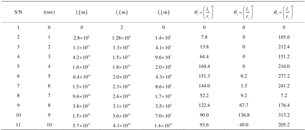
An Analysis and Computation of Optimum Earth Geographical Coverage for Global Satellite Communications
Full text
Figure

Related documents
The main measures were, (1) the percentage of patients spending more than 4 hours to be processed through the A&E department, since the government adopted a performance
The National School of Government will be an important enabler to the implementation of human resource development/training policy in the Public Service through the provision
This series consists of correspondence of the various Directors and Deans of the Institute and Faculty of Public Health, as well as some of their Division Chiefs, especially the
ABSTRACT: The purpose of this study was to investigate the efficacy of dialectical behavior therapy intervention, with the help of three skills of distress tolerance,
The Pension Benefit Guaranty Corporation (PBGC) is a federal agency established by the Employee Retirement Income Security Act (ERISA), whose purpose is to provide “insurance
Table 1 IT workforce skills by type Skills Technical Systems analysis Systems design Programming System testing Database design/management Data warehousing IT
Fog nodes are distributed fog computing entities enabling the deployment of fog services, and formed by at least one or more physical devices with processing
