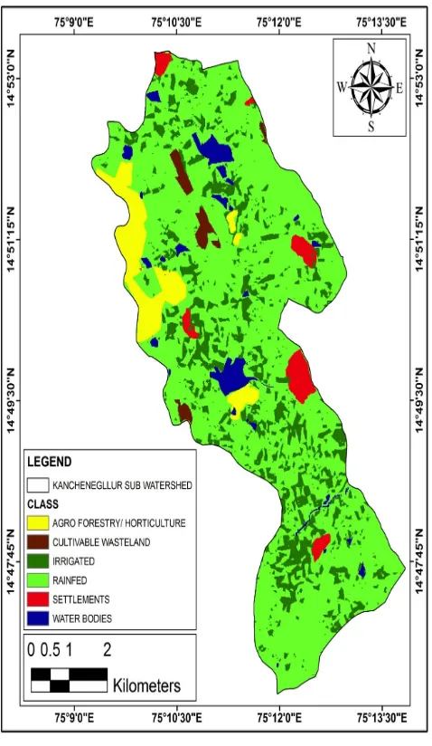
Land Use Land Cover Change Detection on Kanchinegalur sub watershed using GIS and Remote Sensing Technique
Full text
Figure


Related documents
In addition to the Shuler Awards, Cobb Energy Performing Arts Centre Foundation presents the following scholarships: The Morrell Memorial Scholarship to Caroline Grace Stuart
Urease assay, prodigiosin assay, protease assay, biofilm formation assay and growth curve analysis were performed to investigate the effectiveness of linoleic acid in
The Company’s senior secured debtholders (in control) would exchange approximately $300 million in pre-petition secured debt for a combination of cash, a secured note in the amount
ABSTRACT: The present paper presents the results of an experimental investigation carried out to study the effect of Hydrochloric acid on High performance concrete with
These data support the importance of anti-MDV CD8 + T cells responses in the control of the disease, however, the role of MDV-specific CD8 + T cell responses in the control
Wu Z, Dong F, Zhao W, Wang H, Liu Y, Guan B: The fabrication and characterization of novel carbon doped TiO 2 nanotubes, nanowires and nanorods with high visible light
We discovered and confirmed a separate CHIKV introduction to Brazil in Feira de Santana, which com- prises ECSA genotype infections, a CHIKV genotype previously undetected in
fire fighting system and is intended to maintain pressure in the hydrant line to an artificially high level so that the operation of a sprinkler in event of a fire will cause
