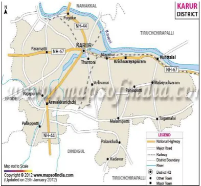
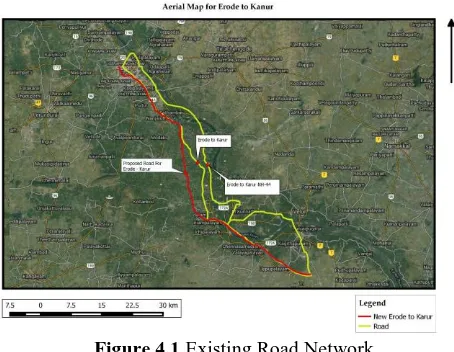
Highway Alignment Using Geographical Information System
Full text
Figure

Related documents
This paper investigates the relative price and relative wage effects of a higher produc- tivity in the traded sector compared with the non traded sector in a two-sector open econ-
Whilst some farmers are able to increase the number of pollinators servicing their crops by utilising domesticated/commercially reared bees, pollination dependent
They are one of the leading exporters of biscuits from India, with approximately 12% share of the Indian biscuit export market in calendar year 2019 and contribute more than 50%
This chapter includes documents which define the requirement for the control of a radio quiet area, documents which define the level of radio interference in
Heath and Cheung [ 18 ] offer a useful review of the employment situation, including experience of racial discrimination experienced by Black and Ethnic Minorities (BEM) adults
2) Factorization of the KL Divergence: Since the KL diver- gence decomposes in a directed acyclic graphical model for Gaussian variables [3], the previous propositions immediately
In summary, to test whether moral suasion has an e¤ect through preferences, we compare the behavior of subjects who received a Blank message with those that received the Golden
Of these three approaches, agency theory and cultural distance predict that an organisation's project monitoring and management processes will be affected by organisational
