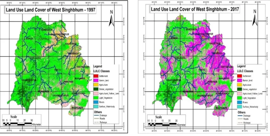
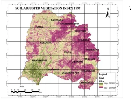
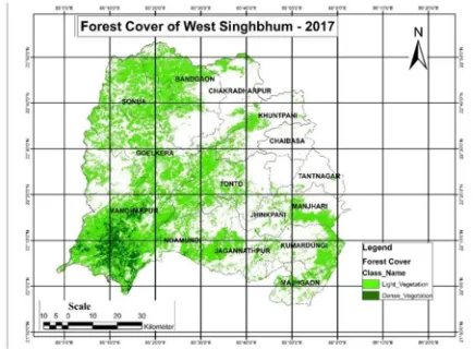
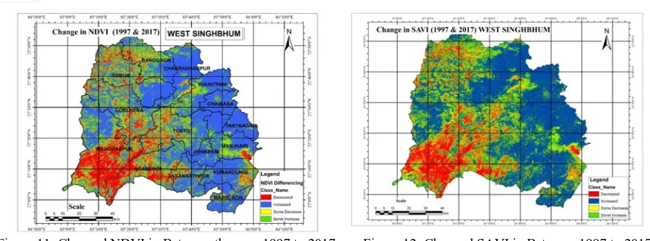
Forest Cover Change Analysis Based on Remote Sensing & GIS of West Singbhum District, Jharkhand
Full text
Figure


Related documents
Between 1950 and 1980 a few studies of past eruptions were published in international scienti fi c journals, but these were either focused on: the most recent 1957/8
information to reap an unfair benefit. Many of these donations were made at a time when it would have been illegal to make a sale of the same securities due to their access to this
Therefore, such groups are more likely to accept working within (and, in a sense, integrating into) established, mainstream political parties as the best strategy
1) To study the effect of lateral load resisting systems for a regular high rise building. 2) To study the effect of lateral forces on high rise irregular structure. 3) To analyze
Chapter 2 Covalent labeling of amine groups in peptides and proteins with N- Hydroxysuccinimidyl ester modified Fe 3 O 4 @SiO 2 nanoparticles containing cleavable disulfide-
To understand better the factors which impact on the economy of the investment of information systems and selection of an IT reference as well as actions susceptible
The national health priority areas are disease prevention, mitigation and control; health education, promotion, environmental health and nutrition; governance, coord-
In this paper we analysed the sample points from the human vertebra by using the method of Stehlík (2009) which is based on the likelihood ratio statistics.. We found out, that
