Photogrammetric Data Acquisition &
Processing, Geomatic Applications in
Construction Industry
Apurwa Masook1, Sahasransu Purohit2
U.G. Student, Department of Civil Engineering, Veer Surendra Sai University of Technology, Burla,India1
U.G. Student, Department of Civil Engineering, Veer Surendra Sai University of Technology, Burla,India2
ABSTRACT: In this convoluted and sophisticated world, where every man-power activity is turning machine-operative; engineers took an initiative to make the job of surveying and construction industries easier, efficient and economical. An innovative approach of using a flying remote controlled, light weight aircraft (referred to as Drones or Unnamed Aerial Vehicle) with an on-board camera associated with special GPS technology for survey of large areas, gave way to better analysis of the topographic surveys prior to the construction job.
KEYWORDS: Data Acquisition, Geomatics, Photogrammetry, Remote Sensing, Surveying, Topography
I. INTRODUCTION
Technically, aerial mapping can be defined as the procedure of drawing planimetric maps, contours and features that are extracted from the aero-triangulated aerial imagery. With the increasing demands for accuracy and sustainability, Drones or UAVs are being employed in greater numbers to simplify the task of construction managers and builders; thus in turn establishing an improvised economical outcome from the architectural projects. Blooming onto a number of useful applications, the aerial mapping drones have proved to be the most efficient ones in the field of construction and building works. It performs various important tasks, which further includes the aerial monitoring through the power line net-work to have a regular check on the vegetation growth and to detect the damaged areas and the 3D mapping through which one can generate detailed 3D images of the worksites to introduce proper planning, designing and evaluation of the distances of installations.
Drones can be also used for stock-pile monitoring by the use of volumetric calculations to measure the extraction area and other stockpile dimensions in addition to the traffic monitoring applications for efficient transport and communication. The advanced use of the UAVs or Drones have revolutionized and welcomed tremendous progress in the construction industries. In the stepwise procedure of construction works, the drones find its primary application in the topographic surveying of the site prior to the job of construction.Thus with an overall inspection of the construction work and the jobsite, drones or UAVs promote efficient completion of the jobs indicating their crucial necessity in the field of construction industries and civil engineering.
II. PHOTOGRAMMETRY
Photogrammetry can be referred to as the science of measurement in photos. It is a part of geodesy, belonging to the domain of Remote Sensing. It helps to reconstruct the position, orientation, shape and size of objects from pictures. It allows the analysis of the characteristics of the object, without any physical contact to it. Its principal application lies in the production of topographic maps. It helps to record substantial geodata, which is fed to a comprehensive Geoinformation System (GIS). [1], [2]
Photogrammetry is based on perspective geometry. At the simplest level, a camera lens can be a perspective centre and light rays traveling in straight rays from a point in the scene, through the perspective centre, to the image of the point. If the camera is calibrated, i.e., we know the principal distance (focal length), we can determine the angles between light rays from various points. Given at least 3 points in the scene with known 3D coordinates in some coordinate system, we can determine the position of the perspective centre and the orientation of the image with respect to that coordinate system.
Stereoscopic viewing:
By simply understanding the properties of human vision, where we see objects in a spatial manner. We at all times, receive slightly two different images, due to the different positions of our left and right eye. This principle is referred to a stereoscopic viewing, which is used to extract three-dimensional information in photogrammetry. So if we have multiple images of the same object, taken from different positons. I.e. different perspectives we can calculate three-dimensional coordinates of the points, represented in the images. This helps us to digitize points, lines and calculate distances, areas, slopes volumes, etc. [2]
III.PROPOSEDMETHODOLOGY
IV.WORKFLOW
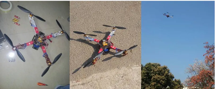
Few preliminary checks are made, and the entire Drone system is accounted for. After the Flight Planning is completed, the RC drone is deployed at the site to be mapped. Various parameters such as altitude, wind speed, battery level, GPS coordinates are monitored all the time during the complete flight. The flight is made in such a way to get 360-degree view of the complete site, keeping in mind the 80-90% overlap ratio, so that the frames can be stitched into complete Raster Data. Regulatory concerns include proper Permissible flight approval from relevant authority (AAI), vertical flight limit and line of sight at all times. The Limited Battery life (15-25 minutes) should be also taken into consideration and additional battery may be kept ready for next flight. Flight should be delayed during unpleasant weather conditions such as rain, fog, wind, etc. During the Project work for this thesis, 2 different sites were aerially mapped using the proposed methodology.
Site 1:
(a)
(b)
Fig.2 Data Acquisition and processing (a) Original Raw Images taken by drone (b) 3d Map rendered in Agisoft
Site 2:
(a)
(b)
Fig.3 Data Acquisition and processing (a) Original Raw Images taken by drone (b) 3d Map rendered in Agisoft
V. APPLICATIONS
Drones, more accurately described in a business context as unmanned aerial vehicles (UAVs), present increasingly attractive opportunities for achieving several goals. UAVs can take different forms, with different levels of controls and the capacity to carry a very wide range of payloads. We can mount a High resolution camera, or Thermal Camera, or Multispectral Camera, or Hyperspectral Camera, as we deem fit for our purpose. We have so many sensors at our disposal, to use along with the drone. Namely to monitor, Light Intensity, Pressure, Frequency, Radiation, Cell Reception and so on. The UAVs can be remote controlled or semi to fully autonomous. There is no limit to customization it offers. It helps to automate simple tasks and hence reducing Labour costs significantly. [4] It can be used for surveillance of Transmission Line Network, Stockpile Calculations, Smart City Traffic Monitoring, Use of thermal imaging for monitoring gas emissions, and GIS applications.
VI. CONCLUSION
mapping applications. This will disrupt the existing GIS data collection process. Collateral industries will also be affected (drone and sensor manufacture, sales, repair, etc.). Software industry will adapt(Drone2Map from ESRI, AgiSoft, Pix4d, etc.)[6]. The range is incredible. As with GIS, almost any use case can benefitfrom higher-resolution, self-service imagery and 3D point clouddata.
VII. ACKNOWLEDGMENTS
This work was supported by Idea & Innovation Cell, VSSUT, Burla. Sincere thanks to Sudarshan Samal, Sovan Panda for contributing information and assistance to the article. And to all those who are directly or indirectly involved for drafting the paper.
REFERENCES
[1] K. Kraus, Photogrammetry: Geometry from Images and Laser Scans, Volume 1, second Edition WDeG, pp. 1-3. [2] W. Linder, Digital Photogrammetry: A Practical Course, fourth Edition Springer, pp. 1-3.
[3] 3D Mapping and 3D Modeling Market, Press Release, Markets and Markets [4] Drones in Engineering and Construction, Report by Accenture