• No results found

Hydrodynamic Modelling of Coral Reefs:Ningaloo Reef-Western Australia

N/A
N/A
Protected

Academic year: 2020

Share "Hydrodynamic Modelling of Coral Reefs:Ningaloo Reef-Western Australia"

Copied!
8
0
0

Loading.... (view fulltext now)

Full text

Figure

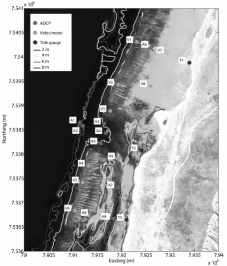
Fig. 1.a) Map illustrating the study area. The field study will focus on a stretch of reef located in the Sandy Bay region of Ningaloo Marine Park b) Bathymetry derived from hyperspectral imagery (adapted from Lowe et al., 2008)
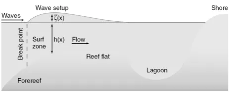
Fig. 2. Definition sketch for wave-driven flow over a reef and into a lagoon (redrawn from Hearn 1999, courtesy of R
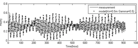
Fig. 4. Oceanic and meteorological forcing conditions, observed during the field experiment
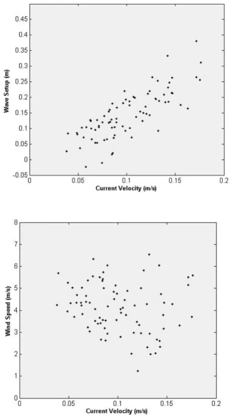
Fig 6. Wave setup and Current velocity in V3 on the reef flat
+3

References

Related documents

Seismic Facies T 3 Facies TJ forms an acoustically transparent bathymetric high that disconformably overlies channel facies ChI and Ch, Figure 5.8.. The position and description of

Turbidity and hydrodynamic data have been delineated into periods of high and low turbidity "events" to examine the potehtial causes and differences of turbidity at Paluma Shoals

4 and 5 the residual currents computed for winter and summer seasons as the algebraic averages of the three- dimensional hourly current speeds obtained for winter (Jan- uary,