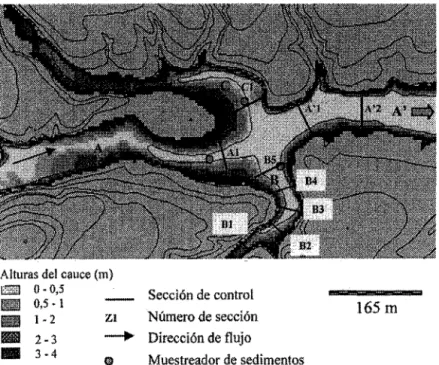
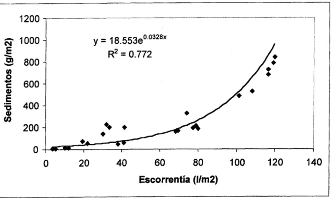
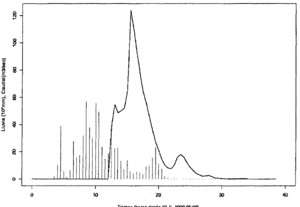
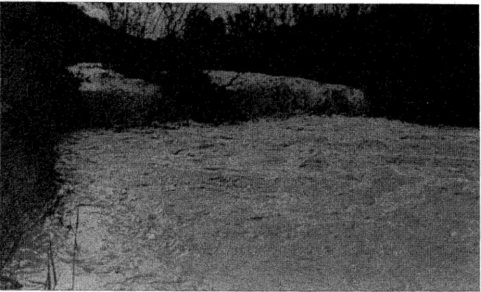
The experimental catchment of Rambla Salada (Murcia) : hydrol-geomorphological researchs
Full text
Figure

Related documents
In conclusion, abnormal QRS|T angle, as measured on a 12-lead ECG, was associated with increased risk for cardiovascular and all-cause mortality in this population-based sample
This means that the arrangement of data items within the corresponding bars of multi-pixel bar charts is the same, i.e., the colored pixels correspond- ing to the different
The use of a loop bus increases the reliability level of each single installation since, in the event of voluntary interruption (due, for example, to sabotage) or not
BY CAR: Highway A4/E70 – Exit Vicenza Ovest Track entrance: Via Alessandro Manzoni, 25 Reception: Via Alessandro Manzoni, 1.. GPS POINT:
The Federal Geographic Data Committee (FGDC), established by the President's Office of Management and Budget to coordinate geospatial data activities, is charged with
The monetary policy implications of the baseline and regulatory models can be assessed by reviewing how the effective federal funds rate could differ between the models and how the
Min S.*, Kim D., Seo S., “GIS-based ecological analysis of environmental risk factors on allergic diseases in Seoul, Korea,” Joint Conference of Korean Policy Forum and
