http://dx.doi.org/10.4236/nr.2016.74020
Cultural Heritage Assets: Rituals, Grinding
Hollows and Other Socio-Cultural Practices
in Simiyu Region, Tanzania
Charles B. Saanane
Department of Archaeology and Heritage, College of Humanities, University of Dar es Salaam, Dar es Salaam, Tanzania
Received 11 February 2016; accepted 26 April 2016; published 29 April 2016
Copyright © 2016 by author and Scientific Research Publishing Inc.
This work is licensed under the Creative Commons Attribution International License (CC BY). http://creativecommons.org/licenses/by/4.0/
Abstract
This paper presents results from preliminary assessments in Ngasamo ward, Busega district in Simiyu region. The main objective was to assess cultural heritage assets in some areas of Bariadi district in Simiyu region. Specific objectives of the assessment are to identify tangible cultural her-itage resources in Simiyu region; to identify intangible cultural herher-itage resources in Simiyu re-gion; and to provide suggestions for pertinent protection, conservation and presentation of cul-tural heritage resources. The assessment was carried out through surveys that included docu-mentation together with records for Global Positioning System (GPS) coordinates per surveyed locality; key informant interviews; and Focus Group Discussion. Results from the assessment re-vealed several worship areas that include immovable physical objects associated to ritual perfor-mance places. For example, wells like Luhuhi in Ilula village, Nkindwa biye tree in Ilula village, Magahi well in Isenge village, Isangijo hill at Isenge village, Dutwa well in Isenge village, Nyabusalu well in Igalukilo village and similar others are worship places that were revealed by informants. The assessment uncovered granite rock boulders that are being chopped off flakes for traditional medicine use in the area. Some cultural heritage sites have been identified such that a lot more needs to be explored in order to establish existence of other physical cultural heritage sites in Bu-sega district, Bariadi district. For example, the grinding hollows, bao and the like are unique her-itage resources. Such resources including undiscovered immovable archaeological objects would need presentation of sustainable preservation as well as conservation plans in line with Antiqui-ties Acts, AntiquiAntiqui-ties Rules and Monuments of 1980 together with Cultural Heritage Policy of 2008.
Keywords
1. Introduction
This report is based on assessments along Ngasamo ward, Busega district in Simiyu region, Tanzania. Assess-ments involved key informant interviews together with focus group discussions in order to report aspects con-nected to megaliths and socio-cultural life ways of Wasukuma.
Historical Habitation of Sukuma Areas
The best scholarly views about early peopling of much of the African continent can be discerned from Lin-guistic and Archaeological disciplines. However, based on nature of data recovered through tangible materials, Archaeology is the best salvage for the problem. It was reported that almost all peoples occupying the southern third of the African continent, notably, from Cameroun to Nigerian sea coast in West Africa to Somalia and Kenyan coastline in Eastern Africa and southwards as far as, for example, Port Elizabeth in South Africa, speak a closely related group of languages known as the Bantu languages [1]. In addition, based on lexical, phonetic, morphological (grammatical) and syntactic resemblances, the Bantu family consists of over four hundred lan-guages all reported to have derived from the same ancestral language known as “proto-Bantu” [1]. Assuming for such population groups descended from a common parentage, some words have common meaning, for example, the word “people” in the following languages, Congo, bantu; Rwanda, abantu; Shona (Zimbabwe) vanhu; Wasukuma (Mwanza, Simiyu and Shinyanga regions), bhanhu s [1]. All these words follow the same pattern because they derive from the form made up of the root-ntu and the prefix b at-, denoting the plural [1].
Archaeological evidence of large-scale migrations can best be compared with spread of Bantu languages in Africa as the only window of hope for deciphering the said movements [1]. In due regard, speakers of Bantu languages occupied from very early times an expansive swath of territory running from the Great Lakes region of East Africa to shores of the Atlantic in Democratic Republic of the Congo [1]. Archaeological evidence points to the fact that Negroid physical type of people occupied Sub-Saharan Africa from Middle Stone Age such that from Negroid stock speakers of Bantu languages emerged [1]. Most likely Bantu languages developed through an interaction of several early Negroid communities and borrowed from one another whereby they de-veloped new “Bantu” languages from several Negro language amalgams [1].
Archaeological evidence shows several areas of early Negro settlement in Sub-Saharan, areas of Negro com-munities, which may have interacted to form utterly new languages. In West Africa, for example, palaeontolog-ical evidence of Negro existence was attested at Iwo Eleru in Western Nigeria where a “proto-Negro” skull ex-humed there was dated to the early tenth millennium Before Christ (9250 BC) [1]. Also in the same region, a Negroid skull was excavated at Asselar in Mali dated at the early seventh millennium (6046 BC) [1]. Other areas included the following: Rop in Northern Nigeria dated to the second millennium (−1990 ± 120 BC) and Kin-tampo in Northern Ghana dated to the fourth millennium Before Christ [1].
In East Africa, the Negro emerged during the end of Pleistocene/beginning Holocene period (around 10,000 years ago) [1]. It was reported that speakers of Bantu languages moved from their original homelands and even-tually, displaced as well as incorporated Khoisan and probably Sudanic stocks in big vast regions of Sub-Equa- torial Africa. Such a pattern was accomplished by the end of Early Iron Age (variously referred to Early Iron Working phase) and the beginning of the second millennium BC [1] (Figure 2).
Archaeological evidence suggests that Bantu-speaking iron-using cultivators from West Africa were settled in Bukoba West of Lake Victoria in Tanzania by 500 BC [2] (Figure 1).
Mainland Tanzania was later on settled with the following population groups: Cushitic herdsmen as well as cultivators, Nilotic pastoralists and Bantu agriculturalists [2] (Figure 2). By early nineteenth-century, Mainland Tanzania was composed of population groups not identifiable to discrete compact and ethnic groups, each with a distinct territory, language, culture and political system [2]. That part of the country had population group names, which evolved to classify them as either political (inhabitants of a particular chiefdom) or simply indicated di-rection [2] (Figure 2). For example, those called Sukuma were “northerners” to their southern neighbours (Nyamwezi in Tabora areas) [2]. Thus, identification was absolutely relative to spatial position of a speaker as it was referred to, for example, by moving away from his/her home and dating to a new environment a person changed his/her identify like a Shambaa in Lushoto who left the Usambara Mountains commonly ceased to be called Shambaa [2]. A Turu became Sandawe in Kondoa district, Dodoma region [2].
The Role of Political Organization in Pre-Colonial Sukuma Area
Figure 1.Probable approximate locations of peoples in east African interior (12th Century). Source: Adapted from Ehret (1984).
area “Busukuma” [2] (Figure 2). The term “Sukumaland” is sometimes used for the Sukuma area [2]. Recall, the name “Sukuma” literally means “north”, but it has become a term of ethnic identification [2]. Furthermore, Sukuma are probably best considered as a single Bantu language with several mutually intelligible dialects [2]. Such features include a seven-vowel system, use of tone, true negative tenses, class prefixes to indicate size and restriction of double prefixes to determine situations [2].
Such a pattern was accomplished by the end of Early Iron Age (variously referred to Early Iron Working phase) and the beginning of the second millennium BC [1] (Figure 2).
Figure 2.Probable approximate locations of peoples in east African interior (16th Century). Source: Adapted from Ehret (1984).
argu-ments following an important discussion by village elders [3].
2. Current Population Groups
Currently, the major ethic group is Wasukuma. Wasukuma is the largest ethnic group in Tanzania, with an esti-mated 5.5 million members representing about 16 percent of the country’s total population [3]. Sukuma means “north” and refers to “people of the north” [3], while other ethnic groups are Wanyamwezi and Wasumbwa who are mainly found in Kahama and Bukombe districts, Geita region [3]. There are also substantial numbers of Wanyiramba, Wataturu and Wahadzabe from neighbouring regions who have settled in Shinyanga rural (Shi-nyanga region) and Meatu district, Simiyu region [3]. Most of the ethnic groups in the areas are Bantus who are believed to have moved into the country during the Iron Age [1]. The dominant ethnic group, Wasukuma, has both agriculturists and livestock keepers [1]. There are also a few people of Arabic origin in the region mainly found in the district and regional headquarters as well as trading centers involved in trade [1].
3. Objectives
3.1. Main Objective
The Main Objective was to assess cultural heritage assets in areas of Bariadi in Simiyu region.
3.2. Specific Objectives
The assessment had the following Specific Objectives:
To identify tangible cultural heritage resources in Simiyu region; To identify intangible cultural heritage resources in Simiyu region; and
To provide suggestions for pertinent protection, conservation and presentation of cultural heritage resources.
4. Materials and Methods
The study was carried out through the following data collection methods:
• Surveys that included documentation together with records for GPS coordinates (see Appendix I) per sur-veyed locality;
• Key informant interviews through unstructured questions (see Appendix II); and
• Focus Group Discussion (please see Appendix II).
Assessment Areas
The assessment covered the following areas that included a claimed footprint around Ngasamo (Busega district, Simiyu region) and Ng’wamang’ola hill (Bariadi district, Simiyu region) as well as land between the two hills including Nyanzawe hill together with contiguous areas (please see Figure 3 and Figure 4). Other areas in-cluded Nyanzawe (Ngasamo ward) in Busega district and Ng’wamang’ola (Dutwa ward) plus contiguous areas (Igegu village) in Sapiwi ward, Bariadi district, all in Simiyu region (Figure 3; Figure 4).
5. Results
The assessment revealed places for traditional worship practices that included graves, trees and wells. There were some indications of archaeological materials in form of stone tools at some locations in the assessed areas. Cultural heritage assets were found on huge granite stone boulders (megaliths) with hollows for grinding cereals. A unique find included huge granite boulders in Dutwa Ward that are pecked by various people and it was claimed that resultant rock fragments (flakes and the like) are carried out such that they are used for medicinal purposes. Results are presented in detail in the following Sub-Sections:
5.1. Graves as Places for Traditional Religious Ceremonies
5.1.1. Ngasamo WardFigure 3. Cultural heritage study areas. NB: Magu district was divided into Magu for Mwanza region and Busega district for Simiyu region. The assessment covered Ngasamo ward in Busega district, Simiyu region.
[image:6.595.89.535.422.697.2]According to informants within the clan, known as Bagasamo (literally meaning people belonging to Ngasamo clan), chief Ngasa was a hunter and cultivated tobacco as well as marijuana around his residence at Ngasamo hilltop. The graves have piles of stones with built up Wasukuma traditional healers’ huts (Figure 5).
[image:7.595.230.400.203.442.2]The heir to Chief Ngasa is Joseph Nkwabi Mandalu, currently living at Malili Village in Busega district, Si-miyu region (Figure 6). As a clan, they normally convene at least once a year, in September and carry out their traditional religious ceremonies beside the graves. It was further disclosed that other people are helped/directed by one of the relatives, a traditional healer and they pray for their requests/fortune. For example, they pray for their wishes for success in mining activities (mostly gold mining because there are artisanal gold miners at Nga-samo village), businesses, farming and the like.
Figure 5.Ngasa and his wife’s graves at Nga- samo hilltop.
[image:7.595.229.399.470.711.2]5.1.2. Dutwa Ward
West of Ng’wamang’ola foothill, there are two graves, one of Mang’ola and the other is his wife’s grave (Fig- ure 7). There are cairns spread at both graves and form a bit of a demarcation between Mang’ola’s grave and his wife’s grave (Figure 7). The hill was named after Mang’ola.
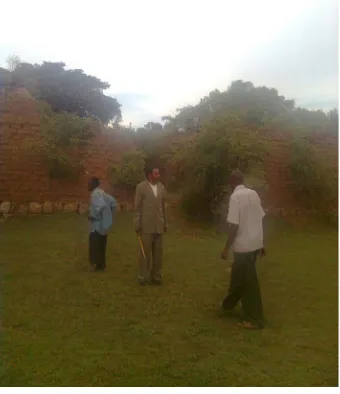
[image:8.595.230.400.202.440.2]It was reported that Mang’ola joined Bahunda chiefdom of Dutwa area in Simiyu region and he was a tradi-tional healer, known in Kisukuma as manga. Due to Wasukuma cosmology, they believe in his help through their traditional religion such that people go to the place and carry out their traditional religious ceremonies be-side the grave as means for getting assisted for their wishes at diverse capacities, for example, for farming activ-ities, mining, businesses and the like. The heir to Bahunda chieftaincy is Maduhu Madaki (Figure 8).
Figure 7. Graves of Mang’ola and his wife.
[image:8.595.229.399.500.697.2]5.2. Other Places for Traditional Religious Worship Cermenonies
5.2.1. Ngasamo Ward, Busega District, Simiyu Region
Kindwa biye is a tree where they worship/pray for rain and those seeking to conceive (Figure 9). It is located at Ilula hamlet in Imalamate village, Busega district, Simiyu region at the following coordinates: Elevation 1272 metres above sea level, 36 M 0597898, UTM 9726080.
Lwinzi lukulu, locally called Luhuhi (Figure 10), is a well that never dries in Imalamate hamlet and it is a place for traditional worship. It was disclosed that Wasukuma call wells that never dry, lwinzi lukulu. Ngasa clan members perform rituals at the well besides such practices at Ngasamo hill whereby people pray for rains by end September of every year. The well is protected by a round ridge planted with trees and herbs as well as grasses as protection from erosion and the like. Its coordinates are the following: Elevation 1268 metres above sea level, 36 M 0597618, UTM 972968. It was revealed that Ngasa clan members are responsible for performing tradi-tional rituals at Ngasamo hill beside Ngasa’s grave and at Luhuhi well. There are oral accounts by local people that include a scenario that were reported. For example, they recalled that in 1960s and 1971, the well yielded ghee, a white chicken and drum beats were heard. All these were said to mean good fortune for people living around the area.
At Ng’wamalwilo B hamlet, Ng’wang’wenge village, Busega district, there is a dead tree whereby traditional ceremonies for rain making are performed every year. The last traditional ceremonies were performed in Febru-ary, 2012. The place was established by one person known as Ng’wenge such that the village assumed the name Ng’wa ng’wenge (literally meaning at Ng’wenge’s place). The following are coordinates for the location Eleva-tion 1259 metres above sea level, 36 M 0600244, UTM 9730956.
[image:9.595.228.399.380.546.2]At Shinyanga hamlet in Ng’wang’wenge village, Busega district, there is a traditional healer and rain maker. The following coordinates were recorded almost 200 metres away from the traditional healer’s residence: Eleva-tion 1280 metres above sea level, 36 M 0601745, UTM 9730322.
Figure 9. Kindwa biye tree, place for tradi-tional worship.
[image:9.595.230.399.581.705.2]5.2.2. Dutwa Ward, Bariadi District, Simiyu Region
Places of Traditional Religious Worship
Nyabusalu wells located in Igaganulwa village, Bariadi district, Simiyu region, never get dry and they are twin wells. Informants reported that the well on the West is known as ngosha (denoting for a male in Kisukuma) or Kulwa and that on the East is called nkima (denoting for a female in Kisukuma) or Doto. There is a very old mango tree planted by the then chief Shimba over 70 years ago. The wells have encircled ridges plus grasses on their top to protect them from erosion and other weathering processes. Water from the wells is used for medicine. For example, water is fetched by using calabashes for ailments like eye sickness and for wishes to succeed in crop yields including business success. It was reported that if wells disagreed for one’s presence, water would suddenly change into mud (tembe in Kisukuma) or blood or any dirt. The wells are located at the following coordinates: Elevation 1263 metres above sea level, 36 M 0607862, UTM 9723246.
In addition, it was reported that the name for the wells assume clan names within the Bahunda chiefdom. Ba-hunda chiefdom has two population groups, namely, BaBa-hunda busalu and BaBa-hunda nyama, literally meaning beads for the former and meat for the latter according to their traditional rituals and genealogical origins.
At Shayayi hill, Lubaga hamlet in Majengo village, there is a tree known as Ng’hologoma or Ng’hoja (Figure 11) at the Eastern part of the hill. It is a place for worship. It was reported that Bahunda clan members are re-sponsible for traditional worship at the site and they request for any aspects in their daily lives. The place is lo-cated at 1310 metres above sea level, 36 M 0604997, UTM 9723766.
At Isangijo hill, Nyanhiga hamlet, almost 30 metres from a cave, all Dutwa people worship traditionally for various requests. The place can be traced at the following coordinates: Elevation 1289 metres above sea level, 36 M 0606395, UTM 9723674. There is a grave nearby for a person (Zaenda) who died over 100 years ago. It was claimed that the area was named after a giraffe (nhiga in Kisukuma) that fell and broke its leg to death at a rock boulder hole that had water. Such wells in rock boulders are known in Kisukuma language as chungu. All Dutwa people are used to take their seeds before planting and perform traditional rituals for good harvests. It was reported that they normally seal the hole by using rocks to save people and other animals so as to prevent them from falling into a dry hole/well thereby prevent them from dying.
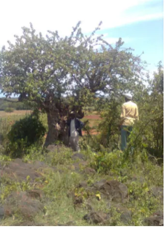
[image:10.595.229.400.459.696.2]At Itemelo A hamlet, Isenge village, there is Magahi well at Magahi foot hill (Figure 12). It is another place for worship. The well also never dries and recall, in Kisukuma language, such well is called as lwinzi lukulu. It belongs to Bashola clan who are spread into various areas in Simiyu, Mwanza and Shinyanga regions. Like oth-er similar wells, the well is encircled with a ridge to protect it from oth-erosion (see Figure 12). Informants reported
that water from the well is fetched by using calabashes and other containers so as to heal eye ailments. The place is located at the following coordinates Elevation 1271 metres above sea level, 36 M 0606707, UTM 9724744.
At Itemelo B hamlet, Isenge village, there is Nama well that is still a place of worship. The site is not very far from the main road from Bariadi to Lamadi. It can be traced at the following coordinates: Elevation 1280 metres above sea level, 36 M 0607764, UTM 9727534.
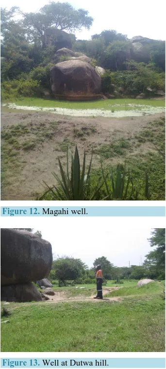
At Dutwa hill, Isenge village, there is a well that has some mysteries for people (Figure 13). Like many wells in the area, the well is encircled with a ridge as protection from erosion. It was claimed that, for example, if a cow emerges from the well it is an indication that they will have good harvests. The place can be traced at the following coordinates: Elevation 1282 metres above level, 36 M 0607220, UTM 9724578.
5.2.3. Sapiwi Ward, Bariadi District, Simiyu Region Igegu Village
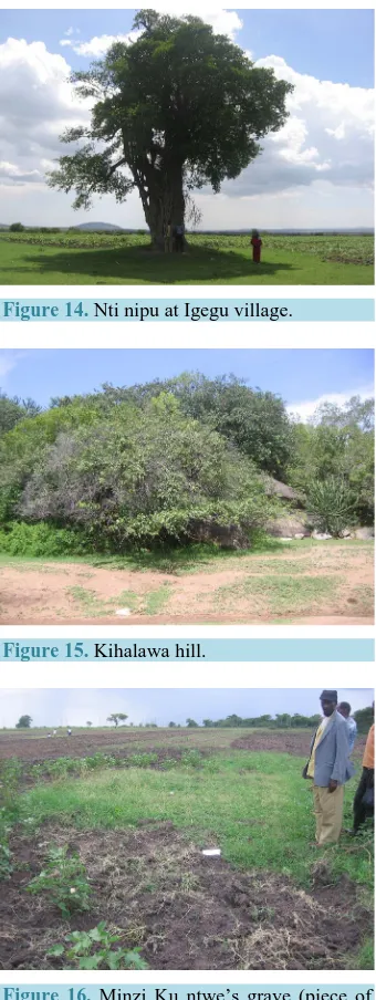
At Nti nipu hamlet, Igegu village, there is the only tallest tree, as the name connotes in Kisukuma language whereby they undertake traditional worship ceremonies (please see Figure 14). There are several graves includ-ing Mabusi’s grave, the person believed to have supernatural powers that they request for their fortune. Most people carry out worship ceremonies in pursuit for rains. Furthermore, it was reported that Mabusi was an ironsmith who had several implements for their daily lives. However, no iron material remains were spotted. Tree barks from nti nipu are always chopped off for medicine. The following are the place’s coordinates: 1315 metres above sea level, 36 M 0603868, UTM 3730390.
[image:11.595.228.399.341.721.2]Figure 12. Magahi well.
At Jibiso hamlet in Igegu village, Kihalawa hill is a place for worship for many people (Figure 15). The place has many trees and granite rock boulders. The place is located at the following coordinates: Elevation 1280 me-tres above sea level, 36 M 0602152, UTM 9732858.
At Mpilingito hamlet in Igegu village, there is a grave of Minzi ku ntwe whereby people perform rituals for rain making (see Figure 16). The name is after a person who was a great rain maker and literally, his name means water on head. Many people from various locations such as Igegu village and Kijilishi at Mkula village attend to such traditional rituals for rain making. They make contributions for all necessary items for sacrifice in the desired traditional rituals. The grave is left untouched while surrounding areas are cultivated (Figure 16). The place can be accessed at the following coordinates: Elevation 1309 metres above sea level, UTM 9730616.
5.3. Other Cultural Heritage Assets
5.3.1. Ngasamo Ward
Secondary data are the only reported so far because primary data from the current reconnaissance work did not
Figure 14. Nti nipu at Igegu village.
[image:12.595.229.399.255.707.2]Figure 15. Kihalawa hill.
reveal archaeological remains on surface. Thus, former archaeological research works [4] reported stone tools earlier in date than Later Stone Age at two sites in Ngasamo vicinity. A few tools were found by the team on the East bank of Duma River tributary north of crossing of Ngasamo Goldmine [4]. Also between 15 and 1.2 kilo-metres due West-North-West of Ngasamo along Nassa road, they [4] discovered artifacts attributed to Middle Stone Age. Furthermore, Nyang’oma rock shelter some two kilometers South-West of Shigala village, along Nyashimo to Ngasamo/Bariadi road, two adjacent small rock shelters have rock paintings with a lot of Later Stone Age materials [4][5]. Other materials were recovered from the locality and included Iron Age pottery; vertebrate fossil remains; shell fragments belonging to nacreous fresh-water bivalve; a few shell fragments of large land-snails; and ostrich egg-shells [4]. The charcoal sample revealed dates at the lower stratum to be 2640 ± 120 Before Present (B.P.) or 690 Before Christ [4].
In addition, at Mwamajo rock shelter, about one kilometer to the South of Shigala village, there is a gong and immediately in the vicinity there is another rock shelter with red paintings, while the floor yielded quartz stone artifacts, iron-smelting remains, pottery remains and bone fragments [4]-[6]. Rock gongs were also found in Moru Kopje areas, Serengeti National Park, Mara region and are believed to have been used as musical instru-ments [4]. The proponent [4] suggested dates of rock gongs to be fourteenth or fifteenth century A.D. based on their dated occurrences in Uganda and Kenya [5].
5.3.2. Dutwa Ward, Bariadi District, Simiyu Region 1) Grinding Hollows
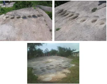
Some places were found with grinding hollows at large granite boulders for grinding cereals. They used them in ancient to contemporary times. For example, at Msanga A and Msanga B hamlets (all of Sengerema village) as well as Magahi hill, such grinding hollows on granite rock boulders were spotted (see Figure 17 and Appen-dix I for GPS coordinates).
[image:13.595.140.488.431.705.2]A characteristic feature on rocks sighted in Dutwa Ward is a grinding hollow that is a depression larger than a cup-mark ground into a flat or a bit convex outcrop of granite bedrock (Figure 17) [6]. Groups of depressions aligned in two rows (Figure 17) and number of hollows varied from forty hollows and above. [6] suggested that as long as grinding hollows have the same overall shape like grinding surface of portable grinding stones, they could be called stationary grinding stones. In terms of outline, the depression may be oval or sub-rectangular
(see Figure 17 and Figure 18). Wasukuma have different terms for various kinds of grinding stones, for exam-ple, a portable stone for grinding snuff, traditional medicine and similar substances is known as izunzu (plural
mazunzu). Iwe (plural mawe) is a large, basin-shaped stone for grinding maize, millet or sorghum, while grind-ing hollows are called manhe or g’homango (see also [6]). They [6] reported such occurrences in Mwanza re-gion. For example, at Kalumwa in Sengerema district, Nyamasale hill (Sengerema district), Gaetje’s dairy farm at Kamanga as well as Nyamatongo in Sengerema district [6]. Like occurrences reported by [6], they are not in use today and in later years, Wasukuma started using portable grinding stones with millers for grinding cereals. The informants said that such grinding hollows were deepened by young ladies who were hard workers. Ex-pected suitors stood by their side in order to spot such hard working young ladies that they can choose from to marry. It was different from the traditional dances at night whereby boys chased girls in order to choose those they love, a pattern known in Kisukuma as chagulaga. It was argued that chagulaga was not as a serious pattern for preparations into betrothal like spotting a young lady to marry later on. Currently, it was reported that Wa-sukuma youth are using other means to get fiancé due to many socio-cultural transformations.
Secondary data help to decipher and compare from the primary data revealed from the reconnaissance surveys of this work. For example, other parts of Africa that yielded grinding hollows include Zambia and Nigeria [6]. Those in Nigeria were reported to have had been associated with percussion boulders and rock paintings as part of the marriage ceremonial complex [6].
Through key informant interviews during reconnaissance surveys, Dutwa grinding hollows were reported as-sociated with marriage complex whereby men stood beside women who were grinding cereals to select the best pair witnessed from a good grinder who produced deep hollows. It was further revealed that such a pattern was a sign of a hard working woman suitable for sustaining the expected family chores. Dates for such occurrences seem to post-date contemporary settlements based on oral accounts reported by [6], a pattern that could be true for Dutwa grinding hollows.
At Magahi hill, there are hollows also reported to have been used as grinding stones on rock faces below at two granite rock boulders (see Figure 18). The remains are located at the following coordinates: 1289 metres above sea level, 36 M 0606606 and UTM 9727688.
2) Traditional Game (bao in Kiswahili and isolo in Kisukuma) Sites
[image:14.595.229.400.470.702.2]The reconnaissance survey at Msanga A, Sengerema village uncovered on a rock surface a game, known in Kisukuma as isolo. Also at Ng’wanhiga hamlet (Majengo village) at Kandawa hill and Nyalule hill in Ng’wanhiga hamlet, Majengo village (see Appendix I for GPS coordinates). The said traditional game sites are located in hill sites whereby people enjoyed shade and breeze as experienced during the survey. Also, like
grinding hollows, a traditional game (bao) has small hollows that resemble current bao hollows on wood. They have deep pits that could hold dices (kete in Kiswahili), like round seedlings or rocks.
At Nyamhunu in Igalukiro (Dutwa) areas, there is a cave and a rock, which was reported to have been used as a drum [4]. Recall, [4] suggested dates of rock gongs to be fourteenth or fifteenth century A.D. based on their dated occurrences in Uganda and Kenya.
5.4. Unique Materials
5.4.1. Dutwa Ward
1) Unique Rock Boulders for Traditional Medicine Purposes
The reconnaissance survey uncovered unique rock boulders after being led by key informants at Msanga A hamlet whereby two rock boulders, one very huge and tall and another one, small and short, are used for medi-cinal purposes (see Figure 19). The small rock boulder’s height does not reach the depression seen at almost half way of the big boulder. It was claimed that people chopped off either of the rocks to get rock fragments and for one wishing to get a baby after failing for many years, she has to tie the piece of rock at her back in order to be successful in the desired wish.
2) Claimed Human Footprint
[image:15.595.229.400.462.697.2]Key informants claimed that at Kindilo hill (1260 metres above sea level, 36 M 0605559, UTM 9723204) there was a human footprint along a huge rock face (Figure 20). Relocation of the claimed rock boulder was di-rected by one of elders who looked enthusiastic to the find. However, upon reaching and carrying out close ex-aminations, it came out to be a granite rock boulder that dates many hundreds of millions of years ago (also con-firmed by one Geologist) such that no protohominin had evolved. Geological formation and dating of the granite boulder precludes the claim for hominin existence by then. Furthermore, even primate evolution started with Prosimians some 65 million years ago. Ascertained pro-hominin evolution is from known from Sahelanthropus chadiensis around 7 million years ago from Chad deposits followed by Tugen hills discoveries in northern Kenya deposits dated at 6 million years ago represented by Orrorin tugensis. The only indisputable hominin footprints were discovered by Dr. Mary Leakey and her team in 1979 from Laetoli in Ngorongoro Conservation Area, Arusha region in northern Tanzania dated at a nitrocarbonatite rock surface 3.59 million years ago and were interpreted to have had been made by hominins named Australopithecus afarensis. Other late dates for hominin footprints have been reported in Engaruka, Monduli District, Arusha region in northern Tanzania from deposits tentatively claimed to be dated over 120,000 years before present. Further examinations showed that
weathering patterns to such mineralized rock boulder caused cracks that could lead one to imagine that a crack looked like a hominin footprint. Thus, there is no such thing as a human footprint at a granite rock face (see
Figure 20).
3) Ipilinga Lya Balya Banhu
At Isenge B hamlet, Isenge village further East of Igalukilo village (Dutwa centre) in hills, there is a cave called in Kisukuma ipilinga lya balya banhu, literally meaning a man eater cave (1289 metres above sea level, 36 M 0609073, UTM 9724394). The cave has three entrances that were used by people (Figure 21). Currently, a lot of huge bats are permanent dwellers in the cave. It is believed that many people died and purported to be ea-ten by man eaters. At the hill top, bees were still there. It was reported that during old times, bees and caves were used during local wars with Maasai warriors who raided villages. Thus, bees were used by Wasukuma as biological weapons in defense against Maasai invaders who were cattle raiders in Sukumaland. Informants dis-closed that the British colonial administration stopped use of the cave for whatever means.
4) Chief’s Residence and Office (Ikulu) at Nyamiselya
Nyamiselya in Isenge village, was the Bahunda chief’s (ntemi means chief in Kisukuma) homestead and offi-cial residence [(ikulu in Kisukuma) 1302 metres above sea level, 36 M 0608821, UTM 9724048]. It was further informed that Chief Sagayika established the place followed by heirs Balina, Mushuda, Ileme, Buyunge and Ka-sili. Ntemi Kasili was the last to stay at Nyamiselya. However, the house is in ruins/dilapidated as shown in
[image:16.595.230.399.482.709.2]Figure 22.
Figure 20. Claimed Hominin footprint.
Figure 22. Bahunda Ntemi Headquarters (Iku- lu) at Nyamiselya. NB: The current ntemi is a shown at the middle in the left photograph.
5.4.2. Sapiwi Ward
At Nti nipu, there could be remains of Later Stone Age and iron working (smelting) remains because Mabusi was reported to be an ironsmith. However, the place showed stone fragments that were not diagnostic or attri-butable to archaeological remains. Probably iron slag materials and similar others used in the iron smelting works could be recovered upon archaeological excavations (Elevation 1280 metres above sea level, 36 M 0602152, UTM 9732858 Nti nipu photograph see Figure 14).
5.5. Results from Interviews and Focus Group Discussions
5.5.1. Biography and Establishment of Chief’s Residential Area
Through key informant interviews, it was revealed that Chief Ngasa founded the area and established his settle-ments at Ngasamo hill. In Kisukuma, the term ntemi is singular and batemi is plural. He had two wives who stayed with him. Chief Ngasa was basically a hunter but by using wooden hoes (from gembe and migunga hard woods), he cultivated tobacco and marijuana at Ngasamo hill top. He dug a well for water supply at the hill top. He lived there before 1909 at 40 years of age. It was reported that he came from South known in Kisukuma as Dakama, which means Tabora. His first wife bore two boys and two girls and his younger wife bore 2 girls and four boys.
Chief Ngasa died before British colonial rule in Mainland Tanzania (then known as Tanganyika). His second wife was also buried there (see Figure 5). It was reported that he was buried at Ngasamo hill and his second wife went to her home place at Sengerema in Kwimba district, Mwanza region.
The origin of the name Ngasa was reported to be an Anglicization from the name Ngasa whereby Europeans asked in poor Kisukuma language that “nani alimo?” Literally meaning, “who is there at that place (the hill)?” Wasukuma responded that “alimo Ngasa”, implied that Ngasa is there but Europeans connected to the word Ngasamo.
tradi-tional prayers. They reported that by end-March, 2012, they performed such traditradi-tional prayers at Ilula and later on it rained heavily.
Their rituals involve local beer (known as walwa wa swizo in Kisukuma), millet, a topi, marijuana, tobacco, an eland’s whisk, shilungu (a special traditional bracelet), special spears used for drilling wood and so on. Al-most 4.5 metres and 2.5 metres away from the grave there are charcoal remains from rituals performed in Feb-ruary, 2012. Currently, the heir to Ngasa is Joseph Nkwabi Mandalu (see Figure 6). He lives at Malili village on the way to Nassa not very far from Ngasamo village.
Recall, it was reported that at wells, for example, at Luhuhi in Ilula village, Ngasamo Ward, in September for every year they perform traditional rituals and build special small huts designated for traditional worship cere-monies. They slaughter white chicken and continue with rituals in request for rains.
It was reported further that Mang’ola was a person who went to Igalukilo area with his wife to settle. With his wife and younger brother, he came from Mang’ola in Babati district, Manyara region, northern Tanzania. He was from Wataturu ethnic group. He was invited by Bahunda (Chief Sagayika father of Balina) in Isenge village. Mang’ola was named by Wasukuma after his place of domicile. Bahunda royal family incorporated him in their royal family. He was a traditional healer (known in Kisukuma as mmanga). He settled at the hill that was named after him, Ng’wamang’ola.
It was reported that because of belief in supernatural powers after Mang’ola, many people from around Tan-zania flock the place and pray for their requests/wishes. It was informed further that because many people suc-ceed, such reported successes make other people to flock the place.
Nyabusalu well at Igalukilo had legendary accounts. It was reported that water was used for healing by fetch-ing through a calabash and splash to eyes of the blind person. Furthermore, water from the well can be sprinkled over farms or businesses for good harvests and prosperous businesses, respectively. If a person is disliked by the well and fetches such water, he/she will find such water turning into blood or becomes dirty or will turn into a traditional hut (tembe). If the well accepts a person, such person will see fish such as cat fish but should not fish it. It was reported those who tried to remove fish from the well and took to their homes, upon cooking, such fish remained live. Then, it would disappear. At a certain time it was reported that one lady found a beautiful baby girl by the well and exchanged such girl to her baby. Upon reaching home in order to sit down, a voice was heard inquiring for reasons she took the baby girl from the well. She was advised to return the baby girl to the well. When she so did, she found her baby dead.
5.5.2. The Chief’s Traditional Power and Strength
It was reported that in order to understand traditional power and strength of the relationship of the chief and his chiefdom, one has to recognize that the key to sustaining power was controlling the state of mhola. The word
mhola derives from the Kisukuma verb Kuhola, meaning to be healthy, thriving, and it is also part of Wasukuma greetings of another person. If the Chiefdom was in such state, the chief's position was secure and if not he could be dethroned in favor of another family member. The chief was not infallible even though his subjects honored his sacred relationship, which linked the powers of god and of his ancestors with the welfare of his people. The magico-religious or semi-divine relationships are revealed to his subjects in several ceremonies, for example, those taking place at his enthronement, before battle, during a period of pestilence, at the birth of twins, and es-pecially during the seasonal ceremonies connected with the annual agricultural cycle. In pre-colonial times, a newly designated Wasukuma Chief went through the following series of ceremonies or rights of passage:
5.5.3. Royal Installation Ceremonies Kundima—Apprehending of the candidate.
Kugundika—Seclusion and lessons from banang’oma on how to be chief.
Kung’wanila Ntemi—Enthronement.
5.5.4. During the Enthronement, the Chief Elects Experienced People for the Following Undertakings
Kufuha Maholelo—Blessing of royal regalia, singing of Kologosho, the bafumu song, and sacrifices to the great diviners like Luhinda.
Kumula Ntemi—Anointing the chief.
Kugabila Ha Mashigo ga Batemi—Offering at chief’s graves.
Bumoga wa Ntemi (Busunzula)—Cutting of chief’s hair.
Mashuda Na mbina ja Ndabaliga—People’s feast and dancing.
Kwolechiwa Ku Banhu—Presentation to the people.
Kuja Lombo—Hunting expedition.
Ngole wa Lwambe—For one night ntemi sleeps with this woman chosen from royal family.
5.5.5. The Manner the Chief was Chosen
Traditionally, the chief was chosen among the son of daughters of the previous chief. The choice was made by banang’oma, royal family members who are official attendants and resembled modern day government cabinet members and ministers. Royal ministers rarely indicated who had to succeed the current ruler until his death such that the new chief was not groomed for the position and it dependent on the ministers for his training. He was also heavily influenced by traditional healers or bafumu (waganga in Kiswahili), the diviners and rainmak-ers. Along with such specialists, he also depended on pieces of advice and expertise from Balongo or black-smiths. Blacksmiths forged agricultural tools, weapons and controlled fire. Such intermediaries would usually take the blame if mhola was challenged and would be punished for mistakes, poor predictions or bad advice that the Chief may have acted upon. In that way, the semi-divine chief was shielded from daily criticism, but if cir-cumstances continued to deteriorate, it was possible that the chief could be dethroned. Historically, in most chiefdoms, chiefs controlled ivory trade, received tribute from community members, controlled use of fire with assistance from blacksmiths and depended on traditional healers for medicine. The relationship of the royal court of the chief with Blacksmiths and traditional doctors was pyramidal and linked spiritually as well as eco-nomically. It was reported that Sukuma culture explains that concepts like “spirits”, “spirit possession”, “spirit of ancestors”, and “medicines” are considered to be sources of “power”, “ability”, or simply “mystical magical power” and are essential to “rituals and the symbols, which help in making the “chief, traditional doctor, and blacksmith”. Through the symbolic, the consecrated, traditional and with the medicine of traditional doctors, manufacturing (hoes and spear heads) and fire making of the blacksmiths including creation of mhola and rain by the chief, these authorities controlled the spiritual and economic vitality of their communities.
Some taboos, like anywhere else in Tanzania, every ethnic group has taboos. For example, in the study area it was taboo to take a shower in a well where they performed rituals. All graves are taboo to sit and stand on them. Such taboos safeguard and protect/conserve sacred places. All taboos are enculturated through the communities.
6. Concluding Remarks and the Way Forward
6.1. Worship Areas
There are several worship areas that include immovable physical objects associated to the ritual performance places, for example, wells like Luhuhi in Ilula village, Nkindwa biye tree in Ilula village, Magahi well in Isenge village, Isangijo hill at Isenge village, Dutwa well in Isenge village, Nyabusalu well in Igalukilo village and similar others. All these places need to be re-examined quickly through heirs and key elders in concerned socie-ty so as to deliberate on future establishment of protected and conserved areas. The granite rock boulders are being chopped off flakes for traditional medicine. Like worship areas, they present another avenue for preserva-tion and continued use because people believe in their own accord.
6.2. Future Prospects
Some cultural heritage sites were identified. However, a lot more need to be explored in order to establish exis-tence of physical cultural heritage sites in Busega district, Bariadi district and other areas in Simiyu region. For example, the grinding hollows, traditional game (bao) and the like are unique heritage assets. Such resources in-cluding undiscovered immovable archaeological objects would need presentation for sustainable preservation as well as conservation plans in line with Tanzania’s Antiquities Acts, Antiquities Rules and Monuments of 1980 together with Cultural Heritage Policy of 2008.
References
Hrbek, I., Eds., General History of Africa III: Africa from Seventh to the Eleventh Century, UNESCO, 140-162. [2] Iliffe, J. (1979) A Modern History of Tanganyika. Cambridge University Press, London.
http://dx.doi.org/10.1017/CBO9780511584114
[3] Ehret, C. (1984) Between the Coast and the Great Lakes. In:Niane, D.T., Ed., General History of Africa IV: Africa from the Twelfth to the Sixteenth Century, UNESCO, 481-497.
[4] Soper, R.C. (1968) Rock Gongs and a Rock Chute in Mwanza Region, Tanzania. Azania: Archaeological Research in Africa, 3, 175-189.http://dx.doi.org/10.1080/00672706809511492
[5] Chaplin, J.H. (1974) Prehistoric Rock Art of the Lake Victoria Region. Azania: Archaeological Research in Africa, 9, 1-50.http://dx.doi.org/10.1080/00672707409511714
[6] Soper, R.C. and Golden, B. (1969) An Archaeological Survey of Mwanza Region, Tanzania. Azania: Archaeological Research in Africa, Azania: Archaeological Research in Africa, 4, 15-79.
Appendices
Appendix I: Dutwa GPS Locations
Place Name/Particulars Coordinates
NGASAMO HILL/NGASA AND WIFE’S GRAVE
ELV. 1413 MASL 36 M 0595803 UTM 9724960
NYANZAWE VILLAGE
ELV 1276 MASL 36 M 0598787 UTM 9725262
NYANZAWE HILL TOP
ELV 1328 MASL 36 M 0599767 UTM 9725806
ILULA HAMLET, IMALAMATE VILLAGE NKINDWABIYE TREE
ELV 1272 MASL 36 M 0597898 UTM 9726080
ILULA HAMLET, IMALAMATE VILLAGE LUHUHI WELL
ELV 1268 MASL 36 M 0597618
UTM 972968
OLD GOLD MINE ENTRANCE, NGASAMO VILLAGE
ELV 1221 MASL 36 M 0594135 UTM 9724334
IKUNGU LYA MBESHI B HAMLET, NG’WANG’WENGE VILLAGE
SMALL STONES
ELV 1276 MASL 36 M 0599595 UTM 9732264
-DO-
ELV 1265 MASL 36 M 0599573 UTM 9732334
MASHAMBITI HAMLET, NG’WANG’WENGE VILLAGE
ELV 1254 MASL 36 M 0598458 UTM 9730216
NG’WAMALWILO B HAMLET, N’WANG’WENGE VILLAGE
ELV 1266 MASL 36 M 0599441 UTM 9729466
-DO-
ELV 1268 MASL 36 M 0599573 UTM 9729238
-DO-
ELV 1274 MASL 36 M 0600743 UTM 9728584
-DO- BORROW PIT
ELV 1282 MASL 36 M 0600160 UTM 9727850
SHINYANGA HAMLET, NG’WANG’WENGE VILLAGE
ELV 1280 MASL 36 M 0601745 UTM 9730322
-DO-
ELV 1287 MASL 36 M 0601311 UTM 9730272
-DO-
ELV 1272 MASL 36 M 0601218 UTM 9730876
-DO-
Continued
IMALAMATE VILLAGE EAST OF NGASAMO HILL
ELV 1263 MASL 36 M 0598073 UTM 9724206
IMALAMATE VILLAGE SOUTH OF NGASAMO HILL
ELV 1247 MASL 36 M 0595386 UTM 9723960
ISADUKILO VILLAGE
ELV 1228 MASL 36 M 0591494 UTM 9722444
-DO-
ELV 1229 MASL 36 M 0592839 UTM 9724028
NGASMO VILLAGE, NGASAMO SECONDARY SCHOOL
ELV 1239 MASL 36 M 0593156 UTM 9724766
ILUJAMINZI HAMLET, NGASAMO VILLAGE
ELV 1227 MASL 36 M 0594243 UTM 9725052
-DO-
ELV 1227 MASL 36 M 0594630 UTM 9725436
-DO-
ELV 1235 MASL 36 M 0594772 UTM 9725358
MSANGA B HAMLET, SENGEREMA VILLAGE, GRINDING HOLLOWS (MANHE)
ELV 1267 MASL 36 M 0606748 UTM 9722524
-DO-
ELV 1272 MASL 36 M 0606813
UTM 972484
ISENGE VILLAGE, NG’WANAMANG’OLA GRAVE AND HIS WIFE’S GRAVE AT NG’WAMANG’OLA FOOT HILL, WEST SIDE
ELV 1294 MASL 36 M 0602910 UTM 9726434
WEST OF NG’WANAMANG’OLA GRAVE
ELV 1299 MASL 36 M 0602849
UTM 972638
ITEMELO HAMLET, ISENGE VILLAGE ITEMELO TREE
ELV 1252 MASL 36 M 0607547 UTM 9723964
NYABUSALU WELLS, IGALUKILO VILLAGE
ELV 1263 MASL 36 M 0607862 UTM 9723246
MSANGA A HAMLET, SENGEREMA VILLAGE, BAO (ISOLO)
ELV 1269 MASL 36 M 0606717 UTM 9722838
-DO- GRINDING HOLOWS
ELV 1270 MASL 36 M 0606753 UTM 9722764
-DO- TWO MEDICINAL ROCK BOULDERS
ELV 1278 MASL 36 M 0606283 UTM 9723490
NYANHIGA HAMLET, MAJENGO VILLAGE, KANDAWA HILL, BAO
ELV 1277 MASL 36 M 0605648 UTM 3723472
NYANHIGA HAMLET, MAJENGO VILLAGE, CAVE PLACE FOR WORSHIP
Continued
-DO- EAST OF KANDAWA HILL BAO
ELV 1273 MASL 36 M 0605754 UTM 9720536
NYALULE HILL, MAJENGO VILLAGE
ELV 1270 MASL 36 M 0605779 UTM 9728444
IKINDILO HILL, MAJENGO VILLAGE
ELV 1260 MASL 36 M 0605559 UTM 9723204
SHAYAYI HILL, LUBAGA HAMLET, MAJENGO VILLAGE, WORSHIP PLACE
ELV 1310 MASL 36 M 0604997 UTM 9723766
NGULULYA HILL, ITEMELO A HAMLET, ISENGE VILLAGE MAGAHI WELL (LWINZI LWA BASHOLA)
ELV 1271 MASL 36 M 0606707 UTM 9724744
NAMA WELL, ITEMELO B HAMLET, ISENGE VILLAGE
ELV 1280 MASL 36 M 0607764 UTM 9727534
ISENGE B HAMLET, ISENGE VILLAGE, MAN EATER CAVE (IPILINGA LYA BALYA BANHU)
ELV 1289 MASL 36 0609073 UTM 9724394
NTI NIPU HAMLET, IGEGU VILLAGE, SAPIWI WARD
ELV 1315 MASL 36 M 0603868 UTM 3730390
KIHALAWA HILL, JIBISO HAMLET, IGEGU VILLAGE, PLACE FOR WORSHIP
ELV 1280 MASL 36 M 0602152 UTM 9732858
IGEGU CENTRE HAMLET, IGEGU VILLAGE
ELV 1314 MASL 36 M 0605479 UTM 9732000
MPILINGO HAMLET, IGEGU VILLAGE
MINZI KU NTWE’S GRAVE, SITE FOR RAIN MAKING
ELV 1309 MASL 36 M 0607096 UTM 9730616
DUTWA HILL, ISENGE VILLAGE
1276 MASL 36 M 0607201 UTM 9724482
SOUTH OF DUTWA HILL, WELL – SITE FOR WORSHIP
ELV 1282 MASL 36 M 0607220 UTM 9724578
MAGAHI HILL, GRINDING HOLLOWS
ELV 1289 MASL 36 M 0606606 UTM 9727688
NORTH OF NG’AMANG’OLA HILL TOWARDS IGEGU VILLAGE
ELV 1372 MASL 36 M 0604934 UTM 9727408
-DO-
ELV 1315 MASL 36 M 0604954 UTM 9727534
-DO-
ELV 1315 MASL 36 M 0604942 UTM 9727622
-DO-
ELV 1312 MASL 36 M 0604992 UTM 9727772
-DO-
Continued
-DO-
1302 MASL 36 M 0605187 UTM 9728092
-DO-
ELV 1302 MASL 36 M 0605276 UTM 9728236
-DO- CLOSE TO ISENGE-IGEGU BORDER
ELV 1328 MASL 36 M 0605024 UTM 9727362
-DO-
ELV 1325 MASL 36 M 0605008 UTM 9727342
ISENGE VILLAGE NORTH EAST OF NG’WAMANG’OLA HILL
ELV 1313 MASL 36 M 0605933 UTM 9727400
ISENGE NORTHEASTERN PART
ELV 1314 MASL 36 M 0606633 UTM 9727032
ISENGE VILLAGE
ELV 1303 MASL 36 M 0606780 UTM 9727156
-DO-
ELV 1303 MASL 36 M 0606973 UTM 9727046
-DO- ELV 1300 MASL
36 M 0606910
-DO-
ELV 1306 MASL 36 M 0606917 UTM 9726886
-DO-
ELV 1305 MASL 36 M 0606880 UTM 9726820
NG’WAMANG’OLA HILL SLOPE ENE
ELV 1320 MASL 36 M 0606746 UTM 9726756
NG’WAMANG’OLA HILL SLOPE NORTHERN SIDE
ELV 1330 MASL 36 M 0606508 UTM 9726806
-DO- ELV 1321 MASL
36 M 0606585
-DO- EAST
ELV 1297 MASL 36 M 0607067 UTM 9726640
-DO-
ELV 1295 MASL 36 M 0607086 UTM 9726552
ITEMELO B HAMLET, ISENGE VILLAGE, BORROW PIT
ELV 1288 MASL 36 M 0607691 UTM 9726142
MAGAHI HILL, ISENGE A HARMLENT, ISENGE VILLAGE-TWIGG CAMP VICINITIES
ELV 1284 MASL 36 0606542 UTM 9724740
-DO- GRAVE, THEN, SOUTHWESTERN PART GRINDING HOLLOWS AND BUILT WEATHER STATION WITHIN GRINDING HOLOWS AREA
Appendix II: List of Participants in Focus Group Discussion and Key Informants
1) One Focus Group Discussion was carried out at Igalukilo (Dutwa) with the following clan members and their Bahunda Chief:
From 3:00 to 5:55 p.m. 4th March, 2012. a) Maduhu Madaki (Bahunda-Chief) b) Anthony Masanja (Elder for Chief) c) Munyula Sabo (Bahunda clan member)
d) Michael Kishiwa Petro (Bahunda clan member) e) Maduhu Mayenga (Bahunda clan member) f) Saguda Buluguta (Bahunda clan member) g) Lunyama Mahila clan member
B. Mapolu (Councilor and Bahunda clan advisor) 2) Key informants, Ngasa clan members and their Chief:
From 11:00 a.m. to 1:00 p.m. on 1st March, 2012 with John Mandalu at Ngasamo village From 9:00 to 11:00 a.m. with respondents (2 to 8) on 2nd March, 2012 at Ngasamo village
From 2:00 to 4:00 p.m. with Chief Joseph Nkwabi and John Mandalu on 3rd March, 2012 at Malili village a) Joseph Nkwabi Mandalu (Chief, Ngasa clan)
b) John Mandalu (Ngasa clan member and Chief’s younger brother) c) Onesmo Juma
d) Paulo Mangashini e) William Shilingwa
f) Malongo Magembe (Village Chair, Imalamate village)