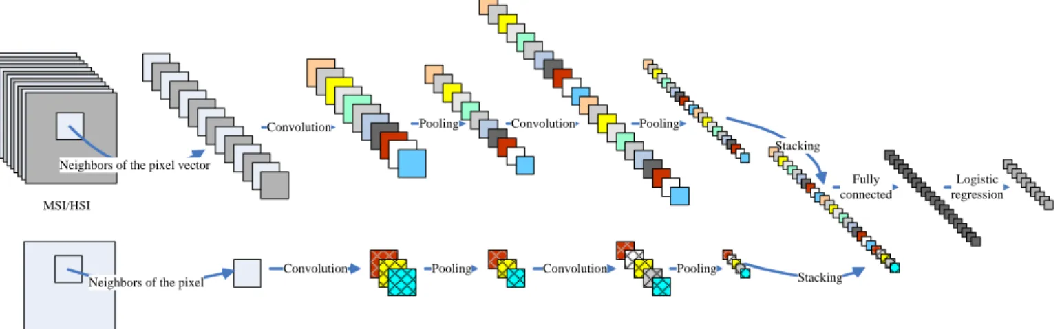
Deep Fusion of Remote Sensing Data for Accurate Classification
Full text
Figure

Related documents
biological abilities (Berducci, 2004, p. 350), Vygotsky has used his observations of children learning a first language to infer the existence of the inner modes of Private
At a global level, there are three types of assessment systems used by DFIs: International Finance Corporation (IFC)’s Development Outcome Tracking System (DOTS),
Adopting innovation is able to be affected the shaping of entrepreneurship status of Madura cattle farmers namely socially responsible
The Highmark Foundation Advancing Excellence in School Nursing Awards applauds those devoted school nurses who exhibit leadership and passion and work tirelessly to keep our
However, organizing clinical concepts along basic science concepts, as the resident groups mainly did, might be a necessary developmental phase in the building of a sound
1.The Network administrator has sensitive data where he distributes the data to some group of trusted third parties who are called as agents, where there is a possibility of some
In the specialty area of Radiation Oncology the need for an appropriately qualified Medical Physicist workforce was identified in the Radiotherapy Inquiry of 2002 detailed in the
Nothing prevents your security team from using the same cloud APIs and management tools as administrators and developers.. Configured and used properly, they provide security
