Visualizing Dante’s World:
Geography, History and Material Culture
Allison DeWitt
Submitted in partial fulfillment of the requirements for the degree of
Doctor of Philosophy
in the Graduate School of Arts and Sciences
COLUMBIA UNIVERSITY
© 2019 Allison DeWitt All rights reserved
ABSTRACT
Visualizing Dante’s World: Geography, History and Material Culture
Allison DeWitt
This study examines the importance of geographical ideas in Dante’s Commedia and develops a historically sensitive geocritical methodology to analyze the function of real world
geography within Dante’s poem. I aim to expand our understanding of the importance of the
poet’s use of geography beyond the consulation of geographical sources and consideration of
place names. In the first chapter case studies of geographical references with connections to the
Islamic world show how historicized approaches open up new possibilities of understanding the
medieval significance of the poet’s references. Subsequent chapters explore the relationship of
the Commedia’s geography to medieval mapping technologies; comparing the parameters and borders of Dante’s world to the genre of medieval mappaemundi as well asputting this
worldview into conversation with the emerging field of portolan charts and the developing
navigational technology of the thirteenth century. This project further expands our definition of
the stakes of geographical knowledge and traces the the social, political and cultural implications
of the various modes of representing the world and how these implications are evident in the
scholarly responses to the worldview represented within the Commedia. Ultimately, this project shows how a geocritical historicized reading of the Commedia opens up new directions for Dante studies and puts the geographical material of Dante’s work into conversation with other
Table of Contents
List of Figures ii
Acknowledgments iii
Dedication vi
Chapter 1. Historicizing Dante’s Geography: How to Read the Commedia Geocritically 1
1.1 Readers of Dante’s Geography 5
1.2 Geocritical Approaches 14
1.3 Case Studies of the Islamic World 19
1.4 Looking Ahead 33
Chapter 2. Defining Dante’s World: The Margins and The Center 37
2.1 Mappaemundi 39
2.2 Boxing the Compass 47
2.3 The Center 51
2.4 The West 58
2.5 The East 69
Chapter 3. Charting Dante’s Mediterranean: Ulysses, Navigation, and Portolani 85 3.1 An Ancient Voyage Along the Trunk Routes of the Medieval Mediterranean 94 3.2 The Sociocultural Stakes of Geographical Knowledge 109
3.3 Trade, Crusade, and Material Culture 115
3.4 Trading the Commedia: Production and Circulation in the Mercantile Spheres 124 Chapter 4. Mapping Maometto: The Geographical Stakes of Inferno 28 129
4.1 Modern Approaches to Understanding Maometto 137
4.2 Historicizing Maometto 148
4.3 Earliest Commentaries 155
4.4 Purgatorio 32: Allegory of The Schism 164 Conclusion. (Re)reading Dante’s Geography and Digital Directions 175
5.1 Digitally Mapping Dante’s Geography 183
Appendix. “Or di’ a Fra Dolcin”: An Excursus on Dolcino di Novara 193
List of Figures
1. Close up of Arabia and the Red Sea 42
2. Zonal Map 43
3. Fra Mauro Mappamundi 45
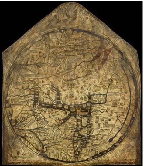
4. Hereford World Map 48
4.1 detail of East 49
4.2 detail of West 49
4.3 detail of Jerusalem 49
5. Ebstorf Map 53
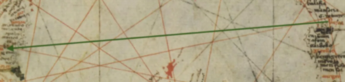
6. Pietro Vesconte Planisphere 64
6.1 Close up of line from Jerusalem to Sibilia in Planisphere 65
6.2 Close up of Sibilia in Planisphere 65
7. Map of Ulysses’ journey 99
8. Close up of Sibilia and Septa in Vesconte Portolan Chart 102
9. Close up of relationship between Marsiglia and Buggea in Dalorto Portolan 111
Acknowledgments
While reflecting on the path that has led to the completion of this project it occurs to me
that I should start by thanking my seventh grade geography teacher, Mr. Robert Woolner, who
decided to teach us a unit on Dante’s worldview and have us create a simple digital image of it.
That day I went to the library to pick up a copy of the Inferno and have not put it down since. It seems especially fortuitous that the culmination of my research on Dante has led me back to a
project which considers Dante’s view of the world and hopes to use digital means to achieve its
full realization. For giving me the foundation necessary to undertake this project I must thank all
of my Dante teachers including John Freccero and Maria Luisa Ardizzone during my
undergraduate study at NYU. Most especially I am grateful to my advisor Teodolinda Barolini
who taught me what it means to be a Dante scholar and who has given me unwavering support
and indispensable advice these past seven years.
I would also like to thank the rest of my committee members for the various ways in
which they have contributed to my intellectual development and the realization of this project.
Pier Mattia Tommasino has expanded my understanding of Mediterranean studies and introduced
me to new ways of conceptualizing Muslim-Christian relations in Italian culture. Jo Ann
Cavallo’s work on representations of the world beyond Europe in Italian literature has inspired
many aspects of this project and she has particularly supported my interest in digital mapping
projects. Christopher Baswell first introduced me to archival work and medieval manuscripts and
gave me many valuable skills which assisted my research during my travel fellowship years.
dissertation into an exciting Digital Humanities project and forge a successful career as a young
Dante scholar.
This research was made possible by research fellowships from the Graduate School of
Arts and Sciences and the Institute for Religion, Culture and Public Life as well as a travel grant
from the Digital Humanities Autumn School at the Universität Trier. I would also like to thank
the Graduate School of Arts and Sciences for the numerous opportunities which have been
afforded to me over the course of my time at Columbia. I am particularly grateful for the efforts
and expertise of Lani Muller and Aurelia Rabot-Hernandez in the Italian Department office,
whose assistance has been invaluable up until the very end.
I am immensely grateful to my medievalist cohort Nassime, Matteo and Julianna for their
solidarity and support from our first semester in the Dante seminar to our final semester teaching
Literature Humanities together. I have learned so much from all of them over the years. Special
thanks also to Alex Cuadrado and Andy Wyatt for reading through this dissertation in its final
stages and offering very helpful feedback and suggestions for future directions.
In addition I need to thank the numerous babysitters who made it possible for me to meet
deadlines, grab books from the library and maintain my sanity. A special thanks to my friend
Alex Brinkman-Young who served as aunt, editor and host during my research trip to Oxford as
well as my Aunt Rose who provided me with writing space in the final stretch and hosted my
children on many occasions. Many thanks to my partner Rhammi for appreciating the importance
of this project and never letting me give up. Finally, I have to thank my two daughters, Safia and
Sabrina, for sharing me with Dante these past seven years. None of it would have been half as
This dissertation is dedicated to my parents who told me from a young age that they expected
great things of me, and supported my interests and efforts in every way.
For my parents
forse non pur per lor, ma per le mamme, per li padri e per li altri che fuor cari
Chapter 1.
Historicizing Dante’s Geography: How to read the Commedia geocritically
L’aiuola che ci fa tanto feroci Paradiso 22. 151
From the pits of Malebolge to the spheres of the Empyrean, Dante’s imagery of the afterlife has pervaded popular culture from the fourteenth century to the present. His Commedia both
replicated and thenfundamentally changed the way in which Western culture conceptualized,
represented and engaged with ideas about divine justice and its physical and spiritual
manifestations. This dissertation does not deny the significance of Dante’s metaphysical
contributions, but rather turns our attention to another sphere of influence which might be
considered more mundane, from the Latin root meaning “of or relating to the earth.” The
Commedia contains over 900 geographical references to more than 450 distinct locations around the world. These range from long geographical periphrases to city names buried in verbose
metaphors. But in order to truly understand the scope and importance of Dante’s geography, we
cannot only pay attention to his explicit geographical references. My goal in this dissertation is to
begin to consider the varied and important ways that Dante engages with ideas of space, place,
borders and topography.
Despite the plethora of real-world geographical information contained within the poem, a
preoccupation with the terrain, details and configuration of the afterlife designed by the poet. 1 Modern editions of the Commedia may include maps of Dante’s Italy to provide readers with some historical context but the majority of drawings and illustrations focus on the fictional realm
of the poem rather than the real world to which the poet frequently refers. Although scholars
have generally concentrated on understanding Dante’s fictional world, his poem is highly
engaged with “real-world” geographical ideas and these deserve substantially more attention.
This dissertation explores Dante’s relationship to geography and cartography and how an
understanding of his relationship to these forms of knowledge can influence our reading of his
poem and expand our understanding of its project. This consideration of Dante’s geography goes
beyond a list of place names and employs a historicized understanding of what Dante’s
references would have meant at his time and how his contemporaries understood geographical
knowledge. 2
Since it would be beyond the scope of this project to consider the more than 900
references within the Commedia, we will focus on Dante’s representation of the world outside of Europe with particular attention on the Islamic world. While “Dante and Islam” has been a hotly
debated topic for the past century, Dante’s geography of the Islamic world has received less 3 Such an interest is evident as early as the 16th century (for example Manetti’s studies included in 1
Landino’s 1481 edition, Velutello’s 1544 illustrations and Galileo’s 1588 calculations). For some modern examples see Demaray (1987), Cachey (2001), and Ginsberg (2012). Even Cachey’s 2015 essay on “Cosmology, Geography and Cartography” spends much more time on the cosmology of the afterlife than it does considering real world geography and its cartographical representations.
This move to historicize is inspired by Barolini’s 2009 essay “Only Historicize” which calls for scholars 2
of Dante to consider the rich social and cultural concerns which are evident throughout Dante’s writings. An early example of this form of historicizing is evident in her 2000 essay on Francesca da Rimini.
Benigni provides a succinct analysis of the centuries long European preoccupation with potential Arabic 3
sources for Provençal and Sicilian poetic forms. The interest in Dante’s relationship to Islamic texts came to a head with the 1919 contribution of Miguel Asín Palacios on Dante y la eschatologia musulmana en la divina commedia. Further attention will be given to the scholarly debate surrounding Dante’s relationship to Islam in Chapter four, especially how it relates to the representation of Maometto in Inferno 28.
scholarly attention. The debate has generally focused on the possibility of Dante having had 4 access to Arabic or Islamic sources in the composition of his poem. This project is not focused
on the question of Dante’s source materials, due to the fact that it is almost impossible to prove
what he had access to beyond acknowledging those sources which were in circulation at his time
in Italy. Instead, we will focus on how a geographically sensitive historicized reading can 5 uncover his level of familiarity with the Islamic world and how this knowledge was circulating
in his society. Each chapter engages with representations of Muslims and “others,” as well as
considering larger methodological analyses of how the poet describes that which is foreign and
unfamiliar, including Ulysses’s journey to the southern hemisphere and the poet’s relationship to
contemporary depictions of the far East. We will consider Dante’s geography from both a literal,
physical level—places that he refers to and maps which might have influenced him—and
continue to an intellectual level which looks at the more abstract ways social and cultural
knowledge of the world beyond Europe is implicated in geographical representations. Although
these analytical tools are being applied to the Islamic world, this project aims to develop a
Schildgen’s Dante and the Orient does consider the geography of the Orient as part of her larger 4
consideration of the poet’s relationship to the region, but she does not apply a geocritical mode of reading or consider all possible geographical references. Gabrieli’s earlier Dante e l’Oriente also includes a section on geography, but as we will see later he manipulates the significance of this geography in service of his larger argument rather than considering the poet’s engagement with the material.
While Palacios did not address the question of textual transmission in his work, various scholars who 5
came after him have attempted to account for possible modes of transmission to prove Dante’s
relationship to Arabic sources. In 1949 Enrico Cerulli published Il libro della scala e la questione delle fonti arabospagnole della Divina Commedia in which he attempted to prove the possibility of Dante’s knowledge of the legend of the Prophet Muhammad’s night journey to heaven and therefore the possible influence of this source on his Commedia, although this contribution is not considered conclusive proof. Maria Corti (1990) proposed a threefold approach for discovering possible sources taking into account ideas which were in general circulation at the time, intertextual influences which could be based on second- or third-hand knowledge of a text and finally direct access to Arabic sources. Again, while her works propose some possible sources of influence none have been widely accepted as undisputed fact by the larger field of Dante scholarship.
geocritical methodology for reading the Commedia which can be applied universally and not just to references which fall within the analysis conducted herein.
The approach of this project is in dialogue with three separate scholarly traditions and
engages with them each in different ways. This research is indebted to the work of previous
scholars of Dante and Italian literature and culture who have considered the geographical sources
and references of the Commedia and contributed to our understanding of how Dante related to the cartography of his day. In order to further our understanding of these references, this
dissertation follows recent trends in the history of cartography and shows how scholarly
approaches to Dante’s geography have been informed by how historians of cartography engage
with medieval geographical ideas. By incorporating the latest developments in our understanding
of medieval cartography and views of the world, this project will uncover new aspects of Dante’s
geography and new ways of conceptualizing what can be considered geographically relevant in
his work. The methodology used for this project is informed by the movement of geocriticism
and scholarship on the intersection of geography and literature. In employing these theories, my
research asserts that the relationship between literature and geography is not linear. Rather than
merely trying to understand the sources of Dante’s geography, we will see how Dante’s text also
serves as geographical source material and how this can help us conceptualize the relationship
between literature and geography in new and interesting ways. Bertrand Westphal reminds us
that “for the ancient Greeks, literature was so ingrained in the concrete forms of understanding
the world that it did not exist independent of the sciences” (34). Bearing this observation in
said to interact centrally and importantly with geographical forms of knowledge, not as a
peripheral concern.
Readers of Dante’s Geography
Previous scholarship has recognized the importance of contextualizing Dante’s
geography through an explanation of medieval forms of mapping and has considered the specific
maps which Dante might have known or which serve as representative examples of the types of
maps with which he would have been familiar. The nineteenth century also saw a surge of
interest in collecting, describing and even mapping the specific places to which Dante refers in
his writings. Sir Edward Moore’s 1903 essay on “The Geography of Dante” provided an 6 understanding of the classical and medieval sources which would have given Dante his
geographical ideas and continues to serve as an important resource for Dante’s geography. The
contributions of this generation were expanded upon by the following in new and interesting
directions. Paolo Revelli’s 1922 L’Italia nella Divina Commedia was the first to engage with specific maps and charts which could serve as representative examples of the types of sources to
which the poet would have been exposed. Giuseppe Gabrieli’s 1921 Dante e l’Oriente takes a similar approach as Moore and Revelli: he too contextualizes the sources the poet would have
been consulting and addresses the locations he would have been aware of, in this case
specifically for the “Orient.” These contributions remain crucial resources for scholarship on the
topic and provide the starting point for the study conducted in this dissertation. However, in
For specific place references see Alfred Basserman’s Dantes Spuren in Italien (1899) translated as Orme
6
di Dante by Egidio Gorra (1902). A similar project for educational purposes is I luoghi d’Italia rammentati nella Divina commedia: raccolti e spiegati alla gioventù italiana by Teresa Gambinossi Conte (1893). Mary Hensman created a Dante Map (1892) including a 51 page booklet sorting the place names between those in Italy and those outside of Italy.
relying on these sources we must also contextualize the ideas and assumptions underlying their
engagement with geographical ideas and the ways in which they conceived of the importance of
their approach to Dante’s geography. In order to do this, we must look at developments in the
history of cartography and how scholarly understandings of medieval geographical ideas have
changed.
Moore’s 1903 survey of Dante’s geographical knowledge offers helpful explanations of
the cartography of Dante’s time and sheds light on many aspects of the geography of Dante’s
world. However, it is his mode of engagement with this world view that is most indicative of the
prevailing opinion held of medieval geography and by extension Dante’s use of it. Moore’s
disdain for medieval geography is evident throughout and he states early on: “A writer cannot be
blamed if, being fully abreast of the knowledge available in his day, he does not rise beyond it,
especially in a subject on which he has bestowed no special study, and wherein he has had no
opportunities of personal investigation” (109). Moore does his best to explain away the aspects
of Dante’s world which are most confusing to the modern reader, emphasizing the “primitive”
nature of medieval cartographic approaches as well as the flawed medieval tendency to prioritize
classical sources over scientific reason. In order to account for some of the more baffling
medieval ideas in Dante’s geography, Moore informs us that “even the author of the celebrated
Hereford Map” (which Moore had previously referred to as “grotesque”) “copies blunders of
Orosius about the British Isles, when the means of correction were both ready to hand and patent
to any person of average intelligence” (142). This comment serves to emphasize both that Dante 7
Moore also ascribes a similar geographical laziness to the work of Dante’s teacher Brunetto Latini, 7
whose Tresor contains a section on geography entitled Mappa Mundi: “B. Latini, for example, often copies the statements of Solinus even on points where they might have been corrected by the most easily accessible knowledge” (143).
should not be held to the standard of a mapmaker, since his primary concern was not
geographical, but also that if mapmakers can make such obvious errors Dante should certainly be
forgiven for any minor blunders. Moore also insists that “Dante’s great poem, at any rate, would
not have been the place for advancing the newest lights on geographical science, even if its
author were acquainted with them” (143).
As we will see throughout this chapter and those which follow, Dante’s great poem is
actually quite well acquainted with the latest ideas of medieval geography and is explicitly and
implicitly involved in advancing them.
This early twentieth century scholarly disdain for medieval mapping technology was not
limited to dantisti, but was certainly inherited from early historians of cartography. The first great scholar of medieval mappingalso felt the need to justify his study of premodern
cartography and acknowledge its lack of scientific rigor. Very early in his groundbreaking The Dawn of Modern Geography (1897) Raymond Beazley offers an apology for his subject matter:
When any one tries to gain a hearing for a subject which is obscure, apparently uninteresting, and possibly despised, he is bound to show cause for his
intrusion. And the reason why the travels and geographical science of the later Empire and the darker Middle Ages are important to history cannot easily be found in the evidence we actually possess of those travels and that science. (8)
Just as Moore had tried to explain away medieval geographical flaws which seemed apparent to
a modern reader, so too does Beazley consider his subject matter flawed from a modern
perspective. Contemporary scholarship on the history of cartography rejects this anachronistic
approach to medieval geography and has subsequently been able to appreciate the contributions
of the genre rather than remaining blinded by their inaccuracies. Similarly, by considering
holistically, with an awareness of the work being done by his contemporaries, we can appreciate
Dante’s contributions on their own terms and not feel obliged to apologize when his geography
does not follow modern standards.
In order to engage with medieval maps without contemporary expectations coloring our
perceptions, we need to analyze the functions these maps served as artifacts of not only
cartographical knowledge, but also theological, historical and cultural significance. While Moore
considered the Hereford map grotesque, contemporary scholarship sees the so-called “errors” in
a different light and argues that the didactic purpose of medieval world maps was not
topographical accuracy, but rather the presentation in one image of the entirety of current ideas
about the earth, the cosmos, and important people and events in human society. For this reason 8 a medieval mapmaker would have privileged the reproduction of classical ideas of the world
over “fixing” a coastline based merely on the experience of walking along the shore. Similarly
we cannot treat medieval maps as a monolith which can be defined by similar parameters and
with similar criteria. Morse reminds us that we must also approach the medieval maps we study
as “tools for thinking and as a flexible means of communicating ideas” (26). By looking at
medieval geographical materials as sources in conversation with each other, we avoid
overlooking their individual nuance and significance. This also opens up our interpretation of
what we consider geographical source material and how we privilege the contributions of one
source over another. When we consider medieval world maps as representations of an entire
This philosophy was described by Hugh of Saint Victor in 1126: “We must collect a brief summary of all 8
things…which the mind may grasp and the memory retain with ease. The mind chiefly esteems events by three things: the persons by whom deeds were done, the places in which they were done, and the times when they were done.” (cited in Woodward, 290).
cosmography, including historical figures and important events, we can see a much closer
correlation between the work of the Hereford mapmaker and the author of the Commedia.9 This correlation is not so surprising, given the relationship between text and image in the
mappaemundi tradition. Unlike contemporary ideas of space, which privilege images, coordinates and measurements, in the Middle Ages the drawn portion of the map was only
considered one component of representing a world view. In fact, mapmaker and Minorite Friar
Paolino Veneto actually argued for the necessity of a “twofold map”:
because painting without writing indicates regions or nations unclearly, (and) writing without the aid of painting truly does not mark the boundaries of the provinces of a region in their various parts sufficiently (clearly) for them to be descried almost at a glance. 10
Although Fra Paolino is convinced of the utility of images in presenting provinces and regions,
there is no evidence to suggest that medieval geographical thinkers considered images to be a
necessary component of mappaemundi, and a number of the most widely used sources of geographical knowledge were purely text. David Woodward highlights the fact that making a 11 mappaemundi was not a specialized task and we can often identify the same handwriting on texts and images, suggesting that they did not consider mapmaking to require any kind of specialized
It has frequently been claimed Dante’s geographical project is a type of mappaemundi. For examples see 9
Demaray (1974), Hawkins (1999), Schildgen (2002), Scafi (2006). The relationship between the poem and the genre of mappaemundi will be discussed further in chapter two.
Vat. Lat. 1960, fol. 13, Biblioteca Apostolica Vaticana. The translation is from Schulz, 452. 10
For instance, the ideas of Orosius influenced an entire genealogy of medieval worldviews, but there is 11
knowledge. He also reminds us that the precedence of text over image was considered a 12 biblical prescription and did not just pertain to representations of the physical world (286). 13
In considering how Dante would have interacted with the ideas of space that were
circulating at his time, we can think about the ways in which his poem also participates in a
similar function as contemporary geographical texts. Although Dante does not set out to write on
geography or to explicitly define his cartographical world view, his construction of the afterlife
has such a strong relationship with the physical world that he is required to expound upon the
parameters of the earth. In order to indicate the positions of hell and purgatory as well as the
passage of time during the journey, Dante situates his pilgrim in relation to places in the known
world. His astronomical periphrases, while often referring to stars and the sun, are also
connected to the edges of his world as well as to significant locations within it. As we will see in
the second chapter, the poet’s prioritization of metaphorically significant axes can lead to
inaccurate continent sizes and relationships between places.
Beyond the fact that Dante’s choices can help us better understand how he saw and
related to the physical world, his text has now served as a source of medieval geographical
knowledge to a greater and lesser extent for more than six centuries. In The History of Cartography Dante’s representation of a spherical earth is actually cited as proof of the
This is not the case for the navigational charts which began to be produced in great numbers at the turn 12
of the fourteenth century. Pietro Vesconte, one of the most famous chartmakers of the early period, is considered one of the first professional cartographers in Europe. Unlike the producers of the
mappaemundi who did not require specialized geographical knowledge, Vesconte only produced charts, maps and city plans.
He also highlights the fact that the term mappamundi was used to denote any kind of depiction of the 13
world; these could be the views of the world we usually associate with the term, a navigational chart (not commonly defined as a mappamundi by modern standards) or even just “a verbal description in a
widespread medieval belief in this concept. It is not just his description of the earth as a sphere
that is highlighted, but the fact that “he, apparently felt not the slightest need to justify his
view” (Woodward, 321). Dante’s references to the Muslim world are cited alongside medieval
maps and archival sources in Youssef Kamal’s Monumenta cartographica Africae et Aegypti, a collection of geographical references to Africa over the centuries. Kamal’s eclectic choice of
source material serves as an important model for our approach to considering Dante’s literary
geography alongside cartographic representations. In conducting a geocritical reading of Dante’s
writings it is important not only to understand his sources and how he obtained geographical
information, but also the ways in which his text serves as a source of geographical information
for his contemporaries and his later readers. As we will see throughout the following chapters,
we can learn just as much about medieval geography by how Dante engages with it as we can
learn about his poem through an understanding of that same geography. The geographical
choices which Dante makes as a poet are just as significant as those made by medieval makers of
mappaemundi and navigational charts. When the poet chooses to defy conventional knowledge or aligns his worldview with one specific tradition we must understand how these choices go on
to be understood and read as geographical contributions.
It is not only the genre of mappaemundi which we must understand in order to have a full historical appreciation of the cartographical milieu in which the poet was writing. At the end of
the fourteenth century the medieval Mediterranean saw a boom in the production of quite
accurate and specific navigational charts, often referred to as portolani or portolan charts. Just as Beazley and his contemporaries derided the absurdities of the mappaemundi, they hailed the arrival of the portolani as the return of classical reason and the appearance of modern scientific
methods. Contemporary scholarship pushes back against this celebration of the modernity of 14 portolan charts over the ignorance of mappaemundi and instead finds evidence that both forms of mapping coexisted for at least two centuries. Rather than seeing navigational charts as an
improvement over mappaemundi, medieval users considered both forms of mapping equally relevant for different purposes and in different spheres of society. Over the centuries following
the appearance of the navigational charts, we see examples of mappaemundi which incorporate the navigational accuracy of the portolan charts and some later charts which include the
decorative and descriptive features of the mappaemundi tradition.
Revelli’s L’Italia di Dante was the first to propose Dante’s specific knowledge of navigational charts, a topic we will explore further in chapter three. Being a geographer and
historian of early Atlantic exploration, Revelli saw in Dante’s geography specific references
which showed his awareness of the latest innovations in mapping at his time. This assertion is
important for beginning to deconstruct some of the weight of Moore’s contention that Dante’s
use of geography shows very little particular interest or specialized knowledge. Revelli uses his
proof of Dante’s awareness of these charts to emphasize that the poet was certainly highly
knowledgeable of the most up-to-date cartography. Not only do Revelli’s findings establish 15 Dante as geographically informed, but they also suggest that knowledge of navigational charts
was so widespread that to lack it would indicate ignorance.
We can see this attitude in Beazley: “the absurdities of dark-age mapmaking are the precursors of the 14
first accurate charts and of modern atlases; the creeping ventures of the pilgrims are the first movements of an ultimately invincible race-expansion” (18). He only assigns value to the mappaemundi tradition in so far as it led to later more accurate and modern maps.
Revelli insists that there is no question that Dante would have been aware of the portolan charts 15
circulating at his time, given their high degree of diffusion across different spheres of society: “Dei portolani del suo tempo Dante ebbe indubbiamente notizia, tanto eran diffusi, tanto eran noti a mercanti e pellegrini” (21).
In recent decades, scholars of the history of cartography have begun to deconstruct the
nineteenth and early twentieth century prejudices about the supposed inaccuracy of medieval
maps. The contributions of Campbell, Woodward, and Harvey to The History of Cartography played an important role in changing how we approach medieval ideas of space. Scholars no
longer maintain that portolan charts were the triumph of reason over the “absurdities” of
medieval mapmaking and the study of mappaemundi understands this genre as a very particular way of viewing the world with its own complicated conventions. Woodward has shown that the
traditional mappaemundi can be better appreciated when we consider the purposes for which they were designed rather than follow modern notions of the functions maps should serve (284).
Even when mapmakers had access to the cartographical techniques used to create navigational
charts, we still find many examples which incorporate the didactic features of the mappaemundi genre. Campbell identifies the existence of a subset of portolan charts which incorporate the
general chart outlines, but rarely have a scale sufficient for navigational purposes, indicating that
they were a hybrid genre meant to be studied and consulted similar to the less accurate world
maps, but incorporating some of the highly specific navigational knowledge of the
Mediterranean region (379).
Campbell also wrote the preface for a groundbreaking study on portolan charts written by
Catalan scholar Puchades i Bataller. In his preface Campbell explains that Puchades employs his
skills as a medievalist to situate portolan charts historically, rather than just study the charts
themselves as has been the standard focus of the field (410). Through the introduction of this
historical background Puchades is able to account for the cultural significance of these new
“contextualising the spread of nautical cartography from the perspective of the development of
maritime trade and the spread of writing as a vehicle of social organization” (411). We will see
how Puchades’ contributions can help us shed light on the role of cartography in Dante’s poem in
chapter three. However, this approach also serves as a model for how we should conduct the
study of literary geography. Rather than merely using historical sources to explain the references
and context of the literary text, we must situate the text and its geography within the same
society and explore the significance of the overlaps and relationships between these spheres.
Geocritical Approaches
It is not only Puchades who identifies the importance of understanding cartographical
knowledge alongside other forms of cultural production. While neither the genre of Dante studies
nor the history of cartography has fully embraced this new mode of engagement with their
materials, there is a larger movement of scholars of literary geography or geocriticism who
advocate for an approach which studies geographical information across all the genres in which
it is represented. Edward Soja argues:
Space was too important to be left only to the specialized spatial disciplines (Geography, Architecture, Urban Studies) or merely added on as a gap-filler or factual background for historians, social scientists, or Marxist sociologists. The spatiality of human life, like its historicality or sociality, infused every discipline and discourse. 16 Soja makes a crucial point that the study of the importance of spatial knowledge should not be
limited to only the disciplines traditionally associated with it. However, up to this point
traditional scholarship on cartography has not embraced the contributions which can be made by
scholars of literature and culture beyond a very minimal amount. Puchades argues that while
Thirdspace: Journeys to Los Angeles and Other Real and Imagined Places (1996) Cited in Westphal, 16
literary sources may be consulted by historians of cartography, they have not been treated with
the degree of seriousness that they merit and that without the correct level of expertise they may
not be utilized appropriately. 17
Although this call has not been taken up completely by the historians, a number of
literary scholars have offered interventions into the field. Bertrand Westphal’s Geocriticism: Real and Fictional Spaces is deeply engaged with the question of how to study the geography and spatiality which exists within literature and how to bring that study into conversation with other
disciplines. Rather than merely study the geography of the text in order to help us better
understand that text, Westphal proposes a complete reimagination of how we consider the
concept of space and how literature relates to that consideration. He argues that literature should
not be studied for its relationship to geography merely because some texts contain geographical
references, but because as a genre it can fundamentally change how we look at space in new and
productive ways. He reminds us that “literature is a vector of assumed instability in a series of
disciplinary landscapes traditionally characterized by stability and saturation…complemented by
theory, it is able to propose solutions, to project representational models applicable to shifting
contexts” (35). This assertion that literature can be seen as more than just a source of place
names and geographical references is particularly relevant to Dante studies. The text of the
Commedia is not just geographically interesting due to the significant number of references, but
Puchades cautions: “recourse to medieval literary or documentary sources is not without its dangers for 17
the researcher. If we use the information they provide without knowing them well, and without reflecting on the problems that, depending on the different nature of each class of source, they may pose, we may become victims of the distortions caused by snippets of data that constitute only a tiny portion of the past” (425).
rather because of the poet’s patent interest in representing and exploring geographical ideas
through his poetic choices.
Another voice in the field of literary geography, and English translator of Westphal, is
Robert Tally, Jr. Although not a scholar of the Commedia, Tally has argued for the importance of studying specifically Dante’s geography within the framework of geocriticism. He argues that
Virgil’s explanation of the cartography of hell in canto 11of Inferno serves to illustrate the way in which “the physicality of the moral geography is itself a sign of the merger of theory and
practice in Dante’s literary cartography.” Although all literary texts are in some way 18
geographically significant, Dante’s text should be even more interesting to scholars of literary
geography due to the poet’s complex engagement with cartographical ideas; both the cartography
of his age and more broadly the idea of what cartography can be and how it can be used in
literature. Similarly, the cartography and geography of the Commedia should be of interest to Dante scholars for more than just their possibility to shed light on historical and cultural details
of the poem. By being attuned to the geographical complexity of Dante’s thought we can open up
new ways of conceiving of his entire philosophical and poetic project.
One scholar who has taken up the cartographic potential of Dante’s writings is Theodore
Cachey, Jr.. His writings have mostly focused on the poet’s mapping of Italy and the
Mediterranean and he argued in 2014: “it would be fair to say that Dante’s cartography of Italy
offers us one of the most important and most detailed representations of the peninsula to survive
See Tally, 2015 (566). Tally has elsewhere (2013) cited Auerbach’s “astonishing claim that, despite 18
being an author of the “divine” Commedia, Dante was the “poet of the earthly world.” While neither of these statements may not seem groundbreaking to Dante scholars, it is important to note that it is literary scholars who are not specialists on the Commedia who have been most attuned to its geocritical
from the period” (208). This is certainly important as it recognizes the geographical contributions
made by the poem which can serve as important source material to scholars of the medieval
Mediterranean and the history of cartography. While Cachey has focused primarily on the map of
Italy in the writings of Dante, Boccaccio and Petrarch, my research is focused on representations
of the world outside of Europe, although always with an awareness of how these descriptions of
foreign places can shed light on cultural and social preoccupations within Dante’s Italy.
Cachey also goes beyond just looking at the geography of Italy and suggests that
“Dante’s cartographic descriptio of the earth might be considered one of the pillars of the poet’s rhetorical program in support of the truth claims of the poem” (203). Such a view of the poet’s 19 geography takes us beyond the level of names and places and brings us to the realm of
understanding the theoretical role of geography within the text. Much previous Dante scholarship
has focused on identifying places named by the poet and then used this naming in order to make
claims about his worldview. Projects like Mary Hensman’s Dante Map (1892) and Gabrieli’s Dante e l’Oriente (1921) stopped at the level of identifying place names. More recently a digital humanities project by Andrea Gazzoni entitled Mapping Dante has published a digital map of the places named in the Commedia. 20While these lists and maps do have some importance in
identifying geographical markers in the text, there is a limit to how much we can glean from an
awareness of how many places are named and the ways in which that naming takes place.
This is the approach proposed by the theorist of distant reading, Franco Moretti:
The relationship between the poet’s geographical project and the truth claims of the poem is considered 19
further in the following chapters two and three. https://www.mappingdante.com
You choose a unit…find its occurrences, place them in a space…or in other words: you reduce the text to a few elements, and abstract them from the narrative flow, and construct a new, artificial object…And with a little luck, these maps will be more than the sum of their parts: they will possess “emerging” qualities, which were not visible at the lower level. (53)
Moretti recognizes that his proposed approach does not actually create geographical maps but
rather diagrams (54). Ultimately this does not offer a strong enough approach to a text as
geographically, culturally and socially rich as the Commedia. This surface level consideration of Dante’s geography has been the status quo in Dante studies for too long, and therefore this
project focuses on understanding the workings of geography within the text and how
geographical knowledge and literary production are related within medieval European cultural
production or within literature as a whole.
Ultimately this dissertation aims to build upon the existing scholarship on Dante’s
relationship to geography and cartography, but also to integrate the latest understanding of
medieval cartography and contemporary theories of the relationships between literature and
geography. This research contributes to our understanding of Dante’s literary project as well as to
our understanding of the society in which he was composing his poem, and it also aims to
contribute to the history of cartography and theoretical approaches to literary geographies. When
we provide a fully historicized background for the cartographical milieu in which the poet was
writing, along with the significance of specific references, we can better understand the role of
individual places and ideas within his poem and how they relate to other references within his
texts or those of his contemporaries. At the same time, this historicized data can contribute to
how we understand the history of cartography, Italy and the Mediterranean region by recognizing
This project also aims to develop a large scale view of the broader role of geography within
Dante’s Commedia in order to illustrate how each geographical reference or larger geographical choice can be seen to contribute to his literary and cultural aims. Once the relevance of
geography within Dante’s poem has been elucidated, the theory behind this understanding can
contribute to the broader conversation on the relationship between literature and geography and
can be used to support geocritical readings of other medieval Italian literary texts and beyond.
Case Studies of the Islamic World
In order to demonstrate the way this multifaceted approach can be applied on a small
scale we will look at examples of references within the Commedia which can be historicized in order to clarify how the reference might have been understood by contemporary readers, and
thereby how the reference is situated within the larger geographical environment in which the
poem was written. By identifying the geographical specificity and historical background of these
references, and how they can then be related to other moments in the poem, we will also be able
to expand our understanding of a particular facet of Dante’s larger worldview. Given that the
case study for expounding this geocritical methodology is Dante’s view of the Islamic world,
these references are those which are either directly or indirectly connected to his representation
of those regions. However, the methodology employed will allow us to reflect on how literary
references and geographical knowledge are thoroughly interrelated and can be applied in other
cases in future research.
The significant number of real world references contained within the Commedia has already been emphasized, as well as the close relationship between Dante’s use of geography and
chartsand other geographical works. It is certainly important to have an understanding of how
the poem’s macroscopic worldview relates to contemporary medieval images of the world and
this topic will be explored further in chapter two. We will also see the significance of
geographical ideas for shaping cultural understandings and how these ideas can influence various
aspects of society in chapters three and four. However, here we will consider more closely how
individual references within the text can benefit from a historicized reading. When we historicize
a specific geographical reference this gives us a greater insight into how the poet is using this
place name or description to enrich the larger significance of the episode. Such a method of
analysis can be used to demonstrate a geographical mode of reading which goes beyond simple
place names in order to approximate the medieval understanding of the place and its importance
in the poem.
In order to illustrate the utility of such a mode of reading, we will consider some of the
failures of the standard geographical markers used by critics and explore new ways of
uncovering important cultural and geographical information. Dante’s City of Dis is most
frequently of interest to scholars studying his representation of Islam because of its infamous
reference to red mosques glowing among the tombs where the heretics are burned:
Ed io “Maestro, già le sue meschite I said: “I can already see distinctly—
là entro certe ne le valle cerno master—the mosques that gleam within the valley vermiglie come se di foco uscite as crimson as if they had just been drawn
fossero” out of the fire.” 21
Inf. 8.70-73 Of course it is notable that, despite this reference to mosques in the distance, the poet does not
highlight the inclusion of any Muslims, barbarians or non-Europeans among his heretics. The
All translations from Mandelbaum unless otherwise noted. 21
two main characters of Inferno 10, Farinata and Cavalcante, are decidedly Florentine. At the beginning of Inferno 11 the poet alerts us of the presence of Pope Anastasius, punished for his supposed acceptance of the heresy of Acacius, which denied the divinity of Christ.22
Therefore, on the surface, it appears that this canto gives us very little material for
expanding our knowledge of Dante’s ideas about Muslim-Christian relations. However, if we
look more closely we will find a reference which gives us much more information than the
generic description of mosques. This reference occurs in the simile which the poet uses to
compare the tombs of the heretics with two famous Mediterranean cemeteries:
Sì come ad Arli, over Rodano stagna, Just as at Arles, where Rhone becomes a marsh, sì com’ a Pola, presso del Carnaro just as at Pola, near Quarnero’s gulf
ch’Italia chiude e suoi termini bagna, that closes Italy and bathes its borders,
fanno i sepulcri tutt’ il loco varo, the sepulchers make all the plain uneven, così facevan quivi d’ogne parte, so did they here on every side
Inf. 9.112-116 At first it appears that the poet has just chosen two relatively well-known cemeteries in order to
elicit the appropriate image in his reader’s mind. This is certainly an example of how the poet’s
use of real world references in the composition of his metaphors serves to bolster the truth claim
being made about his fictional afterlife. The comparison of the tombs of Arles and Pola to the
city of Dis uses the real reference to distract the reader from the fiction being created. It also
creates a sense of familiarity, making the realm of the afterlife seem less strange and foreign.
Most commentators note a confusion behind Dante’s inclusion of Anastasius among the heretics. 22
Singleton explains: “A certain tradition seems to have confused Anastasius II, pope from 496 to 498, and his namesake and contemporary Anastasius I, emperor from 491 to 518. Emperor Anastasius is said to have been led by Photinus, a deacon of Thessalonica (not to be confused with the better-known Photinus, bishop of Sirmium), into the heresy of Acacius, patriarch of Constantinople (d. 488). Acacius denied the divine origin of Christ, holding that He was naturally begotten and conceived in the same way as the rest of mankind. Dante was following the accepted medieval tradition concerning Pope Anastasius' heretical persuasion.”
From a cartographical perspective these references might be noted as an important part of
Dante’s Mediterranean world. Cachey (2010) has argued that Pola and Arles mark the north-east
and north-west boundaries of Italy, respectively (329). This serves to support his argument that
Dante is methodically drawing a map of Italy through his references over the course of Inferno. 23 Scholars interested in Dante’s depictions of France might highlight the reference to Arles and
those focused on the Eastern borders of Italy would be intrigued by Pola. However, our mode 24 of geocritically reading the Commedia goes beyond the surface level identification of places on a map and the assumptions which can be made about those references based solely on their
geographical location. By looking further into how his contemporary readers understand Dante’s
choices we can gain an appreciation of their significance beyond their coordinates and thereby
comprehend the full extent of their geographical importance.
In the early commentaries to this verse, a number of commentators include an interesting
folk tale about the cemetery at Arles which highlights its importance as more than just a famous
place in France. In Boccaccio’s Esposizioni he describes the tale as relating the results of a battle between William of Orange and “barbarous infidels” from Africa. Although the Christians won
the battle, they were plagued with the difficulty of burying their dead. According to the legend,
the night after the battle tombs miraculously appeared over the plain and the following morning
He writes: “the evocation of the boundaries of Italy at the gates of Dis is part of a system of 23
cartographic correspondences that emerges progressively in subsequent similes”; see Cachey (2010), 331. In fact, the latter portion of this quotation is carved into the wall of the Venetian arsenale under a bust 24
of Dante. The inscription reads: “Questa immagine di Dante sottratta alle offese nemiche qui ancora attesti oltre l’avverso destino l’indomita fede della gente istriana nel proprio diritto come un dì a Pola presso del Carnaro ch’Italia chiude e suoi termini bagna”.
all of the Christians who died were buried in them. Boccaccio goes on to say that he doesn’t 25 really believe the fantastical aspect of this legend, but that it is possible that the battle and
subsequent burial of Christian soldiers in the cemetery is accurate. L’Ottimo commento provides an even more detailed and relevant explanation, clarifying that after the battle the surviving
Christians did not know how to distinguish the bodies of their dead from those of the infidels
(“conoscerli da li infideli”). They prayed to God and, miraculously, above each corpse there 26 appeared a plaque on which was written the name and condition of the fallen. Based on these
they were able to bury each Christian soldier on the basis of his condition in life. 27
The Ottimo’s version particularly shows the relevance of the cemetery of Arles for an understanding of this canto. After describing the way in which the tombs covered the plain of Dis
on every side, the poet goes on to describe how they are filled with flames in which the heretics
are punished for eternity. Virgil clarifies for the pilgrim the specificity of the punishment: “simile
qui con simile è sepolto / e i monimenti son più e men caldi” (Here like has been ensepulchered
with like; some monuments are heated more, some less [Inf. 9.130-131]). Just as the heretics are punished according to their level and condition, and sorted “like with like”, so too do we learn
“Di queste dicono i paesani una lor favola, affermando in quel luogo essere già stata una gran battaglia 25
tra Guiglielmo d'Oringa e sua gente d'una parte,… e barbari infedeli venuti d'Africa, ed essere stati uccisi molti cristiani in essa, e che poi la notte seguente, per divino miracolo, essere state quivi quelle arche recate per sepoltura de' cristiani, e così la mattina vegnente tutti i cristiani morti essere stati sepelliti in esse.” This, and all commentaries, consulted on Dartmouth Dante Lab.
This comment in itself gives us a fascinating insight into how medieval Christians saw themselves in 26
relation to their Muslim enemies. Despite the obvious antagonism which resulted in a battle, the difficulty of distinguishing between the dead bodies suggests a level of physical similarity perhaps even to the level of dress.
L’Ottimo explains: “Li rimasi christiani volendo per pietade sopelire li loro morti e conoscerli da li 27
infideli, pregaro Idio che a lloro dovesse per grazia revellare quali fossero li fedeli; exauditi da Dio apparve sopra ciascuno corpo di christiano una cedola nella quale era scripto il nome di colui et la conditione sua. Costoro veduto questo fecioro fare arche a ciascuno secondo la sua conditione, a chi basse, a chi alte, piccoli et grandi.”
that the legend of the cemetery of Arles insists on the importance of burying martyred Christian
soldiers according to their level and condition in life. The only difference is that the inhabitants
of the tombs are reversed. At Arles we have martyred Christians while in Dis they contain
heretics. As discussed, the reference to “meschite” or mosques as glowing red within the city of
Dis (Inf. 8.70) could serve to suggest the presence of Muslims among the heretics being
punished, making even more explicit the reversal of the legend at Arles. After the battle it is the
victorious Christians who are buried, whereas in Dante’s afterlife it is defeated heretics who are
punished in tombs.
Once we understand that the reference to Arles is significant for more than just the fact
that it is a real place, we can look further at the contemporary relevance of the reference beyond
its location. A modern reader would probably make no connection between Dante’s city of Dis,
the cemetery of Arles and medieval views of Muslim-Christian relations. Scholars interested in
understanding how Dante and his contemporaries engaged with ideas about Islam often look at
his references to places in the Islamic world or famous Muslim figures that he mentions.
Similarly, historians of cartography interested in how many of Dante’s references engage with
the Islamic world would never stumble upon his reference to Arles as bearing any significance in
this conversation. However, we can see through his early commentators’ immediate connection
of the legend to the imagery of Inferno that it was significant to their understanding of his choices as well as their knowledge of the historical relevance of the cemetery itself. When we
consider how perfectly the imagery of religious discord and burial based on level matches up
as an important intertext for understanding not only this metaphor but also how geographical
metaphors function within the poem.
Beyond the level of the individual reference, this methodology can also be expanded to
inform a reading of the poet’s metaphors and references with a greater attention to contemporary
information beyond the purely cartographical, surface-level significance. Once we have
identified this mode of reading Dante’s geographical references we become more attuned to
moments of possibility for new readings and new approaches to his overall project. Moving
deeper into hell, we will now consider another circle which has become infamous for its
anti-Islamic depiction of Maometto and Ali, Inferno 28, the specifics of which will be discussed in greater depth in Chapter Four. Before introducing Maometto as the first of the schismatics, the
poet prepares his reader for the horrors which he is about to describe by declaring that they are
worse than the carnage seen in a number of gory Apulian battles. In verses 7 to 21 he describes
five battles which took place at different times in history, but all somewhere in the general region
of Puglia, and explains that even if all the dead and wounded of these battles were collected
together “d’aequar sarebbe nulla / il modo de la nona bolgia sozzo” (that would not match the
hideousness of the ninth abyss [Inf. 28.20-21]).
When we scan the beginning of the canto for geographical references we encounter
“Puglia” (Inf. 28.9), “Ceperan” (Inf. 28.16) and “Tagliacozzo” (Inf. 28.17).After the first reference to Puglia, Dante refers to three battles: when the Trojans first fought to establish
themselves in Italy, the second Punic war against Carthage and the wars of “Robert Guiscard.” In
her commentary on the verse Anna Maria Chiavacci Leonardi tells us that Guiscard was made
Norman counts and surrounding cities. His battles against Saracens were not lost on Dante, 28 who included him amongst the defenders of the faith in Paradiso 18. In any other context this may seem like a piece of inconsequential trivia. However, as part of the introduction which leads
up to the dramatic revelation of the punishment of the Prophet of Islam, it takes on a different
valence, but one which would not be discovered through a standard geographical mapping of the
references contained within the canto. Similarly, a reading of this canto for explicit references to
the Islamic world would only discover the figures of Maometto and Ali and would miss the rich
historical and multicultural tapestry which accompanies Dante’s poetic periphrasis. Through an
attention to the historical details surrounding Dante’s geographical references, we see that the
borders dividing Islamic and Christian worlds were more porous than medieval scholarship
might suppose and that even a reference to battles in southern Italy has resonance for our
understanding of Christian-Muslim relations.
Another example of a hidden and seemingly inconsequential reference to the Islamic
world can be found in Paradiso 16 as the pilgrim converses with his crusading ancestor, Cacciaguida. We learn that Cacciaguida blames the current state of Florentine society on the
“confusion de le persone” (mingling of the populations [Par. 16.67]) which resulted from the influx of people from the countryside moving to Florence. He asserts that this mingling was the
principal cause of the “mal de la cittade” (evil in the city [Par. 16.68]) and this reflection on the evil befalling Florence leads him to reference other cities which have already disappeared or are
close to destruction:
She writes: “fatto duca di Puglia (1059) con investitura del papa Niccolò II, si conquistò il territorio in 28
sanguinose guerre, durate un ventennio, contro i Saraceni, gli altri conti normanni, le città di Bari e di Amalfi, e i Ducati di Benevento e di Salerno, caduti per sua mano nel 1077.”
Se tu riguardi Luni e Orbisaglia, Consider Luni, Urbisaglia, how come sono ite, e come se ne vanno they went to ruin (Sinigaglia follows, di retro ad esse Chiusi e Sinigaglia and Chiusi, too, will soon have vanished)
Par. 16.73-75 Reflecting on the disappearances, past or impending, of these four cities leads the speech to a
discussion of the fleeting nature of all human constructs: “Le vostre cose tutte hanno lor morte, /
sì come voi” (All things that you possess, possess their death, just as you do [Par. 16.79-80]). The importance of this line will become evident over the course of the rest of the canto as
Cacciaguida recites for his great-great grandson the names of illustrious Florentines of his earlier
generation whose legacies are now lost to history. However, we will focus more closely on the
significance of the four cities that Dante chose for his exemplars in introducing this topic.
Chiavacci Leonardi explains the importance of the pairings, as each consists of one Etruscan and
one Roman city, significant because they were the two largest populations of central Italy. 29 There is also similarity in their destructions; Luni and Urbisaglia were both destroyed by
invaders, while Chiusi and Sinigaglia were both eventually abandoned for their malarial and
unhealthy climates. 30
However, it is important to note that, by contrast, the falls of Luni and Sinigaglia were
both tied up with Saracen attacks of the two cities. Further research reveals that the city of 31 Luni was captured by the forces of Mujahid al-Amiri of Denia in 1016, as a beachhead from
She describes them as: “una città etrusca e una romana (che rappresentano quindi i due grandi popoli 29
dell’Italia centrale antica)”.
The identification of the Valdichiana region, where Chiusi is located, as malarial and unhealthy is also 30
present in Inf. 29.46-47 with the reference to “li spedali / di Valdichiana tra ‘l luglio e ‘l settembre” (the hospitals of Valdichiana between July and September) not containing as many sick, festering people as the bolgia of the falsifiers.
See commentaries of Chiavacci Leonardi and Singleton for these explanations of the cities’ falls. 31
which his forces could attack Sardinia. He was eventually defeated by the Pisans and the 32 Genoese with the support of Pope Benedict III, but not before the city was destroyed. Sinigaglia
is referenced by Dante as a city which would soon fall. This city in the region of Le Marche was
under Guelph control, and was sacked in 1264 by Saracen mercenaries under the orders of
Manfred and was almost completely destroyed before it was eventually abandoned due to health
reasons. 33
This connection between two of the four cities named by Cacciaguida to warfare with
Saracens is certainly relevant in the heaven of Mars where Dante celebrates the martial efforts of
his crusading ancestor. This is another moment which serves to remind us that the important
geographical information behind a reference is not always contained in its location on a map or
the explicit reason the poet gives for mobilizing said reference. By incorporating a deeper
understanding of the historical and cultural significance underlying this geography we are
contributing to our overall understanding of Dante’s view of the Islamic world and the way in
which his society conceptualized their relationship to Muslims. Just as the simile of Arles
showed us that references which indicate a relationship to the Islamic world are not only those
geographically located there, this example shows us that even within Italian geographical
“In 1016 during the attack against Sardinia, a group of Muslims from Spain guided by the ruler 32
Mujahîd, made a diversion to Luni. The city was taken by surprise. The inhabitants and the bishop had just enough time to flee away, while the Muslims plundered the town and the countryside around
undisturbed…From this moment on, the image of Luni emerges from the sources unanimously as a center hopelessly condemned to dissolution.” (Busch, 288)
Lodovico Siena (1746) describes: “l’anno 1264…Il Re [Manfredi] medesimo appena ebbe ciò risaputo, 33
che tosto spedi contro dei crocesegnati della Marca un esercito di Saraceni condotti nuovamente dall’Affrica, i quali furiosamente scorrendo da per tutto, giunti che furono a Sinigaglia col favor dei Ghibellini forusciti empiamente la saccheggiarono, e la distrussero”.
confines we can find an indication of the influence of Christian-Muslim relations on Italian
society.
These are examples of how a geographically sensitive historicized reading of the poem
can show us how references within Europe should not be presumed to corroborate our
assumptions about geographical knowledge and ideas. A geocritical reading of the Commedia must take into account more than just locations on a map and frequency of names in order to
fully describe Dante’s worldview. Such an understanding of the Commedia can then contribute to our appreciation of geographical ideas at Dante’s time as well as Muslim-Christian relations in
the medieval Mediterranean. The methodology employed is both informed by and can inform our
ideas of what a geocritical reading of a text can achieve and how that reading can make
contributions across disciplines and time periods.
The reverse is also true and we must not always take references to foreign places and
peoples as truly signifying Dante’s knowledge about and opinion of them. More often than not,
when the poet references a foreign group he is using them as a comparison to his more familiar
Christian, Florentine society. In Purgatorio 23 Dante encounters his old friend Forese Donati among the gluttons and is astonished at how quickly he has climbed the mountain given that he
only died less than five years before their meeting. Forese reveals that it is the prayers and tears
of his beloved widow Nella that have hastened his purgation. His praise for his righteous wife 34 leads him to lament the fact that is she alone (“soletta” Pur. 23.93) in her good works. Forese decries that the women of Florence are so immodest that the time will soon come when it will be
Con suoi prieghi devoti e con sospiri She, with sighs and prayers devout has set me free 34
tratto m’ha de la costa ove s’aspetta, of that slope where one waits and has free me e liberato m’ha de li altri giri from circles underneath this circle.