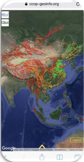
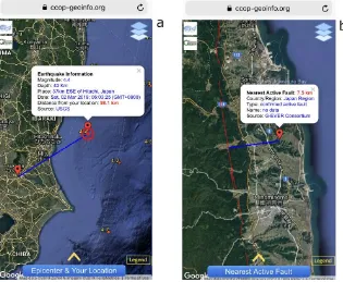
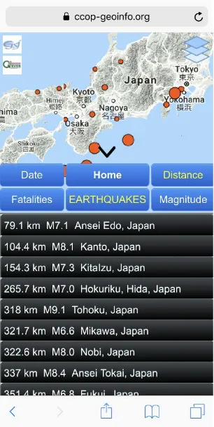
Mobile Application and a Web Based Geographic Information System for Sharing Geological Hazards Information in East and Southeast Asia
Full text
Figure


Related documents
Recognizing sexual function and its components can lead to sexual satisfaction and ultimately to marital satisfaction that has an important effect on couples’ adjustment.. The aim
economic green rout, in which Green Tea is applied as a green reducing agent due to the presence of polyphenols Molecules.. Polyphenol molecules in green tea act as a reductant, thus
Water Cycle Learning Centres: non-fiction reading, written response, experiment and report.. Subtask 2:
(21) The Commission is determined to ensure that the removal of barriers to a single market in retail financial services improves or at least maintains the quality of
industrial sector, a housing downturn that spread to El Paso and a flat year for the ma- quiladora industry all conspired to pull El Paso’s job growth down to less than
Ojaswi Panda [14], which conducted a study on the effect of fiber parameters on the mechanical behaviour of bamboo-glass fiber reinforced epoxy based hybrid composites discovered
Using force field analysis to identify the problems faced Batik SMEs in Medan, it was found that the problems in Batik enterprise development in Medan occurred from: Batik
