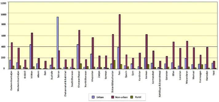
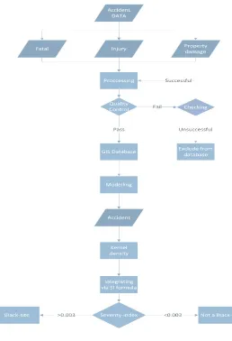
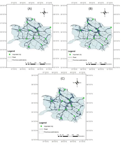
IDENTIFICATION OF ROAD CRASH BLACK-SITES USING GEOGRAPHICAL INFORMATION SYSTEM
Full text
Figure


Related documents
The direction of propagation can be found as cross product between the direction of oscillation of the electric and magnetic field... D. Ramaccia and A. Toscano Pag. 58 2.26
A biomedical science degree followed by a postgraduate qualification, leading to registration with the Health Professions Council; or an accredited three year full-time BSc (Hons)
Perhaps the most common example of using disclosure survey is the results of two surveys conducted by the Financial Analysts Federation (FAF) / the Association for
Overall speaking, H-Binder does the essential interven- tions in the four steps of the Binder data transaction, using the techniques introduced in Section 4. When one step is
Conical-shaped panicles up to 3" long of golden yellow flowers adorn this deciduous shrub from spring to early summer.. Adapts to
Assessment methods such as the Confusion Assessment Method for the Intensive Care Unit (CAM-ICU) and Intensive Care Delirium Screening Checklist (ICDSC) have been developed to
Nevertheless, we have shown that the inclusion of nonlocal Fock exchange is essential to cure the fundamental problem of getting metallic band structures in the Kohn-Sham LDA in
● Good final product particle size distribution ● Good encapsulation efficiency.. ●
