V EVOLUTION OF THE PALEOENVIRONMENT
Va AREAL SYNTHESIS AND RECONSTRUCTION
The stratigraphical themes in the preceding chapters (htho-, bio- and chronostratigraphy) are integrated here in a reconstruction of the paleoenviroimiental evolution. To the vertical, strati-graphical dimension, the horizontal, areal dimension is added by means of distribution maps of the lithological data for each bed and each boring. Because these maps relate to lithostratigraphic units, there may be a certain diachrony in them: the phenomena shown on a map need not neces-sarily have been exactly simultaneous at all boring locations. The same holds true for the landscape reconstruction drawings; thus e.g. in a drawing with a strongly branching river pattern not all small channels need have originated at the same time. However, the periodization of the paleoenviron-mental reconstruction is such that the phenomena shown on a map or drawing certainly always ori-ginated within the period concerned.
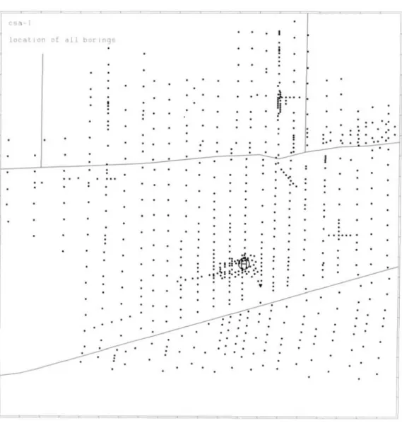
The positions of all borings whose data have been processed in the distribution maps are shown in Fig. 33 (for the Molenaarsgraaf area) and Fig. 34 (for the Leerdam area). The precision of the computer-directed laser plotter (see Ch. Ie) allowed the choice of symbols for the distribution maps such that their size is continuously variable (for the maps showing thickness and depth of the beds) and such that they can be superimposed on each other (for the maps with the remaining lithological data; see the legend, Fig.*35).
The following remarks should be made on the construction of the maps with thickness symbols. Where, from the details of a boring, it could be concluded that a certain bed was not formed at the boring site, a small horizontal dash was placed on the map concerned. If a certain bed was not found in a boring, but non-deposition could not be proved (e.g. because of later erosion, or because of gouging to too shallow a depth), no symbol was inserted. If a clastic bed could not be gouged through entirely because the bed is locally strongly sandy, a circle was placed around the dot show-ing the thickness of the bed so far as gouged through.
On the maps showing the lithological content (inclusive of the organic remains) a symbol was not placed for all borings where a certain bed was found. Namely, where a bed has no marked charac-teristics, e.g. in the case of a poorly humic, non-sandy clay bed without a moderate or large quan-tity of plant remains, no symbol was used. This holds also for the organic beds where these have been developed as rather amorphous peat, which has been found in many places. Where an organic bed consists not of peat but of gyttja, a symbol was used (see legend, Fig.*35), except for organic bed ol 2-3 (Molenaarsgraaf), the upper part of which, consisting generally of gyttja, has been represented on a separate map (Fig. 46).
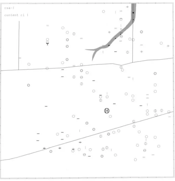
Because of the above-mentioned omission of symbols in certain cases, full evaluation of the distribu-tion maps is only possible by constant comparison with the maps showing the locadistribu-tion of all borings (Figs. 33 and 34). Besides, in many places in the specific description of the paleoenvironmental evo-lution only implicit reference is made to the distribution maps.
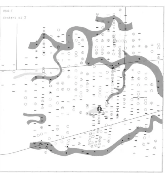
An important advantage of the symbol maps is that point-information is presented about a large number of characteristics. Opposing these are maps with plane-information: here fewer characteris-tics can be shown together, and moreover their construction involves subjective interpretation and interpolation. Nevertheless, for the sake of clarity grey planes have been superimposed on various symbol maps. In all maps except one, these refer to the positions of sandy channel fillings and river dunes. The river dune outcrops were reconstructed for the various maps by comparing the map showing the depth of the river-dune surf ace with the map showing the thickness of the deposit con-cerned (see e.g. Fig. 41).
72
l o c a t i o n of a l l b o r i n g s
Fig. 33. Location of borings, Molenaarsgraaf. Many borings omitted at flank of Hazendonk river dune. See Fig. 3 for topographic details.
Leerdam study area appear to be in good agreement with sheet 38 Oost of the Geological map of the Netherlands 1:50000 (VERBRAECK 1970). The exact location of our study area on this sheet was indicated in Ch. IIb.1 with the aid of profile IV (Fig.* 10). Sheet 38 Oost gives valuable supplemen-tary information about the surroundings of the Leerdam study area; thus, on this map the course of the larger channels can be traced over much wider a distance than in our detailed study. With regard to the main study area (Molenaarsgraaf) the same will hold with relation to sheet 38 West, to be published in due course.
The dune- and loom topography
Fig. 34. Location ot' borings, Leerdam. See Fig. 4 for topographic details.
of the loam and the river dunes were given. For additional paleoecological aspects connected with this and for the description of the vegetational development in the Preboreal and Boreal, see Chs. Ille, -f and -g.
The topography of the river dunes and to a lesser extent also of the loam has exerted an important influence on the paleoenvironmental evolution during the Atlantic and Subboreal, as will be shown in detail in the foUowing chapters. Figs. 36 and 38 show the depth of both (topmost) parts of the Kreftenheye Formation.
74
Fig. 36. Depth of the top of Kreftenheye Formation, Molenaarsgraaf. For legend, see Fig. *35; black stars: river-dunc sand.
of an area with several series of river dunes, each series showing an orientation parallel to the former channel floor. A similar connection is shown by the river-dune pattern in the fossil northern IJssel valley (ENTE 1971, fig. 1). It was not possible to tracé channel floors in the study areas; possi-bly these were ultimately filled with ham and dune sand.
c s a - 1
" o ° t h i c k n e s s " loam"
f
0
0 o .
. " o
• • o
o o o
.»
« • • •
' o
^ •
o
3 " "
O
• o •
• , O
^
3
» '
^ o
^ 3 » ' ° • o
® ' .
j : ^
' ^ > •
. • ' . * '^ • • 0 0 o • • • •
1'ig. 37. Thickness of the loain. Molenaarsgraaf. For legend, see Fig. *35. Grey: river duncs.
Vb THE MIDDLE-ATLANTIC PERIOD (c. 7400-6100 BP) — THE FLUVIO-LAGOONAL PALEOENVIRONMENT
The period from c. 7400 to c. 6450 BP in the Molenaarsgraaf area.
In the landscape of loam and river dunes widespread accumulation of organic and clastic material (Westland Formation) began in the Molenaarsgraaf area around 7400 BP. This was made possible by the rise of the local water level (groundwater-surface and river level) under the influence of the Holocene sea-level rise; perhaps increased river discharge also played a role. ,
76
Fig. 38. Dcpth of the top of Krcftenheye Formation, Leerdam.
For legend, see Fig. *35.
the shores of the lakes stood Typha angustifolia, Sparganium, Cyperaceae and Cruciferae (probably Rorippa and/or Nasturtium), while in the water itself Batrachium, Nymphaea and Nuphar grew. Alnus and Phragmites were present on the shores of the lakes and in general on the somewhat higher parts of the /oaw-surface. On the river dunes, Quercus was dominant, but with Tilia also occurring locally there. Corylus would have been important as undergrowth in the Quercus forest, and may also have occurred along the somewhat moist edges of the dunes, together with Ulmus and presum-ably Fraxinus. As a consequence of some eolian activity and/or slope processes on the dunes a small quantity of dune sand became incorporated into the basal organic accumulation (see App., Fig. a). Because of the time-transgressive nature of this basal peat, the sand admixture also occurred in later periods, namely where the basal peat is situated at a higher level, especially on the river-dune slopes.
Fig. 39. Thickness of clastic bed cl 1, Molenaarsgraaf. For legend, see Fig. *35. Grey: stream ridge.
some-78
Fig. 40. Lilhological content of clastic bed cl 1, Molenaarsgraaf. For legend, sec Fig. *35. Grey: stream ridge.
what drier parts. The dunes were mainly colonised by Quercus, Corylus, Ulmus and some Tilia. The river dunes still widespread outcropping, formed a hindrance to an even deposition of clay in the area. This is apparent from the variable thickness of the clay bed concerned (see Fig. 39). Well bef ore the proper end of this phase of fluviatile clastic deposition (at 6700 BP) the Phragmites fields had already extended into the open-water bodies and thus had initiated their infilhng by plant growth.
reached the marsh-surface), Alnus, Corylus and presumably also Ulmus would have grown. On the river dunes possibly a local decrease of the Quercus vegetation occurred because of prehistorie cut-ting activities, Corylus remaining from the undergrowth of the Quercus forest or quickly regeneracut-ting again. The discovery of charcoal from 6900 BP at the foot of the Hazendonk river dune (see Ch. Illi) provides an indication of Mesolithic prehistorie activity in the area. In this connection reference may also be made to the discovery of a Mesolithic wooden statuette dating from 6400 ± 85 BP near Willemstad, c. 35 km SW of Molenaarsgraaf (VAN ES & CASPARIE 1968).
About 6500 BP the marsh became open once more: the Phragmites fields gave way partly to an environment of shallow, quiet water with many Umbelliferae (mainly the species Sium erectum and S. latifolium), fems, Alisma plantago-aquatica and Typha angustifolia. Clay deposition occurred from some indistinct small channels (App., Fig. c: the sandy patches in clay bed cl 2a).
The Quercus forest on the dunes had been partly restored; some Betuia probably also occurred in it temporarily, which may be connected to the regeneration of the forest. At the low edges of the dunes and possibly on natural levees stood Ulmus and Alnus.
This period of clay deposition lasted only a short time and ended about 6450 BP with a partial fiUing up of the open-water bodies and extension of the Phragmites fields; in many places however some clay deposition still occurred (cf. App., Fig. d).
Fluviatile expansion from c. 6450 to c. 6100 BP (MoIenaarsgraaO
Shortly after c. 6450 BP a densely branching pattern of small river channels developed in the Molenaarsgraaf area (see Figs. 41 and 42). Some guUies in this system may have functioned previ-ously in the short period of clay deposition at about 6500 BP.
Because of the continuing Holocene water-level rise, the dry river-dune area was gradually shrinking and by this time even had become split up: the Hazendonk river dune proper was separated from the western river dune complex. A tributary flowed through the gap between both (see Fig. 41). Here, as well as at the border of the river-dune areas in general, and at places where small isolated river dunes still occurred at shallow depth, slight fluvial erosion and redeposition of dune sand took place.
Fig.*43 is a tentative attempt, but one based on considerable evidence, to depict the scenery of the Molenaarsgraaf study area during this period of intensive fluviatile clastic sedimentation. In this pictorial reconstruction the following landscape components can be discerned:
1. The river channels.
Despite the many bifurcations, main gullies can be discerned which flowed through the whole area. Gullies ending in the basins may have originated as breaches of the natural levees; these crevasses may have served not only as inlets for water into the basins, but also at times as outlets (cf. FISK 1944, p. 28; 1947, p. 45). In the channels mainly sand was deposited. Point-bars are not traceable; in small river chaimels point-bars may pass imperceptibly into natural levees (REINECK & SINGH 1975, p. 244).
2. The natural levees.
80
Fig. 41. Thickness of clastic bed cl 2, Molenaarsgraaf. For legend, see Fig. *35. Dark grcy: stream ridges; lighi grcy: river-dune outcrop.
3. The basins.
The physiognomy of the whole scenery was strongly fashioned by the basins, being large, per-manently open-water bodies. In fact these basins (floodbasins: the lowest parts of the fluvial plain, ALLEN 1965, p. 123) occupied the whole area between the river channels and the still outcropping river dunes. Only in some places, such as at shallow spots along the western river-dune complex, small Phragmites fields occurred with little fluviatile deposition.
c s a - 1 o
c o n t e n t c l 2 ( b )
' ^ © <t^
0
2 o \
®o ^ o o • 1 1 • ^l^p ®
o o o J
4 ° 8 o° " ^
® • . • • 1 1f
? ° o J É
^^^^l^^r iD 1 'm
© 1 o . r f * ^ ^ ^ • I K / ^ 0M
0 ^ o o . ^ ^ 1 ^^M . o o o^•••'ML. o o
'•"•i V © o o _ _ * ^ ^ ^ ^ ^ ^ ^ H
'•"•i V © o o
^^^ o _ - ^ ^ = ^ - T - ""o mT^^^ ' ^ "
1
-r^
o o o ^ ^ ^ ^ ^ ^ ^ ^ K I • • • 1•
o1 o
^ÊI^Ê0^^^ Jr^
+V °
o ^ ^' / Z 1 ^ =
© '^r ' ^ r . ^ ^ ^ ^ •
l^m . . r^"
f o ~ • +
+^Bi
fc > ^^^^^tHH f ^ — ^ H ^B 1 ^ ^ ^o ''^ ^ B "^
® . - i ^ ' w:
® ^ S
.•^.•^r K m ^^^^^^ta^^^^^B ^ ^ ^ ^ is9. m * . ^ m * ^ ^ ^^J-"-^""^ —
^^^H^^B *^^L ^^ÊÊÊ ^ ^ ^ B ix: ^ ^ ^ ^ O
© ^ = \ i r *
: ^ ' ^p''^^^^
= = = o ~ ^ ^ ' • - - ^ ' ^
o _ 1 ^ 3 l fc^^:, 1 ®
^ i ^ ^ ^ i i i ^ ^ -^^^^
1 ° ^ ^ ^ ^ ^ ^ • ~ . ^ ^ L
1 ^ _ , - - - ' ^
® ®o
=J
o ® o
o 1 o 1 o = ^ +
Fig. 42. Lithological content of clastic bed cl 2b, Molenaarsgraaf. For legend, see Fig. '35. Dark grey: stream ridges; light grey: river-dune outcrop.
discussed in Ch. Vc — but then as well the main aspect of the scenery was that of open-water bodies.
a. The basin clays are remarkably soft — this just results in rather easy hand boring over many meters depth. Although this softness has not been quantified by laboratory methods, it is reasonable to conclude that the basin clays were not dried out (Dutch 'ongerijpt'). An exception to this is pro-vided by the late-Subboreal basin-clay deposit in the upstream Leerdam area; this clay is locally tougher (see Ch. Vd).
b. Exposure of the basin clays to the air would have caused not only irreversible drying out (see a) but also oxidation phenomena like concretions. These are virtually absent. Moreover, the perfect state of preservation of the plant material found in the basin clays also denies exposure and oxida-tion.
82
always transported calcareous sediment. During deposition in the perimarine fluviatile coastal plain synsedimentary decalcification of the basin clays would take place if sufficiënt organic acids were present, as would be the case in a densely vegetated basin environment. The fact that decalcification of the clays did not take place except in very shallow localities, and at the end of or after the depo-sitional period (causing the upper few cm or dm to be decalcified) denies a dense vegetation in the basins.
d. Drying up of the basins (or even an important reduction of the water level) during the summer season would have lead to strong expansion of the herb vegetation during that season. However, the pollen diagrams show very low herb values in the basin clays. Absence of herb pollen due to oxidation in exposed basins is unlikely in view of the good state of preservation of most of the pol-len.
Recent examples of such permanently water-logged large fluvial basins will not be found easily in the temperate chmatic zones because of human interference. In the tropics they do occur, e.g. along the Magdalena river in Colombia. Comparison of the situation there — an aerial view of it much inspired the author — with the paleoenvironment discussed here will be useful, but great care is necessary in view of the differences in climate and geology.
COLEMAN (1966) classified fluviatile paleoenvironments in the Atchafalaya basin, situated in the del-taic plain of the Mississippi river. The permanently water-logged basins discussed here perhaps correspond most closely with the 'poorly drained swamp' and the 'freshwater lacustrine' environ-ments distinguished there. Sedienviron-ments of the former show however clear oxidation phenomena, whereas the latter might relate more to the 'fluvio-lacustrine' paleoenvironment discussed in Ch. Vc. The water depth in the basins and the thickness of the clay deposit depended among others on the compaction of the subsoil (sand, clay or peat). Also the distance to the channels influenced the thickness of clay deposition: the basin clay deposits are thicker and sandier near the natural levees. In the neighbourhood of the channels a rhythmic bedding with humic laminae some mm thick was often found in the basin clays. These laminae locally contain tiny fragments of wood, leaves and snail-shells; according to FISK (1947, p. 57) the latter two are often encountered in floodbasin depo-sits. The laminae possibly indicate seasonal fluctuations in sedimentation.
The vegetation in the basins — so far as visible above the water level — was restricted mainly to the edges of the natural levees (see Fig.*43). Phragmites and other hygrophilous grasses (e.g. possibly Glyceria), Umbelliferae {Sium, Oenanthe), Alisma, etc. grew there; in this marsh-herb vegetation probably also Salix occurred locally. At shallow points in the basins farther away from the natural levees, a similar vegetation occurred locally, although it consisted mainly of Oenanthe and Alisma. Consequently, the clay deposited at these shallow spots is more humic (cf. Figs. 41 and 42). In some parts of the larger basins, as in the NW and SW corners of the study area, clay deposition was accompanied by organic accumulation (deposition of clayey gyttja, see Fig. 42).
At only a few places in the basins, Alnus swamp forest would have occurred, namely on small ofTshoots from natural levees (filled up crevasses?), and along the river dunes, where these occurred at shallow depths in the subsoil of the basins, as was the case especially along the western dune area.
4. The river dunes.
The still emerging river dunes would have been visible in the landscape especially because of the tall vegetation mainly of Quercus. Locally Tilia also occurred in the oak forest, and especially along its wetter flanks Ulmus and Corylus would also have grown; the latter would also have occurred as undergrowth and in open locaUties.
com-Fig. 44. Thickness of clastic bed lep, Leerdam. For legend, see Fig. *35. Dark grey: stream ridge; light grey: river-dune outerop.
pared to that of a lagoon. For this reason we propose to use the term fluvio-lagoonal for the paleoenvironment discussed here. It is not certain whether this fluvio-lagoonal region passed sea-ward into the lagoon proper — if any — of the marine section of the coastal plain. In that case the fluvio-lagoonal region might be regarded as the landward part of the lagoon, and the term would be more or less synonymous to HAGEMAN'S (1963) 'para-lagoonal'.
Comparison with the Leerdam study area
84
Fig. 45. Lilhological content of clastic bed lep, Leerdam. For legend, see Fig. *35. Dark grey: stream ridge; light grey: river-dune outcrop.
around the northem end of the river dune and partly eroded it. Moreover migration of the meander in a northerly direction presumably occurred, making the stretch of sandy channel deposits (the stream ridge) broader there, and higher along the northern edge (cf. App., Fig. e).
On the natural levees of this stream Ulmus, Quercus and Corylus occurred, with mainly Alnus and Salix at the transition to the basins. Crevasse channels would have formed many gaps in the levees. During phases of increased clastic deposition, large open-water bodies characterised the basins; non-or weakly sandy clay was deposited there. As at Molenaarsgraaf, locally at shallow points in the basins a marsh-herb vegetation occurred, consisting of Phragmites, ferns, Cyperaceae, Alisma, Typha angustifolia, T. latifolia, etc. During phases of decreased clastic deposition, this vegetation expanded over large parts of the basins; at these times more Sparganium and Cruciferae (presumably Rorippa and/or Nasturtium ) also grew there.
The paleoenvironment of the Leerdam study area during the middle-Atlantic may also be outüned as fluvio-lagoonal, as at Molenaarsgraaf. There are however important differences with regard to the latter, downstream study area. The many small channels at Molenaarsgraaf (see e.g. Fig.*43) were probably the downstream branches of the broad Middelkoop stream at Leerdam (cf. Ch. IIb.3). At Molenaarsgraaf the subphases of decreased fluviatile activity and expansion of the marsh-herb vegetation (there mainly consisting of Phragmites) are much more distinct than at Leerdam. The more continuous clastic sedimentation at Leerdam may have been due to the nearness of the broad, persistent Middelkoop stream.
Vc THE LATE-ATLANTIC/EARLY-SUBBOREAL PERIOD (e. 6100-4100 BP) — THE FLUVIO-LACUSTRINE PALEOENVIRONMENT
AMIDST THE SWAMP FORESTS
The important change in the landscape at c. 6100 BP
At about 6100 BP an important change took place in the paleoenvironment of both study areas. The fluvio-lagoonal environment of the preceding period gave way to an environment of extensive swamp forests with numerous lakes. These lakes expanded gradually but ultimately (about 4700 BP) filled up and gave way to renewed expansion of the swamp forests. In the period described here (comprising c. 2000 years) deposition of clastic and organic material always occurred in very quiet conditions. The local persistence of swamp forest during this period might be related to the slowing down of the Holocene water-level rise. It is also the period in which the most important prehistorie occupation phases on the Hazendonk river dune took place.
Already some time before 6100 BP the filling up of the fluvio-lagoonal area was announced by sand-free clay deposition in the basins as well as the channels. At Molenaarsgraaf this still took place in an environment of open water, but at Leerdam by the time of this clay deposition a marsh-herb vegetation consisting of Cyperaceae, Alisma, ferns and Typha latifolia had expanded. The end of the fluviatile sedimentation, at about 6100 BP, was foliowed by extensive Phragmites growth at Molenaarsgraaf and by the development of Salix bushes at Leerdam. In both areas Alnus growth started too. In the Molenaarsgraaf area lakes locally persisted in those parts of the basins where already in the preceding period mainly organic accumulation occurred. Along the shores of these lakes Urtica dioeca. Solarium dulcamara and Filipendula ulmaria probably grew on the nutritious sub-soil of wasted plant material drifted ashore. At shallow spots in these lakes and also at open places in the Phragmites marsh Umbelliferae and Typha angustifolia grew. Locally, Salix and Alnus would have occurred at drier sites in the Phragmites marsh. More closed Alnus swamp forests developed along the stream ridges left from the preceding depositional period, and along the borders of the river dunes. On the higher parts of the stream ridges Quercus, Ulmus and Corylus would have occurred. On the river dunes the Quercus forest was maintained, including Ulmus and Corylus. The change from an environment with a lot of open water (existing in the preceding period) to a marsh of Phragmites and Alni4s probably took place during a temporary fall of the local water level. The increase in plant decomposition resulting from this may have favoured the growth of Urtica. At about 6000 BP this presumed water-level fall may have lead to local, temporary decline of Alnus stands along the borders of the stream ridges and the river dunes. At the same time the Phragmites fields in the lower parts of the area expanded maximally. Their evapotranspiration may have contri-buted to the compaction of the underlying sediment and so to the inversion of relief, that had already caused the stream ridges to emerge above the marsh surface.
86
Fig. 46. riiickiiess of gyttja bed in organic bed ol 2-3, Molenaarsgraaf. For legend, see Fig. *35. Dark grey: extension of gyltja; light grey: river-dune outcrop.
The expansion of the lakes at Molenaarsgraaf
Some centuries after 6000 BP the lakes already in existence started to expand gradually and at several places new ones were formed by an increased rise of the local water level. The lakes expanded at the cost of the Phragmites fields as well as the Alnus swamp forests. Nevertheless, the latter two still made up the larger part of the area. (cf. App., Fig. f).
The fact that wood-peat accumulation occurred points to water-level rise (cf. OVERBECK 1975, p. 96). The acceleration of this rise in connection with the lake expansion already mentioned may relate to increased compaction of the clay- and peat-subsoil. Such a relationship is also mentioned in connection with the origin and expansion of lakes in the swampy fluviatile coastal plains of Louisiana, USA (FRAZIER & OSANIK 1969, p. 68 f.; COLEMAN 1966, p. 166). In a treatise on the ecology of the Carboniferous coal deposits in Northern Britain, SCOTT (1979, p. 104, 106) likewise ascribes the formation of small lakes in a river-plain swamp to local compaction of the underlying peat.
However, no indication of this has been found in the lake sediment.
The greatest expansion of the lakes took place from c. 5600 BP. Presumably this was caused by an increasing eustatic component in the local water-level rise. In connection with this, the higher parts of the stream ridges would have become too wet to sustain the Quercus stands; Ulmus and Coiylus would have remained there.
In the lakes, organic material accumulated in greatly varying thicknesses (see Fig. 46). At most places this gyttja also contains clay; this would have been deposited from forerunners of channels that developed mainly after c. 5300 BP (albeit in a way quite different from those in the preceding middle-Atlantic period; see below).
The landscape reconstruction for c. 5300 BP (Fig.*47) relates to the period in which the lakes had already expanded considerably but were not yet involved in fluviatile clastic deposition; channels were absent. The original river-dune topography (cf. Fig. 36) still exerted an influence on landscape evolution such that the lakes could not yet expand over this dune-surface, even where it had previ-ously disappeared below the marsh-surface. Thus, the area between the Hazendonk and the western dune complex was covered mainly by Alnus swamp forest.
At many other places the swamp forest maintained itself beside the expanding lakes. Moreover, on the highest parts of the stream ridges dating from the middle-Atlantic period, Ulmus and Corylus would still have been growing. Both these tree species would also have occurred on the (flanks of the) river dunes that otherwise still supported an oak forest. This Quercus vegetation of the dunes has been presented in Fig. *47 as a closed forest. Probably however there were cleared sites in this forest, since the time to which this reconstruction refers is also the time of the prehistorie Hazendonk-1 culture (see Ch. IVb.2). The position of the lakes (reconstructed on the basis of Fig. 46) is such that these Hazendonk-1 people could have taken the water from the southeastern edge of the Hazendonk river dune, to go from there in many directions over the interconnected lakes. Thus they could have gone to the western river dune, bordered at its NE face by a large lake. Just there a Hazendonk-1 occupation influence may be presumed, as witness charcoal discoveries (in boring cores) at the corresponding stratigraphical position.
The discovery of this western river-dune complex and its charcoal (STEENBEEK 1979) signify a par-tial denial of the exclusiveness of the Hazendonk river dune as 'the only dry place of the peat landscape within many kilometers' (LOUWE KOOIJMANS 1976a, p. 153). Precisely this exclusiveness has been used to explain the high concentrations of Neolithic material on the Hazendonk. Nevertheless, the total surface of habitable terrain was undoubtedly still very small in the study area, as stated by LOUWE KOOIJMANS (1976c, p. 233) in coimection with the very modest grain culture on the Hazendonk.
At many spots along the shores of the lakes, at the transition to the swamp forest, a bordering vege-tation of Phragmites, Scirpus (lacustris), Umbelliferae, Sparganium and Typha angustifolia occurred. Some Salix would have bordered the Alnus swamp forest proper. At shallow places in the lakes several of the before-mentioned shore plants were growing too, albeit less densely. In the lakes Nym-phaea, Nuphar and Batrachium grew.
Comparison with the Leerdam study area
After c. 6000 BP Alnus swamp forest spread over the Leerdam area too. A subsequent relative rise of the local water level was not expressed here in the formation of lakes with organic accumulation, but only in an increase of Salix. Otherwise, here too, the swamp forest was never entirely closed. At the more open places in this forest (especially in the western part of the area) Umbelliferae and Cyperaceae were growing and some clay deposition took place (cf. App., Fig. g).
stood an oak forest, probably especially including Corylus, Ulmus and Fraxinus at the moist flanks. A similar vegetation would have grown on the river dunes, but their surface was neghgible with respect to that of the stream ridge (see e.g. Fig. 45).
The existence of wetter conditions at Molenaarsgraaf compared to Leerdam (resulting in the forma-tion of lakes in the former area, see above) was connected with a larger compacforma-tion of the subsoil on the one hand; the underlying clay- and peat beds reach a larger thickness at Molenaarsgraaf than at Leerdam. On the other hand, the so-called gradiënt effect will have played a role too: the eustatic rise of the local water level was stronger downstream than upstream. The slower rise of the local water level was expressed in the Leerdam area not only in the absence of lakes but also in the stronger humification of the peat bed formed (see App., Figs. f and g).
The lacustrine paleoenvironment described for the Molenaarsgraaf area, would have occurred simul-taneously in other parts of the Western Netherlands coastal plain as well. Mention should be made especially of the IJsselmeer area: the oldest precursors of this lake, apparent from extensive gvttja occurrences (WIGGERS' (1955) 'old detritus gyttja'; ENTE 1971), probably also date from the late-Atlantic.
Increasing clastic deposition
Without bringing about important changes in the landscape, clay deposition increased after c. 5300 BP in both areas. This date is not sharp and has been derived mainly from interpolated other dates and from correlation with the Hazendonk-1 culture level (see Ch. IV). In the Leerdam area the increasing clay deposition occurred mainly in the South; there a basin with probably permanent open water developed. The same applies to a very narrow stretch in the northern part of the area. At the transition from these basins to the swamp forest of Alniis and Salix a shore vegetation existed, comprising among others Typha angustifolia, Phragmites (and other grasses), Solanum dul-camara and Iris. Presumably after some centuries the swamp forest had expanded over these shallow basins and gradually also over the Middelkoop stream ridge. This broad, high ridge became fully covered by swamp forest only at c. 4800 BP. Until that time the ridge carried a rather dry forest (mainly oak, see above). It may have been of importance for prehistorie occupation of the region, namely during one or more of the Hazendonk cultures.
In the Molenaarsgraaf area the lacustrine environment did not essentially change at the increase of clay deposition after c. 5300 BP. The lakes gradually expanded still further at the cost of the swamp forests. Because of the continuing rise of the water level and the related peat accumulation in the swamp forests, the highest parts of the stream ridges dating from the middle-Atlantic period also became submerged and consequently could no longer sustain Ulmus and Corylus.
The resultant landscape of the Molenaarsgraaf study area has been reconstructed in the drawing in Fig.*50. The time, 4800 BP, has been chosen as a moment during this period in which the lakes had their maximal extension. Presumably the situation shown in the drawing applies to a rather long period, perhaps from c. 5000 to c. 4700 BP.
Fig. 48. Thickncss of clastic bed cl 3, Molenaarsgraaf. For legend, sec Fig. deposits; lighl grey: river-dune outcrop.
'35. Dark grey: .sandy channel
must have been somewhat more accessible for prehistorie inhabitants of the region during this later phase (c. 4800 BP; this coincides with the time of the important Hazendonk-3 cuUure, see Ch. IVb.2) than during the eariier phase around 5300 BP.
The lake environment described here may be called fluvio-Iacustrine. The term has been taken from DALEY (1973), from his description of Oligocene cyclothems. The term is used there mainly to indi-cate the transition from a fluviatile to a lacustrine environment. The depositional environment mid-way through such a cyclothem probably corresponds well with the paleoenviroimient described here for the Molenaarsgraaf area: lakes through which small rivers were streaming, with a 'periodic incorporation of the shallow lakes into the flowing water of the river system' (op. cit., p. 239). The sedimentological situation resembles that of the 'lacustrine delta fiU', distinguished by COLEMAN (1966; see also Ch. Vb) for the case of a river diverting itself and streaming into a lake.
90
Fig. 49. Lithological content of clastic bed cl 3, Molenaarsgraaf. For legend, see Fig. *35. Dark grey: sandy channel deposits; light grey: river-dune outcrop.
environment of early-Quatemary clay beds in Northern Belgium. However, this probably concerns an environment corresponding more with the fluvio-lagoonal paleoenvironment described in Ch. Vb for the middle-Atlantic period, than with the lake landscape described here. We would reserve the term fluvio-lacustrine for an environment hke the latter. The difference between the paleoenviron-ments (cf. Figs.*43 and*50) is mainly apparent from the weaker relationship between water bodies and river channels in the fluvio-lacustrine environment, and is expressed in the much greater admix-ture of organic material in the deposition of clastic material there. However, a sharp separation between both terms will not always be possible; at some places in the middle-Atlantic fluvio-lagoonal area at Molenaarsgraaf, lacustrine gyttja deposition also occurred (see Ch. Vb).
subsoil, Fraxinus and Corylus may also have grown. On the river dunes the oak forest described before was maintained. There must have been clearings, made by cutting activities of the prehistorie Hazendonk-3 culture. Both river dunes locally bordered open water.
The period from c. 4600 to c. 4100 BP
About 4600 BP, possibly somewhat earlier, the water depth decreased in the fluvio-lacustrine environment at Molenaarsgraaf, and at many places the shore vegetation expanded. At first this involved Umbelliferae and Cyperaceae in particular, but at lower water depths Sparganium and Phragmites, and probably other grasses, like Glyceria fluitans (cf. Ch. IIIc.5, zone 15). Fruits of the latter, which were sought for food in historical times (ROSÉ 1974, p. 23), might have served as a grain erop for prehistorie inhabitants belonging to one of the early Vlaardingen cultures. A consid-erable cutting activity in the oak forests on the river dunes is deduced from the pollen record (see Ch. IIIc.5) for this time.
Ultimately the marsh-herb vegetation spread over the former lakes entirely, and subsequently the swamp forest expanded over practically the whole area outside the river-dune outcrops. In the undergrowth of this swamp forest ferns initially formed an important component.
Around this time (4500-4600 BP) the prolonged existence of the swamp forest covering the Leerdam study area came to an end. Two small river branches started flowing through the area towards the West, the Schoonrewoerd stream in the North and the Schaik stream in the South. From these rivers clay was deposited in an environment of shallow water with a probably dense herb vegetation at this time (deduced from the lithological content of the clay bed concerned, bed uc a). Around 4300 BP this vegetation became denser (in several places a Phragmites marsh developed) and at most places clay deposition temporarily almost stopped. A relative fall of the local water level may be presumed.
At this time (c. 4300 BP) prehistorie occupation occurred on the Schaikse donk river dune. This can be concluded from the numerous charcoal finds (in the borings) at the stratigraphical level of the C-14 dates around 4300 BP (see Ch. IVb.1). One or more of the Vlaardingen culture phases is prob-ably involved here (cf. LOUWE KOOIJMANS 1974, fig. 18, discovery point 92). At about the same time blackening of the clay-surface occurred in the basin bordering the river dune (see Ch. IIb.2). This black colour might be ascribed to prehistorie buming activities; such is suggested by HAVINGA (1969, p. 38) to explain the dark colour of vegetation horizons in certain parts of the upstream, central-Netherlands river-clay area.
In the Molenaarsgraaf area, the Alnus swamp forest, that had spread over the whole area outside the river dunes around 4600 BP, was maintained at most places. Locally however openings ori-ginated, where, in shallow water, Umbelliferae, Alisma, Cruciferae (presumably Rorippa/ Nasturtium), Lythrum, Rumex hydrolapathum and grasses were growing, with perhaps some Salix here and there too. A similar herbaceous vegetation occurred in this period in the basin bord-ering the type locality of the Vlaardingen culture (VAN REGTEREN ALTENA et al. 1963, p. 53 and
106).
The fact that the swamp forest at Molenaarsgraaf became locally more open, probably corresponds with the fluviatile activity described above for the Leerdam area. Presumably some forerunners of the Schoonrewoerd stream (active here af ter 4100 BP) were formed in the still densely forested Molenaarsgraaf area. Some clay may have been deposited too at the open places in the swamp forest. Parts of any channels remaining from the foregoing depositional phase may have functioned as such forerunners of the Schoonrewoerd stream (DE FRETES 1979; compare Fig. 48 with Fig. 51; see also Fig. 3 for the position of the Schoonrewoerd stream ridge).
92
Fig. 51. Thickness of clastic bed cl 4, Molenaarsgraaf. For legend, see Fig. *35. Dark grey: stream ridges; light grey: river-dune outcrop.
apparently Late Vlaardingen). After the cutting of oak, Corylus apparently remained from the undergrowth of the forest and/or, as at Voorschoten (GROENMAN-VAN WAATERINGE et al. 1968, p. 108; also in relation to the Vlaardingen culture), functioned in the regeneration of the forest.
Vd THE PERIOD AFTER THE EARLY-SUBBOREAL (after c. 4100 BP) — THE RETURN TO FLUVIO-LAGOONAL CONDITIONS AND THE SUBSEQUENT COMPLETE COVERING BY SWAMP FOREST
Intensive fluviatile deposition
lim-Fig. 52. Lithological content of clastic bed cl 4, Molenaarsgraaf. For legend, see lim-Fig. *35. Dark grey: stream ridges; light grey: river-dune outcrop.
ited. At c. 4100 BP the latter strongly increased again. A landscape came into being that showed a strong resemblance to the fluvio-lagoonal environment described for the middle-Atlantic period (Ch. Vb): a branching river pattem with wooded natural levees and permanent open-water surfaces in the basins. By now, only very small parts of the river dunes emerged yet above the surrounding wet area.
In both areas practically everywhere clastic sedimentation took place, mainly from the Schoon-rewoerd stream. In both areas this flowed through the northem part (for location see Figs. 3 and 4; see also lithological maps Figs. 51-54). Approximately parallel to it a smaller tributary (with less intensive sedimentation) flowed through the southem part of both areas. In the Leerdam area this is known as the Schaik stream (see Ch. IIb.3) but it is not certain that the southern river branch in the Molenaarsgraaf area was a direct continuation of the Schaik stream.
94
c s a - 2
t h i c k n e s s uc
Fig, 53. Thickness of claslic bed ue, Leerdam. For legend, see Fig. *35. Dark grey: stream ridges; light grey: river-dune outcrop.
depositional history of both areas only in the centuries immediately after 4100 BP. Locally the beginning of the intensive sedimentation may have been about a century later than the 4100 BP mentioned.
Fig.*55 illustrates the scenery of the Molenaarsgraaf study area during this period of intensive sedi-mentation. The point of time c. 3800-3900 BP has been indicated for the reconstruction because it may be assumed that the channel system with the natural levees was fully developed towards the end of the period concerned. In Ch. IVd it was shown that around 3800 BP (or shortly after it) the main channels in the area were filled up with sand.
Fig. 54. Lithological content of clastic bed ue. Leerdam. For legend, see Fig. *35. Dark grey: stream ridges; light grey: river-dinie oiitcrop.
..^^Miflii^^^^^^^^^^^^^^^^^mi^^^^^^^^i
^^^^^^^^^^^K^ « ^^^^^^^^^^^^1 c o n t e n t uc b
° o o 1 " . T °
" o 1 f ^ o r. 0 \ = • ! O o o ° - ® - \ • o - _ o
- ° - o o ^ ^ - o o
n ~ O - - O
O O • o O
n ~ O - - O
O O • o O
° o " ° o ° ^ o ° ° o ° o o o -o _ - _ - o ° . o
o - «'-w
- _ o • Ik o +
^ " \ - + 0 1= o /
n ^ \ — ~ O A /
- ^~~^ ~ _ ° BK ° /
* ~ - * ^ ^ ^ ~ •
4L • n " ^ \ H
- 1 >^ + •
_ _ — ^ ^ V i ^ •
- e ^ • ^ \ m
~ - + ° • • V, 7
- + e , . ^ • \ / o - ^ • • • /
+ o o . , / o ' « - • « • j H ^ ^ » ^ / '"
n ^„„^^Kl^^^w " / -"^^^^^^^^^^^9 <^ /
— , , , « « , / * * /
. • /
The scenery in Fig.*55 is mainly characterised by large open water bodies in the basins and by tree growth on the natural levees. In the channels mainly sand was deposited, in alternation with some clay in the smaller ones. The natural levees consisted of clayey sand and sandy clay. Along the Schoonrewoerd stream sand bodies formed by infilUng of crevasses presumably occurred in the natural levees. The many side-channels finishing in the basins may have developed by enlargement of crevasses. Possibly these side-gullies might even be regarded as crevasses running through into the basins (FISK 1960, p. 189; ALLEN 1965, p. 122 f.; COLEMAN 1969, p. 155 f.). On the natural levees Quercus, Ulmus, Fraxinus, Corylus and, at the lowest parts only, Alnus would have grown. Several authors mention an Ulmus-Fraxinm forest as the natural-levee forest of near-coastal Subboreal rivers (VAN REGTEREN ALTENA et al. 1962, p. 23 f.; 1963, p. 105; VOORRIPS 1964; BEHRE 1970, p. 45). In these cases levees are associated with localities closer to the coast and a more clayey development than at Molenaarsgraaf. On the sandier (and higher) levees at Molenaarsgraaf, Ulmus and Fraxinus as well as Quercus may have occurred.
96
marsh herbs Hke Typha angustifolia and certain Umbelliferae at the more shallow spots. At these shallow sites some Salix shrubs may also have occurred. In general however, the basins were charac-terised by open water with only a sparse vegetation in some places. The notion that the Schoon-rewoerd stream would have flowed through a densely vegetated, even densely wooded landscape (see among others LOUWE KOOIJMANS 1974, p. 99 f.; see also Ch. Ve) is incorrect. For a comprehensive discussion of the fluvio-lagoonal paleoenvironment, see Ch. Vb.
Basin-clay deposition was lowest at some distance from the largest channel (the Schoonrewoerd stream), at the before-mentioned shallow places with sparse vegetation (cf. Fig. 51). Comparison with Figs. 53 and 54 (lithology in the Leerdam area for this period) shows that also in this upstream area clay deposition was lower and vegetation denser with increasing distance from the channel. This vegetation in the shallow border of the basin was however much denser there than at Molenaarsgraaf, and the zone of basin-clay deposition in the open water along the river was rather narrow in comparison with the extensive water bodies in the Molenaarsgraaf area. It is conceivable that the scenery in this period was more open and had more water bodies downstream and was characterised by more frequent branching-ofif of the main channels into side-charmels. The more marshy landscape evolution along the Schoonrewoerd stream at Leerdam might also be explained by shallowness of the basins due to the elevated position of the broad Middelkoop stream ridge. On top of a stream ridge corresponding with the latter, near Zijderveld, N of the Schoonrewoerd stream, the basin clay is likewise mainly peaty (DE JONG 1970-71, see also Ch. IVd).
The Schoonrewoerd stream ridge and its inundated surroundings
The period of intensive sedimentation described above ended at about 3800 to 3700 BP. The (main) channels had been filled with sand and the water depth in the basins decreased considerably. The latter may have been caused by filling with sediment and/or a real fall in water-level (see also Ch. Ve). The basins retained a sufficiënt water depth for the open-water nature to be maintained and no important expansion of the vegetation took place there. The complexes consisting of natural levees with the filled channels in between, stood as wooded stream ridges above the surroundings.
Thus, the paleoenvironmental situation for a few hundred years after 3800 BP still strongly resem-bied that of the period from c. 4100 to 3800 BP (shown in Fig.*55). The main difiference was that the forest cover of the natural levees had expanded over the filled channels in between. It is possible that some of the smaller channels shown in Fig.*55 were not visible as pronounced stream ridges, because they might not have become incised into the resistant sand-subsoil (Kreftenheye Formation) and so might have been subject to subsidence just as the basin clays were. At any rate, the broad Schoonrewoerd stream ridge remained standing above the wet surroundings, at Molenaarsgraaf as well as at Leerdam. The same is true of the Schalk stream ridge, situated in the south of the Leer-dam study area. The situation resembles somewhat that in the lower valley of the Mississippi river: in this river plain (with active sedimentation) some abandoned river courses occur as dry 'alluvial ridges' (FISK 1944, p. 21).
At several places in the Quercus stands on the broad Schoonrewoerd stream ridge there may have been clearings, created by prehistorie inhabitants. Just east of the Molenaarsgraaf study area, settle-ments dating from c. 3700 BP have been found on this stream ridge (LOUWE KOOIJMANS 1974, p.
become even less turbulent compared with the period before 3800 BP. The sedimentation that occurred was less extensive and the deposited matenal more clayey. Local breaches through the stream ridges may have caused the deposition of sandier material, as found near the so-called through channels by LOUWE KOOIJMANS (1974, p. 100 f.; see also Ch. IVd). Such break-through channels, that presumably correspond with the 'overflow guUies' distinguished by HAVINGA (1969, p. 36) in an upstream area (the Betuwe), connected basins, that were separated from each other by stream ridges. PANNEKOEK VAN RHEDEN (1942, p. 669) supposes that in this way 'a drainage system from each basin to the next western one' may have developed.
The above-mentioned prehistorie settlements are found next to the break-through channels (LOUWE KOOIJMANS 1974, ibid.); POORTMAN (1980) made the interesting suggestion of a partly artificial creation of these breaches.
In the Molenaarsgraaf area, the slow clay deposition stopped completely around 3300 BP. In the more upstream Leerdam area however, it continued up to c. 2700 BP. It is possible that in this upstream area the Schoonrewoerd stream remained active after 3800 BP, a view that is supported by the distribution of the archeological discoveries over the whole Schoonrewoerd stream ridge (LOUWE KOOIJMANS 1974, fig. 18). This would mean that the clay deposition in the Leerdam area may also have been fed after 3800 BP by the Schoonrewoerd stream. This leads furthermore to the presump-tion that the same may hold for the Molenaarsgraaf area, albeit that deposipresump-tion did not occur directly from this river, but via branches (and/or break-through channels) upstream of the area.
The complete covering by swamp forest
In the Molenaarsgraaf area, the final clay deposition, some time before the above-mentioned 3300 BP, occurred in an environment with decreasing water depth, in which stretches of Cyperaceae and possibly also Rorippa/ Nasturtium and Thelypteris ferns were formed. The Alnus swamp stands along the borders of the stream ridges would have expanded somewhat into the basins. Probably, human interference with the vegetation on the stream ridges was temporarily more intense at that time (see Ch. lllc.5, zone 22). This would correspond with occupation phase 4 (Middle Bronze Age) in LOUWE KOOIJMANS' (1974) scheme in fig. 120.
At the end of clay deposition, swamp forest (mainly consisting of Alnus) spread over the whole study area, except over the Schoonrewoerd stream ridge, on which a Quercus forest was maintained, with presumably Fraxinus at the lower edges. In and around httle ponds in the swamp forest Cyperaceae, Umbelliferae and Phragmites among others occurred. After some centuries, these open-ings in the swamp forest enlarged temporarily, probably because of a temporary increase of the local water-level rise. These wetter conditions might be connected with the possibly simultaneous clay deposition in the Leerdam area (namely in the last centuries before 2700 BP, see above). At the open sites more Salix than before grew in the more closed swamp forest. In and around the (shallow) water, UmbelUferae, Alisma and Cruciferae {Rorippa/ Nasturtium) occurred in particular. The extensive wood-peat accumulation stopped presumably no earlier than 2000 BP. lts termination would have been due to the end of the Holocene water-level rise.
Afterwards, in the whole region in which the study areas are situated a normally thin clay bed ('cover') has been deposited by inundation from the large rivers (Rhine and Meuse branches). This clay cover occurs in both study areas on both the peat and the Schoonrewoerd stream ridge.
98
Ve SOME ADDITIONAL REMARKS ON THE REGIONAL PALEOHYDROLOGY IN ATLANTIC AND SUBBOREAL
The central and Western Netherlands area of the so-called large rivers (Rhine- and Meuse branches) has been denoted as the Rhine/Meuse estuary (VAN REGTEREN ALTENA et al. 1963, p. 97) and as Rhine/Meuse delta (LOUWE KOOIJMANS 1974). The former term should indicate only the tidal river area and therefore comprise only the most downstream part of the latter. KRUIT (1963) objected to the use of the term delta here, mainly because the Atlantic progradation of coastal barriers would not have been fed by fluvial supply, but by supply of marine sands only. Even if true, this argument would neglect the important fluvial sedimentation in the Atlantic coastal plain behind the barriers. The question depends of course largely of the definition of the term delta. Instead of the term delta, deltaic plain may also be used for this region, as FISK (1944, p. 33) did for the region of the lower Mississippi river, to indicate the whole plain downstream from where, about 300 km upstream of the present bird-foot delta, the Mississippi starts to split into distributaries. In the Rhine/Meuse deltaic plain, the perimarine fluviatile coastal plain forms the western (downstream) part, whereas the eastern (upstream) part is mostly denoted as the 'river-clay area'.
FISK (1947) and ALLEN (1965, p. 124) stress that in river plains the surface area occupied by flood-basins tends to widen in a downstream direction. For the region of the lower Mississippi river this is visualised by LEBLANC & BERNARD (1954, fig. 5). The fluvio-lagoonal paleoenvironment described in Chs. Vb and Vd may be regarded partly as a result of this downstream increase of the floodbasin surface area, and partly of course also as a result of the Holocene water-level rise. It is conceivable that the fluvio-lagoonal nature of the paleoenvironment (large open-water bodies separated by chan-nels with their levees) will apply, for the relevant periods, to the larger part of the Western Nether-lands perimarine fluviatile coastal plain. The permanent open-water nature of the (flood-)basins in this coastal plain has been argued in Chs. Vb and Vd, and contrasts strongly with former notions (PONS et al. 1963; LOUWE KOOUMANS 1974, p. 99 f.) of a densely vegetated, even wooded paleoen-vironment of the floodbasins. The basin enpaleoen-vironment was too wet for tree growth during the phases of clastic deposition, as also stated by HAVINGA (1969, p. 37) for the upstream 'river-clay area'. The downstream decrease of river gradiënt leads to decreasing complexity of meandering patterns (FISK 1944, p. 21). This may be observed especially for the Subboreal Rhine/Meuse deltaic plain by comparing the rather straight course of the so-called Schoonrewoerd stream ridge (stressed by LOUWE KOOUMANS 1974, p. 99) with the more or less contemporaneous complex patterns in the upstream river-clay area (cf. HAVINGA 1969). Moreover, free meandering of river branches may also have been hindered in a downstream direction by the resistance ofi'ered by the downstream thicken-ing of clay beds in the subsoil (cf. FISK 1947, p. 64). Besides, at many places the channel pattern was influenced by the topography of the former, mostly buried river dunes.
The paleoenvironment of both study areas would always have been a freshwater environment. One of the commonly used salt indicators in palynological sections of the Dutch coastal areas is the pol-len of Chenopodiaceae. The values of this are always very low in our sections, especially so in com-parison with the high values in the sections Alphen aan de Rijn (JELGERSMA 1961, p. 83) and Hillegersberg (VOORRIPS 1964); both these sections are situated more seaward in the Western Neth-erlands coastal plain. Phragmites, one of the most important herbs encountered in this study, can tolerate salt, but should not be regarded conversely as an indicator of brackish influences, as is done sometimes. Although several of the marsh herbs that occurred in both study areas during the larger part of the described history, may grow equally well in freshwater- as in oligohaline environments (cf. DEN HELD & DEN HELD 1976, p. 90 f.), there were several species too, that cannot tolerate salt at all.
com-parison with the former freshwater tidal area of the 'Biesbosch' (ZONNEVELD 1960) can be justified in the üght of its extreme tidal ampUtude (2 m), it is striking that several of the plant species men-tioned by ZONNEVELD (op. cit., p. 312) as definitely lacking in the tide-influenced parts of the Bies-bosch, did occur in our study areas (e.g. Oenanthe aquatica, Carex pseudocyperus, Valeriana dioeca, Nymphaea alba). Moreover, during the existence of the large open-water bodies, tides may have disappeared rapidly in landward direction (cf. JELGERSMA 1961, p. 21; VAN DE PLASSCHE 1980).
During the Atlantic and Subboreal periods, phases of fluvio-lagoonal/fluvio-lacustrine clastic deposi-tion alternated with phases of organic accumuladeposi-tion. It has been shown in Ch. V that this alterna-tion was more or less synchronous throughout a large part of the region (the perimarine fluviatile coastal plain). The alternation probably reflects water-level fluctuations: the genesis of stream ridges and the origin of swamp forests (giving rise to wood-peat accumulation) should have been ini-tiated by a temporary relative fall of the water-level, whereas the phases of clastic deposition began with a drowning of the swamps and marshes as a consequence of a temporary increase in the rela-tive water-level rise. The relarela-tive fall of the water level may have been caused by heightening, and the temporarily increased rise of the water level by subsidence of the sediment- and peat-surface. However, in view of the emergence of channel fills as stream ridges, there may also have been an absolute component in the relative water-level fall; this applies especially to the times 6100 and 3800 BP (see Chs. Vb and Vd).
The phases of clastic deposition in the perimarine fluviatile coastal plain appeared (see Ch. IV) to show a (partial) synchrony with the marine transgressive phases distinguished by HAGEMAN (1969) only for the early- and middle-Subboreal period. A direct relation between the marine and the peri-marine fluviatile area regarding their depositional phases and water-level fluctuations, as supposed by HAGEMAN (ibid., see also Chs. Ia and IVe), is thus very uncertain. A possible impeding of marine influences on the perimarine fluviatile area may have been caused by such important factors as the gradiënt effect and the floodbasin effect (i.e., the raising effect of the river gradiënt on the water level, and the effect of storage in the huge floodbasins; see further LOUWE KOOIJMANS 1974 and 1976b, and VAN DE PLASSCHE 1980). On the ether hand, periodical increase of the water-level rise in the perimarine fluviatile area cannot be easily linked only to increased fluvial activity in the hinter-land: the second of the three main depositional phases distinguished in the perimarine fluviatile area, the late-Atlantic/early-Subboreal phase, shows high water-levels like the other two, but much less intensive fluviatile depositional activity.
The better correlation mentioned above between the marine area and the perimarine fluviatile area for the early- and middle-Subboreal period might indicate a larger impact of sea-level fluctuations on the perimarine area in this period compared with the preceding Atlantic period. This would not be surprising in view of the decrease in the fluvial gradiënt and the decrease in the general water-level rise during the Holocene. The first is illustrated by the following time/depth data:
Molenaarsgraaf study area Leerdam study area
Molenaarsgraaf study area Leerdam study area
depth below N A P of time-correlative deposit on river-dune flank
6060 ± 80 BP (see Fig. 27) 6.80 m 6090 ± 70 BP (see Fig. 30b) 2.25 m
100
The gradiënt between both study areas in the perimarine fluviatile coastal plain appears to have been roughly three times higher in the middle-Atlantic than in the early-/middle-Subboreal. This agrees well with data pubhshed by LOUWE KOOIJMANS (1974, fig. 23). It is conceivable that the steeper fluvial gradiënt in the Atlantic period impeded influences of sea-level fluctuations more strongly than in the Subboreal. It is even possible that during the middle-Atlantic, in particular the period from c. 6450 to c. 6100 BP (see Ch. IVb), there was a fluvial dominance over marine influences. Thus, the strong fluviatile expansion in that period might have brought freshwater — fluvio-lagoonal — conditions to a large part of the coastal plain and thereby have contributed to (or even dictated?) the marine withdrawal known as the regression-interval Calais I-II (see also Ch. IVe). This would agree with the idea ventured sometimes (HAGEMAN 1970b; DE JONG 1971, p. 148) that marine regressions may have been stimulated by inflow of river water.
ABSTRACT
In the Western Netherlands, in the region to be denoted in a Holocene-geological perspective as the perimarine fluviatile coastal plain (where the vertical space for fluviatile and related organic accummulation was offered by the local water-level rise induced by the Holocene sea-level rise), two small case-study areas were selected for a reconstruction of the paleoenviron-mental evolution. This reconstruction has been based on extensive geological mapping, detailed paleobotanical analyses, and numerous radiocarbon dates from several sections. Apart from showing a much more detailed paleoenvironmental picture of the region than hitherto available, the results provide alternatives for several of the existing notions.
In the study areas fluviatile clastic beds (clay- and sand deposits) alternate with organic beds {Phragmiles peat and wood peat, partially also detritus gyttja). The loamy top of the braided-river deposits at the base of this clay/peat alternation may have originated as a partly fluvial, partly eolian deposit and thus may be ünked genetically with the river dunes that also occur abundantly at the base of the clay/peat alternation and at several places pierce through it (as so-called donken). Both the loam and the river dunes may be dated probably as Late-Weichseüan cum early-Holocene. From c. 7400 BP the Holocene (ground-)water-level rise brought constantly moist conditions of a strongly varying nature to the region. After slow initial organic lacustrine deposition, Phragmiles-peat accumulation, and precursory fluvial clay deposition, extensive fluvial deposi-tion of clay and sand took place in the middle-Atlantic in the whole region, in a so-called fluvio-lagoonal environment: per-manent open-water surfaces covered the area outside the outcropping river dunes and the wooded natural levees of the many small river branches. An important relative, perhaps partly also absolute water-level fall at c. 6100 BP caused the region to become covered by swamp forest (mainly Alnus swamp) and to a lesser degree Phragmites marsh. These swamp forests per-sisted at many places notwithstanding the continuation of the Holocene water-level rise, probably because of its gradual slow-ing down in the course of the Holocene. In the more seaward of the two study areas, wetter conditions created many lakes amidst the swamp forests. In these lakes organic (gyttja) accumulation took place, and from c. 5300 BP also clay deposition, in very quiet conditions (the so-called fluvio-Iacustrine paleoenvironment). This late-Atlantic/early-Subboreal depositional phase (ending c. 4600 BP m the downstream study area) was foliowed during several centuries by an environment of closed swamp forest and Phragmites marsh. In the middle-Subboreal (from c. 4100 BP) extensive fluviatile depositional activity returned to the region with an environment much like the middle-Atlantic fluvio-lagoonal one. This phase and the final part of the foregoing phase show some synchrony with the marine depositional (transgressive) phases in the foreland, and this might indicate a temporary marine influence on the perimarine area; this contrasts with the situation in the Atlantic period, when there was no such synchrony. After the slowing down of the main fluviatile depositional activity in the region, around 3800 BP, shallow open-water conditions persisted for several centuries. The ultimate complete covering by swamp forest (mainly Alnus) first took place in the downstream study area, around 3300 BP, and only occurred in the upstream study area six centuries later. In the downstream study area, the local and temporary existence of open sites (with Vmbelliferae) in the swamp forest may possibly be related to a temporary increase of the local Holocene water-level rise. The swamp forest per-sisted at least up to c. 2000 BP.
During the Atlantic and Subboreal evolution of the region, amidst the generally moist environment dry sites, suitable for prehistorie occupation, were oflered by the outcropping Late-Weichseüan/early-Holocene river dunes, the natural levees of the many small river branches in the middle-Atlantic and middle-Subboreal, and by the stream ridges (channel fiUs with levees) originating from these river branches. The arboreal vegetation of these dry sites consisted mainly of Quercus, Ulmus and Corylus, and some Tilia on the higher parts of the river dunes. Prehistorie wood cutting, occurring at intervals on these dry sites, seems to have been conflned largely to Quercus. Marsh herbs occurring along the margins and at shallow places of the wet basins, and at open sites in the swamp forests, were among others Phragmiles (and other hygrophilous grasses),
1Q2
REFERENCES
Ahlbrandt, Th. S. S. Andrews & D. T. Gwynne 1978. Bioturbation in eolian deposits. J. Sed. Petrol. 48, p. 839-848. Allen, J. R. L.1965. A review of the origin and characteristics of recent alluvial sediments. Sedimentology 5, p. 89-191. Becker, B. 1980. Dendrochronology of Holocene oak tree deposits along the Main and Regnitz rivers. In: Schirmer, W. (ed.). Guide-book for the Symposium Franken. Holocene valley development — methods and results. Düsseldorf.
Becker, B. & W. Schirmer 1977. Paleoecological study on the Holocene valley development of the river Main, southern Ger-many. Boreas 6, p. 303-321.
Behre, K.-E. 1970. Die Entwicklungsgeschichte der natürlichen Vegetation im Gebiet der unteren Ems und ihre Abhangigkeit von den Bewegungen des Meeresspiegels. Probl. d. Küstenforsch. im südl. Nordseegeb. 9, p. 13-47.
Bennema, J.1949. Het oppervlakteveen in West-Nederland. Boor en Spade 3, p. 139-149. Berendsen, H. J. A. in prep. Thesis, Utrecht.
Bosch, J. H. A. & A. P. Pruissers 1979. De laatste 4500 jaar Rijn bij Leiden. Jaarverslag archeol. begel. cie. Leiden 1978, p. 25-36.
Coleman, J. M.1966. Ecological changes in a massive freshwater clay sequence. Trans. Gulf Coast Ass. Geol. Soc. 16, p. 159-174.
Coleman, J. M.1969. Brahmaputra river: channel processes and sedimentation. Sediment. Geol. 3, p. 129-239. Daley, B. 1973. Fluvio-lacustrine cyclothems from the Oligocene of Hampshire. Geol. Mag. 110, p. 235-242. De Bakker, H. & A. W. Edelman-Vlam 1976. De Nederlandse bodem in kleur. Wageningen, 148 p.
De Boer, Th. A. & L. J. Pons 1960. Bodem en grasland in de Vijfheerenlanden. Versl. landbouwk. onderz. 66.6, 72 p. De Fretes, J. A. 1979. Verslag veldwerk Alblasserwaard Molenaarsgraaf. Internal report Institute of Earth Sciences, Free University Amsterdam.
De Jong, J. 1970-71. Pollen and C14 analysis of Holocene deposits in Zijderveld and environs. Ber. Rijksd. Oudh. Bixlemonderz. 20-21, p. 75-88.
De Jong, J.D. 1967. The Quaternary of the Netherlands. In: Rankama, K. (ed.). The Quaternary II. Wiley, New York. De Jong, J. D. 1971. The scenery of the Netherlands against the background of Holocene geology; a review of the recent literature. Rev. géogr. phys. gèol. dyn. (2) 13, p. 143-162.
Den Held, J. J. & A. J. den Held 1976. Het Nieuwkoopse Plassen gebied. Zutphen, 314 p.
Ente, P. J. 1971. Sedimentary geology of the Holocene in Lake IJssel region. Geol. Mijnbouw 50, p. 373-382. Faegri, K. (& J. Iversen) 1975. Textbook of pollen analysis. 3rd. ed. Blackwell Sc. Publ., 295 p.
Firbas, F. 1949. Spat- und nacheiszeitliche Waldgeschichte Mitteleuropas nordlich der Alpen. I: Allgemeine Waldgeschichte. G. Fischer Verlag, Jena, 480 p.
Fisk, H. N. 1947. Fine-grained alluvial deposits and their effects on Mississippi River activity. Miss. River Commission, Vicksburg, Miss., USA, 82 p.
Fisk, H. N. 1960. Recent Mississippi River sedimentation and peat accumulation. Quatr. congr. p. l'avanc. d. étud. de stra-tigr. et de gèol. du Carbonifère, Heerlen 1958, Compte rendu I, p. 187-199.
Florschiitz, F. & F. P. Jonker 1939. A botanical analysis of a late Pleistocene and Holocene profile in the Rhine delta. Rev. trav. bot. néerl., p. 686-696.
Frazier, D. E. & A. Osanik 1969. Recent peat deposits — Louisiana coastal plain. In; Dapples, E. C. & M. E. Hopkins (ed.). Environments of coal deposition. Sympos. Coal Geol. Div., Geol. Soc. Am., Special paper 114, p. 63-83.
Geys, J. F. 1978. The paleoenvironment of the Kempenland clay deposits (Lower Quaternary, N. Belgium). Geol. Mijnbouw 57, p. 33-43.
Griede, J. W. 1978. Het ontstaan van Frieslands Noordhoek. Thesis, Amsterdam, 186 p.
Groenman-van Waateringe, W. A. Voorrips & L. H. van Wijngaarden-Bakker 1968. Settlements of the Vlaardingen culture at Voorschoten and Leidschendam (ecology). HeUnium 8, p. 105-130.
Grosse-Brauckmann, G. 1961. Zur Terminologie organogener Sedimente. Geol. Jahrb., p. 117-143.
Hageman, B. P. 1963. De profieltype-legenda van de nieuwe geologische kaart voor het zeeklei- en rivierkleigebied. Tijdschr. Aardr. Gen. 80, p. 217-229.
Hageman, B. P. 1969. Development of the western part of the Netherlands during the Holocene. Geol. Mijnbouw 48, p. 373-388.
Hageman, B. P. 1970a. Klimaatverbetering en zeespiegelrijzing, Intermediair 49. Hageman, B. P. 1970b. De geologische ontwikkeling in ons kustgebied. Intermediair 51.
Hartman, A. A. 1968. A study on pollen dispersal and sedimentation in the western part of the Netherlands. Thesis, Amster-dam, 48 p. Also pubhshed in Acta Bot. Neerl. 17.
Havinga, A. J. 1969. A physiographic analysis of a part of the Betuwe, a Dutch river clay area. Meded. Landbouwhogeschool Wageningen 69-3, p. 1-47.
Havinga, A. J. 1974. Problems in the interpretation of pollen diagrams of mineral soils. Geol. Mijnbouw 53, p. 449-453. Hedberg, H. D. (ed.) 1976. International stratigraphic guide. Wiley, New York.
Heukels, H. & S. J. van Ooststroom 1968. Flora van Nederland. Groningen, 892 p.
Janssen, C. R. 1959. Alnus as a disturbing factor in pollen diagrams. Acta Bot. Neerl. 8, p. 55. Jelgersma, S. 1961. Holocene sea level changes in the Netherlands. Thesis, Leiden, 101 p.
Jelgersma, S. 1966. Sea level changes during the last 10.000 years. Royal Met. Soc., Proc. Intern. Sympos. on world climate from 8000-0 BC, p. 54-71.
Jelgersma, S., J. de Jong, W. H. Zagwijn & J. F. van Regieren Altena 1970. The coastal dunes of the western Netherlands: geology, vegetational history and archeology. Meded. Rijks Geol. Dienst, N. S. 21, p. 93-167.