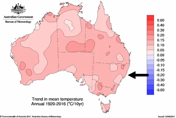
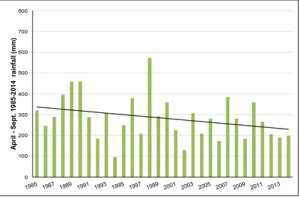
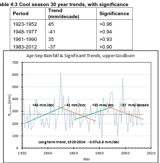
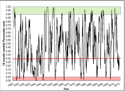
Changing land use in an uncertain climate: impacts on surface water and groundwater in the Goulburn River NSW
Full text
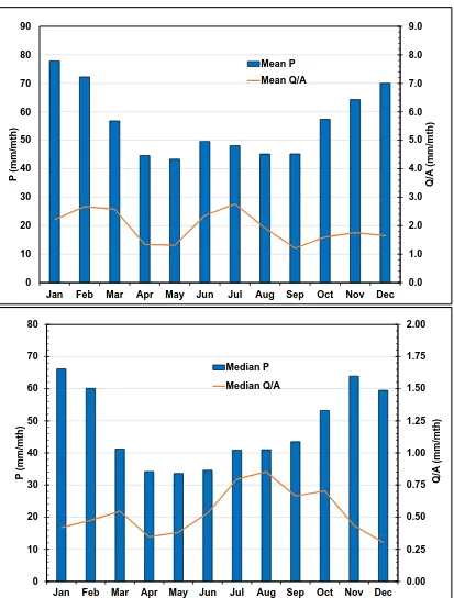
Figure


Related documents
The total coliform count from this study range between 25cfu/100ml in Joju and too numerous to count (TNTC) in Oju-Ore, Sango, Okede and Ijamido HH water samples as
Allergic diseases are inflammatory disorders that involve many types of cells and factors, including allergens, immu- noglobulin (Ig)E, mast cells, basophils, cytokines and
Expression frequency and clonality of TCR V δ T cells in AML In this study, the complementarity-determining region 3 (CDR3) sizes of eight TRDV subfamily genes were analyzed in γδ
Accounting for the Economic Risk Caused by Variation in Disease Severity in Fungicide Dose Decisions, Exemplified for Mycosphaerella graminicola on Winter WheatD. The
The major findings of this study were that: (a) h hypoxia exposure increased the ex- pression of PASMC Kv α subunits (Kv., Kv., Kv., and Kv.) at the
Student (Computer Science & Engg), Sipna College of Engg & Technology, Amravati, Maharashtra. HOD, Department of Information & Technology, Sipna College
The final reading approval of the thesis was granted by Martin Corless-Smith, Ph.D., Chair of the Supervisory Committee1. The thesis was approved for the Graduate College
Another meditation teacher, who has facilitated meditation teachers training, has also worked with vulnerable populations in San Francisco including those with psychiatric
